Welcome to SP!  -   
 
 New features are here! - Read More... 
Areas & Ranges·Mountains & Rocks·Routes·Images·Articles·Trip Reports·Gear·Other·People·Plans & Partners·What's New·Forum

Map

 
[ Sizes: Orig | Med | Small | Thumb ]
Map
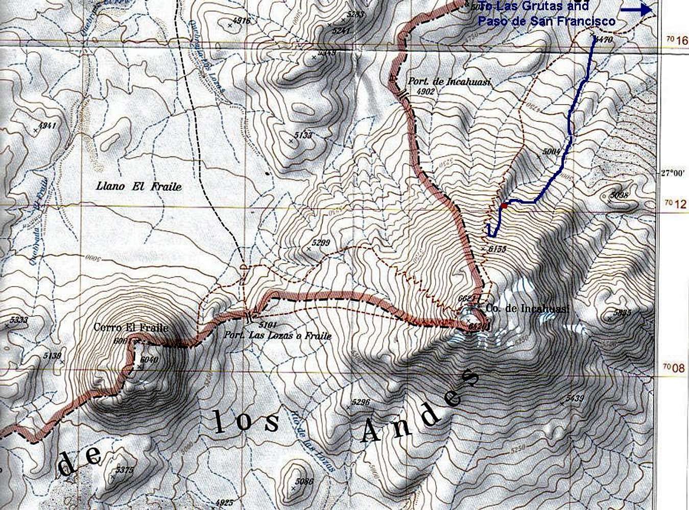
The blue line shows the way we went.
The sharp bend of the blue line tells you were we gave up the idea of climbing up the rock band, due to rotten rock and headed for the north ridge/normal route instead.
The red dot marks the approximate location of our only camp on the peak.
It's a good camp spot, provided there's snow. From that place, it's better to head straight for the north ridge and follow the red line marking the normal route.


Comments

No comments posted yet.


Sign in to post!

Don't have an account? Register now.


Rate This Image
Current Score: 86.5

Log In To Vote
 Great map sources (Fact Sheet)

A map of Adil Su valley. 
 If...
« PREV

Viewing
#2 of 4
GALLERY
Overview maps from RV
NEXT »

 Corax's Image Gallery

Snowfields
« PREV

Viewing
#580 of 682
GALLERY
Dychtau
NEXT »


 Incahuasi (Mountain/Rock)


 El Fraile (Mountain/Rock)


 Maps of South America (Album)


Image Data

CoraxSubmitted by Corax
on Oct 13, 2006 8:48 am

Image ID: 234821
Hits: 2218 

Image Type(s): Alpine Climbing


"To die? No, I climbed up there to LIVE!"   --JC   

© 2006-2012 SummitPost.org. All Rights Reserved.