
-
 1416 Hits
-
 79.78% Score
-
 11 Votes
|
|
Route |
|---|---|
|
|
27.10435°S / 109.25068°W |
|
|
Hiking |
|
|
Summer |
|
|
Half a day |
|
|
Class 2 |
|
|
Overview
Muanga Pukatikei is the second highest mountain on Easter Island - Isla de Pascua - Rapa Nui. I see a variety of published elevations on websites and maps. Some indicating the mountain is over 1500’ high. The true height is closer to 1200’ and some change. Both Maunga Terevaka, the highest summit on Easter Island, and Rano Kau with a road leading to the Orongo archaeological site see more visitors.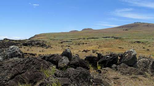
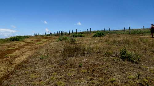
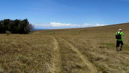
Maunga Pukatikei from Trailhead
Getting There
While it is possible to walk to both Maunga Terevaka & Rano Kau from Hanga Roa, Maunga Pukatikei is at the other end of the island. We rented a vehicle from Paul at Hotel Tekarera on Christmas Day to do some site seeing and to climb Pukatikei.Getting to Easter Island – Isla de Pascua. We flew LAN Chile from Miami to Santiago and then the next day LAN Chile to from Santiago to Easter Island. When booking our tickets we found LAN flew to Easter Island and back every day but Tuesday. The scheduled flight was 5 hours 40 minutes to Easter Island and 4 hours 50 minutes on the return.
![Trailhead turnoff]()
Trailhead turnoff
![Maunga Pukatikei - looking back at trailhead with Terevaka in the background]()
Maunga Pukatikei - looking back at trailhead with Terevaka in the background
![Maunga Pukatikei - this road ends at the fence]()
Maunga Pukatikei - this road ends at the fence
![Maunga Pukatikei - we crawled under this fence]()
Maunga Pukatikei - we crawled under this fence
![Lupins in the foreground. Terevaka in the background.]()
Lupins in the foreground. Terevaka in the background.
![We aimed for the saddle between Maunga Vai - Heva and Maunga Pukatikei]()
We aimed for the saddle between Maunga Vai - Heva and Maunga Pukatikei
![This hawk watched our passage]()
This hawk watched our passage
![Erosion Feature]()
Erosion Feature
![We met up with this road which we followed to the saddle]()
We met up with this road which we followed to the saddle![On the road looking up towards the saddle]()
On the road looking up towards the saddle
![Maunga Vai - Heva looking up from the saddle]()
Maunga Vai - Heva looking up from the saddle
![The road crossing the saddle]()
The road crossing the saddle![Pukatikei from the saddle]()
Pukatikei from the saddle
![Approaching the Moai]()
Approaching the Moai
![The moai - looking down towards Maunga Vai - Heva]()
The moai - looking down towards Maunga Vai - Heva![Maunga Pukatikei crater rim]()
Maunga Pukatikei crater rim
![Trees in the crater - lupines in the foreground]()
Trees in the crater - lupines in the foreground![Maunga Pukatikei summit cairn with Rano Kau in the background]()
Maunga Pukatikei summit cairn with Rano Kau in the background
![Climbing bear Snowball on the summit of Maunga Pukatikei]()
Climbing bear Snowball on the summit of Maunga Pukatikei![Maunga Pukatikei summit view of Maunga Terevaka]()
Maunga Pukatikei summit view of Maunga Terevaka
![Rano Kau from the summit of Maunga Pukatikei with Rano Raraku in the foreground]()
Rano Kau from the summit of Maunga Pukatikei with Rano Raraku in the foreground
![Thistle - one of the invasive species]()
Thistle - one of the invasive species![Heading back down to the saddle with Maunga Vai - Heva]()
Heading back down to the saddle with Maunga Vai - Heva
![Cairn where we left the road to head back to the trailhead]()
Cairn where we left the road to head back to the trailhead
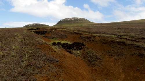
![Erosion feature]()
Erosion feature
As long as it’s clear you shouldn't have any trouble finding your way. Even if there were thick fog, the mountain takes up the eastern peninsula of the island. You would just have to head west to hit the main road. We had great weather our entire time on Easter Island, with only a few light sprinkles.
Route Description
Many maps show a track heading northeast up the mountain from along the road that crosses the island from the south by Ahu Tongariki to the north shore. We saw what was probably that road, but chose instead to head to near where the main road meets the shore on the north side of the island. Just before the road turns west to head across the north side of the island, there is an unpaved road on the right.
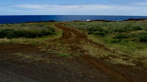
Trailhead turnoff
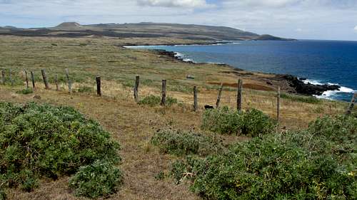
The first part of the road was okay for most vehicles, but it quickly became a 4WD road. Fortunately there are wide spots to park with a beautiful view of the rugged shoreline. This is probably the first time I climbed a mountain where the trailhead was right next to the ocean.
Maunga Pukatikei - looking back at trailhead with Terevaka in the background
After parking the rented Suzuki we started up the road for as far as it would take us. We could see the trees in the summit crater rising above us to the southeast.
Maunga Pukatikei - this road ends at the fence
It wasn't far before the road ended at a wire fence. We crawled under the fence at a dip in the land.
Maunga Pukatikei - we crawled under this fence
Lupins in the foreground. Terevaka in the background.
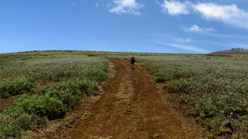
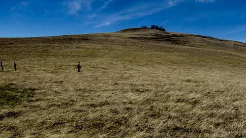
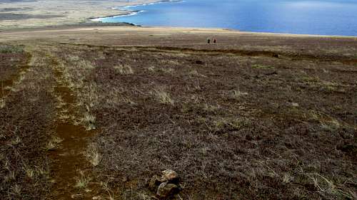
After the fence the route was simple. We aimed for the saddle between the summit and the row of volcanic cones on the north side of the mountain.
We aimed for the saddle between Maunga Vai - Heva and Maunga Pukatikei
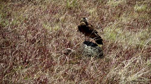
This hawk watched our passage
Erosion Feature
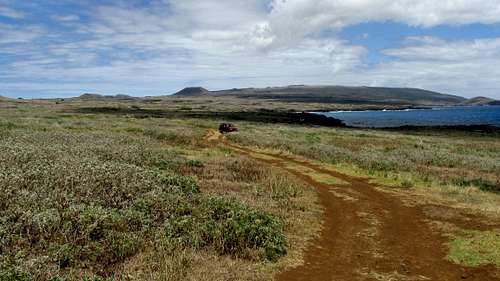
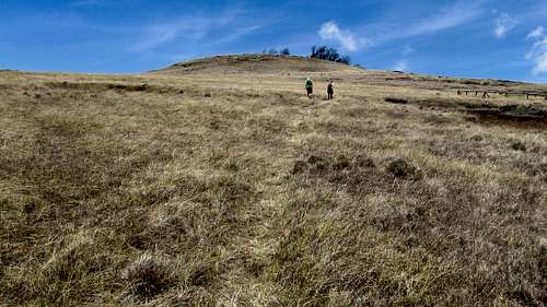
After gaining about 500’ we came across a road. Not a constructed road but one formed by driving on the terrain. This was probably the same road we passed on our way to our trailhead.
We met up with this road which we followed to the saddle
This road conveniently headed straight up to the Maunga Vai – Heva saddle.
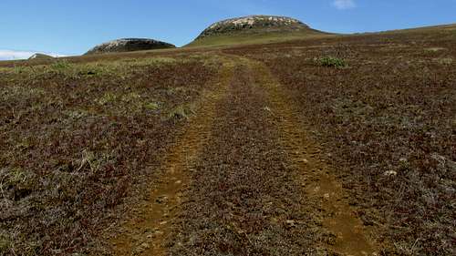
On the road looking up towards the saddle
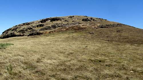
Maunga Vai - Heva looking up from the saddle
It continued down the other side a distance unknown to us. The GPS showed the saddle elevation to be 828’. It took us around 50 minutes to come this far.
The road crossing the saddle
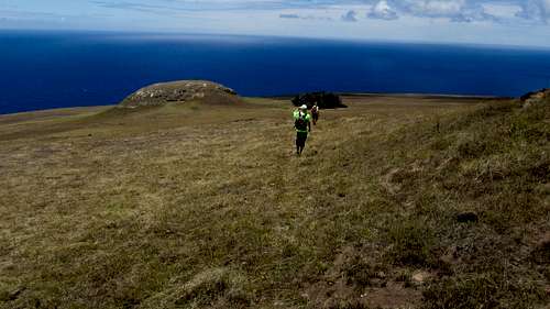
From here, we made a right turn and headed up a social path towards the summit.
Pukatikei from the saddle
On the way to the summit at around 1000’ is a small moai marked and protected by a fence. We took a few pictures and continued on to the summit.
Approaching the Moai
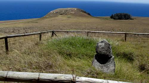
The moai - looking down towards Maunga Vai - Heva
A direct approach to the crater rim started getting a little steep near the top so we swung a bit to the right. On the first high point of the rim was a couple with a two kids.
Maunga Pukatikei crater rim
After exchanging pleasantries we continued around the crater clockwise until we came to the high point.
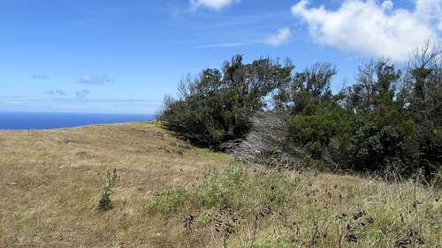
Trees in the crater - lupines in the foreground
The crater has a thick patch of trees and other vegetation growing in it. We stayed on the broad rim without exploring the crater. Whereas we gained the crater rim on the northwest we traveled around to the south to get to the summit marked by a cairn.
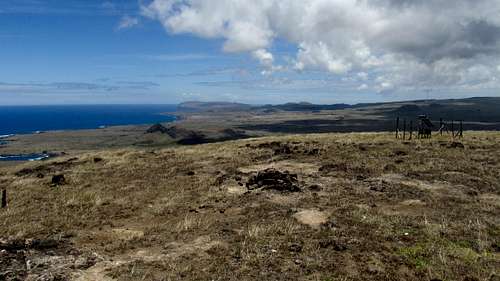
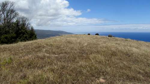
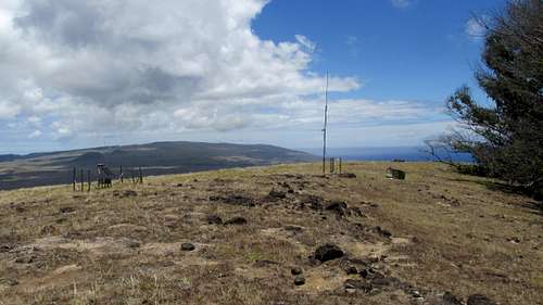
Maunga Pukatikei summit cairn with Rano Kau in the background
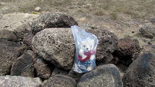
Climbing bear Snowball on the summit of Maunga Pukatikei
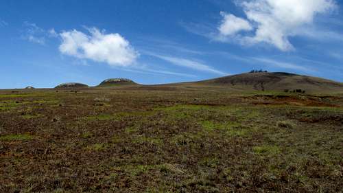
There are a couple small antennas on the summit and great views of much of the island. The broad shield volcano Maunga Terevaka, the monarch of Easter Island provides views for most of the hike.
Maunga Pukatikei summit view of Maunga Terevaka
Rano Kau and Rano Raraku line up nicely for a picture.
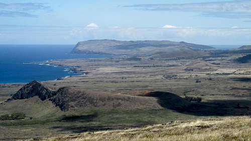
Rano Kau from the summit of Maunga Pukatikei with Rano Raraku in the foreground
From the saddle to the summit took a casual 30 minutes. We took our time having a lunch on top and taking pictures while completing the circle of the crater rim.
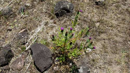
Thistle - one of the invasive species
It took about an hour to hike back down to the trailhead at an easy pace reversing the same route.
Heading back down to the saddle with Maunga Vai - Heva
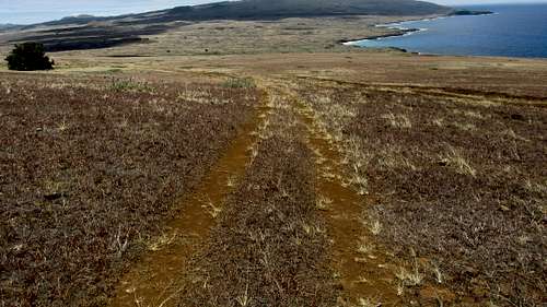
Cairn where we left the road to head back to the trailhead
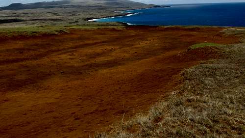
Erosion feature
As long as it’s clear you shouldn't have any trouble finding your way. Even if there were thick fog, the mountain takes up the eastern peninsula of the island. You would just have to head west to hit the main road. We had great weather our entire time on Easter Island, with only a few light sprinkles.
Essential Gear
The standard advice on Easter Island is to take lots of water and sunscreen! Hiking boots or trekking shoes recommended along with sunglasses and a hat! It's possible the wind might pick up or there will be a shower, so a jacket in case a t-shirt proves not to be enough.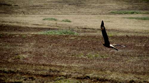
Hawk in flight on Maunga Pukatikei
Money changing: There are a couple ATMs in Hanga Roa, the only town on the island. We didn’t use them but changed our money at the gas station - PUNA VAI Mini Market - just off the main street on the south side of town. The exchange rate was reasonable and we exchanged on a few occasions. The rate can change daily. The gas station also has a large wine selection! If you have time in Santaigo you can get a better rate there. Downtown in the Central Banking District, on Agustinas between Ahumada & Bandera is a row of Money Changing storefronts with their Buy / Sell rates posted outside. We made it a point to have US dollars in good shape.
Map: Prior to going to Easter Island I ordered the International Travel Maps - Easter Island (Chile). It's a pretty good map with 20 meter contours and a 5 minute grid and 1 minute grid ticks. I used a straight edge to make a one minute grid. I wasn't able to identify the datum. The shift between the map and WGS 84 was mainly in longitude. My GPS has an Easter Island 67 datum that might have been a bit closer than WGS 84 but was still shifted in longitude. On Easter Island I was able to pick up a couple more glossy tourist maps that were also good to have. You will notice inconsistencies between real life and the road / trail patterns on the island. I get the impression the less constructed roads and trails have migrated a bit over the years. There are also contradictions with the elevations between the maps and various websites. This is especially true with Maunga Pukatikei, the volcano that anchors the eastern side of the island. You will also see inconsistency in feature names. Sometimes is English / Spanish / Rapa Nui - Easter Island / Isla de Pascua / Rapa Nui. Other times native names will be broken in different places with or without apparent spelling differences: Pukatikei / Pu a Katiki / Pua Katiki. Have fun!
Weather: We had highs in the 70s and lows in the 60s all week. On a couple occasions there was a light sprinkle. I wore shorts and a tshirt the whole time. Even on the windy mountain tops it never got real cold. Some might want a jacket so it would be prudent to pack one. Sunscreen is a must! A hat for the sun is recommended. I wore trekking shoes on the hikes and they were sufficient. Hiking boots would have been good, especially on Rano Kau. Do not recommend only being in sneakers. There are some places, especially on Rano Kau where the horse grass is tall, the trail isn't established and the surface underneath is rough. There are no water options on the trails. Be sure to pack at least a couple liters, or three liters if you'll be taking a scenic way back!GPS 12/25/14 WGS 84 Zone 12 Latitude Band J
Puka turn off 671113 7002070 27m 1:52:50pm 27.09318 109.27406 89'
Puka Trailhead 671157 7002141 6m 11:02:53am 27.09253 109.27363 19'
Puka fence 671647 7002115 38m 11:19:22am 27.09271 109.26868 124'
Puka track 672645 7001592 167m 11:44:33am 27.09731 109.25855 548'
Puka saddle 673229 7001330 252m 11:57:22am 27.09960 109.25262 828'
Puka moai 673099 7000947 310m 12:08:12pm 27.10307 109.25388 1016'
Puka crater 673041 7000744 366m 12:20:54am 27.10491 109.25445 1201'
Paku summit 672965 7000627 372m 12:26:55pm 27.10597 109.25519 1219'Magnetic declination is about 15 degrees to the east
Time Zone: UTC -6 The longitude should put Easter Island in the same time zone (Mountain) as Colorado, but they probably don't want to be the extra hour different from the mainland. UTC -6 is the same as the Central Time zone in the US which includes Chicago & Dallas. Interestingly Easter Island observes Daylight Savings Time at the opposite time of year as the northern hemisphere. So for Standard Time in the winter, Easter Island is on the same time as Daylight Savings Time in Colorado. (summer) When it is Daylight Savings Time on Easter Island in their summer, they are the same as Eastern Standard Time in the US! (Miami, New York)
External Links
We stayed at Kainga Nui cabin at Hotel Tekarera. Our host Paul picked us up at the airport. Paul drove us around town pointing things out to get us oriented. The next day Paul was our guide for a full day tour of island. Paul is very knowledgeable of the history of Easter Island. As a teenager in the 60s he worked with archaeologist William Mulloy. Paul is American but spent much of his adult life on Easter Island married to a native Rapa Nui. We spent 6 nights on Easter Island and could easily have spent another week.
http://tekarera.com/index.html