
|
|
Mountain/Rock |
|---|---|
|
|
35.46440°N / 118.19452°W |
|
|
KERN |
|
|
Hiking, Mountaineering |
|
|
Spring, Fall, Winter |
|
|
6108 ft / 1862 m |
|
|
Overview
 Snow covered Joshua trees on Mayan Peak.
After you park at the wooden posts you will see the Pacific Crest Trail (PCT) signs, and it's about 2 1/2 miles to the summit of Mayan. Climb out of the drainage on the PCT. The PCT winds around so it is better to leave it, and just head Northwest in this desert terrain toward the base of Mayan Peak. You want to avoid climbing too far on the West side of the mountain, so as you approach the base choose paths that lead to your right (East) but not too far.
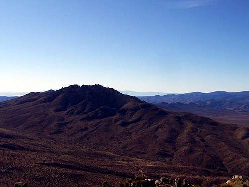 This is Walbrecht Peak as seen from the summit of Mayan.
After you reach the base you begin the climbing section, and it's about 1600 feet to the summit. There are rocks, yucca, cacti, and Joshua trees to keep the climb interesting, but no serious bushwhacking. There are a few ducks here and there and a number of false summits, so just keep climbing up. After going over several plateaus where the grade is lower you will reach the small summit block at the top. I have seen the register behind the summit block, and on top of it. The summit block is an easy climb if the register is up there.
 A photo from snow covered Mayan Peak.
I often do a loop hike that includes Mayan Peak, Pinyon Mountain, Gold Peak, and Walbrecht Peak.
 Mayan Peak in the snow.
Getting There
View Larger Map
This peak is accessed...
--- From the West on Highway 178 turn South onto Kelso Creek Road. Drive South 18.5 miles. You will see Mayan Peak on your left so turn left on Butterbreadt Canyon Rd. BLM SC 123. Drive on the dirt road for .5 miles and park at the PCT junction there where you will see wooden posts.
--- From the East on Highway 178 turn South onto Kelso Creek Road past Onyx. Drive South 18.5 miles. You will see Mayan Peak on your left so turn left on Butterbreadt Canyon Rd. BLM SC 123. Drive on the dirt road for .5 miles and park at the PCT junction there where you will see wooden posts.
--- Note: It is also possible to access Kelso Creek Road from Jawbone (highway 14) though much of the way is either a dirt road or an ungraded paved road.
--- Much of this area is also used by OHV ( Off Highway Vehicles ) so you may see them in the parking area, but not on the PCT. They have all been very friendly to me, but I try and be especially careful when driving on those dirt roads so that they have plenty of time to stop around corners and etc..
Red Tape
There are no restrictions here for hiking. This peak lies within the Kiavah Wilderness, managed by the Bureau of Land Management. BLM information available hereFor more information you can contact:
Bureau of Land Management
Bakersfield Field Office
3801 Pegasus Drive
Bakersfield, CA 93308
(661) 391-6000 Bureau of Land Management
Ridgecrest Field Office
300 S. Richmond Road
Ridgecrest, CA 93555
(760) 384-5400
Camping
Camping is permitted anywhere for up to 14 days, after which you need to move at least 25 miles. No permits or fees are required. Campsite are available at Lake Isabella (recommended) Walker Pass, and also at Jawbone Canyon.Mountain Conditions
Hiking is primarily for Spring, Fall, and Winter, and the weather in this range can be extreme. During the summer it is very hot, during the winter the higher elevations get some snow, and wind can also be a factor in this region. Current weather conditions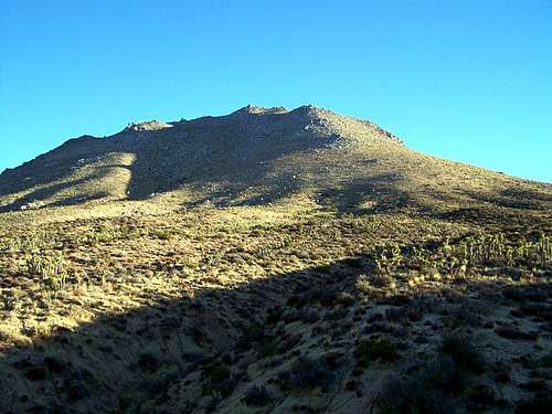 Mayan Peak