Into the Wilderness in search of a Highpoint...
The McCormick Tract is an area I’ve been wanting to visit for a while. Encompassing something like 17,000 acres, the McCormick Tract preserves some of the wildest and most rugged terrain in Michigan. There are only around 6 miles of trail within it leaving the majority a true trackless wilderness. It is located in the center of the
Huron Mountain Range of Upper Michigan. You can access the area from two points, one north and one south. The southern access point is really the only practical option, however as the northern access is reserved for those possessing off-road vehicles and an intimate knowledge of the Huron Mountain back roads.
Our plan was to make a short 4-mile round trip east along the North Country Trail to an unnamed peak marking the highest point in Marquette County. We would then spend a cozy night among the pines listening to the snow fall around us. Oh, did I mention that there was a Winter Storm Warning in effect? Well, here’s our little adventure…
![Heading in...]() Heading In
Heading In![The North Country Trail]() The NCT
The NCT![Home, Sweet Home]() Home, Sweet Home
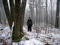
Home, Sweet Home![Getting on the Trail]() On the Trail
On the Trail![Rock Outcrop]() Small Clearing
Small Clearing![Not Making Great Time...]() Lots of Pics
Lots of Pics![Looks Fun!]() Fun, Fun!
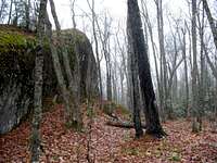
Fun, Fun!![A Big Rock...]() Big Rock
Big Rock![A Granite Ledge...]() Ledges
Ledges![Rock tripe]() What?
What?![Starting to Stick...]() Starting to Stick
Starting to Stick![More Ledges...]() More Ledges
More Ledges![No Problem!]() No Problem!
No Problem!![Huge Erratic...]() Huge Erratic
Huge Erratic![Hiding the Trail...]() Hiding the Trail
Hiding the Trail![Old Growth?]() Old Growth
Old Growth![Reaching the Ridge...]() The Ridge
The Ridge![Marquette County Highpoint]() The Highpoint
The Highpoint![Buried Treasure...]() Buried Treasure
Buried Treasure![Marquette County Highpoint - 1932]() Summit Register
Summit Register![Long Time No See...]() Long Time No See
Long Time No See![Summit Shot...]() Summit Shot
Summit Shot![Time to Head Back...]() Heading Back
Heading Back![Snow on the Pines...]() Snow & Pines
Snow & Pines![Lagging Behind...]() Lagging Behind
Lagging Behind![Thick Woods...]() Thick Woods
Thick Woods![Back to the Playground...]() Back to the Playground
Back to the Playground![Last Water Crossing...]() Water Crossing
Water Crossing![Time to Break Out the Cards...]() Time for Cards
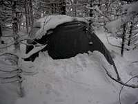
Time for Cards![Morning View...]() Morning View
Morning View![Nice n Cozy]() Nice n' Cozy
Nice n' Cozy![Amazing...]() Amazing...
Amazing...![Peshekee Bridge...]() Peshekee bridge
Peshekee bridge![Peshekee River]() Peshekee River
Peshekee River![Now Where s My Snow Brush?]() Snow Brush?
Snow Brush?![Farewell, Wilderness...]() Farewell
FarewellTrip Info...
Trailhead: Peshekee River off County Road 607
Distance Hiked: 4 miles round-trip
Elevation Gained: ~300'
Arrival Snowdepth: 0 inches
Departure Snowdepth: 13 inches
Beefaroni Consumed: 3 cans
Jerky Consumed: 2 - 4oz. bags
Beers Enjoyed: 6
Card Games Won By Yours Truly: All of Them
Experience: PricelessLinks...
McCormick Tract Wilderness Area page
- Just about the only worthwhile source of info I could find on the McCormick Tract. Lots of good info and maps. Also tells the story of how this remarkable area came to be.


Comments
Post a Comment