
-
 2731 Hits
-
 78.27% Score
-
 9 Votes
|
|
Route |
|---|---|
|
|
39.59060°N / 106.1559°W |
|
|
Hiking |
|
|
Spring, Summer, Fall, Winter |
|
|
Half a day |
|
|
Overview
 Peak 1 and Tenmile through the fog
This scenic outing is pleasant choice for all seasons. It is mostly on-trail, leveraging the Meadow Creek Trail, with an approximately ½ mile off-trail segment to the summit. There are even two choices presented here for reaching the summit.
Roundtrip Distance: 9-10 miles depending on route chosen from meadow to summit and back
Elevation Gain: 2,200 feet
YDS Rating: Class 2 (off trail segments)
Getting There
 Up at Chief from Meadow
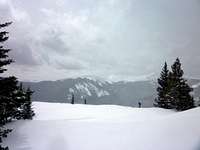 West from the summit area
From I-70 westbound
• Take Frisco Exit #203
• Enter the traffic circle, then take the dirt road (that parallels I-70) to the west side of the roundabout
• Follow this dirt road for about one-half mile to the trailhead parking
Route Description

 Northeast slope of Chief Mountain
 Tenmile Range from the summit area
 Evergreens in Fresh Snow
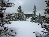 Springtime Snow
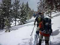
• The trail begins at the north side of the parking area.
• The route ascends gradually for the first ¾ of a mile to the junction with the Lily Pad Lake Trail.
• Roughly ½ mile past this junction you will reach the Eagles Nest Wilderness Boundary.
• Traverse for about ½ mile past the wilderness boundary into the Meadow Creek drainage.
• The trail gains elevation more rapidly for about 1 mile until you enter the meadow opening at roughly 10,500 feet.
• Shortly below 11,000 feet in elevation, where the meadow is broadest and the terrain most level, you have a choice (see map for details):
o Leave the trail and head sharply southwest up the northeast facing slope of Chief Mountain (this option means longer mileage and denser timber, but a gentler elevation gain)
o Continue on the trail for another ½ mile until it nears the saddle with the northern end of Chief Mountain (this option means shorter mileage and sparser timber, but a steeper way to the summit ridge; also, be careful about trending west when ascending the northeast slope during snow season to avoid potential avalanche risk)
• The summit area is non-descript and no cairn was present when I was on the summit (though the snow we stood on was several feet deep per a probing).
• Explore the general summit area – the views are fantastic – before selecting your descent option to regain the Meadow Creek Trail.
Essential Gear
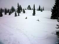
 Breaking trail near the meadow
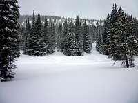 Northeast slope of Chief Mountain
• Trail map (Trails Illustrated #109 (Breckenridge, Tennessee Pass) would meet most needs)
• Compass
• Sturdy, waterproof hiking boots
• Snowshoes or skis for floatation
• Water and snacks
• A camera to save memories of the high country views
• First aid kit
• Other standard backcountry essentials