Mendenhall Glacier Approach

Mendenhall Glacier Approach

Page Type Page Type: Route
Location Lat/Lon: 58.45900°N / 134.53923°W
Additional Information Route Type: Mountaineering
Additional Information Time Required: Most of a day
Sign the Climber's Log

Overview


The Mendenhall Glacier is probably the quickest way to access the Juneau Icefield, especially in winter when many of the the crevasses between icefalls are filled in. It is the standard approach for most of it's bordering peaks. It can be a long difficult slog, and is not void of objective hazards, but can be quite safe and enjoyable under the right circumstances. The conditions can vary widely between seasons, and years. If you spend much time climbing mountains in Juneau, you will learn to love and hate the Mendenhall Approach.

View from McGinnis
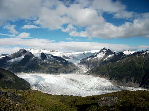
Mendenhall Glacier from Mt. McGinnis

Getting There

Access is via the West Glacier trail, off of Montana Creek Rd. in Juneau, Alaska. 

Route Description

At the end of the west glacier trail (3.5 miles), at a rocky outcrop overlooking the glacier, look for a climber trail heading down hill (not the one heading up towards Mt. McGinnis). You might find cairns or flagging but don't count on it. If you don't see a trail just follow the path of least resistance, you will need to fight your way through a patch of alders before scrambling down a gully to the glaciers edge on the northeast side of the outcrop.

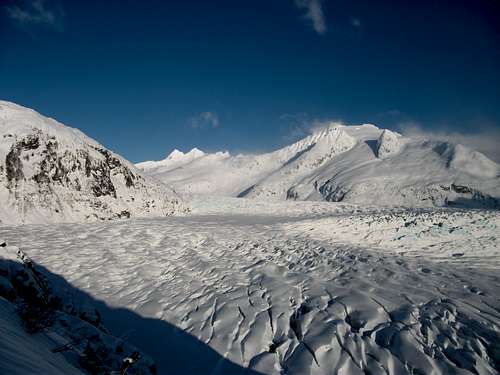
Start of Mendenhall Approach

Put the crampons on and begin picking your way through the first crevasse field. You want to aim for the lookers left (west) edge of the "Second Icefall" (you already bypassed the first icefall by taking the west glacier trail). You can see the calm area below the third icefall in the photo above, if you got a late start this is a good spot to camp. From this calm (crevass free) area, head east toward Mt. Bullard, staying between the second and third icefalls. Go all the way to the other side of the glacier, when you reach the edge on the Mt. Bullard side start heading north past Suicide Basin toward Mt. Wrather. 

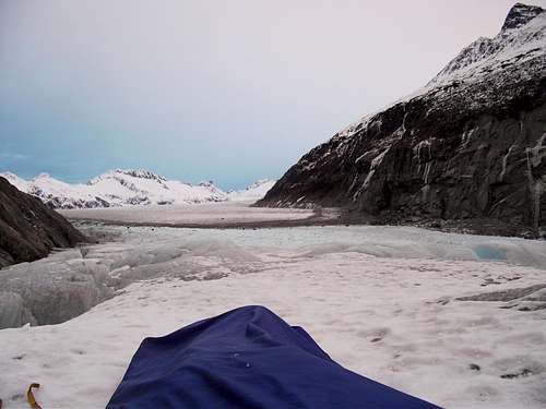
Looking North From Suicide Basin

Skirt the edge of the glacier on the Wrather side for as long as you can before tackling the third icefall. Usually its easiest to cross the third icefall in a east to west direction (parallel to most of the crevasses) until you get to the center of the glacier. The third icefall is the last major obstacle, from here it's easy walking (or skiing) in the center of the glacier.

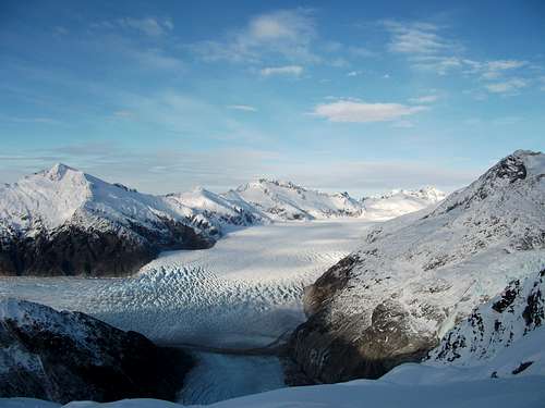
Third Icefall and Beyond


Essential Gear

The whole route can be done on skis in the winter and early spring. In the summer and early fall, it will be bare ice until well past the third icefall, there are no snow bridges if there is no snow, so a rope and glacier gear doesn't do you much good in these conditions, but is advised in winter and especially in spring. An axe and crampons is usually fine. Two tools can be nice, and gives you some options for short cuts.

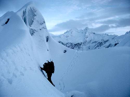
Third Icefall Shortcut


Parents 

Parents

Parents refers to a larger category under which an object falls. For example, theAconcagua mountain page has the 'Aconcagua Group' and the 'Seven Summits' asparents and is a parent itself to many routes, photos, and Trip Reports.