
|
|
Route |
|---|---|
|
|
47.74449°N / 120.91105°W |
|
|
Mountaineering |
|
|
Winter |
|
|
A long day |
|
|
Overview
For those who are interested in winter mountaineering, this route is for you. If you are willing to endure a 5500 foot elevation gain to attain Middle Chiwaukum or 6000+ elevation to achieve both and Middle and North Chiwaukum than this is the climb for you. The two 7000+ elevation summit gems are located right off of Route 2 between Stevens Pass and Levenworth by the White Pine Campground Trailhead. Both summits have excellent views and each summit has different views than the other.
I would only recommend this route in winter because summit presents a whole other set of obstacles and the trip is likely to be much more unpleasant with the summit being more scrambly. The route on the way up is also bushwacking through very steep forest and if the snow has melted the footing here could be very poor. Therefore when attempting this route do it on a clearer winter day if possible.
Map of the Route
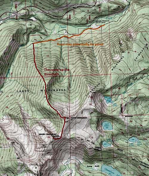
The winter route to Middle Chiwaukum
Getting There
VIA ROUTE 2: You want to a look for a south exit listing the WhitePine roughly 30 miles from Leavenworth and 25 from Stevens Pass. Take the road all the way to the trailhead. You will be going underneath a bridge along the way. In summer the true trailhead requires a Northwest Forest PassRoute Description
From the White Pine Trailhead: If the road conditions are good you will be able to drive 3 miles to the parking for both snowmobiles and hikers. From this starting point you want to head up the road roughly 3 miles. Though this road walk is almost the same distance as the actual climb there is little elevation gain here and most people can travel this road walk in 30 minutes to one hour. Midway through you will see a road cutting off to your left. Stay right and continue to the summer Trailhead. Once you hit the summer trailhead the fun will begin.At the summer trailhead, you want to make a left and head up the steep slope. While ascending though don't go straight up but veer right. This will be a steep climb but the this is a moderately wooded area. Continue to veer right while ascending until you obtain a general ridge. From there stay close to the ridge while ascending the steep slope up the mountain. The key here is to stay on the ridge for the easiest rise in elevation gain. You will be rising up this slope from 2800 to 6000 feet all the way to main ridgeline where views break out.
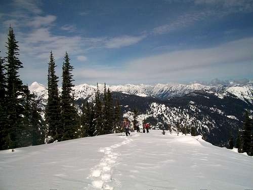
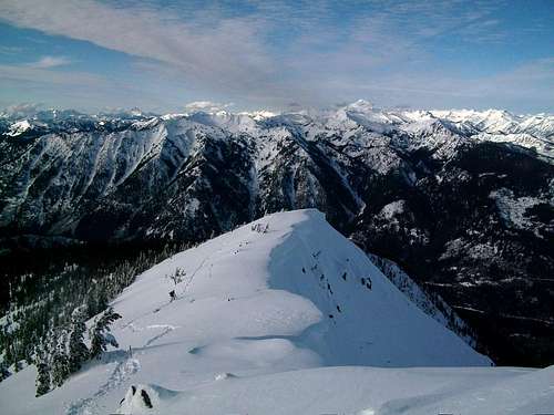
From that main ridgeline you will get your first view on North Chiwaukum. Stay on the ridge but be cautious of the drop-offs on the left side. You will continue a steep rise but at 6200 feet the grade will be gradual for a short bit in a meadow. The first views of Middle Chiwaukum should be opening up now. Continue to stay fairly close to ridge and head due south to North Chiwaukum. Continue to rise up the now mixture of alpine meadows and smaller trees up to the shoulder of North Chiwaukum (marked on map as Point 7132).
From here you can either head directly to the summit of North Chiwaukum or side traverse over to Middle Chiwaukum. North Chiwaukum will require a quick 30-40 degree snow climb to the true summit. If avalanche conditions are questionable do not attempt to side traverse to Middle Chiwaukum but instead summit North Chiwaukum first than head over to Middle Chiwaukum.
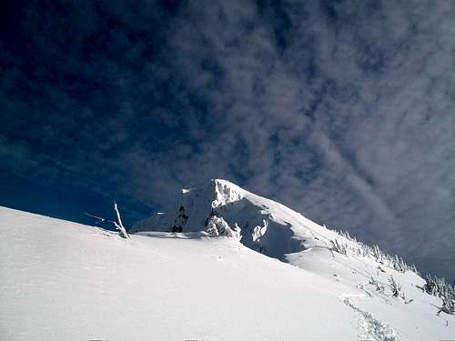
If you are continue to the summit of Middle Chiwaukum then head to the saddle between to summit. Here you will be on a wide ridge between the two mountains. Head over to the northeast shoulder away from the northwest cliffs. From here if conditions are right a nice snow ramp will form between the shoulder and the summit.
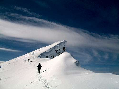
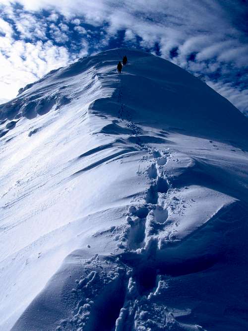
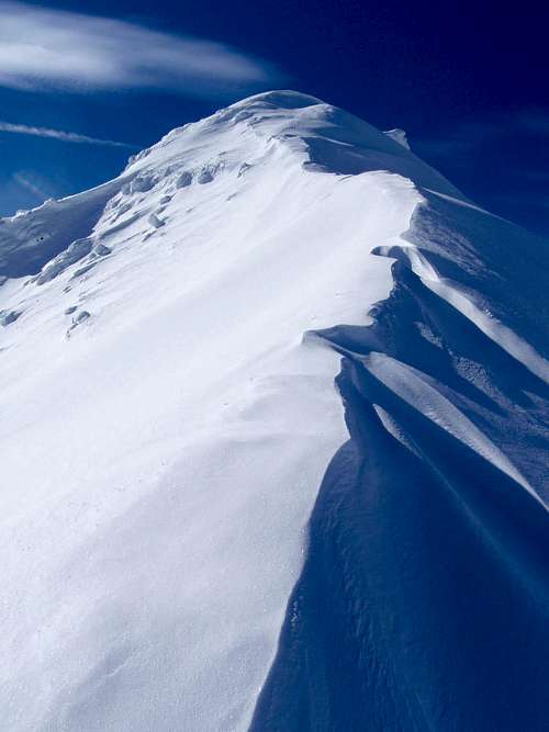
This last 400 feet will be the highlight of the climb. From here you will first climb over a 40 degree section (looks greater but it isn't). Use caution here because there are often large cornices between these ridges. Once you attain the ridge with exposed on both sides of you, continue heading but stay at least 10 feet from the cornices on the right of you. Stay left of the cornices and you reach the summit block, which will be a quick 30-40 foot climb to the actual summit. If you are lucky (we weren't because I suspect the summit log was hidden under the large summit cornice) you will also find a summit log there.
Essential return the way you came on this route.
Essential Gear
Gear Needed:Ice axe
Crampons
Snowshoes
Avalanche Probe
Shovel
10 essentials