
|
|
Route |
|---|---|
|
|
40.83181°N / 110.18269°W |
|
|
Hiking, Skiing |
|
|
Spring, Summer, Fall, Winter |
|
|
A long day |
|
|
Overview
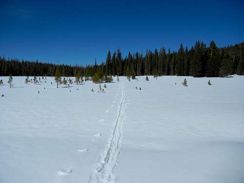
This page describes how to get to the summit of South Burro Peak via the Middle Beaver Trail. The trailhead is located 9.3 miles south of Lonetree Wyoming, which is so small that if not for its sign, you wouldn't know it was a town.This route is suitable either for hiking or skiing with some minor variations between the two. In the summer, don't expect to see very many people. On a 3 day trip to the general area which included the 4th of July, we only saw one other group. In the winter, seeing another person would be like seeing someone come back from the dead. You can count on miles and miles of pristine untracked snow. Above treeline, there was very good snow cover which is unusual for the Uintas. I was able to keep my skis on until a quarter of a mile from the summit.
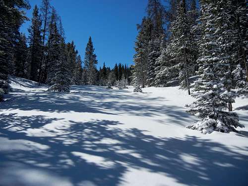
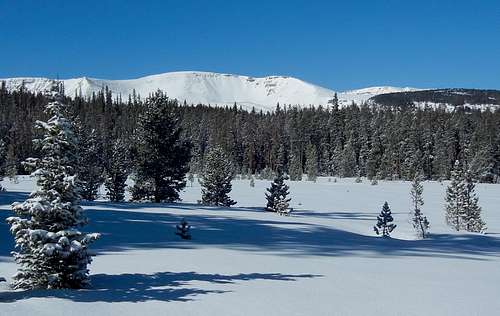
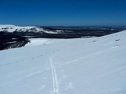
Beautiful untracked snow
If you go skiing for a thrilling descent, this is probably not the route for you. Below treeline, the terrain is mostly gentle and there are many completely flat areas.
Flat
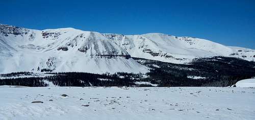
You will get outstanding views of Coffin Benchmark and "Mount Davis", and will be able to see all of the 13000 footers between Gilbert Peak and Mount Emmons.
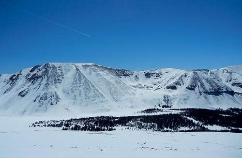
Mount Davis (12443) and Point 12233
Getting There
If not coming from Salt Lake, find your way to Lonetree Wyoming and follow the directions from there.If coming from Salt Lake, head east on I80 to Wyoming. Once in Wyoming, take exit 34 towards Fort Bridger. Go through Fort Bridger about 5.1 miles to a 4 way intersection with a blinking red light. Turn right onto Wyoming State Route 414. Go through the town of Mountain View where there is a 24 hour Maverick gas station, a ShopKo, a Pizza Hut, and a Subway. At the south end of Mountain View bear left to stay on 414. Go a total of about 26.4 miles on 414, from the blinking red light, to just past Lonetree, Wyoming which has no services and only a few buildings. Turn right onto a dirt road at the sign which says "Hole in the Rock" and "Hoop Lake". After making the turn, you will see a fence in front of you which says "Lone Tree Ranch". Immediately bear left onto Uinta County Road 295.
Note that there is another right turn off of 414 shortly before the one mentioned above that is an alternate route, but the road is a little less good.
Once on #295, go south. After about 4.5 miles, the alternate route will join on the right. Bear slightly left at this intersection and continue south 2.8 miles to a signed intersection. The sign says left to "HOOP LAKE 4" and right to "MID BEAVER CR. 1". Go right and continue for 3.3 miles on the main road to the trailhead. The last 10th of a mile is a little rough but is still suitable for passenger cars. The trailhead is barebones and obviously doesn't get much use as it more resembles a field than a parking lot. There are 2 trails leaving here. You want the one leaving from the far left corner.
The turn south onto the dirt road off of Wyoming 414 is at N41.04826 W110.12578.
Stats
Trail Head Elevation: 9150'South Burro Elevation: 12726'
Vertical Gain: 3576' plus many small ups and downs
Summer one way mileage: 10.35 miles
Snow route one way mileage: 8.5 miles from the TH plus how ever many miles it takes to ski to the TH
Route Description for Summer
There are two trails leaving from the unimproved "parking lot", which is really just a bumpy patch of dirt with no trees on it. You want the trail at the far left corner. Go through the gate and bear right. In .1 miles, you will come to an open meadow where the track fades. The trail leaves from the far right corner of the meadow even though there are posts marking the left side. The track leaving the meadow should be obvious. The trail goes in a straight line at a gentle grade another .7 miles and then veers right up a steep slope to a small saddle. From the saddle continue another 4 miles to the start of the aptly named Long Meadow, where there is an intersection with the Highline Trail which branches right across the stream, heading for the Mirror Lake Highway. Stay on the Middle Beaver Trail which also becomes the Highline Trail (heading for Leidy Peak) for the next .6 miles to a second intersection where the Highline Trail leaves left.
All of the above I have done in the summer so I am sure about how it goes. The rest of the summer route I've only seen with snow cover. If you encounter any difficulties along it please let me know.
At this point you have a few options. You could take the Highline Trail to the point where it crosses the North Burro ridge and then head south up the ridge to South Burro. North Burro would be a short side trip east, .4 miles one way.
Alternatively, you could bushwhack to the west ridge of North Burro and proceed as in the ski route. Follow the ridge until about 11400', contour along its south side, and then make a beeline for South Burro Peak. There are many options to approaching the ridge, there is no one right way.
Route Description with Snow Cover
The access road is unlikely to be plowed, so a winter ascent could be as much as an additional 10.6 miles one way. However, in late April through early May, much of the road will be melted out, making South Burro a reasonable one day ski trip destination. How far you'll be able to drive depends upon current snow conditions. To give you some idea of what to expect, on May 6, 2007 we drove to within 1.6 miles of the trailhead with no difficulties. On April 21, 2013 we drove to 3.9 miles of the trailhead where we got stuck and decided that was a good place to start. 11 days later, on May 2, I was able to drive 1.9 miles farther. Expect more of the road to melt while you are out skiing, necessitating some muddy road walking on the return.Drive as far as you can and then ski the summer road the rest of the way to the trailhead. You know you're there when you reach a big open spot with a sign board at the far end. There is a good place off of the road to park at N40.94629 W110.17823 if you can make it that far. It's marked as a gravel pit on the map. Otherwise, the road is narrow and it might be hard to find a spot that doesn't block others.
There is an unsigned turn at N40.94304 W110.18021 where you should bear right. It's obvious that the main road goes right in the summer, but not so with snow on it.
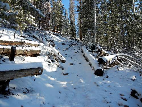
At the far left corner of the trailhead squeeze through the gate and bear right. Go .1 miles and when you come to a big open area, look for the trail at the far right corner, even though there are posts on the left side. If you don't find an obvious trail you should look harder as there are many downed trees in this section and it would be painful to have to step over them.
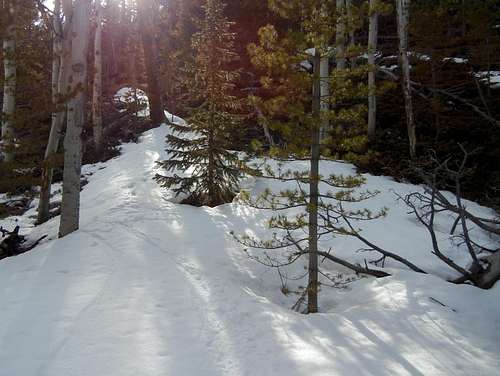
From the clearing, ski another .7 miles on a very obvious and wide trail at a gentle grade. After this, the trail will seem to peter out. Look for a somewhat obscure right turn up the hill. After a few feet if you are in the correct spot the trail should become obvious. I had to go back and forth several times to find it. After a short distance, the rest of the climb up to a small saddle was straightforward. At the beginning of May, the hillside was mostly melted out and teeming with downed trees. It would be very painful to bushwhack up it with skis, so you really want to be on the trail here.
Obscure right turn on trail
The trail soon becomes obvious
Once at the top of the hill, the trail descends the other side. At this point it is not so crucial to be on the exact trail, but if I was to do it again, I'd stay on the summer trail until the small saddle south of point 9812. (See map.) After this, the summer trail makes a lot of small ups and downs which can be avoided by contouring on skis. The summer trail also does some left/right zigzagging to avoid wet areas. With snow cover you can just go straight across them.
One of many swampy areas
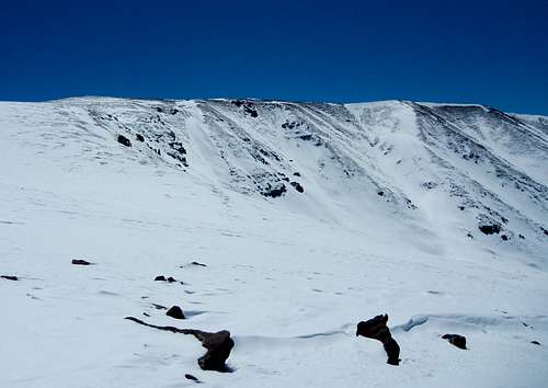
Sometimes the trees are on the thick side, but usually they are appropriately spaced. Head generally south, paralleling the steep east side of the valley. When you get to Corral Meadows, turn left and go up the gully that drains the area between Thompson Peak and the Burros. Work your way up to the west ridge of North Burro and then cross over to the south side. When you get to about 12000', make a bee line for South Burro.
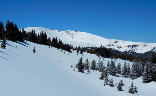
Approaching treeline. Elevation here is about 11000'
Trees are gone by 11400'
Looking back to treeline
Approaching South Burro
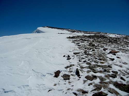
Almost at the summit
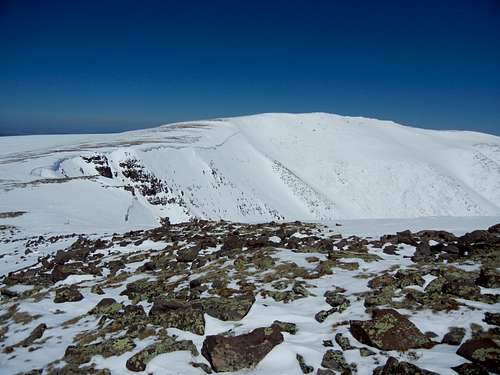
Looking back at North Burro Peak
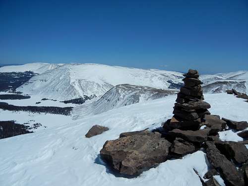
The summit
Essential Gear
Standard hiking gear is needed for a summer ascent. At the beginning of July, we found the trail teeming with mosquitoes, so insect repellent is recommended.For a ski ascent, x-country touring skis with metal edges and kicker skins worked very well. My skis have a sidecut of 78-60-70mm with NNN-BC bindings. I used 50mm kicker skins.
Maps
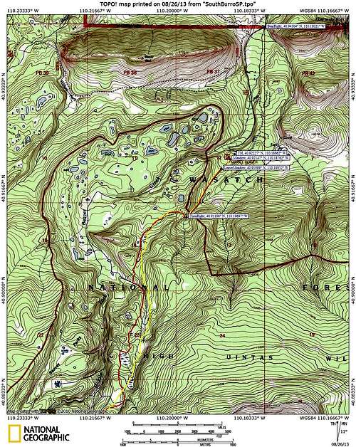
Map 1
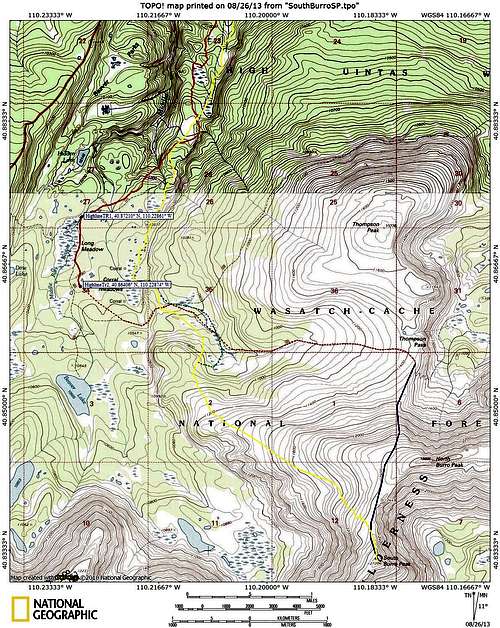
Map 2