
|
|
Route |
|---|---|
|
|
47.39410°N / 120.744°W |
|
|
Hiking |
|
|
Spring, Summer, Fall |
|
|
Half a day |
|
|
Walk Up (YDS Class 1) |
|
|
Overview and stats
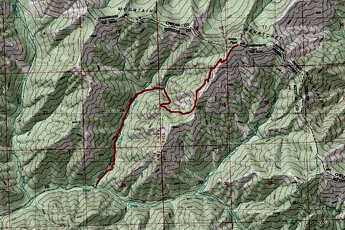
Map of the Route up Miller Peak
Elevation: 6400 feet
Elevation Gain: 3200 feet
Distance: 8 miles
YDS Class: 1 (total walkup)
The Miller Peak trail is the main route to the summit of Miller Peak. This trail usually is snowfree by early June (with exception to high snow years) and is fairly well traveled. That being said it see considerably less travel than many of the western Cascades such as Mailbox and Mount Si. The mountain though comes with great views and often as rewards when the western Cascades are covered in clouds.
The trail though is not just for hikers. It is also traveled by hunters, dirt bikes and mountain bikes. Surprisingly it is still in decent shape, probably due to the dryer climate on this side of the mountains. Don't let that deter you because this a great visit to go for.
Getting There
VIA MILLER PEAK TRAIL 1379: Take exit 85 off of I-90 and head east onto State Route 970 for about 7 miles. Make a left onto Teanaway River Road and head about 12 1/2 miles on the road past 29 Pines Campground. Just past the campground you will hit a fork in the road. Merge right onto forest road 9737 and stay on the road for about 1.25 miles. Make a right on road 9703. Take the road all the way down to the end (roughly 4 miles) where the Miller Peak Trail 1379 will be on the left side of the turnaround. There is also a very well built toilet located at this trailhead.Route Description
Miller Peak can be reached most easily by the YDS Class 1, complete walk up, Miller Peak Trail. At 8 miles and 3200 feet of elevation it gives just enough elevation to give a good workout, but for this region, it is makes for a very attainable summit. There are no scrambles on this trail and hardly any exposer on this mountain, making the trail up completely hike. The hike starts off barely gaining 800 feet in the first 1.8 miles. During this section the trail crosses four streams before steepening up.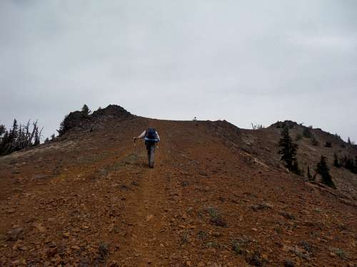
Zephyr heading up near the summit
The rest of the trail is the bulk of the climb, ascending a number of switchback and traverse across the edge of the mountain. Views on this mountain start around 5200 and get better the higher you go. At 3.6 miles this trail hits a junction with another trail 1226. Stay on the Miller Peak Trail which head up (left).It ends going up a steeper section (700 feet in 0.4 miles) to the summit rocks.
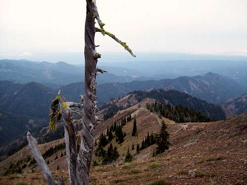
Looking down the ridge