
-
 2900 Hits
-
 72.08% Score
-
 2 Votes
|
|
Route |
|---|---|
|
|
46.72970°N / 12.80190°E |
|
|
Hike |
|
|
Half a day |
|
|
Walk-Up |
|
|
Approach
See the main page for the descriptions to get to Lesachtal. The trailhead is located at the hamlet Assing, which you can reach by turning north from the centre of Liesing in Lesachtal.
Route Description
- Start altitude: 1427m
- Summit altitude: 2386m
- Prevailing exposition: N, later W
- Type: 1h 30 min over forest roads (Joch Saddle Approach), 2h 30min over paths (both approaches)
- Protection: marked
From the trailhead at Assing follow the sign to Lumkofel. The trail runs north, losing altitude until you reach the hamlet Ladstatt. From there an unmarked trail leaves to the north, shortcutting the forest road to Tscheltscher Alpe. Once back on the road you need to decide:
- take the road, until you reach the Joch Saddle, from there turn west over Milnazenkofel until you reach Milnazen Saddle where both trails meet again
- Follow the Milnazer Bach Valley towards Milnazensattel (tricky, while slippery).
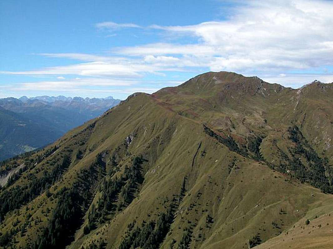
The remainder of the ascent follows the ridge, which you perfectly see in the picture above. It runs south-west first before turning northwest heading directly for the summit.
 |  |
Essential Gear
Hiking gear is sufficient. For the ascent through Milnazer Bach Valley, hiking sticks are advisable.