Introduction
After nine days hiking and summiting mountains in the Bishop Pass and Little Lakes Valley areas, Ruvicha, Jim*, Steve2 and I headed for Lone Pine for our final objective of the August 2015 eastern Sierra trip. We planned to hike to the Meysan Lake area, camp overnight, and summit Mt Mallory. After Mallory, which at 13,850 feet would be our highest peak of the year, we would return to camp, spend a relaxed evening, and hike out the next morning. A nice plan but, as they say in the military, few plans survive contact with the enemy – the enemy in this case being the combination of a strenuous hike, a lapse in good sense, and several small missteps that added up to a big one.
I’ve been to Meysan Lake twice before, and Ruvicha once. It’s a gem, with gorgeous lakes and tarns surrounded on three sides by the likes of Mallory, Irvine and Lone Pine Peak. It’s also relatively empty. We saw fewer than ten other people in the three days we were in the area.
Leaving Whitney Portal
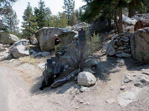
There is parking for the Meysan Lake area on the south side of the Whitney Portal Road, just before the entrance to the Whitney Portal Campground. From the parking area, one can quickly cut through the campground. The trailhead is marked with a sign for Meysan Lake just up a road that runs southeast from campsite no. 13.
![Sign to Meysan Lake]() Sign to Meysan Lake
Sign to Meysan Lake![Trail to Meysan Lake]() Ruvicha on start of trail to Meysan Lake
Ruvicha on start of trail to Meysan LakeHiking In
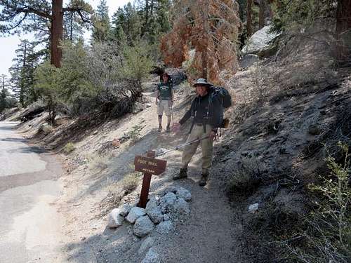
We started hiking about 12:30 pm. The trail climbed through a rocky wooded area before intersecting a road that accesses summer cabins above Whitney Portal Campground. Turn left (east) on the road for a short distance, before a second sign on the southern side of the road indicates the trail to Meysan Lake.
![Second Sign to Meysan Lake]() Steve2 and Jim* pass second sign to Meysan Lake trail
Steve2 and Jim* pass second sign to Meysan Lake trail
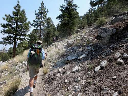
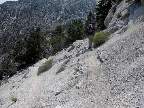
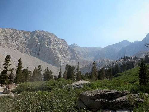
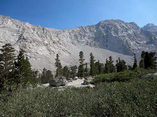
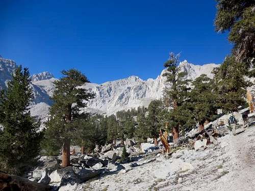
The well-established sand and gravel trail ran east for a short distance before moving around a ridge and turning toward the southwest. It climbed steadily, with several sets of switchbacks. The trail had been recut over the washouts that Ruvicha and I had encountered in 2011. As we climbed, we had a steady view of the northwest ridge of Lone Pine Peak, looming on the eastern side of the canyon above Meysan Creek.
![Trail to Meysan Lake]() On trail to Meysan Lake
On trail to Meysan Lake![Trail to Meysan Lake]() Early switchbacks on trail to Meysan Lake
Early switchbacks on trail to Meysan Lake![Lone Pine Peak]() Lone Pine Peak and its northwest ridge above Meysan Lake trail
Lone Pine Peak and its northwest ridge above Meysan Lake trailMeysan Lake Area
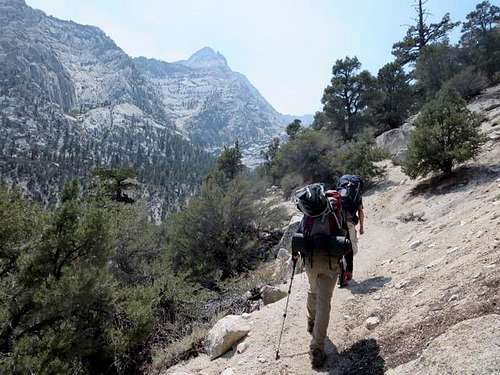
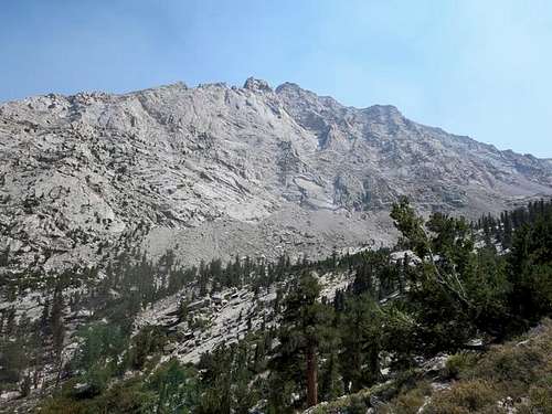
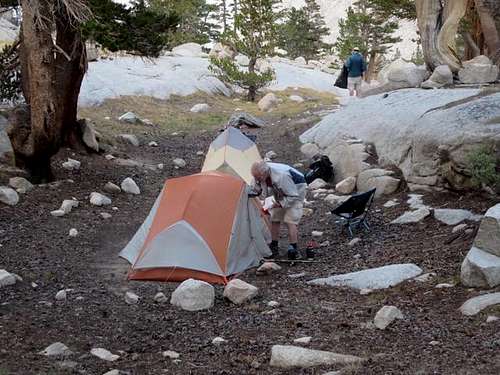
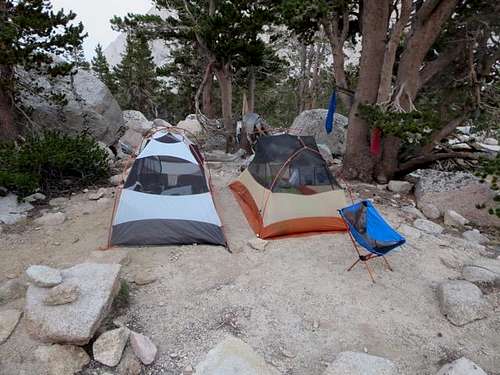
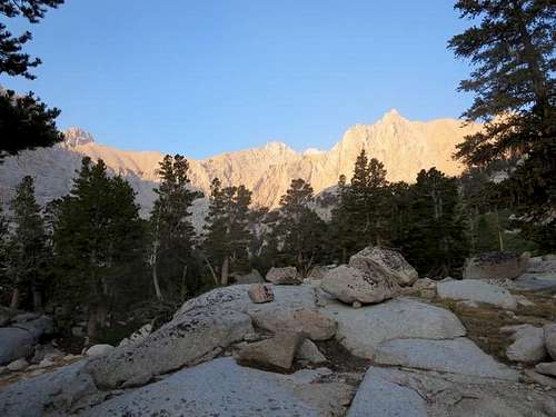
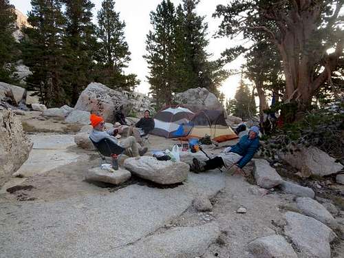
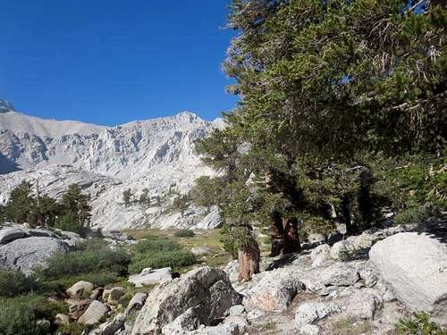
One of the frustrating things about the trail is the number of headwalls that it tops, each time generating a hope that you have arrived at the lakes … only to produce a view of another headwall. The actual lakes – first Grass Lake – lie above the third headwall. We reached that point about 4:00 pm, four miles from and some 3500 feet above the trailhead. At that point the trail splits, with Grass Lake to the left and the trail to Meysan Lake climbing to the right (Meysan Lake itself lies another mile to the southwest, above yet one more headwall). We went off trail to the left (south) and quickly found a campsite near a small tarn, set up camp, and settled in for the night.
![Trail to Meysan Lake]() Last headwall before Meysan Lake area
Last headwall before Meysan Lake area![Trail to Meysan Lake]() Last switchbacks on Meysan Lake trail
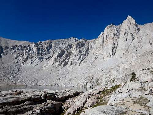
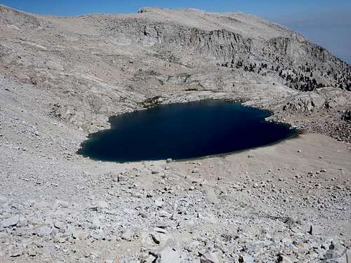
Last switchbacks on Meysan Lake trail![Meysan Lake]() Meysan Lake area
Meysan Lake area![Meysan Lake]() East wall above Meysan Lake area
East wall above Meysan Lake area![Meysan Lake]() Setting up campsite near Grass Lake
Setting up campsite near Grass Lake![Meysan Lake]() Upper rent locale at campsite near Grass Lake
Upper rent locale at campsite near Grass LakeGetting to Meysan Lake
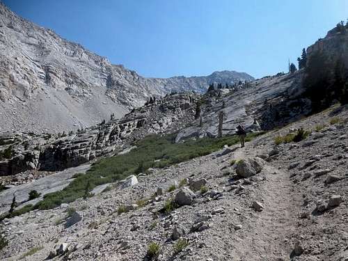
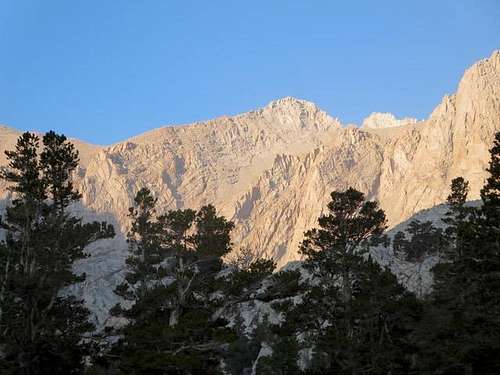
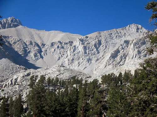
We arose the next morning to a beautiful view of Mallory, Irvine and Le Conte, but did not get on the trail until 8:30 am, something that would come back to bite us later. We followed the trail for Meysan Lake for about three-quarters of a mile, heading southwest, to the point where it entered a grassy meadow with a small tarn to the south and a headwall directly in front. At this point, the trail turned up and to the north. Steve2 and Jim* decided to try the trail. Ruvicha and I, however, recalled how we had reached Meysan Lake four years before and set off across the meadow to directly ascend the granite slabs of the headwall.
![Mallory and Irvine]() Mallory and Irvine in early morning light
Mallory and Irvine in early morning light![Mt Mallory]() Mallory in early morning light
Mallory in early morning light![Mt Irvine]() Irvine in early morning light
Irvine in early morning light![Meysan Lake]() Leisurely breakfast before Mallory hike
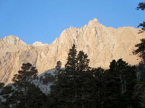
Leisurely breakfast before Mallory hike![Mt Mallory]() Mallory from trail to Meysan Lake
Mallory from trail to Meysan Lake![Mt Mallory]() Mallory at upper right; watercourse to approach chute visible at left center
Mallory at upper right; watercourse to approach chute visible at left center![Mt Mallory]() Meadow and granite slabs to Meysan Lake
Meadow and granite slabs to Meysan Lake![Meysan Lake]() Looking back down granite slabs to meadow (Meysan Lake is behind me)
Looking back down granite slabs to meadow (Meysan Lake is behind me)
It’s not clear where the trail ends up, but Steve2 and Jim* returned and traced our steps up the headwall, a delay that cost about a half hour. From there we found what we called “Brian’s ledge” – a ledge that fellow hiker Brian had found in 2011 that leads directly to the lake. “Brian’s ledge” is marked by a tall, solitary pine tree, which we referred to as “Brian’s tree,” which makes the ledge very obvious. So far as we know, “Brian’s ledge” provides the clearest and easiest entry to Meysan Lake.
![Mallory and Irvine]() "Brian's ledge" and "Brian's tree" in middle right leading to Meysan Lake
"Brian's ledge" and "Brian's tree" in middle right leading to Meysan Lake
The ledge led us to the northern side of Meysan Lake, almost exactly a mile from our campsite. From there, we worked our way clockwise around the lake to the southern side, where we had read was a good, manageable chute that climbed toward the west to the plateau at the southern base of the Mallory summit. The chute was easy to locate, even from across the lake. A clearly visible watercourse ran down from the chute almost to the lake.
![Mt Mallory]() Watercourse at south side of Meysan Lake to Mallory approach chute
Watercourse at south side of Meysan Lake to Mallory approach chuteThe Slog in the Chute
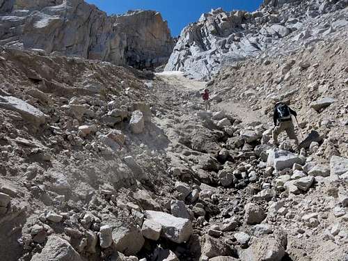
We began working our way up the rocks, sand and scree along the watercourse toward the chute about 11:00 am. At some points, the easiest and most stable path was in the watercourse itself, alongside a trickle of water from the small bit of still melting snow up in the chute.
![Mt Mallory]() Working up along the watercourse to Mallory approach chute
Working up along the watercourse to Mallory approach chute![Mt Mallory]() In the watercourse to Mallory approach chute
In the watercourse to Mallory approach chute![Mt Mallory]() Steve2 and Jim* nearing the Mallory approach chute
Steve2 and Jim* nearing the Mallory approach chute
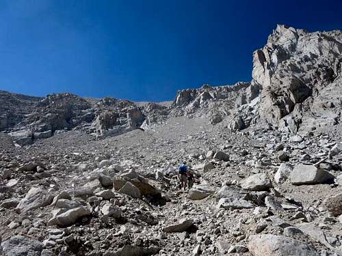
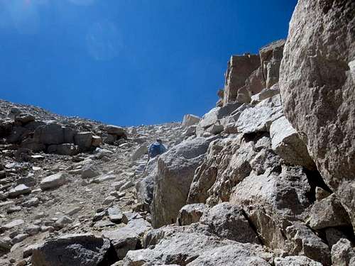
We entered the chute about 11:45 am, and the going became tougher. The climb steepened, and we encountered more slippery scree. We found larger and more stable rock on the right (northern side of the chute), but one had to take care, as the rocks often were slick with sand and gravel.
![Mt Mallory]() Ruvicha works up the right (north) side of the Mallory approach chute
Ruvicha works up the right (north) side of the Mallory approach chute
Partway up the chute, Jim* showed uncommon common sense (for this group) and decided to turn back. He spent a pleasant afternoon exploring the area below Meysan Lake and doing some scrambling below Lone Pine Peak. The other three of us pressed on. Steve2, who preferred scree, worked his way up the center of the chute, while Ruvicha and I stayed on the right side, which seemed to offer more larger rock, for stability.
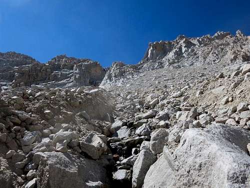
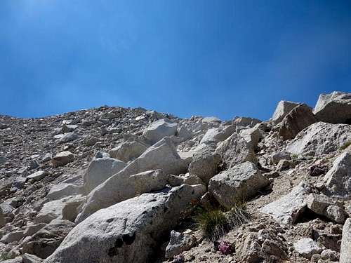
![Mt Mallory]() In the approach chute; need to work toward upper left
In the approach chute; need to work toward upper left![Mt Mallory]() Top part of Mallory approach chute
Top part of Mallory approach chuteThe Plateau
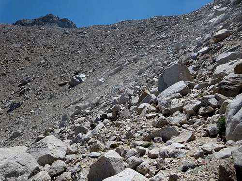
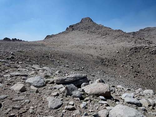
After a long slog, we topped out of the chute about 2:15 pm, hitting 13,220 feet at a point about a third of a mile across a rocky plateau from Mallory’s summit. After a lengthy rest break (too lengthy), we crossed the plateau and made for the final climb to the top of Mallory.
![Mt Mallory]() The plateau between approach chute and final stretch to Mallory summit
The plateau between approach chute and final stretch to Mallory summit![Mt Mallory]() Nearing the final stretch to Mallory summit
Nearing the final stretch to Mallory summitMallory's Summit
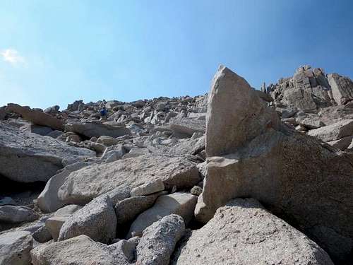
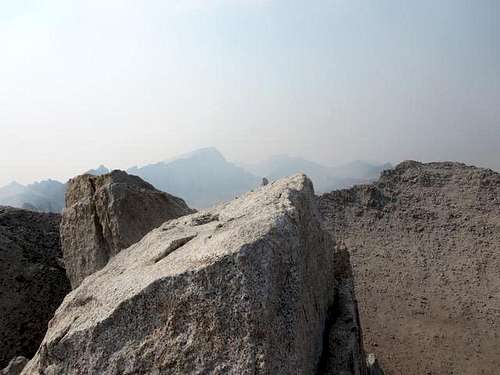
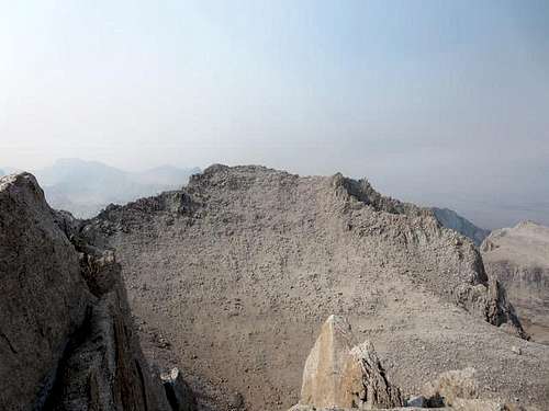
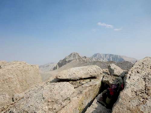
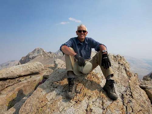
The closer we got to the summit, the more boulders there were to scramble over, which I preferred to the scree. Occasionally, one could find use trails, but they seemed to fade in and out. All three of us reached the summit about 3:45 pm, perhaps two miles of hiking from and 2700 feet above our campsite. Unfortunately, the wind was blowing smoke from the fires on the western side of the Sierra. While we could see many surrounding mountains – Whitney, Irvine, Lone Pine Peak, Le Conte and Langley – as well as the Meysan Lake area below, the smoke obscured what otherwise would have been striking views.
![Mt Mallory]() Rock scrambling near Mallory's summit
Rock scrambling near Mallory's summit![Mt Mallory]() Top of approach chute and plateau from near Mallory's summit
Top of approach chute and plateau from near Mallory's summit![Mt Mallory]() Smoke-obscured view of Whitney from Mallory's summit
Smoke-obscured view of Whitney from Mallory's summit![Mr Irvine]() Irvine from Mallory's summit
Irvine from Mallory's summit![Le Conte and Langley]() Le Conte and Langley from Mallory's summit
Le Conte and Langley from Mallory's summit![Mt Mallory]() Atop Mallory
Atop MalloryWhat Goes Up Must Come Down
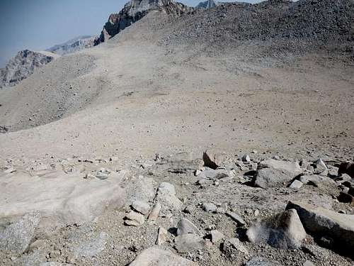
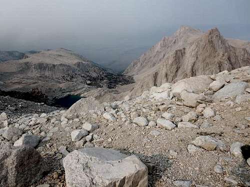
After 15 minutes of photos and snacks on the summit, we headed back down, retracing our course across the plateau to where we had emerged from the chute. We briefly considered trying another chute but worried that we might run into something beyond our capabilities, so we headed down the way we came. At first, at the wide top of the chute, we could proceed in parallel, Ruvicha finding rock on the north side of the chute and Steve2 moving down the scree in the center, while I found some good, stable rock between them. We had space and no one else in the chute, so we did not have to worry about unleashing rocks on vulnerable colleagues below us.
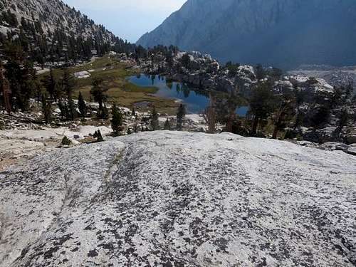
![Meysan Lake]() Myelin Lake area and Lone Pine Peak from top of Mallory approach chute
Myelin Lake area and Lone Pine Peak from top of Mallory approach chute
That worked until the chute narrowed, and we then had to move one at a time, down and then out of the rockfall area before the next headed down. Suffice it to say, we way underestimated how long it would take to get down the chute. By the time the three of us had safely exited the chute, made our way down the watercourse, and reached the south shore of Meysan Lake, it was 8:15 pm … and pitch dark.
No problem, we thought, because we all had headlamps. We found our way around the lake to the northern side and began looking for “Brian’s ledge” – and looking and looking. After two-plus hours of looking and some wandering in circles, we concluded we weren’t going to find it.
![Meysan Lake]() Meysan Lake with "Brian's ledge" visible at 1:00 position
Meysan Lake with "Brian's ledge" visible at 1:00 position![Meysan Lake]() What Meysan Lake and "Brian's ledge" looked like at 8:30 pm
What Meysan Lake and "Brian's ledge" looked like at 8:30 pm
About 11:00 pm, we contacted Jim* via walkie-talkie – he was comfortably relaxing at the campsite with his tent, sleeping bag, extra layers of clothing, food and designer coffees of various kinds – and told him not to wait up; we were going to bivouac. We found a not-too-rocky area, broke out our emergency space blankets, and bedded down for the night somewhere above Meysan Lake. Not particularly pleasant. At best, we dozed a bit. We all shivered, and we were ecstatic when the eastern sky began to gray about 5:30 am.
With a bit of light, it took us five minutes to figure out where we were – a hundred feet or so higher than “Brian’s ledge.” We had walked past the ledge a couple of times in the dark the night before. (Always willing to share blame for our own mistakes, we later told Brian that, in the future, he has to do better at choosing ledges that can be found more easily in the dark.)
We radioed Jim* that we were up and moving. After filtering water from the lake, we headed down, reaching our campsite before 7:00 am, where we enjoyed a breakfast of lasagna and chili mac with beef, i.e., the supper we had expected the night before. After short naps, we broke camp and hiked down to the trailhead, making surprisingly good time. We rewarded ourselves with hot dogs and fries at the Whitney Portal Store.
Observations
This was not our smartest hike. We fixated on getting to the top of Mallory, lost track of time, and completely underestimated how long it would take to descend. With another 30 minutes of light, we would have been able to find “Brian’s ledge” and get back to the trail to our campsite. But we didn’t have that 30 minutes – delays at the start and a longer break than was wise under the circumstances added up. Fortunately, it did not get too cold (in the 40s). We were miserable but not in particular danger. The experience reinforced rules we knew but had neglected: get an early start, set a turnaround time, and keep to the turnaround time.
We had thought the chute from the south side of Meysan Lake to the plateau leading to Mallory would be Class 2. Parts certainly seemed Class 3 to us. As Ruvicha observed, in the chute, we were always one false step from a broken leg. The chute seems to be advertised as the easiest and most direct path to Mallory’s summit from the Meysan Lake area, but it poses challenges and should not be taken lightly.
Finally, I put our times in for reference. We would expect many people to be able to hike this route much more rapidly than we did. But it still is, and should be treated as, a very serious venture.


Comments
Post a Comment