
|
|
Route |
|---|---|
|
|
45.88289°N / 10.96991°E |
|
|
Hiking, Via Ferrata |
|
|
Spring, Summer, Fall, Winter |
|
|
Less than two hours |
|
|
EEA - Easy Via Ferrata |
|
|
Overview
Monte Biaena 1618 m, Via Ferrata del Somator
This itinerary is a round trip which provides a pleasant and panoramic ascent along a route running on the North-East ridge of Monte Biaena 1618 m and involving brief and quite easy rocky passages, well equipped, along the Via Ferrata del Somator, and the descent by walking on "Sentiero della Pace" (Peace Trail). Monte Biaena m. 1618 is an interesting mountain belonging to Prealpi Trentine, located between Val Lagarina and Val di Gresta.
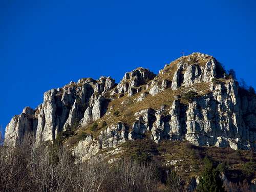
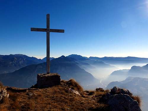
Monte Biaena is rocky and steep on its East side (Val Lagarina), on the contrary it's covered by dense vegetation, mainly composed of coniferous and deciduous beechs, on its West side (Val di Gresta). On the summit there are a cross, some trenches and caves of the Austro-Hungarian positions during the First World War. Just below the culminating point of the mountain, on Val di Gresta side (West), we also can find the nice Capanna Monte Biaena, erected by the S.A.T. Val di Gresta in the year 1984, on the ruins of a WWI cable car summit station starting from Ronzo-Chienis. Also some engineering works designed to collect rainwater, established by the Austrian army during the WWI, are visible, in addition to a small chapel.
Monte Biaena prime and particular location makes it a summit from which it's possible to enjoy unusually large views all around. It's a true open balcony.
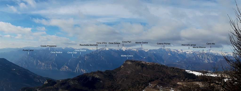
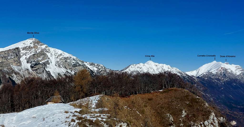
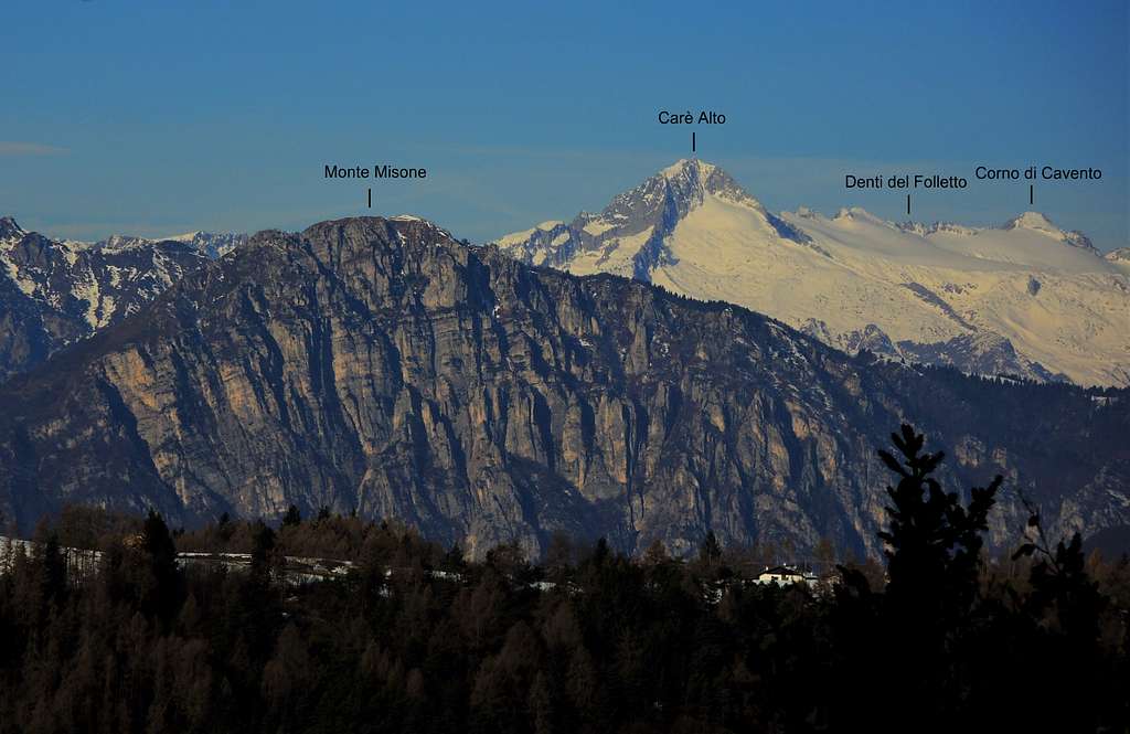
When we reach the top the view extends to 360° over all the surrounding mountains and we can understand the reason of the strategic importance of Monte Biaena for the Austro-Hungarian Empire. The whole Vallagarina, Mount Baldo and Lessini, Pasubio, Carega, Adamello and Presanella, Garda Lake and the Folgaria Plateau, everything remains in view. Monte Biaena was never involved in infantry fighting, anyhow it played an important role for the strategic control of surroundings.
Getting There
Road approach
Coming from A22 Auto Brennero exit Rovereto Sud. From Rovereto are two possible roads to reach Passo Bordala, the starting of our outing: via Val di Gresta or via Val Lagarina.
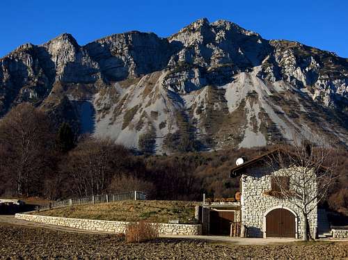
- Val di Gresta approach: follow the signposts to Riva del Garda, getting to Loppio, between Mori and Nago. At Loppio roundabout turn to right and follow the signposts to Val di Gresta, along the road SP88, towards the village of Ronzo – Chienis, which you will reach after about 12 kilometers. Passed this village continue in the direction of Passo Bordala m. 1253, lying between Val di Gresta and Vallagarina, getting to Prà del Lac, then to the Restaurant La Baita m 1180, located just before the pass on the right. Continuing a few hundred meters to the left there is a parking lot.
- Val Lagarina approach: follow the signposts to Villa Lagarina and Passo di Cei, then to Passo Bordala and Ristorante la Baita

|

|

|

|

|

|
Route
Via Ferrata del Somator description
Difficulty: EEA (expert hikers with equipment)
Equipment: the route is well equipped with iron ropes along the most difficult steps
Difference in level: 300 m. from Malga Somator, 420 from La Baita
Exposure: NE
Easy, short and not exposed Via Ferrata that leads up along the North-East ridge of Biaena to the panoramic summit of the mountain. The difference in level is low. The Via Ferrata is managed by the section S.A.T. and has been recently retooled.

|

|
The start is at the restaurant La Baita m. 1180, shortly before Passo Bordala, if coming from Ronzo-Chienis (shortly after the pass if coming from Villa Lagarina), from where a track leads to Malga Somator m. 1310. Reached the shelter, located in the middle of wide meadows, just in front of it across the road and on the right are clearly visible the signposts in the direction to Via Ferrata. Here it begins the route. A well-defined path rising along the slopes through the wood makes us climb up to the mountain NE ridge, along which the itinerary winds. This is the starting point of the equipped sections, that are short and not continuous, alternating with stretches of trail along the crest rising South ward.

|

|
The upper part of the route overcomes a wide groove on a rocky cliff, giving access to the summit ridge. This is the steepest section, equipped with metal cables and fixtures. Exiting the rocks follow the easy summit ridge, leading to the wide grassy summit of the mountain. From the summit meadows heading uphill to the left the trail reachs the summit cross with amazing views all around, while slightly down to the right you reach instead the beautiful Capanna Monte Biaena.
Descent: two possibilities
- from the summit cross descend immediately to the East taking the path 673 (Sentiero della Pace) that descends at first along a grassy slope, then across the wood getting to Casa Grigolli, then following the road in the left direction to Malga Somator
- from the summit cross head to West, reach the Capanna Monte Biaena and from here take the path descending along the West slope to Passo Bordala and reaching the base of the mountain. From here a mainly level path leads on the road connecting Passo Bordala with Malga Somator.

Essential gear
Via Ferrata set is advisable on the last steep crag
Views
Red Tape
No fees no permits required.
When to Climb
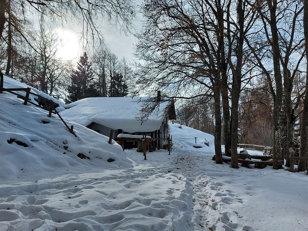
All year round. The mountain is frequently accessible also in wintertime, but you need to inquire in advance about the presence of snow or ice along the route, in which case the route is not advisable.
Shelters

|

|
- Malga Somator
- Capanna Monte Biaena
Accomodation
Several possibilities of accomodation in Val Lagarina and Val di Gresta