
-
 766 Hits
-
 81.84% Score
-
 14 Votes
|
|
Route |
|---|---|
|
|
46.09371°N / 11.38679°E |
|
|
Mountaineering, Skiing |
|
|
Spring, Winter |
|
|
Half a day |
|
|
F |
|
|
Overview
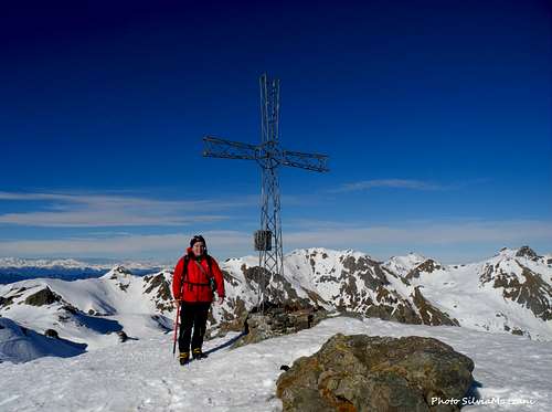
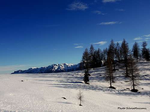
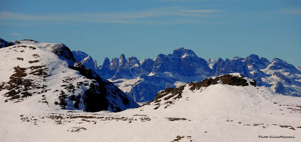
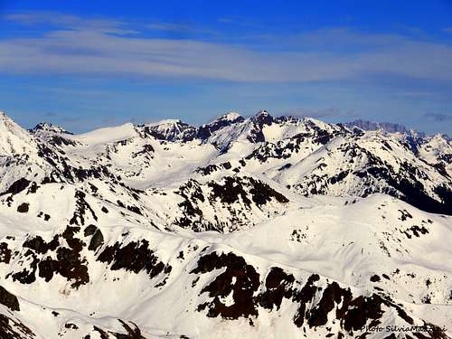
Monte Còla 2262 m is a mountain belonging to the Lagorai group and has a dual aspect: on the North side it is rocky, while towards the South and West it descends less steeply with grassy slopes. On the summit crest of the mountain there are remains of a trench and WWI posts. A large iron cross with the summit book has been placed on the summit, from which it's possible to enjoy a superb panorama, vast in every direction.
This page describes a rewarding winter itinerary which is not too demanding in terms of technical difficulties and with a difference in altitude of about 900 meters. Depending on the conditions of the snow and personal aptitudes, it can be tackled on skis, with crampons and ice-axe or snowshoes. It's a popular itinerary, anyhow the southern exposure and the not very high altitudes make this route advisable only with a settled snowpack.
Getting There
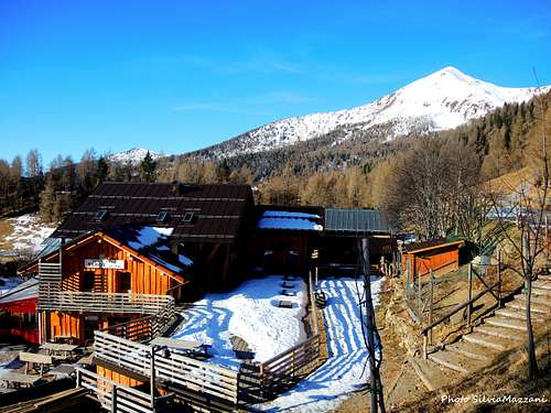
By car - autoroute A22 (Brennero-Modena) - exit Trento Centro - take the SS47 - Valsugana state road direction Padova-Venezia and follow to Levico and then Roncegno. In the village of Roncegno continue in the direction of Ronchi along the SP65. After about 1.5 km at a crossroads, take the road on the left with indications to Le Pozze and Rifugio Serot. Continue driving along the road rising with several hairpin bends between the farms, until you reach the parking lot in locality Le Pozze 1435 m. near the bar-restaurant.
Nearest airports : Verona (Aeroporto Valerio Catullo) - Venezia (Marco Polo Airport) - Bolzano (Bolzano Sud Airport)
Route Description
Monte Còla winter route from Le Pozze
Summit altitude: 2262 m
Difficulty: F
Difference in level: 832 m from Le Pozze
Starting point: Le Pozze 1430 m
Interesting winter itinerary in an alpine environment
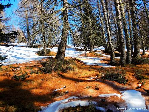
From the parking lot near the restaurant Le Pozze 1430 m you go to intercept a road on the right with indications Agritur Rincher and follow it up to a hut, where the road ends to become a path. You immediately come to a crossroads, to the left there is the route to Lago delle Prese and to the right to the Rifugio Seròt. Follow the signs for the Rifugio Seròt, taking immediately a small sunken valley. Go up it passing near a nice alm to exit on an asphalted road that quickly leads to the Refuge Seròt 1570 m. In front of the refuge, you proceed walking on an open slope, reaching at the top a nice group of alms. Go past the group of alms in the North-West direction and continue obliquely to the left and then again in the bottom of the valley with a mule track that you follow in the sparse larch forest exiting on an open slope.
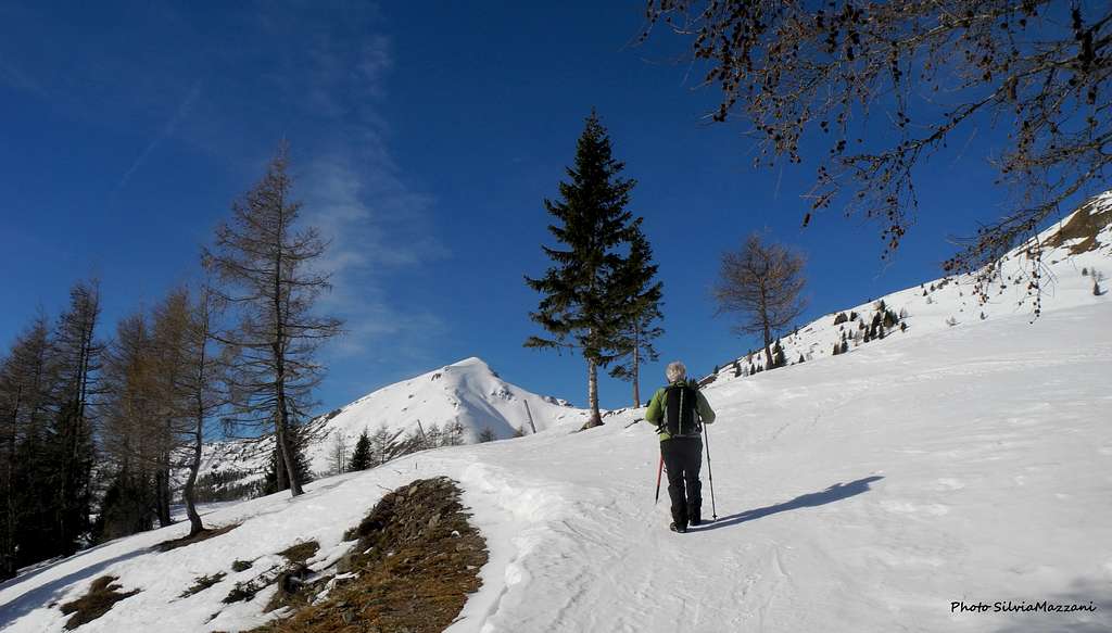
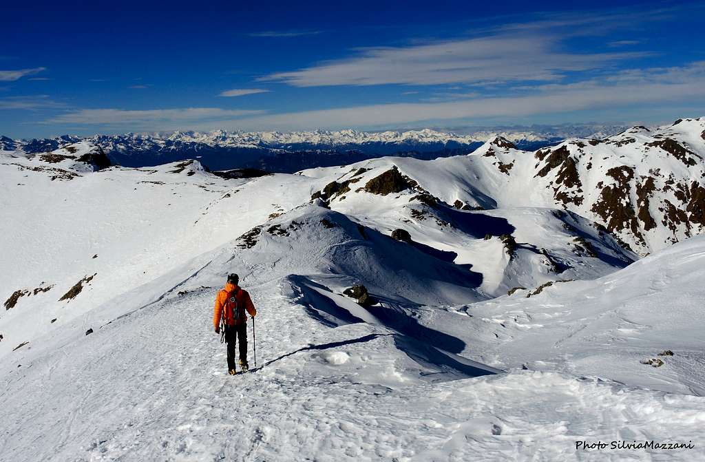
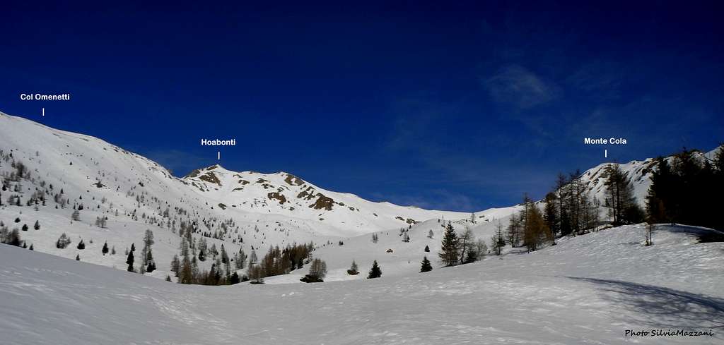
To the right walk up an open slope aiming for a large saddle on the right. At the saddle turn left taking a mule track that you follow for a long time with several hairpin bends until you come out on an open slope. We overlook here the beautiful Val d'Ilva and in front of us we have the outline of the Monte Fravort and up to the right a big cross. Now the vegetation ends and we start to climb the open slopes with a beautiful view of the rest of the route, the Val d'Ilba and the Hoabonti mountains (left) and Cola (right). You enter the valley up to the evident small hut at an altitude of 1902 m meters.
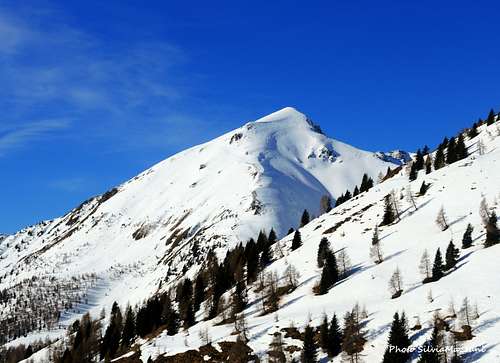
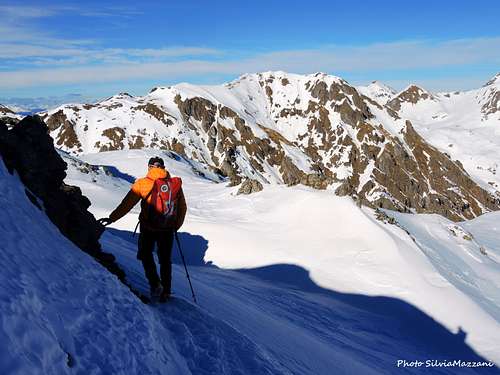
Proceed directly by coming out on the upper slopes, keeping a little on the right below the slopes of Monte Cola and aiming to the wide saddle between Monte Cola on the right and the Hoabonti previews on the left. At the base of the slopes under the wide saddle go up the steep slope reaching the depression along the ridge between Monte Cola on the right and Hoabonti on the left with a characteristic reddish boulder. From the saddle keep to the right and traverse skirting a short ridge reaching the base of the final slope. Climb it in a fine snow milieu reaching the high summit cross.
Descent: reversing the route
Essential Gear
Ice axe, crampons or snowshoes, winter clothing
Summit views
Red Tape
No fees no permits required
When to climb
Snowshoeing and ski-mountaineering: from December to March/April
Hiking: from May to November
Accomodation and support points
Different possibilities of accomodation in Roncegno and Valsugana.
Nearest support points: Bar/Ristorante alle Pozze, Rifugio Serot
Meteo
Meteo Trentino
Dolomiti Meteo - Trentino
Guidebooks and maps

"Lagorai - Cima d'Asta" - Mario Corradini - Collana Guide dei Monti d'Italia CAI-TCI 2006
"In vetta con le ciaspole nel Trentino" Ed. Tappeiner 2014
"Lagorai - Scialpinismo d’avventura" - Alessandro Beber, Ed. Tappeiner
Maps
"Lagorai - Cima d´Asta" KOMPASS N. 626
"Lagorai" Tabacco scala 1:25.000 – Foglio 014
"Lagorai-Cima d'Asta" 4Land n.113