
-
 5715 Hits
-
 87.31% Score
-
 24 Votes
|
|
Route |
|---|---|
|
|
45.94144°N / 10.84558°E |
|
|
Hiking, Mountaineering |
|
|
Spring, Summer, Fall, Winter |
|
|
Most of a day |
|
|
F |
|
|
Overview
Monte Misone Normal Route
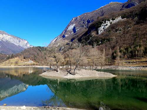
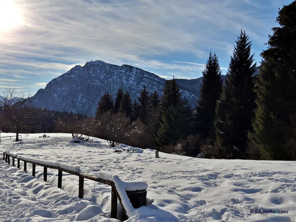
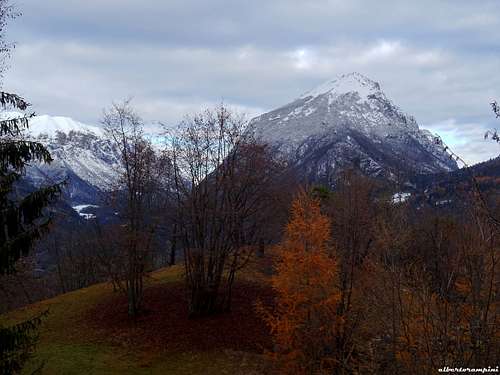
Monte Misone 1803 m is a mountain of significant size that overwhelms the beautiful body-water of Lago di Tenno, rather isolated from the central part of the group to which it belongs, the Ledro Alps. Monte Misone stands alone to the NW of the Lago di Garda, between the Ledrensi Alps and the Brento-Casale group, and also dominates the southern head of the Sarca Valley. Although it does not reach the 2000 meters of altitude, it is a impressive mountain, steep and imposing on its Eastern side with high rock walls.
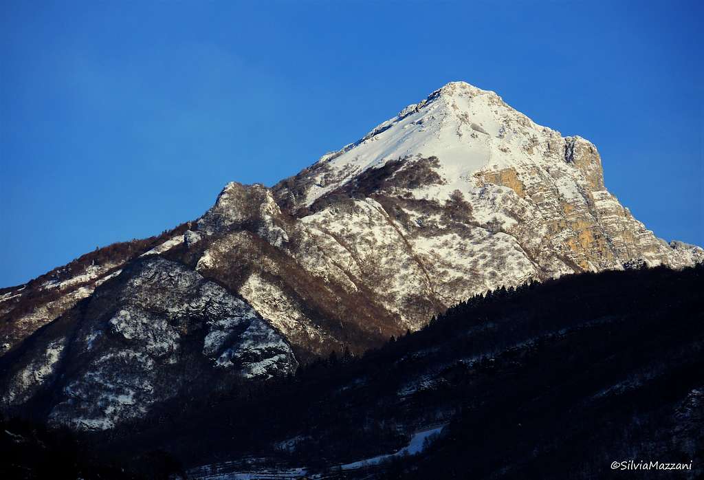
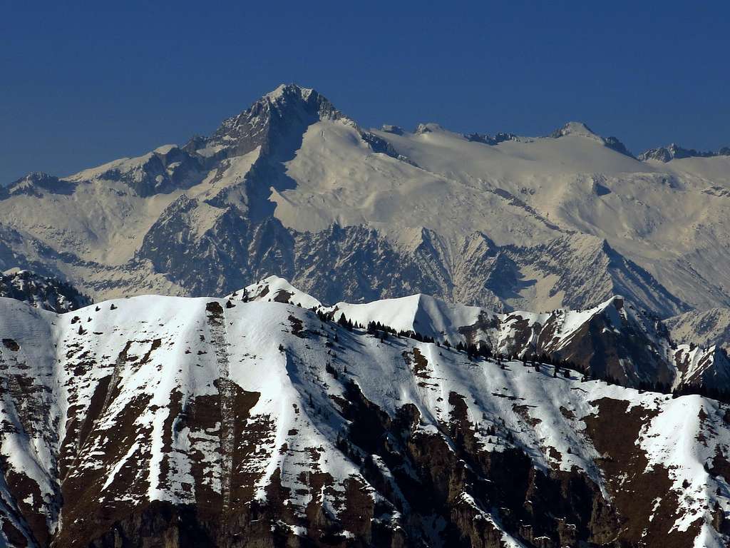
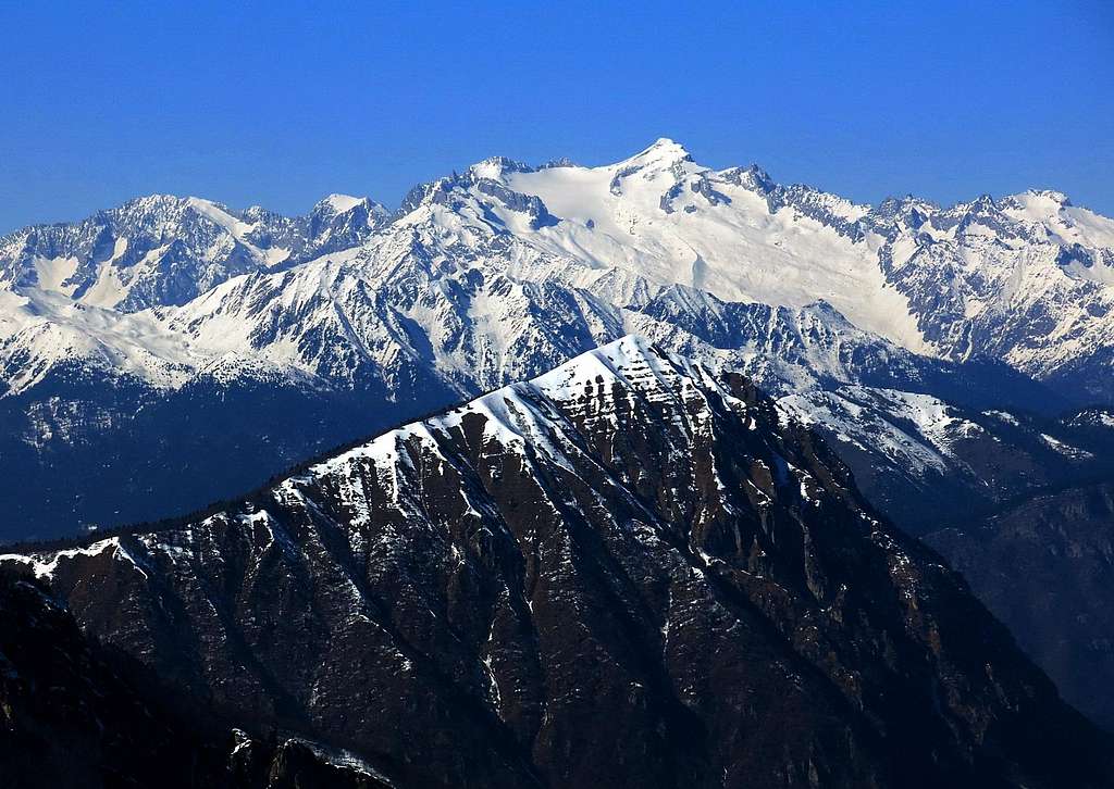
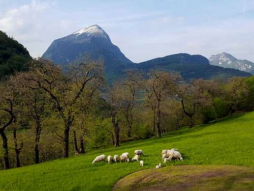
Monte Misone has instead a wood-covered West side standing above the grassy basin of Malga Tenno, also called Malga Misone. Its prime and secluded location makes Monte Misone a very interesting destination in reason of the wide summit views, indeed from the top the view extends over the lakes of Garda and Tenno and over the major mountain ranges of Trentino. Right in front of us in the NW direction we see the magnificent Brenta Group and the beautiful glaciers of the Adamello and Presanella Groups.

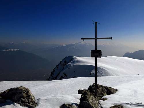
A moderately difficult hike leads to the summit of Monte Misone, where it opens a breathtaking 360-degree panorama over the lakes Garda and Tenno and the major mountain ranges of Trentino groups: amazing the glance on Presanella, Adamello and Carè Alto with their glaciers and, to the South-East, the vast ridge of Monte Altissimo di Nago and Monte Baldo range.
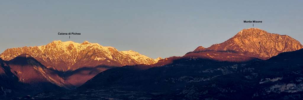

Moreover the view can range over the groups of Alpi di Ledro-Gavardina and to the North over the Brenta Dolomites, Paganella and Sarca Valley with Bondone, Cornetto Cronicello and Monte Stivo.
Getting There
Road approach
 from South-East")
 and Brenta Dolomites (back) from Cima d'Oro")

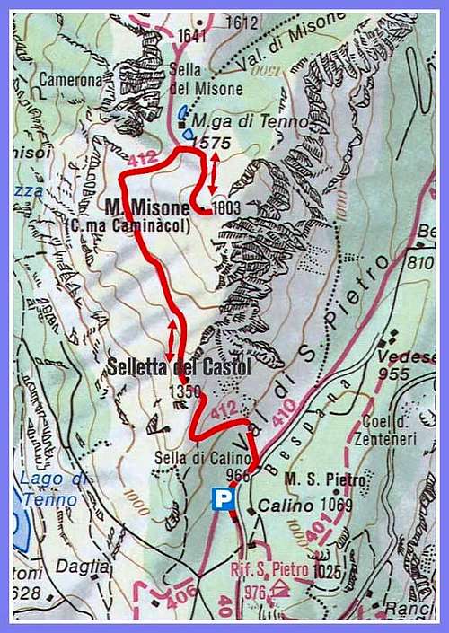
Coming from A22 Auto-Brennero exit Rovereto Sud. From here take the direction towards Arco and Riva del Garda. Pass Nago and follow the road to Riva del Garda. Once in Riva del Garda take the road SP37 towards Tenno. Getting the village of Tenno proceed briefly in the direction of the lake, passing the hamlet of Villa di Tenno. A little further on we find, on the right, a narrow asphalt road signposted "Rifugio San Pietro". Leave the main road and follow this latter, rising up to a fork in the woods in the vicinity of a little group of alms at about 900 meters of altitude, located below Sella di Calino. Small parking lot near the alms. From the parking lot the right branch of the forest road leads to the refuge San Pietro. You must take the forest road left branch to Monte Misone and Sella di Calino.
Route Description
Monte Misone Normal Route
Summit quote: 1803 m
Difficulty: E/F (in winter)
Difference in level: 900 m from the parking lot below Sella di Calino
Exposition: South-East, then West and North
Time required: 5 hours round trip
Moderately difficult hike that leads to the summit of Monte Misone, where it opens a breathtaking 360° view of the lakes Garda and Tenno and major mountain ranges of Trentino groups. In winter usually there is a beaten track up to Malga Tenno. Winter ascents needs axe and crampons or alternatively snowhoes with fresh snow.
Route report


From the parking lot the right branch of the forest road leads to the refuge San Pietro. You must take instead the left branch to Monte Misone and Sella di Calino. After a few tens of meters along this road we find the turnoff to the left (signpost 412) leading to Sella di Castiol and to the summit of Monte Misone. Therefore we leave the forest road and start to climb along the steep path in the direction of Sella di Castiol, allowing to quickly gain altitude. Sella di Castiol m 1350 is the point that marks the passage from Monte Misone South-East side to the West side. The trail features changes becoming less steep and navigating inside the beech forest keeping us higher than the Lago di Tenno valley.


Slowly the beech forest becomes sparser giving way to the larch. After crossing a gully, we reach a characteristic narrow saddle from where the view opens towards the Giudicarie and in the background, towards Brenta Dolomites and the peaks of the Adamello. The path turns to North-East and after a final stretch again in the shadows of the forest the trail comes out in the superb and idyllic basin of Malga Tenno, also called Malga Misone, enclosed to the North by beautiful pine forests, with some small shelters. A few tens meters before getting to the alms we find the signpost to the summit of Monte Misone. We leave the open basin to turn sharply to the right, following an ascending slanting right path climbing the North-East side of the mountain.


The climb leads briefly in coniferous forest and then a new sharp bend brings us back to the left. When there is a considerable amount of snow it takes us longer to cross the slopes between scattered trees. After the long cross trail with a new sharp bend the trail to the summit brings us back to the right, where the forest gives way to the altitude grassland. We climb the last steep grassy hump reaching the cross and the summit book. Broad and boundless is the landscape, thanks to the isolated location of Misone.

To the South the head of Lago di Garda dominated to the left by Monte Altissimo di Nago and further the long chain of Mount Baldo. To the South-West the chain from Rocchetta Giochello to Sclapa and Parì peaks. Immediately to the right of Cima Parì we see the marked Bocca di Trat, then up again, to the West, the Pichea summits and Tofino.

To the Northwest it appears the vast icy regions at the foot of Carè Alto and Adamello and Presanella groups. The northern horizon is closed the Brenta Dolomites and to the right on clear days we can see also Paganella and Lago di Molveno.
Descent: reversing the same route
Essential Gear
In winter axe and crampons are needed
Red Tape
No fees no permits required.
Huts and accomodation
- Rifugio San Pietro
Several possibilities of accomodation in Riva del Garda and Tenno.
Views of Monte Misone
When to climb

 on Monte Misone")
All year round. Anyhow the climb is not recommended in winter after recent heavy snowfalls. Be aware that in winter time and early spring the Western and Northern sides of Monte Misone, given the exposure, may present significant accumulations of snow after the Sella Castiol.
Meteo
Guidebooks and maps
Maps:
KOMPASS sheeet 071 – Alpi di Ledro Valli Giudicarie 1:50.000
LAGIRALPINA sheet 016 - Alpi di Ledro - Tremalzo
TABACCO sheet 055 - Arco/Valle del Sarca/Valle dei Laghi