
-
 530 Hits
-
 82.48% Score
-
 15 Votes
|
|
Mountain/Rock |
|---|---|
|
|
46.50274°N / 10.98616°E |
|
|
Bolzano Alto Adige |
|
|
Hiking, Scrambling |
|
|
Summer, Fall |
|
|
7858 ft / 2395 m |
|
|
Overview
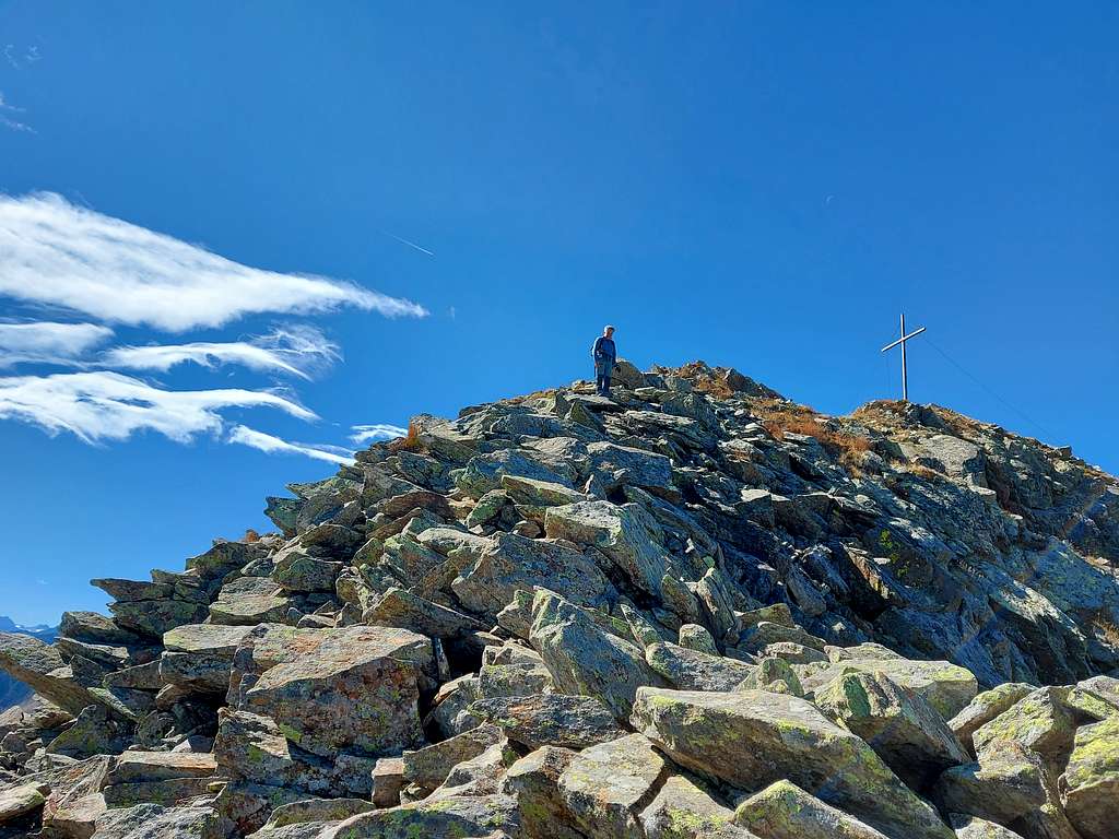
Monte Ometto / Mandlspitz 2395 m
As all the mountains in the county South Tyrol/Bolzano Alto Adige, this mountain has two names: Monte Ometto in italian and Mandlspitze, the original Tyrolean name. It is a mountain belonging to the little-known Maddalene/Magdalener Group, in the upper Val di Non, and it's located in a secluded position, slightly shifted to the South of a crown of peaks that goes from the Cornicoletto m 2418 to Vedetta Alta m 2627 to Monte Brez.
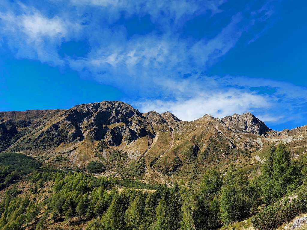
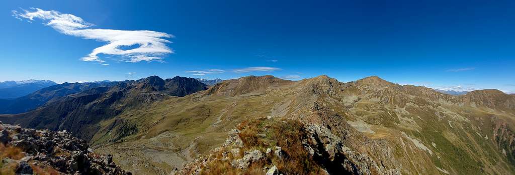
The particular position of Monte Ometto allows a beautiful view of the nearby surrounding mountains such as the Vedetta Alta/Hochwart, just in front of it. In addition to these ones, further away, the summit truly enjoys a formidable wide panorama over countless alpine groups, such as the Brenta Dolomites, the Adamello Presanella group, the Ortles-Cevedale and to the east various groups of the Western Dolomites, such as Pale di San Martino, Catinaccio, Marmolada, Sassolungo. To the North the view stretches over the mountain groups on the border with Austria, while to the South we have a broad overview of the Trento pre-alpine mountain groups, as just for example the Little Dolomites and the Bondone group.
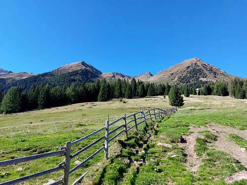
The summit can be reached by following different itineraries, a couple of them are presented on this page. The first part of both itineraries takes place mainly in a bucolic area with alpine huts, woods and pastures, then the route becomes steeper and on wilder terrain in the final stretch.
Getting There
From Cles in Val di Non continue towards Cagnò and Revò, then take the Val d'Ultimo state road towards Proves, a village in the German-speaking part of the Val di Non.
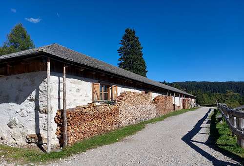
- Access to the first itinerary: at the junction to Proves, along the Val d'Ultimo state road turn left towards the village center. Shortly after the crossroads and before a bridge, a few hundred meters before reaching Provès, we take a road on the right that climbs up the “Kirchbach” valley. Follow it up to the first bend, where there is a large clearing for parking, near the beginning of path 19, signposted to Stierbergalm (Malga Manzara). We follow this signpost and after a stretch in the woods we return to the cart track that reaches the hut.Shortly after the crossroads and before a bridge you will notice a dirt road on the right: take it up to the first bend where there is a large clearing for parking. From the car park take the trail number 19 which, along the forest road, interspersed with a forest path, reaches the Stierbergalm alm 1850 m.
- Access to the second itinerary: at the junction to Proves continue along the main Val d'Ultimo state road connecting the Val di Non with the Val d'Ultimo. You can leave your car at the first car park on the right before the tunnel at 1700 m of altitude or at the second one after the tunnel (Hofmahd car park).
Route from Proves
Summit quote: 2395 m
Difficulty: EE
Difference in level: 990 m from parking lot near Proves
Starting point: parking lot near Proves
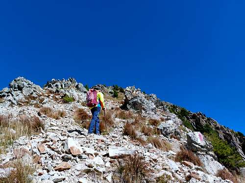
From the car park take the trail number 19 which, along the forest road, interspersed with a forest path, reaches the Stierbergalm alm 1850 m. Here we continue on the path n. 12 which heads to the top of Monte Ometto. The track, which is initially very bumpy and steep, crosses the path 133 "Aldo Bonacossa" at an altitude of 2120 m, a path that crosses the entire Southern slope of the Maddalene chain, starting from the Palade pass and reaching Rabbi. We ignore this trail and we continue on the path n. 12. After an easy stretch that takes us to the foot of the rocks, the path continues very steep and sometimes requiring a bit of scramble up the rocks. At an altitude of 2395 m we reach the wooden cross on the top of Monte Ometto. Below us we have the Stierbergalm and the village of Provès, while further away, among the clouds, you can see the highest peaks of Brenta and Presanella. Magnificent views also over the nearby Val di Non with the Lake of Santa Giustina
Route from Val d'Ultimo tunnel parking (Passo Castrin)
Summit quote: 2395 m
Difficulty: EE
Difference in level: 710 m, long develope
Starting point: Val d'Ultimo tunnel parking (Passo Castrin) 1685 m
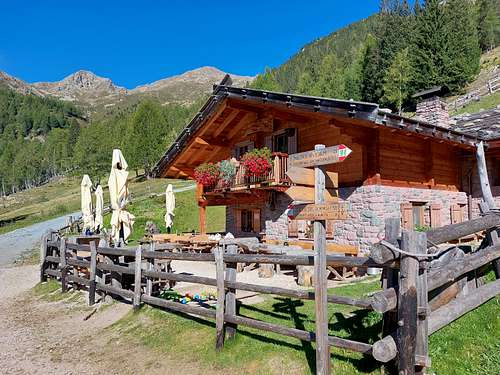
The first part of the itinerary is a pleasant path that touches three fine mountain alms. From the parking lot follow on the left of the road the mule track n. 8 which climbs into the woods, or alternatively take the shortcut track starting just in front of the parking lot and joining soon the mule track. The mule track gets quickly the Malga Cloz 1732 m. From here in about 10 minutes to the following Malga Revo/Rawauer Alm 1734 m.
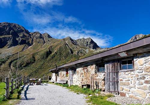
From Malga Revo head towards the lower Kessel alm 1670 m by walking slightly downhill. Once you have descended to Malga Kessel, it start the track (n. 11) to reach the upper Kessel alm with various hairpin bends.
A shorter alternative without passing the lower Kessel alm is to take the path 133 named "Aldo Bonacossa" on a track between pastures at a crossroads, always follow path 133 towards the Brez pass, then proceed on a path in the woods following to the upper Kesselalm. Out of the woods reach a dirt mule track that leads to the upper Malga Kesselalm 1917 m.
Here ignore the path n. 11 and take to the left the path 133 ("Aldo Bonacossa"). This path descends briefly, then climbs first through some meadows and then on a stony ground with slightly exposed stretches crossing the hillside. When you arrive in a grassy area with no more exposure there are two alternatives:
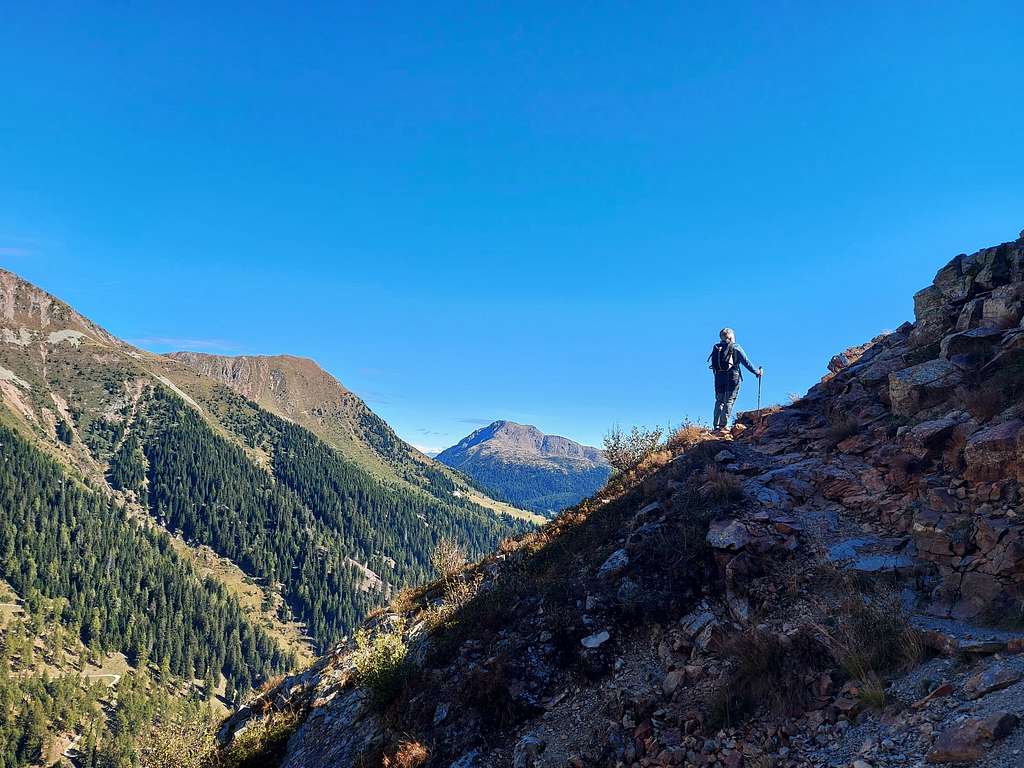
- ignore the path 133 and turn right to take a path, visible but not marked apart from a red sign on a boulder that climbs up the slope where some avalanche barriers are visible further high, then on a nice ridge to the summit cross.
- alternatively the second choice is to continue to cross the side of the mountain along the path n. 133 to join the path n.12 coming from Proves and take it to the right to reach the summit as with the previous itinerary. These two itineraries can be combined, going up by the path 12 and going down the ridge.
Red Tape
No fees no permits required
Hiking and scrambling grades
T - Turistico (Tourist): Itineraries on wide, clear and well worn paths, sometimes on mule tracks or gravel roads. The routes are never exposed, don't give any orientation problems and don't exceed 2500 meters of altitude. Suitable also for children.
E - Escursionisti (Hikers): Itineraries on marked trails, even narrow and with possible steep and impervious sections. They are never exposed and don't give any orientation problems. They can tread different kinds of ground, such as forests, gravel, meadows, pastures, easy rocks, etc.). They form the majority of the trails that wind up in the mountains and require a certain habit to walk; you need equipment suitable for the altitude and resistant footwear with soles suitable for rough terrain.
EE - Escursionisti Esperti (Experienced Hikers): Itineraries for hikers with experience and good knowledge of the mountain. Some of these paths may have exposed sections, however brief, which require firm foot and no dizziness. They require the ability to adapt to particular terrain, such as steep grassy slopes or stretches of rocks with difficulties that can reach the 1st degree of the UIAA scale. They can also reach high altitudes (3000 m or more). Sometimes they may include unmarked sections, requiring a good sense of orientation. Snow slopes are possible, however which can be overcome without specific mountaineering gear (rope, harness, crampons, ice-axe).
EEA - Escursionisti Esperti con Attrezzatura (Experienced Hikers with equipment - The same as EE, in addition these routes require the use of via ferrata equipment (lanyards, harness, carabiners, heat sink, helmet). This kind of itineraries range from the trails with short easy and not much exposed sections, previously equipped with fixed ropes and iron pegs, to the true and more difficult Via Ferratas climbing on rocky walls or on aerial ridges and ledges, previously equipped with long stretches of iron ropes, iron steps, ladders without which proceeding would constitute a real climbing. It is necessary to know how to use the technical equipment and have a certain habit of exposure and mountaineering terrains.
When to Climb
From June to October
Accomodation
Various possibility of accomodation in Proves and surroundings.
Meteo
Guidebooks and maps
Maps
- Val di Non 4land Scala 1:25.000 2020 ISBN 978-8-88982-390-3
- Kompass n. 53
- Tabacco n. 42