Overview
![Monte Piana and Monte Piano]() Monte Piana from Rifugio Locatelli
Monte Piana from Rifugio Locatelli| route type | snowshoes |
| elevation | 2324 m |
| elevation gain | 570 m from Misurina |
| length | 11 km |
| Difficulty | easy hike – no avalanche danger |
| Time required | 4 hours |
This popular route is a very easy and relaxing snowshoes hike ( that can be done also with skis following a slightly different trail ) , very rewarding for the spectacular views especially on the famous Tre Cime di Lavaredo. The 360° panorama from the summit is fantastic, much better than the summer view even though you can’t see the very impressive rests of the WWI on Monte Piana, completely covered by the snow. My advice is to avoid this route on the weekends, because the Rifugio Bosi ( that is situated a few hundred meters below the summit of the mountain ) can be reached by shuttle services with motor-sleds from Misurina so there is always too much people to enjoy the perfect beauty of this magic place.
Getting There
Misurina can be reached from
Dobbiaco/Toblach trough the
Val di Landro and the
Val Popena Bassa ( 21 km ), from
Cortina d’Ampezzo trough the
Passo Tre Croci ( 14 km ) and from
Auronzo di Cadore trough the
Val d’Ansiei ( 20 km ). From the lake follow the indications for
Rifugio Auronzo and park your car before the toll road, near the
Bar Genzianella.
Route Description
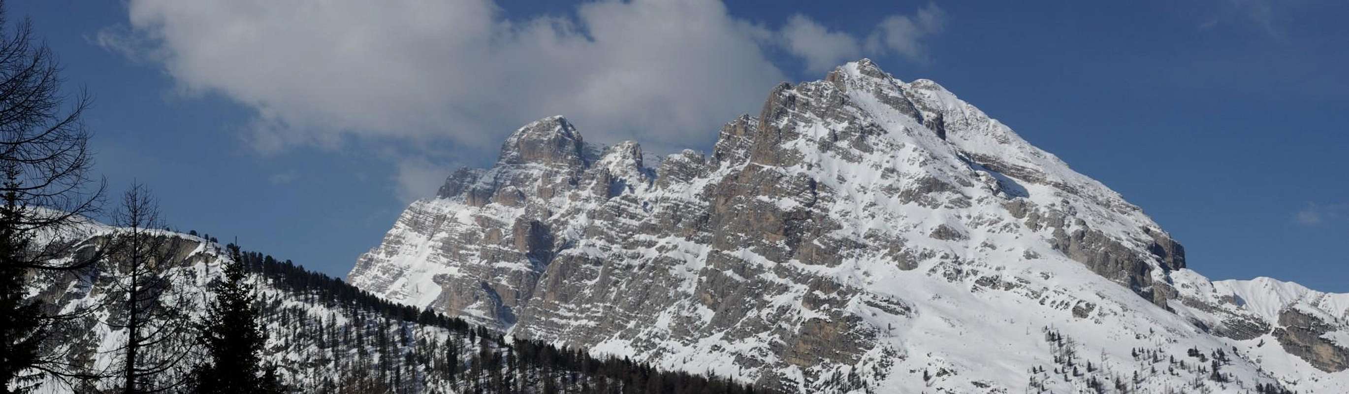
Cristallo group ![]() |
From the parking lot take the road to
Rifugio Bosi ( big sign ) and after 20 minutes or so turn left following the indications “
Monte Piana – Pedoni” or “
itinerario ciaspe n°1” . If you are with skis you have to follow the tracks of the motor-sleds on the right. In this first part are really beautiful the views to the
lake of Misurina with the massive
Sorapiss in the background , to the
Cadini and to the
Cristallo group. After 1 hour you’ll reach the
Forcella Alta ( 1984 m ), where the view opens to the wonderful
Tre Cime. From the notch you have just to turn left and follow the road to the
Rifugio Bosi, that you’ll reach in half an hour. From the hut you have to go up for another 20 minutes till you’ll reach the
Capanna Carducci on the summit of
Monte Piana. From there you can admire a stunning view of the
Tre Cime di Lavaredo but also of the
Cadini, the
Marmarole, the
Sorapiss, to all the
Cristallo group, the
Tofane, the
Fanes-Braies-Sennes group, the
Croda Rossa d’Ampezzo, the
Croda del Becco, the
Picco di Vallandro, the
Rocca dei Baranci group, the
Monti Rudo group, the
Croda dei Rondoi and all the
Tre Scarperi group.
![Forcella Alta]() Forcella Alta Forcella Alta | ![Rifugio Bosi al Monte Piana]() Rifugio Bosi Rifugio Bosi | ![Capanna Carducci]() Capanna Carducci Capanna Carducci |
Summit views
Tre Cime di Lavaredo  | | Croda Rossa d’Ampezzo  |
|---|
|
![Views from Monte Piana - Punta dei Tre Scarperi]() Punta dei Tre Scarperi Punta dei Tre Scarperi | ![Views from Monte Piana - Cristallo]() Cristallo group Cristallo group | ![Rifugio Locatelli alle Tre Cime di Lavaredo]() Rifugio Locatelli Rifugio Locatelli |
![Picco di Vallandro]() Picco di Vallandro Picco di Vallandro | ![Cadini di Misurina]() Cadini di Misurina Cadini di Misurina | ![Monte Piano]() Croda dei Rondoi, Monti Rudo and Rocca dei Baranci Croda dei Rondoi, Monti Rudo and Rocca dei Baranci |
Panoramic views

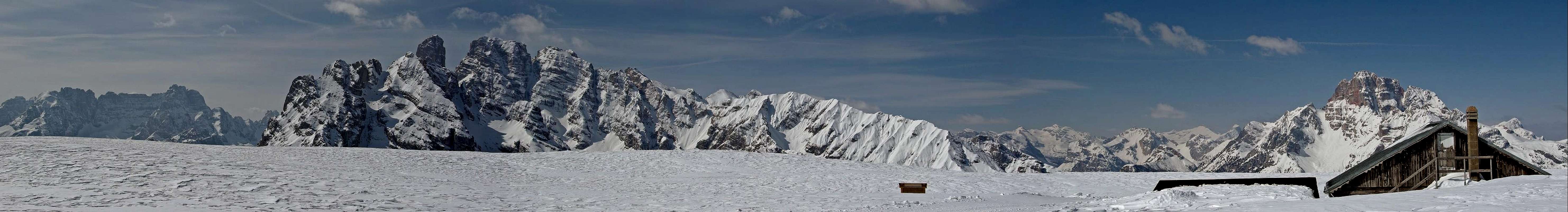
 Monte Piana from Rifugio Locatelli
 Forcella Alta
 Rifugio Bosi
 Capanna Carducci

 Punta dei Tre Scarperi
 Cristallo group
 Rifugio Locatelli
 Picco di Vallandro
 Cadini di Misurina
 Croda dei Rondoi, Monti Rudo and Rocca dei Baranci