
|
|
Route |
|---|---|
|
|
45.80928°N / 11.15979°E |
|
|
Hiking, Scrambling |
|
|
Spring, Summer, Fall |
|
|
Half a day |
|
|
EE |
|
|
Overview
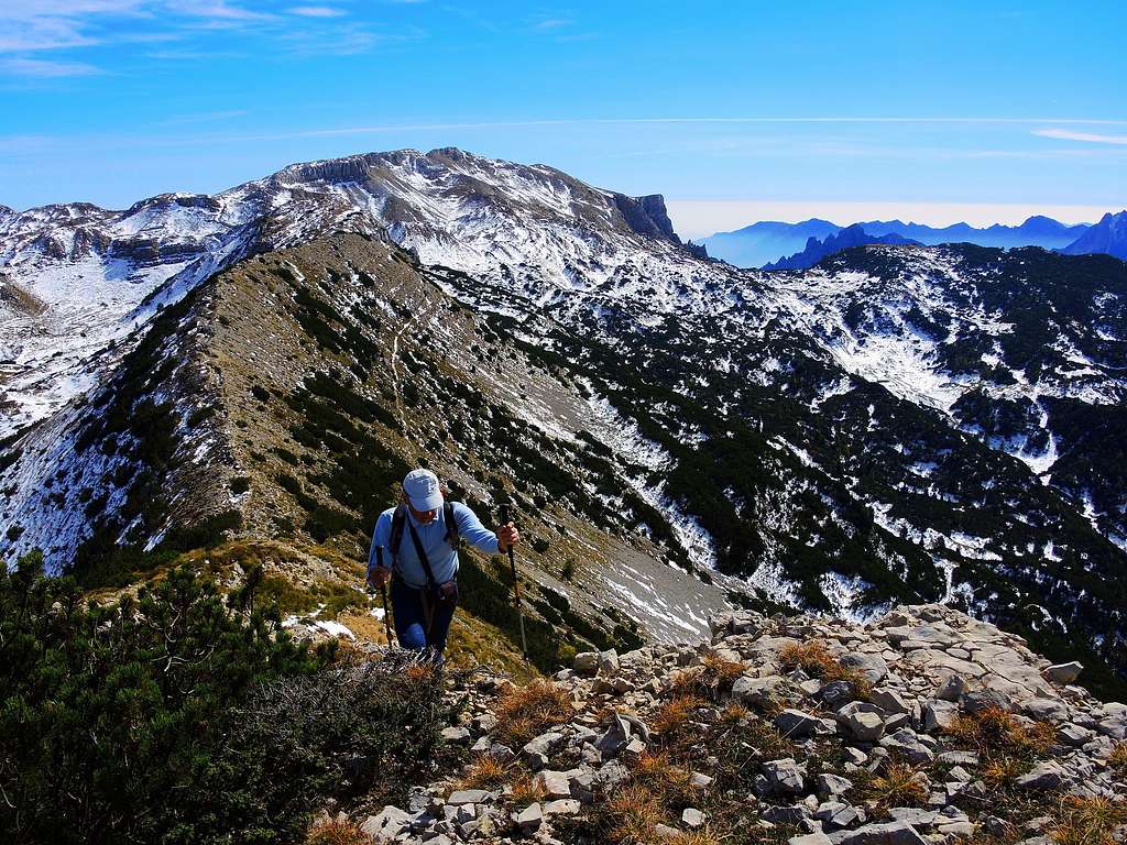
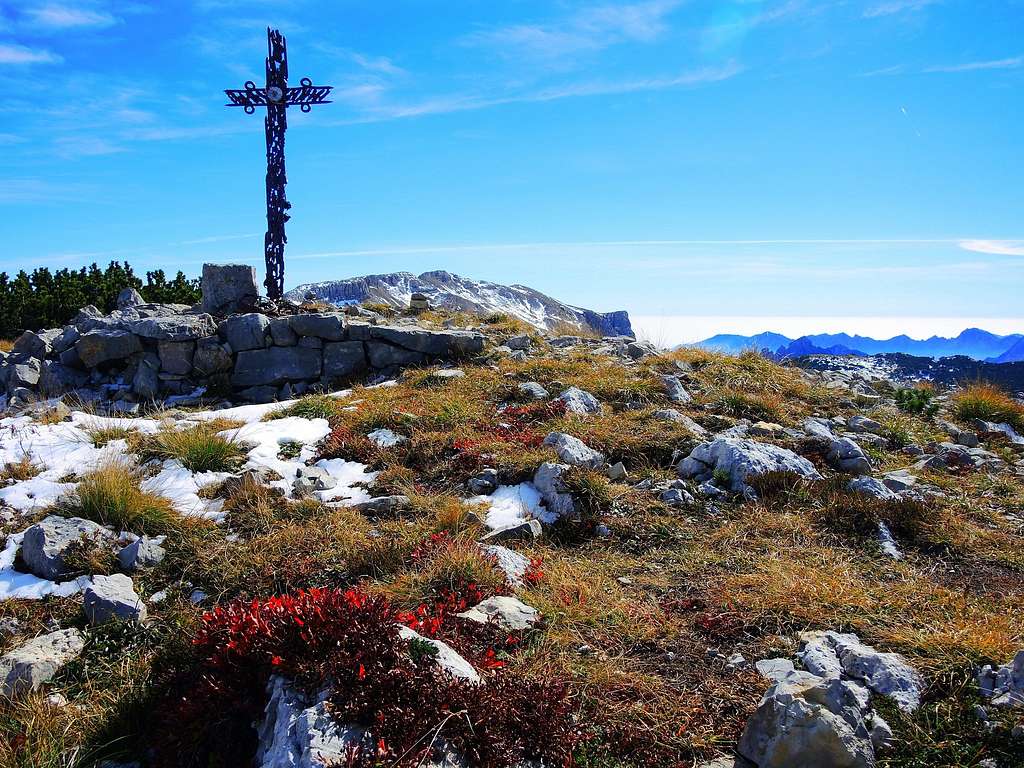
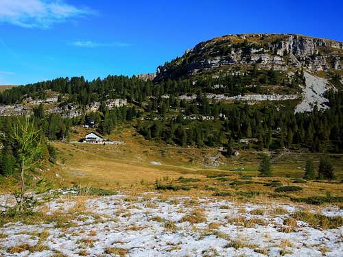
Monte Roite 2144 m is a mountain located on the Trentino side of the Pasubio Group in the shape of a marked ridge that extends from the Bocchetta delle Corde to the Sella del Ròite. This summit, one of the highest of the group, played an important role during the battles held in this area during the WWI. Its crest is largely occupied by a big Austrian trench.
There are some routes to reach the summit, the one described on this page is not the Normal route. This itinerary winds through an uncontaminated and spectacular landscape, interesting also in reason of the numerous and significant remains of artefacts dating back from the Great War. It entirely follows the long mountain ridge that starts from the Bocchetta delle Corde and descends to the Sella dei Campiluzzi.
Getting There
The ascents starts from Malga Chéserle 1402 m, which is reached from Rovereto.
Road accesso to Malga Chéserle
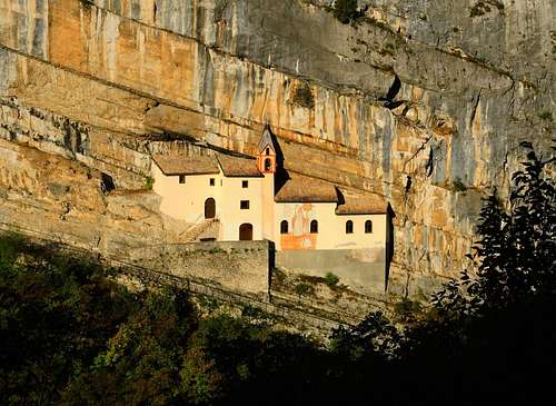
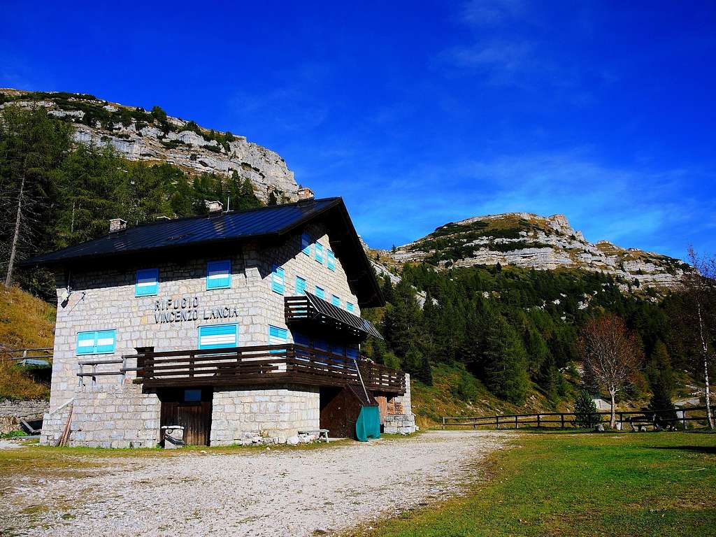
From Autobrennero A22 exit Rovereto Sud ant take the SS46 Vallarsa-Pasubio state road. After the interesting Eremo di San Colombano, leave the main road and turn to left on the road SS 50 following the signpost "Trambileno", "Giazzera" and "Rifugio Lancia". The road climbs up with some bends and forks, we always follow the signposts for the Rifugio Lancia and Giazzera. Once in the little village of Giazzera 1095 m we follow the signpost to the Rifugio Lancia. Here the road becomes narrow, even if it remains paved for about 3 km until reaching the plain of Malga Chéserle at about 1400 meters of altitude, where it becomes a dirt road and where it is possible to park the car in some parking lots. Nearby there is a small former Austro-Hungarian war cemetery
Route Description
Monte Ròite NW ridge
Summit quote: 2144 m
Difficulty: EE
Difference in level: 740 m from Malga Chéserle 1402 m
Time required: 4 hours round trip
Starting point: Malga Chéserle
Route description
From the car park follow the unpaved road (Path SAT n. 101) that continues towards the Refuge Vincenzo Lancia, with possible shortcuts cutting the bends of the road. Along the way ignore all the paths that branch off from the gravel road and continue along the path SAT 101 getting the enchanting pastures of the Alpe Pozze, where it's located the Rifugio Vincenzo Lancia 1802 m. Reached the refuge we continue passing in front of the building of the hut along the path SAT 105, which continues horizontally and after a short distance heads to right.
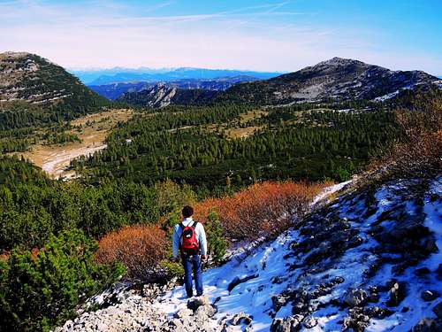
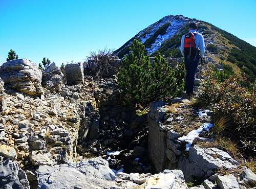
Alternatively, without passing in front of the refuge, we can take the path SAT 102. Both paths soon reach the Bocchetta delle Corde. From here continue on the path 105 (European E5, the Path of Peace) until we reach a small plateau at the foot of Monte Roite. At this point, while the path E5 105 continues to the right in the direction of the Refuge Achille Papa, head to the left taking a faint track that after a few tens of meters heads to right, leading to the foot of the Monte Ròite NW ridge. After reaching the base of the ridge we begin to climb it carefully between rocky walls, keeping on the edge of the long Austrian trench that cuts all the ridge to the top of Monte Roite. From the summit the panorama is wide and magnficent, we can in fact see the Pasubio Group with the Dente Italiano and the Dente Austriaco, the Col Santo and on the other side of the Vallarsa the Carega group.
Descent: the descent may be donealong the same route. Alternatively - advised - is possible to continue on the summit ridge and reach the Sella dei Campiluzzi and frome here take the path SAT 120 to Sella delle Pozze and Refuge Lancia
Essential Gear
Usual mountain equipment and clothing
Hiking and scrambling scale
T - Turistico (Tourist): Itineraries on wide, clear and well worn paths, sometimes on mule tracks or gravel roads. The routes are never exposed, don't give any orientation problems and don't exceed 2500 meters of altitude. Suitable also for children
E - Escursionisti (Hikers): Itineraries on marked trails, even narrow and with possible steep and impervious sections. They are never exposed and don't give any orientation problems. They can tread different kinds of ground, such as forests, gravel, meadows, pastures, easy rocks, etc.). They form the majority of the trails that wind up in the mountains and require a certain habit to walk; you need equipment suitable for the altitude and resistant footwear with soles suitable for rough terrain
EE - Escursionisti Esperti (Experienced Hikers): Itineraries for hikers with experience and good knowledge of the mountain. Some of these paths may have exposed sections, however brief, which require firm foot and no dizziness. They require the ability to adapt to particular terrain, such as steep grassy slopes or stretches of rocks with difficulties that can reach the 1st degree of the UIAA scale. They can also reach high altitudes (3000 m or more). Sometimes they may include unmarked sections, requiring a good sense of orientation. Snow slopes are possible, however which can be overcome without specific mountaineering gear (rope, harness, crampons, ice-axe)
EEA - Escursionisti Esperti con Attrezzatura (Experienced Hikers with equipment - The same as EE, in addition these routes require the use of via ferrata equipment (lanyards, harness, carabiners, heat sink, helmet). This kind of itineraries range from the trails with short easy and not much exposed sections, previously equipped with fixed ropes and iron pegs, to the true and more difficult Via Ferratas climbing on rocky walls or on aerial ridges and ledges, previously equipped with long stretches of iron ropes, iron steps, ladders without which proceeding would constitute a real climbing. It is necessary to know how to use the technical equipment and have a certain habit of exposure and mountaineering terrains.
Red Tape
No fees no permits required. Cars are not allowed on the dirt road after Malga Chéserle.
When to climb
From middle April to middle November
Huts and other accomodation
Bibliography
“Piccole Dolomiti – Pasubio” by Gianni Pieropan - Collana Guide dei Monti d’Italia, CAI TCI
"Sentieri Pasubio-Carega" - guidebook and map 1:25.000 - Sezioni Vicentine del C.A.I.
Meteo Forecast
External links