
-
 834 Hits
-
 75.81% Score
-
 6 Votes
|
|
Route |
|---|---|
|
|
46.38718°N / 13.51349°E |
|
|
Hiking |
|
|
Summer, Fall |
|
|
Half a day |
|
|
T4 (Swiss Hiking Scale) |
|
|
Overview
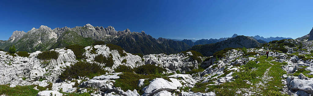
Very beautiful hike up on a panoramic mountain, excelling with a wonderful karst landscape. The most beautiful part of this route is crossing the high Kanin plateau. This is the longer of the two normal routes, nicely combined with the E route.
General Information
Difficulty (grading is on the Swiss Hiking Scale): T4. Medium difficult is only the summit ascent Till the Sella Robon the tour is very easy (T2 and T1) - a very nice mule track from the World War I.
Orientation: Easy, the route is well marked (No. 636 and 637). The summit ascent is formally not marked, but there are many cairns, so in normal visibility passages can be easily found.
Altitude to overcome: From 1120 m to 1981 m, so some 975 m of altitude gain overall (across the plateau you lose 105 m).
Time for the ascent only: 3 h 15 min.
Best season: Summer and autumn months, normally from June till October (or first snow). The most beautiful months are end of June (spring on Kanin) and October.
Best hour: Start early to do the ascent on the plateau before the sun comes over the ridges. If From Sella Nevea you go up on the plateau with cable car, check on the web the itinerary.
Slopes orientation: At first west, then north and south.
Gear: Hiking only - good shoes and poles.
Maps: Online maps (like OpenTopo map or OpenStreet map) are sufficient.
Huts: Rif. Celsio Gilberti, 1850 m, reachable by cable car (in winter and in summer, but check on the web how they operate). Bivouac Modonutti-Savoia, 1908 m, just below the summit.
Getting There: The starting point is on the Sella Nevea road pass. Big parking lots there.
Route Description


The start of trail No. 636 is on Sella Nevea, on the circular road Osvaldo Pesamosca, a bit east above the lower station of the cable car. Once we hit it, all the orientation issues are over. A good, broad mule track is ascending gently in many turns through beautiful beech woods towards the south. Only now and then some views open down on the tourist resort and through the trees the wall of Bila pec / Bela peč can greet us. I guess the mule track is used also by mountain bikers, so well preserved it is.
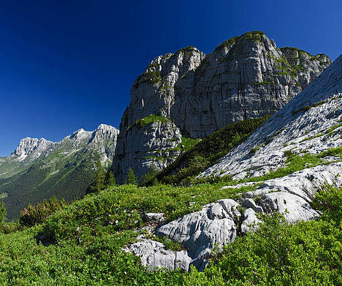
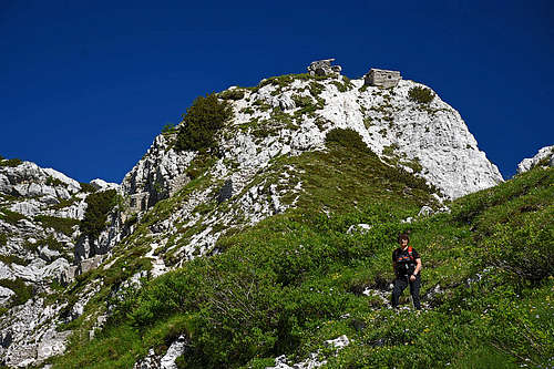
Higher on the slopes more and more beautiful views open towards the north, on the magnificent range of Viš and Montaž mountains. Left above us the wall of Monte Poviz is looming. This summit is also the measure of altitude gain which we must do.
In the last few hundred meters the trail is already leading us through the high mountain karst terrain. Wild abysses, cracks, sinkholes, white limestone slabs, eroded by water and through the last larches we reach the crossroads on 1866 m. From the right comes the trail from the hut (and cable car), we turn left, on the trail No. 637.
|
|
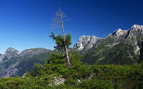
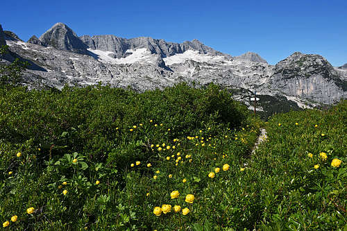
The next stretch is the most beautiful one. Easpecially in late June or early July when all kinds of flowers are blossoming there. The trail goes almost horizontally, so you can enjoy various scenes. Yet, the broad mule track still ascends a bit - on the unnamed saddle 1906 m northwest of the Monte Cergnala summit. From there an even broader view opens and also our summit appears.
Then the trail descents gently across the slopes. Finally with a few turns we get down into a picturesque basin south of Monte Robon. We lost more than 100 m of altitude.
In the same direction we hike up again. The trail leads us in several turns towards the east and in less than 15 min we gain Sella Robon (saddle), 1865 m. Nice bench there.
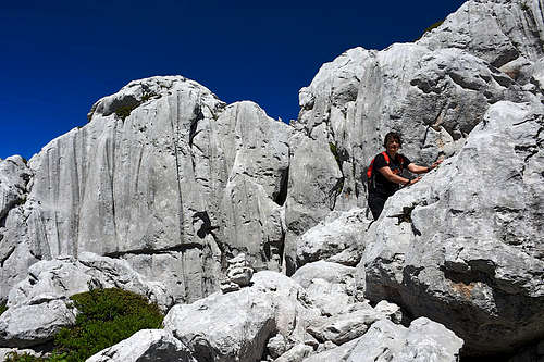
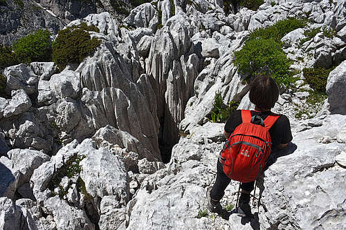
On the saddle we turn left, towards our mountain. A narrow, even a bit exposed military path crosses the slope, passes several buildings and caverns and then ascends on a more flat part on the ridge. There, on 1908 m the red bivouac of speleologists stands. From the bivouac we continue left, again a bite exposed (T3) and then right up through a steep, rocky channel. Above the channel we find ourselves in a chaos of rocks, sinkholes and caves. Several cairns are showing the best passages, scrambling is just easy, but be careful not to twist ankle in a rugged terrain. Above the chaos a huge sinkhole is preventing us to continue comfortably. The wooden bridge over its right edge is very decayed, so we best climb above it by easy rocks. Climbing is just easy (T4, perhaps UIAA I), then we keep left down again to hit the trail. In a few minutes the cairns bring you on the eastern summit.
|
|
|
Descent
You can descend by the same route or you can cross the plateau back to the point 1866 m and from there continue to the upper station of the cable car. But the most recommended hike down is by the eastern route (No. 637). So, you descend from the summit only down on Sella Robon, more down into the basin south of the summit (1801 m) and there deter right. The good, marked trail No, 637 will bring you on Sella Nevea road pass in some 2 h.