“Can you speak?" I gently asked Freddy when phoning him in early spring 2000. Maybe he was in a vulnerable position on a high mountain where it was not appropriate to take phone calls. "Well...," he answered with a strained voice, adding after some seconds, "I lie in my bed sleeping."
The background was that I this year planed to do what never came off two years earlier: To climb an unspecified number of high summits in the Monte Rosa massif. To the layman the Monte Rosa is a mountain just like the Matterhorn. In fact, the Monte Rosa includes a dozen independent peaks, all above 4000 meters. The Freddy I called was the Swiss mountain guide together with whom I had successfully climbed the Zinal Rothorn the previous year. Five minutes later when Freddy had woke up it was all set. Monte Rosa in August it was to be.
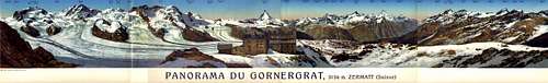
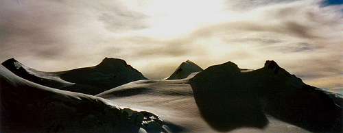
An old Gornergrat Panorama with the Monte Rosa massif to the left.
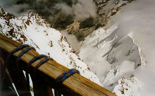
The train toiled hard on its way up towards Zermatt. This was the fifth time Zermatt and I were to meet. A village, a place, a town or a street can be used to describe Zermatt. Here you find a mixture of young, old, poor, rich, Europeans, Japanese, Americans, tourists, mountaineers, and me. Here you stand in the middle of the street, pointing at that thing sticking up above the rooftops, pointing to what is why most of us are coming here, pointing to the huge pyramid called the Matterhorn.
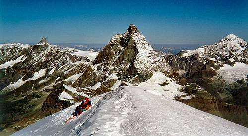
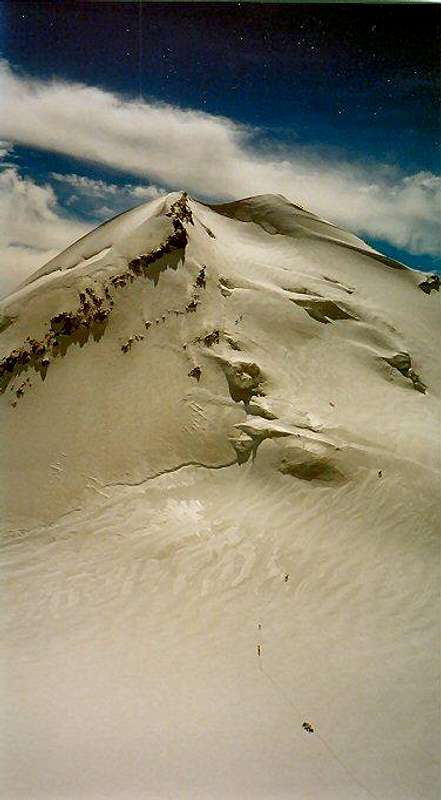
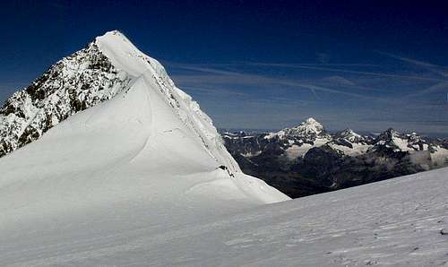
Ten some 4000m peaks can be seen looking east from the summit of Breithorn. Which ones should see me as guest the coming days?
The bulletin board on the town square outside the train station caught my interest. I read the latest weather forecast: Friday sunny, Saturday less sun and still less thereafter. It could have been worse. My plan was to get up at high altitude for a few days before meeting Freddy. Three options to sleep high were: The Täsch hut at 2500m, the Thrift Hotel at 2300m or Gandeg Hut at 3000m. I rejected the first two because the third had a better sequel, a possible ascent of the simple four thousand meters peak Breithorn. On the negative side it meant breaking no new ground. But first, a night waited in the old rustic Hotel Mischabel. Peter welcomed me at the reception as he had always done.
Looking at two horns on the way to the hut, Breithorn and Klein Matterhorn.
At ten o'clock Friday morning the bakery opposite the church got an opportunity to sell two large cheese sandwiches. Those two together with a liter of water were the day's ration. Gandegghütte 4 1/2 Sd. said the yellow sign. The height difference was as much as 1400 meters, which was a bit over the edge. Clouds were unknown this day. It was almost a relief when a long stretch of the trail went through the woods out of the sun. And the Matterhorn of course, I shot probably ten photos from different angles. There was a lot more snow than usual on the mountain this year. It did not bother me since I did not intend to set foot on it. And of course, last year’s acquaintance the Zinalrothorn could be seen far behind a moraine ridge.
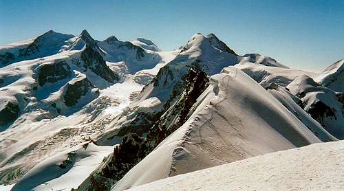
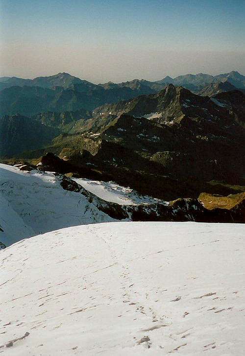
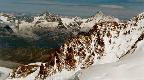
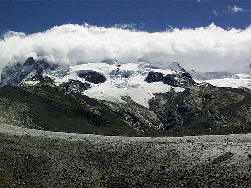
Seven 4000m peaks in view including the Monte Rosa.
To walk alone in the Alps is a pleasant experience. You decide yourself both the tempo and when to rest. Having no one to talk to is easily compensated by talking to yourself. I and myself talk out loud. We discuss subjects such as expensive Swiss watches and that Switzerland seems to do well despite not being a member of European Union. When we were in the middle of such a loud discussion a person suddenly popped out from behind a sharp bend. What he was thinking we do not know but we can tell he looked surprised.
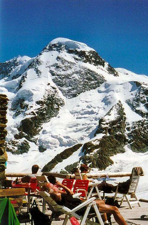
Lazy days at the Gandegg Hut.
Everything has an end, even so the long walk up to the Gandegg Hut. Half a dozen people sat in the sun on the hut terrace. Since the dinner was not served until half past seven, I joined in trying to get a tan. Three options existed: To turn the head to the right and have the view blocked by the Matterhorn, to the left where the Monte Rosa massif was standing in the way, or straight ahead where the Breithorn more or less threatened to fall over you. Since I could not decide which way too look I looked right up where the gondola to the Klein Matterhorn climbed its last 800 vertical meters.
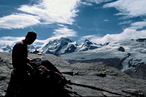
View towards the Monte Rosa from the Gandegg Hut.
If you have nothing to write about you can write about food. It is dangerous to generalize, but the fact is that the food offered in the Swiss huts is quite excellent. There is one exception that I will come back to later. But how about this four-course dinner at 3030 meter: Asparagus soup to begin with, salad with finesse, beef as main course and finally apple cake with cream for dessert. A glass of red Dole from the region did not make things worse. Add to that a bed with a blanket and a pillow and a good breakfast the next morning. All at 63 Sfr (about 50 dollars) which did not scare off any of the six hut visitors this evening.
Looking north from the Gandegg Hut with Obergabelhorn and others in the background.
The Breihorn North West Face is a serious project not suited for amateurs. I am convinced that the legend Wilo Welzenbach who made a famous ascent in 1926 would confirm my statement. Two of the six of which none was a Swede, intended to start this climb from the hut at three o'clock next morning. The other two, of which neither was a Swede, were on the new tour called Europe Route. It is about going from hut to hut and crossing various Alpine passes. The hut warden told us that the Matterhorn had been closed the last weeks due to too much snow and that all attempts had been cancelled earlier this day. The Swede told the Swiss about the long bridge being built between Denmark and Sweden. The rest of the evening the Swede was looking at his maps and reading his guide book. The two North wall climbers were the first ones to call it a day. The Swede had also decided to climb the Breithorn the following day, by the normal route though.
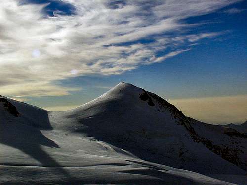
The Easy One
The first gondola from the station Trockener Steig, fifteen minutes walk from the Gandegg Hut, to Klein Matterhorn was according to the time table to leave at 7:40. I always like to have a good margin and was waiting already at 7:29. The gondola full of sleepy skiers from Zermatt left at 7:30. Normally the gondolas meet on the same level in the air. This time the full one going up was at least 5 meters below the empty one going down.
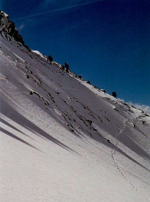
Hard route finding on the Breithorn.
As I felt a bit uncertain of the trail to the top of the Breithorn I had no hurry to leave the lift station, hoping someone else should to take the lead. While I put on plenty of sun cream two teams were already on their way out on the glacier. My reluctance to find the trail was much exaggerated because it was just to follow a beaten track. Turning left after a while it got steeper and I stopped to put on the crampons. The groups in front of me were so slow that I could not avoid passing them. Just before the summit I met two characters who were on their way back down. Guess who? Right, it was the two North Wall climbers I had met in the hut the day before. They greeted me happily and still looked to be in good shape.
Three 4000m peaks can be seen looking west from the summit of Breithorn, Dent d'Hérens – Matterhorn - Dent Blanche.
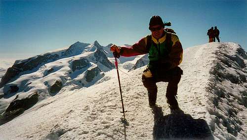
I had a moment to myself on the summit. The view eastward was impressive, the Breithorn ridge, the Lyskamm ridge and all the Monte Rosa summits. I wondered which ones should see me as guest the coming days. A glance downwards showed that the line of groups was bunching up, a dozen people were on their way up. Before my solitude was over I thought about the five men who in 1977 had not made it back from the summit. The weather had changed very quickly and they had been trapped in a storm. But this day saw no storm, no wind, just a sun in a blue sky. Before I left I asked an Italian to take a photograph as proof that I had been at 4165 meters altitude that day. He shot picture after picture so I had to stop him before he had used up my entire film.
Hans on the summit of the Breithorn with Monte Rosa in the background.
Down at the lift station Klein Matterhorn I made the wrong decision. I decided to walk to the Trockener Steig 800 meters lower down. What I did not know was that I had to walk through the large ski system on the Plateau Rosa to get down. It was difficult, but luckily I managed without getting run over by skiers. Two others were not so lucky; a snowboarder had landed far outside the track and was being looked after by a rescue team, and an unfortunate skier was tucked up in a sledge behind a scooter. Skiing seemed to be far more dangerous than mountain climbing. Down at the lift station I didn’t have to stop since I could walk into the waiting gondola. A few minutes later I walked out 1000 meters still lower down in green surroundings. I had a well earned rest behind a woodpile. It may even be that I fell asleep because a couple of hours disappeared without a trace.
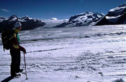
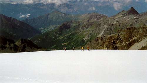
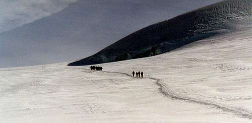
Groups walking up the Breithorn from the Kleine Matterhorn.
Sunday was a rest day before what was to come. A rack railway seemed to be a good idea. I stepped on the train headed up to the Gornergrat with “breathtaking, all-round views of 29 peaks above 4000 metres” as advertised outside the ticket office. The most remarkable thing happening the next half hour was that I ended up next to two elderly American tourists. If you consider that they traveled on a train having one of the best views in the world, it is remarkable that they did not once look out of the train window. Instead, they discussed baseball, in detail and lively, which apparently is a game of which you can have different opinions. But to be oblivious to the scenery and the train ride of a lifetime defies one of reasons for travel.
Reserve Day
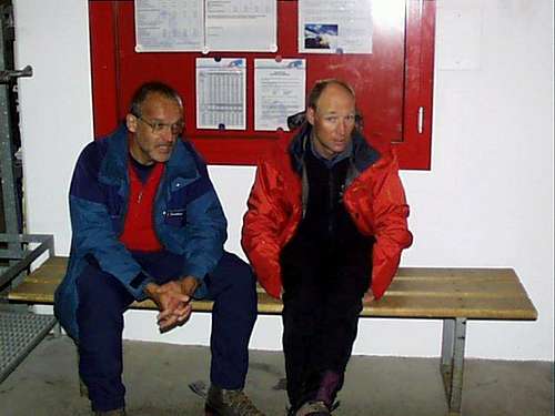
Later in the day I met Freddy and Rudi, my two squires the coming days. Freddy is the guide I had climbed together with on many peaks the last years. Rudi I also knew from two years ago when climbing in the Berner Oberland. Rudi and I have some things in common; like mountaineering, age, number of daughters and wives. Being Swiss he is a physician and lives in Lucerne. During dinner in the evening we outlined a plan for the coming days:
Monday: Take the first gondola up to the Klein Matterhorn (3883m). Walk on the glacier and climb Pollux (4028m) and Castor (4228m). The options were to climb both or only Castor. Accommodation was planned on the Italian side in the Sella Hut (3585m).
Tuesday: Freddy's proposal was to traverse the Lyskamm (4527m) from west to east and then spend the night in the Mantova Hut (3450m) or in the Gnifetti Hut (3611m). Ambitious.
Wednesday: Ascents along the Monte Rosa trail. Climbing Parrotspitze (4432m) and staying overnight in the highest Alpine hut, the Margherita Hut on top of Signalkuppe (4554m).
Thursday: Climbing the Zumsteinspitze (4563m) and then have a try on the highest Monte Rosa peak the Dufourspitse (4634m). Down to the Monte Rosa Hut (2795m) for the night. Ambitious.
Friday: Back to Zermatt (1600m). Reserve day.
I realized for us to succeed everything must be optimal, weather, snow and above all my physical condition. "The one who lives will know", I thought but said nothing while I felt the seriousness of the expression.
Rudi and Freddy being two unhappy mountaineers down at the gondola station in Zermatt hoping for better weather.
The rain was pouring down when we walked to the lift station early the next morning. No gondolas were leaving due to the strong winds. We did not laugh when we sat there wondering what to do. On a TV-monitor we saw a grey picture illustrating the weather situation at the lift station halfway up to the Klein Matterhorn.
Two hours into the morning a gondola took off with three mountaineers aboard. We came only halfway, which was the restaurant at the station Trockener Steig. The right decision had been to "call it a day". But we did not. Instead, we had minestrone soup and were hoping the weather would get better. Freddy who was eager to get going said that if we could get to the Mezzalama Hut on the Italian side we would have a better position for tomorrow.
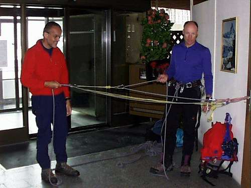
Demonstrating glacier rescue techniques using the handle to the toilet door as a firm anchor.
To pass the time Freddy demonstrated glacier rescue techniques. The handle to the toilet door was our firm anchor. Using a few carabineers he elegantly showed how instead of pulling 100 kg he reduced the necessary force to one sixth or one fourth.
In the early afternoon it was decided to try to send a gondola to the top station Klein Matterhorn. The right decision had been to go in the opposite direction. But we did not. On the other hand, it became an interesting journey. The strong wind made it difficult to drive past the last pylon since the gondola was swinging so much that it hit the pylon several times. Finally we reached the top station together with a handful of terrified Japanese tourists.
We made it through the long tunnel to the south side. Despite closed doors a lot of spin drift snow was on the inside. Freddy was still eager to go and was hoping for a window in the weather. But the only window we saw was the window in the closed door. It was a complete white out and it had been pure madness to go out on the glacier under such conditions. The right decision had been to go down again. But we did not, for the simple reason that the gondola could not leave in the strong wind. The Japanese wearing shorts had a hard time in the cold. In the late afternoon we finally were back in Zermatt again. We could have had a better start rather than using our reserve day and spending plenty of money on the lift getting nowhere.
The Twins
Between jobs on the Breithorn plateau.
At last we were on our way. The storm had wiped out all tracks in the snow. The sun shone on the glacier, the sun shone on the mountains and the sun shone on us when we as the first rope team entered the glacier. We walked for two hours in a comfortable pace since Freddy as the leader had to make the track in the fresh snow. We made our way along the south side of Breithorn massif and eventually arrived at the foot of the Pollux. Close by was the two hundred meter higher Castor. “Both or only Castor?” Freddy asked since Castor must be climbed to reach the Sella Hut. “Both”, I said and so it was decided.
The first slope of the south east Ridge on Pollux.
The period 1858 to 1865 was a very remarkable one. Peak after peak including the two twins in front of us, were conquered on initiatives by members of the Alpine Club. On 23 August 1861 Castor was first climbed by a party using the South-East Ridge. The men were William Mathews, who proposed the formation of the Alpine Club of London in 1857 and was its president in 1868-1871, his fellow countryman and AC member F.W. Jacom and the Chamonix guide Michel Croz with many first ascents but most remembered for his death on the first ascent of the Matterhorn in 1865. The three men made the first ascent of Monte Viso a week later the same year. The smaller twin Pollux was first climbed in 1864 led by the Matterhorn conquerer Peter Taugwalder the father and Jules Jacot from Geneva and Joseph Maria Perren. They climbed to the summit from the Schwarztor, the col between Breithorn and Pollux.
Traffic jam at the Crux section on Pollux.
We sat in the sun below the Zwillingsjoch for a while, had tea and talked. In the meantime, a few teams passed. The trail runs along the rocky South Western ridge and involves an ascent of about 300 meters with the guidebook grade of AD. The conditions were very icy which made the ascent more difficult than normal. About halfway up there are a couple of difficult passages, a ten meter horizontal traverse and an equally long vertical rock step. Without the iron chains to help us the difficulty would have been of another dimension. Even using the chains there was a queue since several climbers found these sections awkward. To be honest I have to include myself in that group. Having done the hard part the snow ridge leading up to the summit was more or less a nice walk. Without being too exhausted, we stood on the top of Pollux at 4092 meter and studied the surroundings. To the north it fell away one thousand meters down to the Grenzgletcher, to the south the twin Castor stood waiting for us, and to the east we saw the impressive Lyskamm ridge with its two summits. The scenery is very good captured by SP-member Corvus in his short video clip from the Pollux summit:
Castor seen from the summit of Pollux.
We descended without incident along the same route as we had come up. Already from the summit I had had a good view of the long steep trail up the West-North-West flank of Castor, graded PD. Several rope teams had slowly struggled their way uphill. And now it was our turn. Up, up and more up the snow and ice slopes. The visibility decreased the higher we climbed and when we finally stood at the 4228 meter summit we were rewarded with no views at all. Not all summit moments are glorious. We started almost immediately the descent down the other side of the mountain. Being in the midst of a cloud the track helped us find our way towards the hut. Although it started snowing, we had a much needed break with some tea to drink.
Castor from the south side.
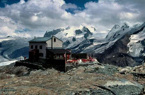
After having been going for nine hours we stepped into the Sella Hut (3585m) at five o'clock in the afternoon. The hut is named in honor of the Italian statesman and financier Quintino Sella (1827-1884), a passionate alpinist and founder of the Club Alpino Italiano.
The Quintino Sella Hut on the south side of Castor and Lyskamm.
Almost immediately, we had a bowl of hot minestrone soup. When I had eaten half the bowl I felt sick. The cause was probably a combination of high altitude, strong effort, and soup. The only thing I could have later in the evening was one liter of tea. But after all, I was satisfied with the day, two high mountains climbed.
The Man Eater
At four o'clock the next morning Freddy’s alarm clock woke us up. I was hoping it was a dream but I knew that the truth was different. Freddy disappeared out of the room to come back with the news: "It's beautiful out there”. A new day dawned with new opportunities even for the one who felt a bit weak. One hour later the three companions were on their way. All tracks were covered by fresh snow and it was still dark so the head lamps came to good use.
Lyskamm West as seen from Felikjoch.
Lyskamm was the goal of the day. This famous mountain is a three kilometer long ridge where the eastern summit wins over the western by fifty meters. The north side is an impressive snow and ice wall that falls deep down to the Grenzgletscher. The south side is not as high but has a more rock like appearance. The ridge between the two summits is notorious for overhanging cornices. To make it still more dangerous, they are often double sided. The Lyskamm has earned the epithet "man eater" or as it is called in German "Menschenfresser". The phrase refers to the fatal accidents that have occurred on the mountain over the years. The first took place as early as 1877 when a team of five, two Englishmen and three local guides, also brothers, were killed when they fell from the ridge. Charles Gos makes in his book "Alpine Tragedies" a reconstruction of what happened. We read:
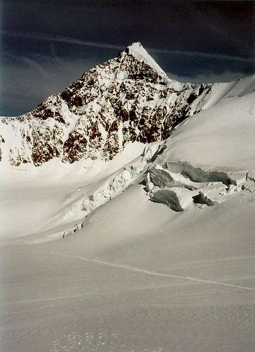
Lyskamm, East summit from the South side. The men from 1877 fell from a point close to the summit on the right side.
"The snow was good. They found it easy to place their feet, which bite into the crust of sparkling crystal. But are they not drifting too far from the crest? To assess the thickness of the cornice and to estimate the extent of its overhang they should be below it, or lower down, at a point clear of snow. But they are above it. Now it is just at this point that very thin fissures begin to run parallel to the cornice at the edge of the crest, blue serpentine lines on white snow. They are too far to the left, completely above the overhang. The five men never reach the edge. For them it is all over. For suddenly, some ten feet from the arête, the snow beneath them moves and slips away, like a ship sinking in the trough of a wave. They are swallowed up in a flash and vanish into the abyss of the Italian side in a cloud of snow and ice."
It was one of those days when my engine was not running on all cylinders. It had to be compensated by sheer will. From the hut to the Lyskamm west summit it was about one thousand vertical meters. We passed steep snow slopes, plateaus and ridges. We rested at Felikjoch, a plateau five hundred meter below the summit. Freddy thought out loud, "The wind is the only problem." We looked up towards the West summit and saw a long plume of snow drifting out from the ridge leading up to the summit.
The higher up we got the stronger the wind blew. Bearable at first, but when we approached the ridge, an "un" had to be put in front. There were two things to choose from, to stand still or to more or less get down on your knees and move upward. I tried to protect my face with my hand from the ice crystals carried by wind. Several times I felt how Freddy pulled on the rope. Maybe it was to help me, but more likely it was to see if I was still there.
“Lyskamm from Lysjoch. The distant peaks are Dent Blanche, Grand Cornier and Obergabelhorn.
We reached the western summit. There was no discussion whether we should continue along the ridge or turn back. The reason was that it was impossible to out voice the storm winds. Another pair came up and turned around without stopping for a single second on the 4477 meter high summit spot. I can clearly picture the duo duck-walking down in a low and straddled position. A moment later we followed their example. The situation was so strained that it was impossible to take pictures.
Rudi said afterwards that he had been afraid that I being the smallest would be blown off the ridge. It was hard to tell if he was serious or not. What was serious, however, was that our original plan with night quarters in the Gnifetti Hut did not work. Instead we decided to return to the Sella Hut where we arrived as early as two o'clock. It was after all a good day's work with "Still another mountain climbed" - a windy one.
The Monte Rosa Trail
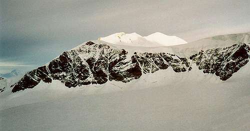
Viewpoint is the Lyskamm south ridge (Il Naso). The Quintino Sella Hut is just visible at the edge of the glacier in the centre of the picture.
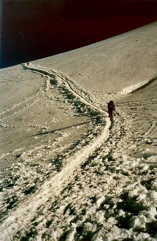
A new day dawned with the weather on our side. Our primary objective this day was to move up to Europe's highest hut, the Margherita Hut on top the 4545 meter high Signalkupe. On the way we planned to climb one or two other Monte Rosa peaks. We were, as usual, the first to leave the hut when the night was turning into dawn. It is one thing to study a route crossing a number of contour lines on the map. It is quite another thing in the real world where contour lines adds up to the entire mountain. The contour lines we climbed up this morning were on the south side of the Lyskamm.
With rhythmic steps we traveled in a dark, cold and silent environment. The rope ran out between us and made elegant impressions in the snow. Time stood still despite the fact that the clock was moving. Such were the realities when the three travelers were reaching the first high point of the day, a contour line at 4100 meter on the pass between the Eastern Lyskamm summit and its southern ridge Il Naso.
The Monte Rosa trail is passing Ludwigshöhe.
At the highest point we sat down on our backpacks and enjoyed what was offered, a breathtaking painting more detailed than any picture. We saw the main Monte Rosa trail with small groups of mountaineers, looking like toy trains, on their way to waiting summits. We saw the peripheral Vincent Pyramide, the small rock knob Balmenhorn, the rocky Coro Nero, the inviting Ludwigshöhe, the nicely shaped Parotspitze, the Signalkuppe with the Margherita Hut, the fore-summit Zumsteinspitze, and finally we did not see the highest point Dufourspitze. Unfortunately we had to descend three hundred meters followed by an almost equally long ascent before we could join the line of trains.
Vincent Pyramide (4215 m) seen from the west.
Parrotspitze is named for the German doctor Friedrich Wilhelm Parrot who made an unsuccessful attempt as early as 1813. The first ascent is dated from 1863 when the Englishmen RS Macdonald, FC Grove and M Woodmass together with the two local guides M Anderegg and P Perrin reached the summit the easy way from the Lysjoch on the west side. An ascent from the east is more like a Himalayan undertaking since it involves climbing the huge and difficult 2000 meter high Monte Rosa East Face. Or as Leonardo da Vinci wrote during a visit in 1511, “No mountain has its base at so great a height as this, which lifts itself above almost all the clouds and snow seldom falls there.”
Zumsteinspize – Signalkuppe (with the Marghérita hut on top) – Parotspitze – Ludwigshöhe - Coro Nero.
Luckily we approached Parrotspitze from the south west, Freddy first, I as number two and Rudi at the end of the rope. The symmetrical snowy pyramid with a narrow summit ridge looked inviting from our position 150 meters lower down. The flank steepened as we neared the summit ridge. Up on the ridge we were met by our friend from yesterday; the strong wind. We crawled our way eastward along the ridge and finally we had a glimpse down the huge east face.
Having tea on the summit of a windy Parrotspitze.
Looking to the west we noticed a rope of at least six climbers coming over the Lyskamm ridge. “Like a jumbo, if one goes all go”. Freddy commented. To the north we saw Signalkuppe, our ultimate goal for the day. So close but still so far away was Margherita Hut, close for those who could fly, but far away for us who first must descend one mountain and climb another. We went down what we thought to be the best and shortest way. However, we ended up in deep snow that was tiresome to get through. The last part up to the hut was also tiresome illustrated by the fact that we passed several groups trying to find strength to get the hut. The problems they had probably had something to do with lack of oxygen molecules.
The Dufourspitze ridge with Zinalrothorn and Weisshorn futher away. The viewpoint is the summit of Parrotspitze
The name Signalkuppe can be interpreted as Signal for gendarme and Kuppe for hump. The mountains other name being Punta Gnifetti is easier to understand as the clergyman from Alagna Giovanni Gnifetti was the the first to climb the peak. In a group of eight men he made an ascent from Italy via Lisjoch and the west flank in 1842.
The Margherita Hut is a remarkable three-story building, secured by wires to make it difficult for wind to blow it away. The background to its creation was an interest from the Italian royal family. The Queen Margherita herself was present at the opening of the original hut in 1893. Today’s modern hut was built in 1980.
Minestrone soup in the Marghérita hut no doubt.
You never learn. First thing inside the hut we ordered something to eat. Guess what? Yes, a bowl of hot minestrone soup. It could only end in one way; stomach upset. After an hour’s sleep I was back on track again. But never minestrone soup for me again.
Looking down from the doorstep of the Marghérita Hut.
In the late afternoon we were sitting in the dining room discussing tomorrow's ambitious plan, ascent of the highest Monte Rosa peak Dufourspitze. However, outside the wind was picking up and it had started snowing. The weather forecast had promised good weather the coming days so we did not worry. When I woke up at midnight it snowed even more. It did not look good. When I woke up next time it was steaming hot since the blanket in the bed above me had fallen down as a curtain in front of my bed opening.
Blindfolded
No one said anything at the breakfast. Everyone realized that there was not to be any Zumsteinspitze and by no means any Dufourspitze this day. The big question was rather if and how we could get down back to civilization in the complete white out conditions outside. The challenge was to move from the Margherita Hut, down on the Grenzglescher to the Monte Rosa Hut at 2795 meter. To navigate through ravines and around crevasses would not be easy. An hour elapsed but weather did not improve. We studied the map and tried to memorize the contour lines. It was absolutely essential that we find the entrance to the long glacier.
Had we succeeded in climbing the 4634 meter high Dufourspitze I certainly would have written a few lines about its history. I would have written that the peak is named after the famous Swiss co-founder of the Red Cross, topographer and military man Guillaume-Henri Dufour. And that the summit was first reached from the Zermatt side in 1855 by a group of eight including Rev. C Hudson.
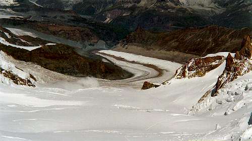
Looking down the Grenzglescher from the summit of Parrotspitze.
At six o'clock we started the descent together with three equally disappointed Germans. It was like walking blindfolded since I barely could see Freddy five meters in front of me as we made our way through the thick cloud. The snow whirling into my jacket hood and goggles complicated the ability to see even further. We stopped every other minute. Freddy checked the compass and read the height on the altimeter. I once noticed Freddy and one of the Germans discussing, the German pointed his pole to the left while Freddy pointed more to the right. "How will this end?" I thought. It ended well since we took to the right and hit the glacier at the exact right spot. Coming down about five hundred meters, the fog eased somewhat and you could begin to glimpse the contours of the rocks on both sides. The snow turned into rain, which eventually ceased completely. When we got to the most difficult passage on the glacier we were just under the clouds which made things a lot easier.
“As a small dot in the middle of the Monte Rosa.” Ten years earlier I had visited Zermatt for first time. As a tourist at the Gornergrat viewing plateau I looked up towards the Monte Rosa. Clearly I remember the barely visible small dots on their way up. It looked so exciting and appealing that I wished to experience it myself some day. Ten years later, I was the little dot on the vast slopes of Monte Rosa negotiating its crevasses and grotesque ice formations.
Out of the cloud the Monte Rosa Hut came in sight.
François Bétemps was a Swiss engineer who in 1894 gave his name to a mountain hut. Until 1939 the Bétemps Hut was overlooking the Grenzglescher coming down between the Monta Rosa and the Lyskamm. After 1939 the name was for some reason changed to the Monte Rosa Hut. Being rebuilt and improved many times a completely new Monte Rosa Hut was built in 2009. This new hut full of modern technology obtains 90 percent of its power needs from the sun.
Monte Rosa from Gornergletscher. The cloud may seem innocent but coming down from the Marghérita Hut that morning route finding was a challenge.
More than three hours after the start we stepped into the Monte Rosa Hut of year 2000. All of us thanked Freddy for his excellent route finding. All of us but one had a bowl of hot minestrone soup.
We were not clean, we did not smell good, but we were indeed satisfied with our four day tour.
Two stages remained, one by foot and one by train, before we were sitting in a cafe down in Zermatt. The first was a tough two and a half hours walk from the hut over the Grenzgletcher. The train ride from Rotenboden was a pleasant experience since my tired legs could take a rest. We were not clean, we did not smell good, we did not say much but we enjoyed eating the apple cake. In the end we were indeed satisfied with our four day tour which included five 4000 meter peaks. Freddy’s phone rang and he listened before answering “Nesthorn, yes it is possible”. He was already discussing the next day’s project. I, however, decided to take a break from climbing high mountains - for about a year.
Thanks to desainme and isostatic for comments on the original text.
I just loved reading it, I was in Monte Rosa the last 2 years and your report brought back such great memories. It is a beautiful place, one that I plan to see again.
thank you for writing it...oh, and if you ever go back, have the pizza at the Margherita Hut, it's fantastic!
cheers
Sylva
Thanks!
I am glad you liked reading it and that I could bring back some nice memories. If a next time I will for sure try the pizza in Margherita Hut:)
Parents refers to a larger category under which an object falls. For example, theAconcagua mountain page has the 'Aconcagua Group' and the 'Seven Summits' asparents and is a parent itself to many routes, photos, and Trip Reports.


Comments
Post a Comment