
|
|
Area/Range |
|---|---|
|
|
36.94900°N / 109.923°W |
|
|
Hiking |
|
|
Spring, Summer, Fall, Winter |
|
|
5564 ft / 1696 m |
|
|
Overview
Monument Valley in northern Arizona is one of the most enduring and familiar landscapes in the American West. The towering solitary buttes that characterize this area have been the backdrop of many movies (Stagecoach, Forrest Gump, Indiana Jones & the Last Crusade, Easy Rider, Thelma & Louise), TV shows (MacGyver, Airwolf), and commercials. This isn't a valley in the traditional sense, but rather the buttes are remnants of broader plateaus that have all but worn away. The nearest river is the San Juan River which is about 20 miles to the north of the valley.Monument Valley is a Navajo Tribal Park that is 91,696 acres in size. There is an entrance fee and climbing and backcountry camping are not allowed. There is a visitor center, a 17-mile loop drive, and a few hiking trails that will take you up close to the buttes and other beautiful sandstone formations such as chimneys, spires, and natural arches. There are also some pictographs and petroglyphs. There are many tour companies who will show you around, see the Monument Valley Navajo Tribal Park Website for contact info.
Perhaps the most famous of Monument Valley Buttes are the twin Mittens and Merrick Butte. They are clearly stratified and made up of three main rock layers. The lowest is Organ Rock shale, the middle de Chelly sandstone, and the top layer is Moenkopi shale.
The vegetation is sparse out here but there is some rabbitbrush, snakewood, and the occasional juniper tree. Wildlife is equally scarce... Archaeologists believe that people have occupied this landscape, at least seasonally, since 12,000 BC.
The Navajo name for the valley is Tsé Bii' Ndzisgaii, "Valley of the Rocks".
Getting There
 Heading south to Monument Valley from Mexican Hat
Monument Valley is 22 miles north of Kayenta, AZ and 22 miles south of Mexican Hat, UT on Hwy 163. Kayenta has your basic services as far as gas, groceries, restaurants, and lodging. Mexican Hat has a gas station with a small grocery store but that is pretty much it. Needless to say, this area is on the rural side so come prepared with a full tank of gas, extra food and water, and the gear and clothing that you'll need. The nearest big city is Flagstaff, 175 miles to the south.
Link to a handy map of Monument Valley
Red Tape
Monument Valley Navajo Tribal Park Visitor Center HoursSummer (May-Sept) 6:00am - 8:00pm
Spring (Mar - Apr) 7:00am - 7:00pm
Thanksgiving Day - closed
Christmas Day - closed
Monument Valley Navajo Tribal Park Scenic Drive Hours
Summer (May-Sept) 6:00am - 8:30pm
Winter (Oct - Apr) 8:00am - 4:30pm
Entry Fees
General Admission - $5.00
Ages 9 or under - Free
**National Parks and Golden Eagle Passes are not accepted.
Rock Climbing, mountain biking, backcountry camping, and firewood gathering are prohibited. Campfires are permitted only at designated campsites. No open fires are permitted in the campground. Permits are required for camping, hunting, fishing or investigative projects. The Navajo ask prior consent before photographing them or their property.
Camping/Lodging
Mitten View Campground near the Visitor Center has 99 sites available for a $10/site in the summer, $5/site in the winter. Campsites include a table, grill, ramada and trash can. During the summer, a restroom with coin-operated showers and a filling/dump station are available. The campground is open year round on a first-come, first-served basis. Reservations are taken for group sites, which are available for $20.Camping and Lodging along with a restaurant and gift shops are available at nearby Goulding's Lodge.
There are several lodging options in Kayenta, 22 miles to the south. Among the hotels here are a Best Western and a Holiday Inn.
External Links
 Monument Valley before dawn
Monument Valley Navajo Tribal Park
NWS Weather Forecast for Kayenta, AZ
American Southwest - Monument Valley
Desert USA - Monument Valley
Wikipedia Page for Monument Valley
NY Times Article: "Monument Valley: Endless Earth, Infinite Sky"
Etc.
Don't bust the crust!When hiking off trail please stick to durable surfaces such rocks and sandy washes. Most of the land out here is covered with a cryptobiotic soil crust. This is a living layer of mosses, fungi, and bacteria that help hold the soil in place, prevent erosion, retain moisture, and provide vital nutrients to neighboring plants. Without the crust many other plants wouldn't be able to grow and one footprint can break down years of this living crust so stay on trails whenever possible!
More info on cryptobiotic crust
Nearby Areas to Explore!
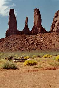 The Three Sisters
San Francisco Volcanic Field
Grand Gulch
Bullet Canyon
Comb Ridge
Moki Dugway
Goosenecks State Park
Mexican Hat
Natural Bridges National Monument
Hovenweep
The Bear's Ears
Dark Canyon
Abajo Mountains
Antelope Canyon
Glen Canyon/Lake Powell
Canyonlands National Park, Needles District
For more info, please contact
Monument Valley Navajo Tribal ParkPO Box 360289
Monument Valley, Utah 84536
(435)727-5874/5870 or (435)727-5875
Mark Doiron - Sep 2, 2015 6:32 am - Voted 10/10
Camping in the ParkThere is a primitive campground within the park boundaries now. It's located on the southern side of Rain God Mesa. Have not camped there myself, but have noted the sign for the campground during multiple trips there this past year. I checked the Navajo Nation website and it has no info on this campground. You may want to contact the Monument Valley Visitor Center directly for the most accurate info ... 435.727.5870. Also, the link to a map is broken. In labeling the photos I uploaded yesterday I did a lot of searching for maps that identified the geological features. This was the most complete one I could find--it's partly in French. If you wish, I could fix that and upload a copy. http://www.arizona-dream.com/usa/arizona/454-carte-monument-valley-navajo-tribal-park.php --mark d.