
|
|
Area/Range |
|---|---|
|
|
35.35200°N / 80.093°W |
|
|
906 ft / 276 m |
|
|
Overview
The Uhwharries are a good example of the fact that the term "mountain" is relative. These peaks are very old, very eroded, entirely clothed in forests, and low on the horizon. But mountains they are, according to the locals. Morrow Mountain is the highest of many peaks in the range. What makes the Uwharries unique is certainly not their height, or their steepness (the tallest being only about 700 feet above its base), but in their age and in their geology.
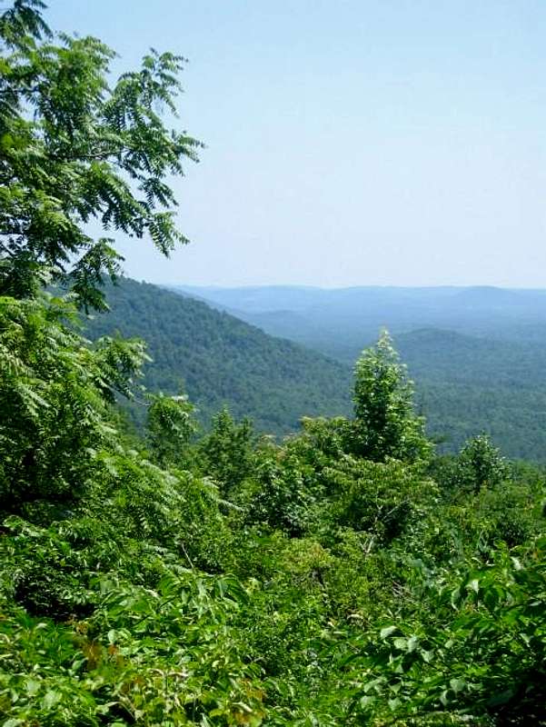 Uwharries, from Morrow Mountain.
It is said that these low, eroded peaks are the oldest in North America, certainly in eastern North America. The remains of ancient volcanic activity, the rocks are now metamorphic, principally of rhyolite, with some quartz and quartzite outcropping. This was a particularly important area to the ancient Native Americans whose presence here can be traced back, perhaps, as long ago as 10,000 years. The Uhwharries were the most imporant source of tool-making material in the area for thousands of years, as rhyolite is both hard and brittle and as such is ideal for making arrow points, spear points, scrapers, knives, drills, and the like. On the higher peaks, virtually every stone you see is some type of native American artifact--chips and hammers and blanks lie everywhere the soil is disturbed. Locals and tourists trod underfoot objects made and touched by the first Americans.
 |  | 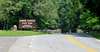 |
Getting There
Morrow Mountain, being the highest of the Uhwharries has, of course, an auto road to the summit. The way to the park is easy:From Charlotte, merely follow 24/27 to 740, and then turn right on Morrow Mountain Road which takes you to the park. The road goes to the summit. Or you can park at the trailhead and walk up at a parking area just past the park entrance.
From the north: From I-40 take I-73/I-74 south. Near Biscoe, take 24/27 west toward Albemarle. Six miles past Albemarle, take Valley Drive for three miles, and then right on Morrow Mountain Road into the park.
 |  |  |
Red Tape
No admission fees. As far as I can tell, there is nowhere to rock climb or rappel in the Uwharries. I have even been unable to find what would be suitable bouldering areas. |  |  |
When To Climb
Any time. Summer is typical southern stuff: dreadful. Hot, humid, sometimes dry. Ticks are always a concern. I was host to a platoon of small ticks by the time I had climbed and descended Hattaway Mountain. Check yourself thoroughly after entering these woods.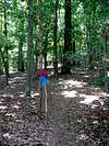 | 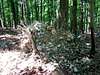 |  |  |
Camping
There is camping inside the park, at developed and group campsites only. No off trail camping is permitted except in one backpack campsite. Fees for camping are $15 per day at the developed campsite and $9 per day at the primitive site.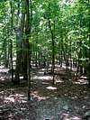 |  |
Mountain Conditions
Check weather for Albemarle, NC. |
External Links
- Morrow Mountain State Park, official site.
- http://www.cs.unca.edu/nfsnc/recreation/uwharrie/birkhead_mountain_wilderness.htm
Birkhead Mountains WIlderness (part of the Uwharries range).
Rock climbing information
The following information was supplied by summitpost member rathvon350The first place is called Bald Mountain. It is located on Tuckertown Lake.
To get there from Hwy 52 in New London take hwy 49 north approx. 7 miles
to Hwy 8 at a flashing yellow light.
Turn left on Hwy 8 and continue for approx. 1 mile to Stokes Rd.
Make a left on Stokes Rd and follow for about 3 miles to the stop sign at
Newsom Rd.
Take a left on Newsom Rd and follow until it ends in a parking area.
At the parking area follow the RR tracks about 1/2 mi. North and the
mountain will be on the right.
From Hwy 109 take hwy 49 south about 5 miles to Hwy 8 and turn right on
8. The rest is the same.
There are plenty of places to scramble and explore but the main rappel
site is on the left when facing the mountain, it can't be missed. You can
hike up either side of the mountain but it is also really fun to scramble
up the middle. As far as I can tell this face was created when they were
building the railroad because it looks like the side of the mountain just
fell away after blasting. The repel is right about 60 ft and the views from
the top are wonderful, it feels like you could see Charlotte. This is a
great place for sunset viewing. As far as I know this land is State owned
because it is open to hunting and fishing, so in duck and deer season extra
care should be taken. However, I was out there on the opening day of deer
season and didn't run into any trouble.
The other site is called Spivey's Bluff and it is on Falls Resevoir. It
is more in the wilderness and Fall's is a spectacular location.