
-
 16953 Hits
-
 83.1% Score
-
 16 Votes
|
|
Mountain/Rock |
|---|---|
|
|
37.54580°N / 118.84276°W |
|
|
Mono |
|
|
Hiking |
|
|
Spring, Summer, Fall, Winter |
|
|
11561 ft / 3524 m |
|
|
Overview
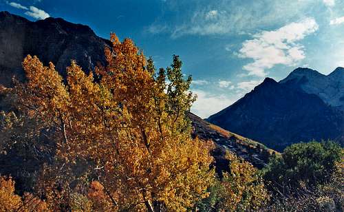
Fall colors McGee Creek
Mt. Aggie is a pretty simple class 2 scramble from all sides and can easily be done in less than a day. Staying on the ridgelines will probably save you from scree slopes.
There are outstanding views of Mt. Morrison and The Great White Fang to the north and west and south to the peaks over the McGee Creek drainage.
Getting There
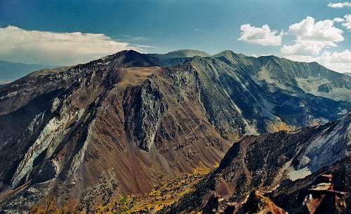
South over McGee Creek canyon from Mt. Aggie
From the south: From Bishop go 29 miles north, pass Tom's Place and turn left on the Mc Gee Creek road. Go 4 miles and park by the Upper McGee Creek campground. Follow the McGee Creek Trail southwest for .5 miles and break off directly up the sagebrush slope curving to the left where the slope eases and take the east ridge to the class 3 north summit, continue on to the main summit to the south.
Red Tape
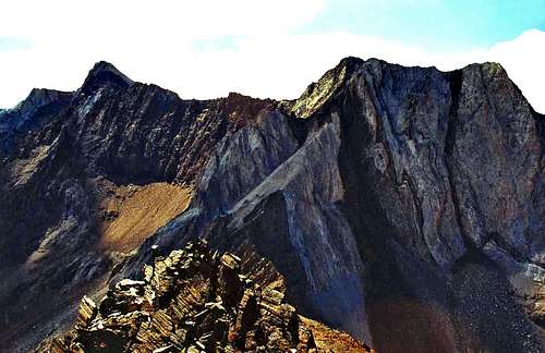
Mt. Baldwin and White Fang from Mt. Aggie
Camping
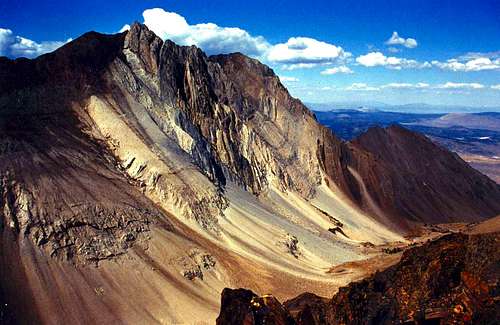
Mt. Morrison from Mt. Aggie
Convict Lake campground 2.2 miles in on the Convict Lake Road at 7,600'
McGee Creek campground 2 miles in on the McGee Creek Road to the left at 7,500'
Upper McGee Creek campground 4 miles in at 8,000'.
Current weather and 5 day forecast for Mammoth Lakes area.
