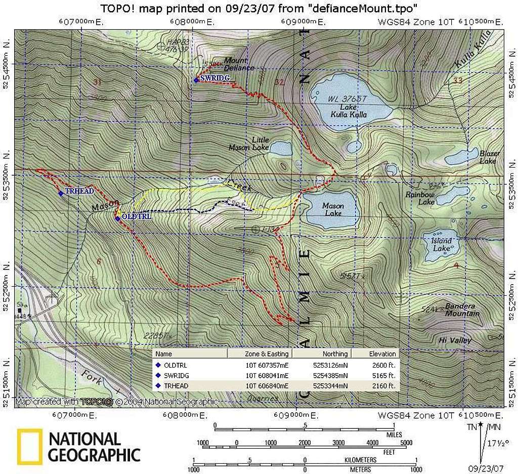
This topo map shows the main trails to Mason Lake and Mt Defiance. The dotted-red route is the new trail, and the round trip stats are about 9.5 mi, 3620'. The old Mason Creek trail (dotted-yellow) is a great ascent route. You get to it soon after crossing Mason Creek (there is a decoy creek before the correct, larger creek.) Look for the start at 2600'. It switches back 180 degrees to the left, just 20-30' before the main trail makes a left turn. Stay left at a couple of forks, and note that the trail crosses over Mason Creek twice during a short span (by the "Cr" in Creek), and manages to avoid the boulder field crossed by the trail shown on the USGS topo map (dotted-blue route). You will need to duck under a few large, downed trees. The Mason Creek trail is very efficent with elevation, and saves 135', and about 1.1 mile each way compared to the new trail. We descended on the new trail because it was a wet day.
The final summit trail goes up the SW ridge. We passed another climbers' trail that is probably what a couple of other folks described as "steep." At the turnoff, the climbers' trail looks as good or better than the continuing trail, so you shouldn't miss it.
Sept 22, 2007


