
-
 39485 Hits
-
 79.04% Score
-
 10 Votes
|
|
Mountain/Rock |
|---|---|
|
|
47.43527°N / 121.56447°W |
|
|
Download GPX » View Route on Map |
|
|
King |
|
|
5584 ft / 1702 m |
|
|
Overview

Mount Defiance Seen From Pratt Mountain
Mount Defiance is one of the highest hiking peaks along the I-90 corridor. With over 1400 feet of prominence, it has a nice pronounced summit. For those that started with Mount Si and Mailbox Peak, this is a good way of branching out. There are many possible routes to reach the summit but the most popular way is the circuitous Ira Spring trail. This trail which leads up to Mason Lake was dedicated in 2003 to the much-loved hiker, photographer, guidebook coauthor, and conservationist Ira Spring.

Mason Lake In April
Being a hiker's peak, Mt. Defiance is climbed mostly during the summer months. However, road 9031 to the Mason Lake trailhead remains open during the winter and ascents are possible year-round. I have been up on the summit in waist deep snow so it is possible. Additionally, access to Mount Defiance via the Pratt Lake trail is available any time of year as well. Views from the summit of Lake Kulla Kulla and Kaleetan Peak make the effort worthwhile.

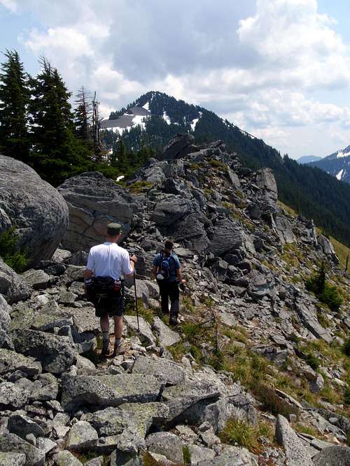
Open Slopes Near The Summit
Route Map
Getting There
Mason Lake TrailheadFrom Seattle, take I-90 E to exit 45. Cross over the freeway and take road 9030 to a junction about 1 mile down the road. Follow road 9031 to the left for another 3 miles until the trailhead is reached at the end of the road.
Good parking lot with toilets available.

Lake Kulla Kulla Seen From The Summit
Pratt Lake Trailhead
From Seattle, take I-90 east to exit 47 and then cross over the freeway. Take a left and the trailhead will be .25 miles up on the right.
Good parking lot with toilets available.
Routes
Ira Spring / Mason LakeThis is the main standard route on the mountain. The trail is well graded as it goes up to Mason Lake and a little steeper thereafter. It's possible to combine this peak with nearby Bandera since they primarily share the same trail. Please see the route page.
Pratt Lake
This is the longest approach to reach the summit, although it has the added draw of passing several lakes before the final approach to the mountain. Please see the route page.
Old Defiance Trail
This is the most direct route on the mountain with the shortest amount of distance. Unfortunately in recent years, this old fishermans trail has become rather overgrown in a couple of spots. It's still possible to follow though for those that don't mind a bit of bushwhaking and a few fallen logs. Please see the route page.
P3 Traverse
This route begins with the summit of P3 and has several possible descent routes. Here is a trip report which describes the route.
Approaching Defiance From Putrid Pete's Peak
When To Climb / Red Tape
All year, depending on avalanche conditions, but July through October are best. If climbing in winter conditions please check NWAC for current avalanche conditions.A Northwest Forest Pass required to park at the trailhead.
Camping
Camping is allowed under the Alpine Lakes Wilderness regulations and Mason Lake has several nice sites, however, Defiance is a day-climb.Trip Reports From NWH
- 2008 Trip Report by GeoTom
- 2010 Trip Report by Obi Tony Kenobi
- 2011 Trip Report by Further
- 2011 Defiance to P3 traverse Trip Report by GeoTom
wildstar - Feb 19, 2007 10:45 pm - Hasn't voted
Road 9031 is closedAs of Feb 19, 2007 most of road 9031 is closed because the road is washed out.
mbgriffi - Jul 10, 2007 7:55 pm - Hasn't voted
Re: Road 9031 is closedThe Road is open to Mason Lake Trailhead, still closed up to Talapus
wildstar - Jul 15, 2008 9:22 pm - Hasn't voted
Re: Road 9031 is closedThanks, I just discovered that same fact last week. I should have posted. Thanks again.