Toggle navigation
Mountains
Routes
Images
Trip Reports
Forum
What's New
People
Areas & Ranges
Articles
Trailheads
Canyons
Huts & Campgrounds
Albums
Logistical Centers
Fact Sheets
Lists
Custom Objects
Gear
Plans & Partners
WELCOME TO SUMMITPOST
SIGN IN
REGISTER
UN 9540 "Mount Esther"
Additional Parents
Image
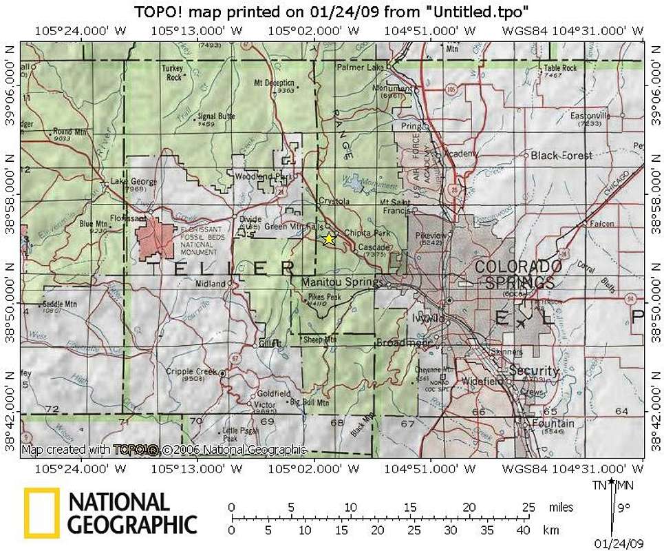
Mount Esther Area Map
View High-Resolution Image
Mount Esther Area Map
Mount Esther rises just north of the Ute Pass / Hwy 24 community of Chipita Park, a western exurb of Colorado Springs. The mountain sits in western El Paso County, not far from the border with Teller County.
Jan 2009
« PREV
NEXT »
Sarah Simon
on
Feb 6, 2009 7:28 pm
Comments & voting
Other parents
Lat/Lon:
38.91820°N / 105.0164°W
Image Type(s):
Topo/Diagram
Image ID:
487039
2448 Hits
71.06
% Score
1
Votes
Log in to vote
Comments
No comments posted yet.
to post!
Don't have an account?
UN 9540 "Mount Esther"
(Mountain/Rock)
« PREV
Viewing
#12 of 12
GALLERY
You are at
the Last
Image
Sarah Simon's Image Gallery
« PREV
Viewing
#4314 of 5480
GALLERY
NEXT »
×
You need to login in order to vote!
User Name
Password
Remember me
Forgot your password?
Log me out when I close my browser.
Keep me logged in all the time.
sign in as a user
Don't have an account?
Register now for FREE
Rating available
Suggested routes for you
People who climb the same things as you
Comments Available
Create Albums
Register Here


