


bakcast - Jan 5, 2005 7:11 pm - Hasn't voted
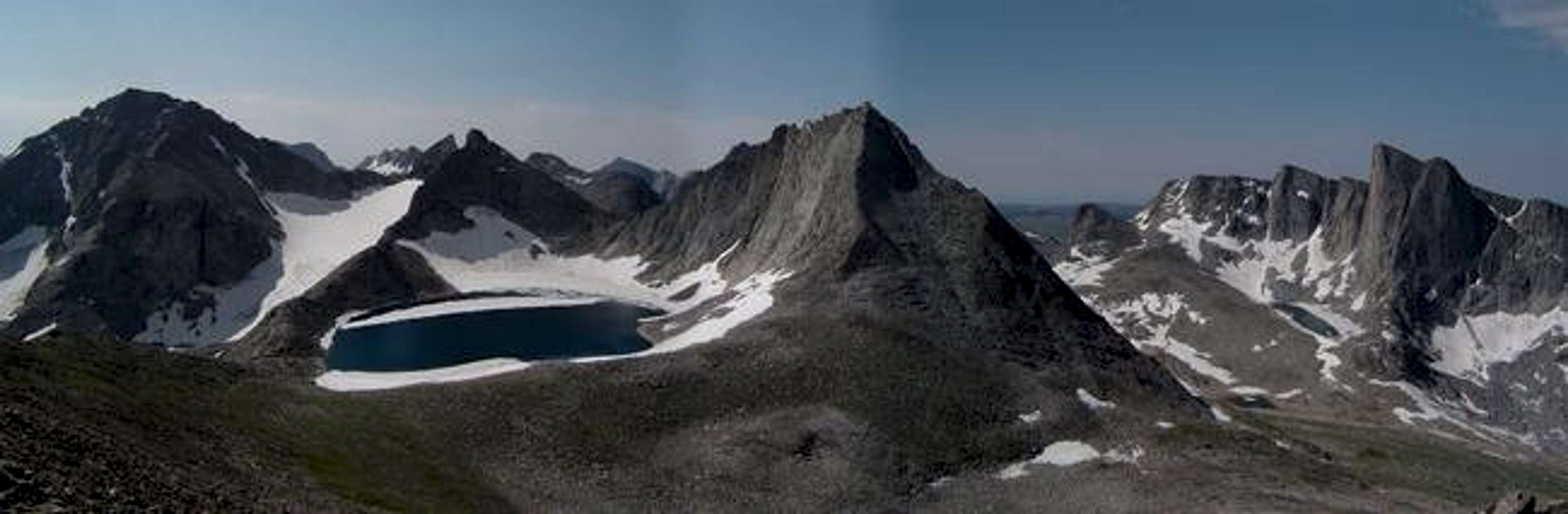
Great PhotoI read somewhere (probably in Kelsey's Book) that Noel Lake used to drain into the Moraine Lake basin to the N as opposed to where it now drains to the east. Did it have an obvious outlet while you were there.
Also, did you get a chance to look at the terrain that was between Moraine Lake and Noel Lake? Did it look like a reasonable pass with, say, a 10-day pack?
Brock

Dave Hodge - Jan 6, 2005 10:39 am - Hasn't voted
Re: Great PhotoThe lake didn't seem to have an outlet, but the ridge was higher on the east. Did the pass look reasonable to Moraine Lake? I think I remember that it looked like steep talus and boulders, and could probably be done with a pack, although it would be slow and tedious.

wyopeakMike - Dec 25, 2008 8:31 pm - Voted 10/10
amazing photoThat is one of the most beautiful photos from the Winds that I have ever seen. Noel Lake looks like a spectacular place to be.


Comments
Post a Comment