
-
 13433 Hits
-
 86.85% Score
-
 23 Votes
|
|
Mountain/Rock |
|---|---|
|
|
42.89800°N / 109.339°W |
|
|
12170 ft / 3709 m |
|
|
Overview
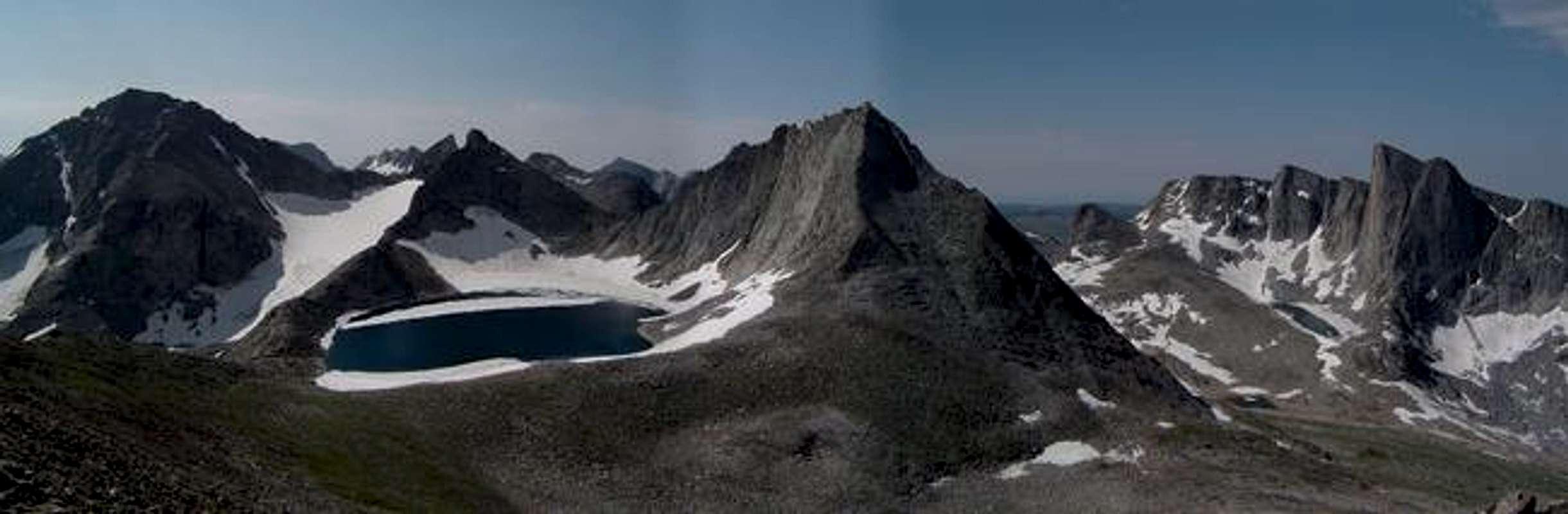
View south from the South Ridge
Located deep within the Bridger Wilderness, Bailey Peak (also known as Walt Bailey Peak) rests on the Continental Divide in the heart of Wyoming’s Wind River Range. Surrounded by other high peaks, this rarely climbed mountain is nearly invisible from all points outside the wilderness, and waited until 1963 to see a first ascent. Further obscuring the peak, the USGS map and the Earthwalk series map: Wind River Range South both locate the summit at a point 4 feet lower than the ridge high point, 0.25 miles to the north for no apparent reason. Compared to its neighbors such as Nylon Peak, Pronghorn Peak, and Mount Bonneville with impressive spire-like summits, Bailey Peak does not pose the same level of mountaineering or climbing challenges. In spite of this, this is a beautiful mountain in a remote location and provides remarkable vistas into the rarely traveled surrounding country to the north and east. The easiest route is a slightly exposed third-class scramble along the South Ridge. An ascent of this peak provides an opportunity to enjoy a few days backpacking in the Bridger Wilderness surrounded by rugged peaks.
Walt Bailey, the mountain’s namesake, was a chemistry professor and founder of the “Wyoming Mountaineers” climbing club at Casper College. He lost his life in 1958 to high altitude pulmonary edema (HAPE) on Alpamayo in Peru. Five years after his death, the mountain had its first recorded ascent by two of his students, although it is possible that there were undocumented earlier ascents. Tragedy seems to follow those whose names are associated with this mountain. In an unfortunate coincidence, one of these first ascenders (Gary Cole) also died of HAPE on Denali a few years later. In addition to Bailey Peak, Wyoming is also home to a Walt Bailey Memorial route on Devils Tower, and oddly enough, Boulder Canyon in Colorado has one of his routes from the 50s.
 |  |  |  |
Wind River Range
Wyoming’s Wind River Range runs southeast from its intersection with the Absaroka Mountains at Togwotee Pass to South Pass, where the Continental Divide yields to the rolling hills and sagebrush desert of the Great Divide Basin. Nearly the whole range is protected as wilderness totaling roughly 1 million acres, without a single road crossing or even entering the entire range. This necessitates multi-day approaches for most peaks or climbs. The range contains 43 of Wyoming’s 50 highest peaks, including most of its thirteen thousand foot peaks. The range was deeply chiseled by glaciers during the Ice Ages, resulting in many steep-walled cirques and river valleys, as well as massive lakes such as Green River Lakes, Fremont Lake, and New Fork Lake where the glaciers pushed out of the high country into the surrounding plains. The glaciers still linger primarily on the leeward side of the divide in the northern part of the range, and are some of the largest remaining in the U.S. Rockies. Much of the rock in the range is bomber granite and metamorphic providing abundant opportunities for rock climbing if you’re willing to undertake the approaches.
Getting There
Scab Creek Trailhead:
From Boulder, WY, take Wyoming 353 west for about 7 miles until the Scab Creek Road is reached on the left. This road is marked, but easy to miss, and is just as the road curves to the south past an oddly out of place Air Force research station on the left. Follow this unpaved but well-maintained road through several signed splits about 10 miles to the trailhead, which is only 0.25 miles before the undeveloped BLM Scab Creek Campground at the end of the road.
Approach:
Follow the Scab Creek Trail about 11 miles to Dream Lake in the spacious Raid Lake Meadows, at the junction of the Highline Trail. From here, the Middle Fork Lake Trail splits to the northeast. Camping can be found after about 4 miles near the massive Middle Fork Lake or earlier near Rainbow Lake. Bailey Peak lies directly west of Lee Lake. Total distance from the trailhead to the summit is approximately 17 miles.
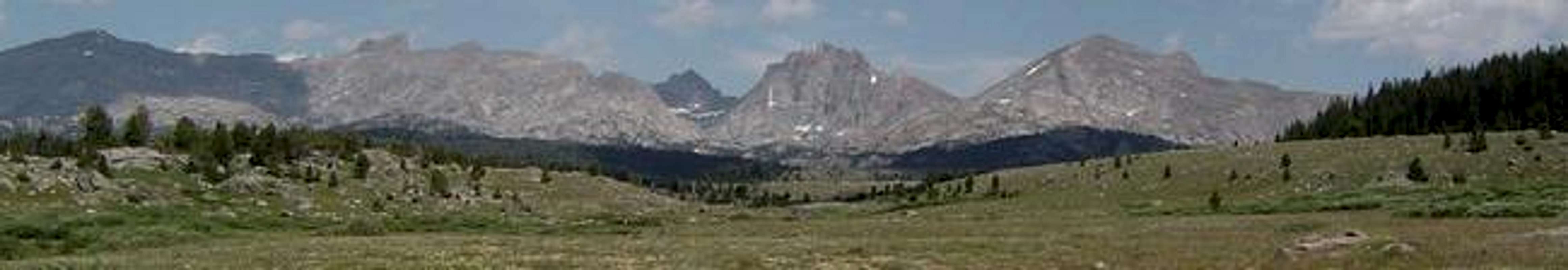
Raid Lake Meadows
Red Tape
Bailey Peak is located near the boundary between the Bridger Wilderness in Bridger-Teton National Forest and the Wind River Roadless Area in the Wind River Indian Reservation. All practical approaches start in Bridger-Teton National Forest. Standard wilderness regulations apply, i.e. no motorized vehicles, bicycles, etc. Camping is free anywhere in the backcountry, although camping within 100 yards of streams and lakes is prohibited and open fires are prohibited above treeline. The practice of low-impact camping techniques is critical in these popular wilderness areas. While there are no grizzlies in this part of the range (yet?), precautions should be taken to minimize encounters with black bears such as hanging food and cooking away from the area where you sleep.
When To Climb
Summer is the most common season for hiking, mountaineering, and climbing. While mountaineering and ski touring are possible in the winter and spring, the multi-day approaches and wilderness flavor make this a pursuit of only a hardy few. Expect plenty of other backpackers and large pack trains of horses in the popular areas. Summer also brings hordes of mosquitoes that will drive you crazy. They’re not as bad when you’re moving, but can make cooking and pumping water miserable. Mosquito repellant containing DEET is partially effective. By September the mosquitoes are mostly gone for the year.
Mountain Conditions
