
|
|
Trip Report |
|---|---|
|
|
Jun 29, 2015 |
|
|
Summer |
Mount Sill Day Hike 2015 via North Fork and NE Couloir
Mount Sill - elevation 14,154' / 4,314 m - was on my list for a couple of years. The class 4 section alone was enough to discourage me from going, especially since the only way I was going to get to the top of this mountain was alone, without any climbing experience. Everything I hiked up to this year was mostly class 2, with a little bit of class 3 on Mt Muir and Mt Russel. As a matter of fact, only 3 days before I got to the top of Sill, I was on top of Mt Agassiz. From up there, looking at the Palisades, Mt Sill stands out very well. It looked so impressive, mean and hard to summit, I actually decided not to go. Hiking back on Bishop Pass trail to South Lake, I made the decision to postpone Mt Sill indefinitely, opting for Mt Conness instead. Hiking Mt Conness for half the day and taking part in an interesting tour at Mono Lake for the rest of that day, seemed a more responsible approach. In the 11th hour however, the plan turned 180 degrees around and Mt Sill came into total focus.Since I hiked to the top of Middle Palisade only two days prior, I knew where the trail head for Mt Sill was, I knew where to park and of course, I had down all the logistics about hiking Sill at lest for six mouths. As I was frantically preparing for the hike, I checked the weather: 30% thunderstorm by 11 AM and definitely thunderstorm in the afternoon. The though of being caught in a thunderstorm on the top of a mountain again, is not part of my favorites at all. Actually, only the thought of it makes me nervous. I read in Bub Burd's report that he made it to the top of Sill in 6 hours and 35 minutes. I read in Scaruffi's trip report that he made it to the top of Sill in 8 hours. So I figured that I'd make it to the top of Sill in between 6:35 and 8 hours. I made it in 7 hours and 10 minutes.
The Trailhead
From I-395 in Big Pine, take Crocker Ave (only goes West). That road becomes Glacier Lodge Road, take it until it dead ends. Once feet away from where the road dead ends, there is a bridge to the left that would allow cars to cross the South Fork Big Pine Creek on the other side. That's not the situation a hiker going to either Middle Palisade or Mt. Sill wants. At that small intersection, which is not confusing at all, there are a few parking spots for day hikers. One just has to remember that the trailhead for either Middle Palisade or Mt. Sill are where the street dead ends, and not passed the small bridge over the creek on the left. There are a few parking sports there, some toilets, a metal barrier and the Big Pine Creek Trailhead sign (however, the sign is passed the metal barrier.) That is where the trailhead is located, for both South Fork and North Fork trail. After a short distance, the trails split, but the sign is easily noticeable. On the sign at the trailhead there is no mention of Mt Sill. The trail for Mt Sill is called "The Seven Lakes Trail." Passed Lake 3 the trail splits: straight takes you to Lake 4, 5, 6 and 7, left goes to the Glacier. To the Glacier is where one wants to go.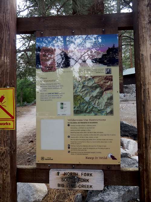 Big Pine Creek Trailhead sign | 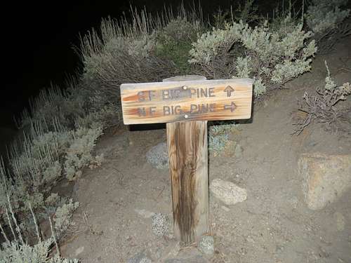 North Fork & South Fork Trails Split | 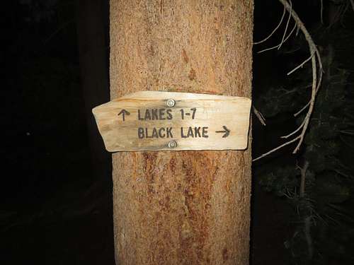 North Fork Trail - follow Lakes for Sill | 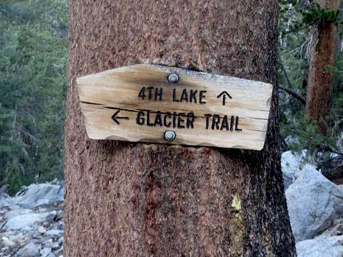 North Fork Trail - follow Glacier for Sill |
The hike up
My initial plan was to start my hike at 5 AM didn't actually happen. Since I was so nervous about the hike, I went to bed at 6 PM. By 1:15 AM I was up. I tried to get back to bed but, after tossing and turning until 1:45 AM, I got up, got ready and hit the road. At 3 AM sharp I started my hike: 2 hours before plan. That was great. I hiked in the pitch black forest, in the cool of night, the flash light was my best friend, for 2 hours. I hiked at a good pace, I think, and by 5:20 AM I was passed the First Lake. 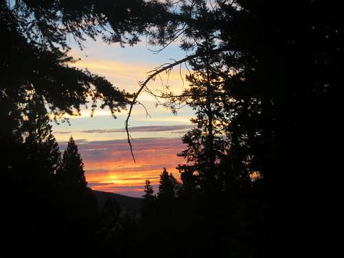 Sunrise on North Fork Trail | 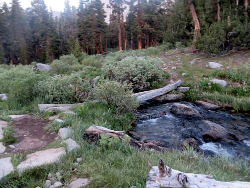 North Fork Trail | 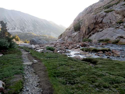 Glacier Trail at Sam Mack Meadow |
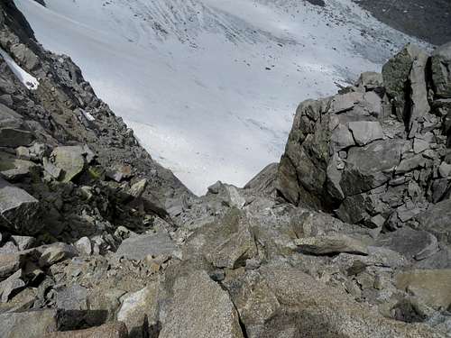
At 6 AM I made the left on Glacier trail, after a short snack break. At 6:25 AM I was at Sam Mack Meadow (3 hours and 25 minutes from the start.) At 7 AM the trail started to disappear from under my feet and I started to see the field of boulders. For most of the distance, there are cairns that lead (supposedly) an easier way to the Glacier Notch. Not that one needs signs to see how to get to the Glacier Notch, since that is pretty obvious. But to find the easiest way of negotiating the boulders would be a fantastic thing. The field of boulders is as boring, slow and tiring as it could be.
 Mount Sill Glacier Notch | 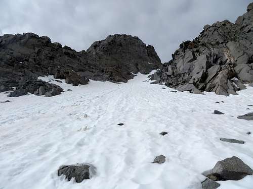 Mount Sill - North East Couloir | 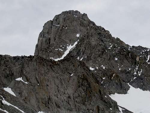 Mount Sill & the NE Couloir |
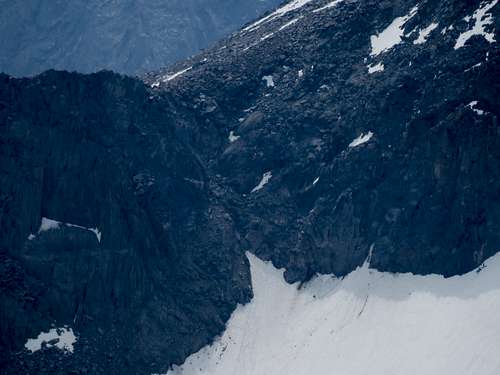
At 9 AM I was passed the Glacier Notch, which is easy class 3, and at the bottom of the North East Couloir. The Couloir was full of snow. There wasn't a way of avoiding hiking on the snow. The hike up on snow was not difficult but if felt tiring at times, since I'd slip when I'd least expect it, and for every step up I'd slide half a foot down.
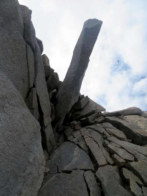
 Mount Sill - Glacier Notch | 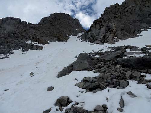 Mount Sill - North East Couloir | 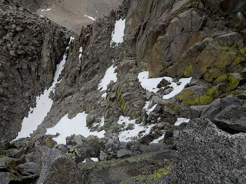 Mt Sill - above class 4 section | 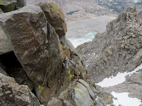 Mt Sill - above class 4 section |
As soon as I hit the rocks again, things got easier. At the top of the Couloir there are solid rocks I could walk over without needing to hold my balance every step I took, as I did on boulders or snow. The traverse over to class 4 and the class 4 section itself was a pleasure. A little technical, but a pleasure to climb. At 10:10 AM I was on the Summit of Mount Sill.
The summit
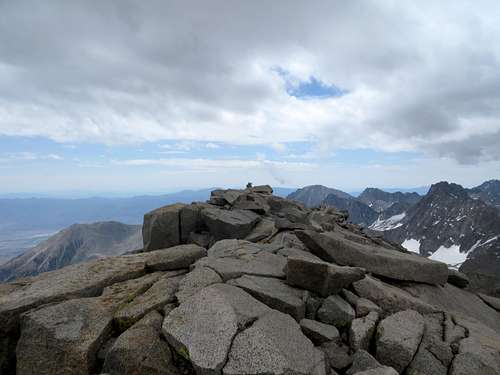 Summit of Mount Sill | 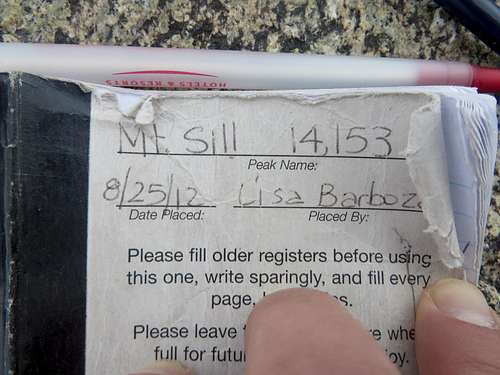 Mount Sill summit registry | 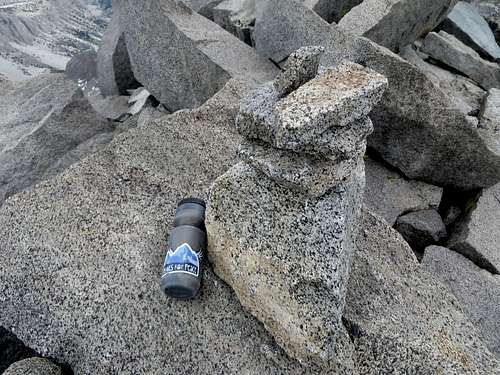 Summit registry on Mount Sill | 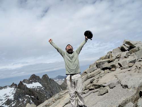 Summit of Mount Sill |
The clouds that were covering the mountain the whole day so far, were getting darker and bigger. I was sure that the weather guys knew their prediction that day. I sign the summit registry, I looked all over for the geological survey marker I didn't find, I took some pictures, I did not eat or drink absolutely anything, and 10 minutes later after I hit the summit, I was on my way down. The dark clouds were making me very nervous. A little rain would not bother me, but lightning is a different matter.
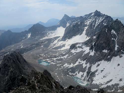 The Palisades from Mt Agassiz | 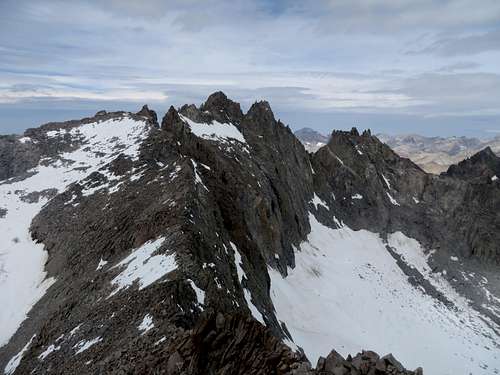 The Palisades from Mount Sill | 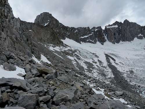 The Palisades from top of boulder field | 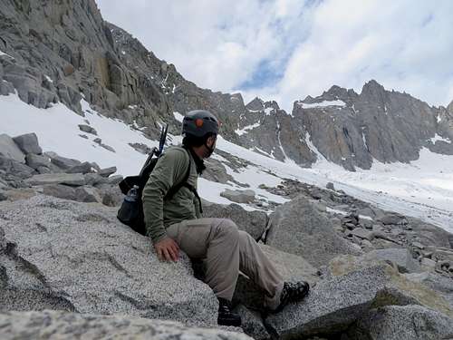 Palisades from bottom of Glacier Notch Palisades from bottom of Glacier Notch |
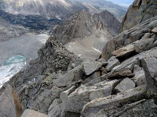 View North from Mount Sill | 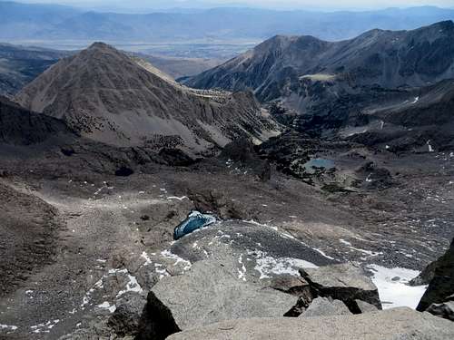 Mount Sill - view South East | 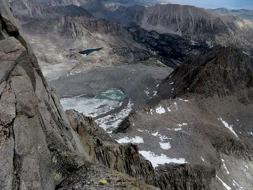 Mount Sill - view North | 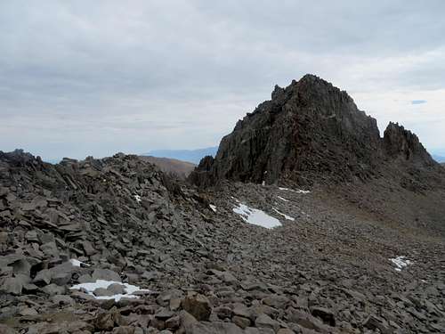 Mount Gayley from bottom of Couloir |
The hike down
Climbing down the class 4 section took a little attention, but again, it was more fun than I expected. At 11:20AM I cleared the Couloir. Going down on the snow in the Couloir was more difficult than I thought. My feet were at times sinking in the snow all the way to my waste. One time I entirely started to slide down, in the process my ice axe was also slipping from my hand. I eventually stopped and lucky for me, the ice axe was only about 6 feet uphill from me. From there I took it easier and made it down without any other incident. Meantime, the clouds were getting heavier, no thunder yet.
 Mount Sill | 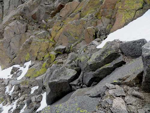 Mount Sill - above the class 4 section | 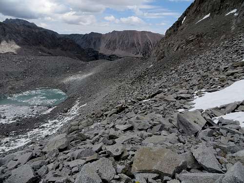 Mount Sill field of boulders |
At 11:30 AM I was at the bottom of the Notch. Coming down the Glacier Notch was a little more difficult than going up since I decided not to climb down on class 3 but rather slide down on the scree. That made my knees scream. After all, I was at the end of a week of hiking, most of that hiking was crossing boulder fields. And yet, I had one more to negotiate right in front of me. But as everything else, step by step, I made it across the field of boulders in one hour. Hiking down on more solid terrain, seeing the beautiful North Fork valley with the lakes and green vegetation, I knew the thunderstorm, if came, would not bother me now. Shortly after getting on the visible trail, I started hearing thunder. The clouds above the Palisades were heavy and dark.
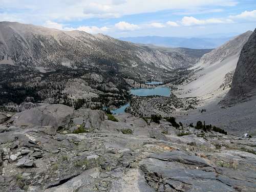 Mount Sill - view of the North Fork valley | 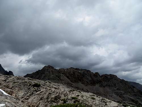 Dark Clouds over Mount Sill and Palisades | 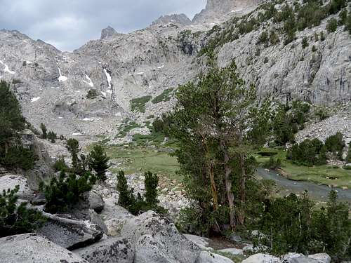 Sam Mack Meadow on Glacier Trail |
By the time I got back to Sam Mack Meadow, I was almost out of water. I got water at the meadow, but it looked so blue-green, like the glacier lake, I thought twice about if I should drink it. Hiking down about 10 minutes I came across a small creek with clean looking water. I treated with iodine both waters and eventually drank both, with no issues. Hiking down from the meadow, a few drops of rain hit me. I thought the rain would start, but it didn't. At least not where I was. I heard some more thunder and that was it.
 North Fork Trail |  North Fork Trail |  North Fork Trail |
Hiking down the trail, close to Lake 3, I started seeing campers. I talked for a while with and Asian guy who told me that he and his friends planned to hike to the Glacier the next day, "maybe higher." Talking to the guy I could tell that he had no idea what getting to "the Glacier, or maybe higher", meant. I told them not to go and wished them good luck. Hiking down below Lake 1 the Sun started to bake and I did not like it. I was fortunate the whole day to hike in the protection of the clouds. But now, at the end of the day, still having two hours to go, being in the baking Sun I did not see it as fun. But I pushed through, crossed paths with a lot of campers going up, mostly in the first mile from the trailhead. I did not feel like talking anymore. I got back to the trailhead at 4:30 PM, 13.5 hours and 18.5 miles later.
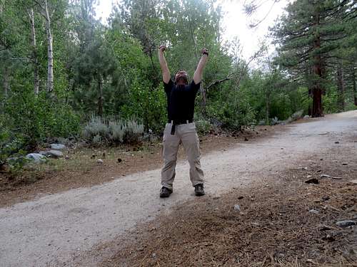 Mount Sill - Yes! |


Comments
Post a Comment