
|
|
Route |
|---|---|
|
|
40.77080°N / 109.8784°W |
|
|
Hiking, Mountaineering, Scrambling, Skiing |
|
|
Summer, Fall |
|
|
Most of a day |
|
|
Class 2 |
|
|
Overview
The route up Mount Untermann from the Highline Trailhead/Hacking Lake is but one of the many routes that could be used to climb Mount Untermann. Because it is the route I used climbed the peak, it will be the route with a route page.As peak climbs go, it’s a pretty gentle route and since the trailhead is at a relatively high elevation, it is a fairly mellow climb. The climb is above timberline for most of the way, so you have to keep a close eye on the weather.
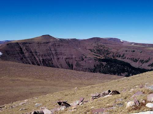 Mount Untermann from the west. The route crosses the bench below and then either climbs the ridge that follows the left hand skyline or heads farther left to Gabbro Pass before climbing the south slopes.
Getting There
From near the center of Vernal along Highway 40, turn north at the sign for Maeser and follow the road north to 500 North. Turn west here and follow 500 North to 3500 West. Turn north here. There is a sign for Red Cloud Loop Road. Follow the Red Cloud Loop Road through Dry Canyon. If you have time, make sure to stop at the pictographs and petroglyphs along the way.The road becomes a good gravel road at the Forest Service boundary. Follow the Red Cloud Loop all the way to a major junction with the road to Hacking Lake. A sign points the way to Hacking Lake, and follow the road to near Hacking Lake. Instead of turning left at the lake, follow the main road right and to its end. This is the trailhead.
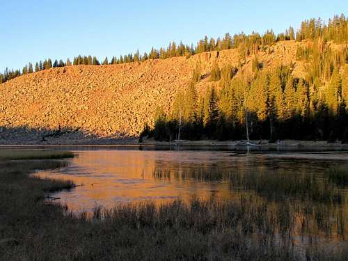 Hacking Lake is near the trailhead.
Route Map

Route Description
From the trailhead and gate at 10,880 feet elevation, follow the trail/old road west. The trail divides shortly. Continue right on the old un-used road. After a short distance, notice the bench to the southwest. Leave the old road and climb up to this bench. There is a cairned route in places, but don’t worry if you don’t see it and don’t waste too much time looking for it; just head for the bench.Once on the bench, traverse to the southwest along the bench. There are scraps of trail and cairns marking the route, but as long as you are on the bench northwest of Leidy Peak, you are on route.
Follow the bench and route (cairns are in places) to where it becomes a ridge. From here, you can either head west along the ridge and over Point 11,651, or you can skirt Point 11,651 by staying on the bench to the south.
There are two route variations to reach the summit of Mount Untermann. You can either head for the saddle between Mount Untermann and Point 11,651 or you can take the old trail across the south slopes of Mount Untermann to Gabbro Pass. See the map for marked routes.
The ridge route from the Untermann/Point 11,651 is the shortest, but there is some scrambling. Simply head up the Southeast Ridge of Mount Untermann to the summit.
If you took the trail to Gabbro Pass, head NNW up the gentle slopes to the summit of Mount Untermann.
After enjoying the fine views, you can either return the same way or climb other peaks in the area such as Leidy Peak, Deadman Peak, and/or Lakeshore Peak.
The route to Mount Untermann is 8.2-9.4 miles round trip depending on the route variation and takes the better part of a day.
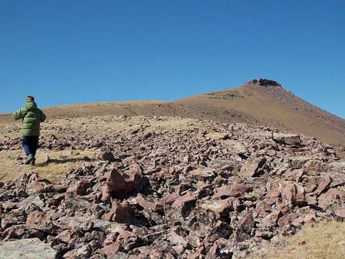 Nearing the summit of Mount Untermann from the Southeast Ridge.