-
 15605 Hits
-
 78.27% Score
-
 9 Votes
|
|
Mountain/Rock |
|---|---|
|
|
40.01580°N / 9.30190°E |
|
|
5997 ft / 1828 m |
|
|
Overview
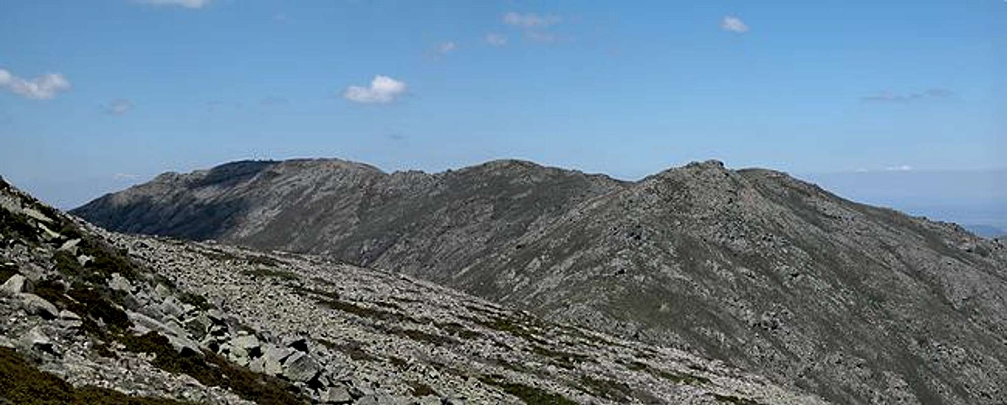
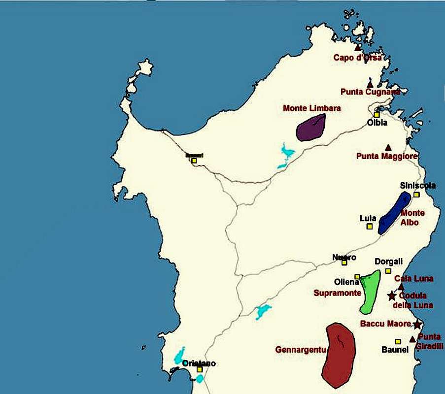
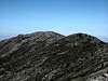
Bruncu Spina is Sardinia / Sardegna’s second highest mountain. It is located in the Gennargentu Mountain Range near the centre of the island almost directly on 40° eastern latitude. It is the only mountain on Sardinia which boasts a ski lift and two (!!) downhill courses. At 1828m, however, it is not high enough to offer secure ski conditions so that the number of days per year on which you can actually ski up there is limited. Bruncu Spina is the northernmost summit of the main Gennargentu ridge which includes all the five highest summits of the island. All are about the same height (just around 1800m) and Punta La Marmora is the highest one.
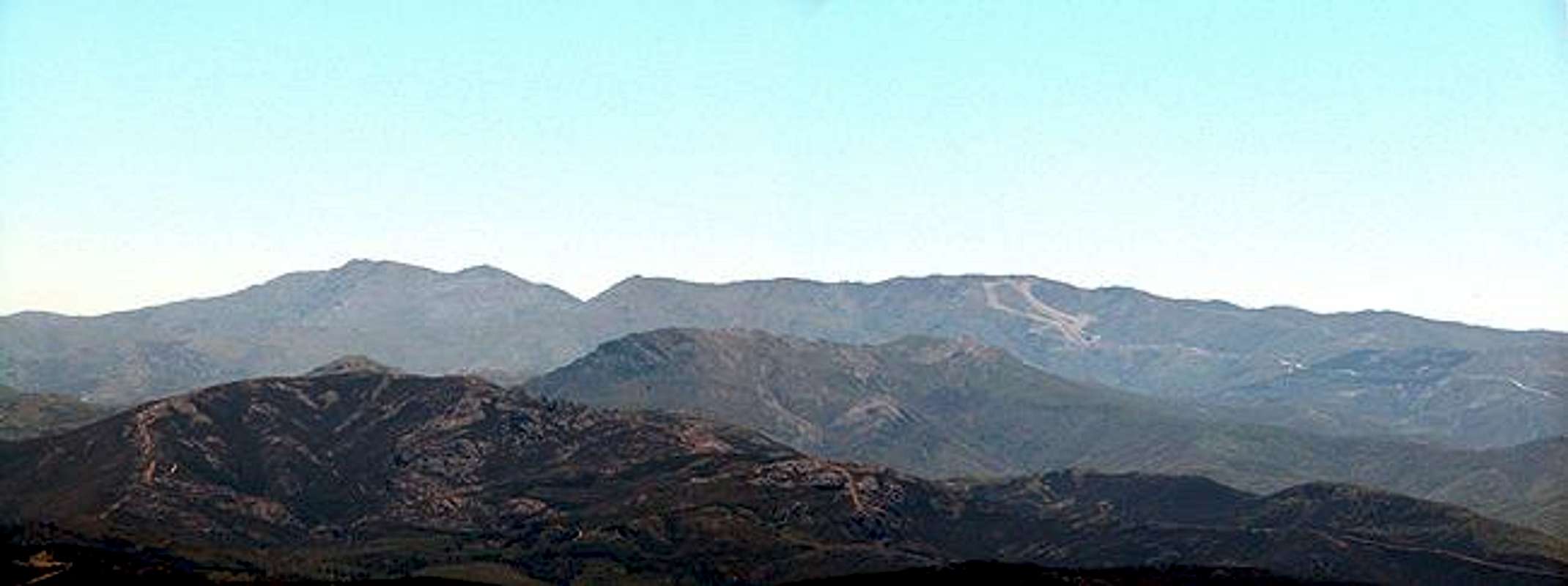
The whole appearance of the Gennargentu Range resembles the Scottish highlands. Also the history seems to be very similar. Almost all of the old oak forests of Sardinia have been logged in the 18th and 19th century, mainly to produce charcoal. You can still see the remnants of charcoal kilns between the mountains. Many of today’s hiking trails follow old mulatterias – mule trails which were used to carry the charcoal to the coast. Since that meant crossing the Supramonte Mountain Range which is rather inaccessible the mulatterias always follow the best trails, many times using the gorges that have been cut into Supramonte’s limestone. Codula della Luna is one of these gorges which – as is typical – ends in the solitary beach of Cala Luna.
From Bruncu Spina – as well as the whole Gennargentu main ridge you have Sardinia’s best views. It is located almost at the centre of the island and thus all coasts can be seen - on a clear day even as far as Corsica. The nearer views include High Supramonte and Monte Albo as well as the eastern coastal ranges.
The trail to Bruncu Spina follows the maintenance road for the ski lift as described in the Punta La Marmora Route. You can, however scramble up directly to Genne Erbeghe north of Bruncu Spina (and directly west of the trailhead). From there follow the ridge to Bruncu Spina’s summit.
What’s in a name? Gennargentu means “Silver Saddle”. The range has been named by Arcu Gennargentu, the saddle between Punta Paulinu and Punta su Sciusciu, which in winter receives its silvery shine from the only snow on the island.
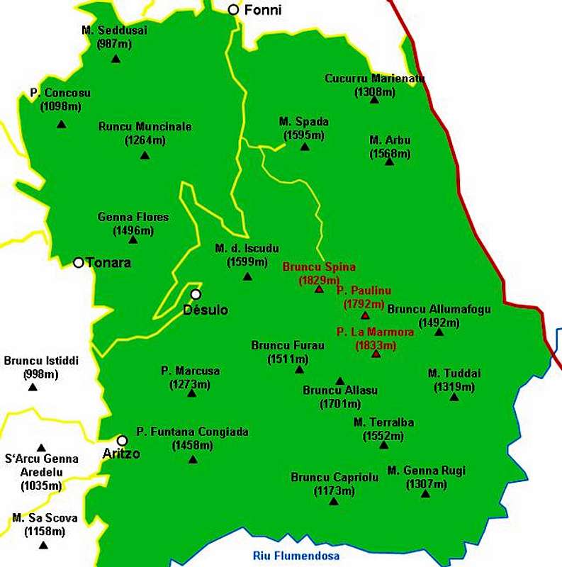
Interactive overview map of the Gennargentu mountain range. The summits which have been posted to SP are marked in red.
 |  |  |
Getting There
Sardinia can be reached either by plane or by ferry. The main ports are Porto Torres and Olbia in the north as well as Arbatax and Cagliari in the south. Airports are at Alghero and Olbia in the north as well as (again) Arbatax and Cagliari in the south. For exploring the north eastern part of the island where most of the mountains are the best entry point is Olbia, which is where most flights go anyway.
Approaching the mountain from Arbatax airport
From the airport take SS125d west towards Tortoli and onwards on SS198 to Lanusei. There switch to SS389 north direction Nuoro until you reach Passo di Caravei. At the pass turn west again un SS389, direction Fonni. Shortly before you reach the town SP7 (a small side road) turns off left (south) and leads in direction Desulo. After 5km turn left (signs Monte Spada, Bruncu Spina). 7km will lead you to the trailhead which is not at the end of the road at the ski lift but rather some 1km before, where there is a dirt road to the right and a parking place to the left.
Approaching the mountain from Olbia airport
Get on motorway SS 131 south in the direction of Siniscola / Nuoro. At the second exit for Nuoro get off and turn onto SS389 south direction Mamoiarda. First get around Nouro to the west and then follow the road to Fonni. After the town, turn on SP7, direction Desulo and follow the descriptions given above.