-
 29687 Hits
-
 85.36% Score
-
 20 Votes
|
|
Area/Range |
|---|---|
|
|
40.23670°N / 9.48950°E |
|
|
4800 ft / 1463 m |
|
|
Overview
The Supramonte Mountain Range is Sardinia's / Sardegna's second highest one. It is formed by limestone rock, which is is quite similar to the formations you can find in the Dolomites. in fact the mineral composition is very similar, the limestone being a special kind of Dolomite. The range, however, is older so that it is in a state of advanced erosion. You won't find the large scree piles beneath the summits, that you get used to in the Dolomites - most of them have been grown over and are pretty easy to ascend.
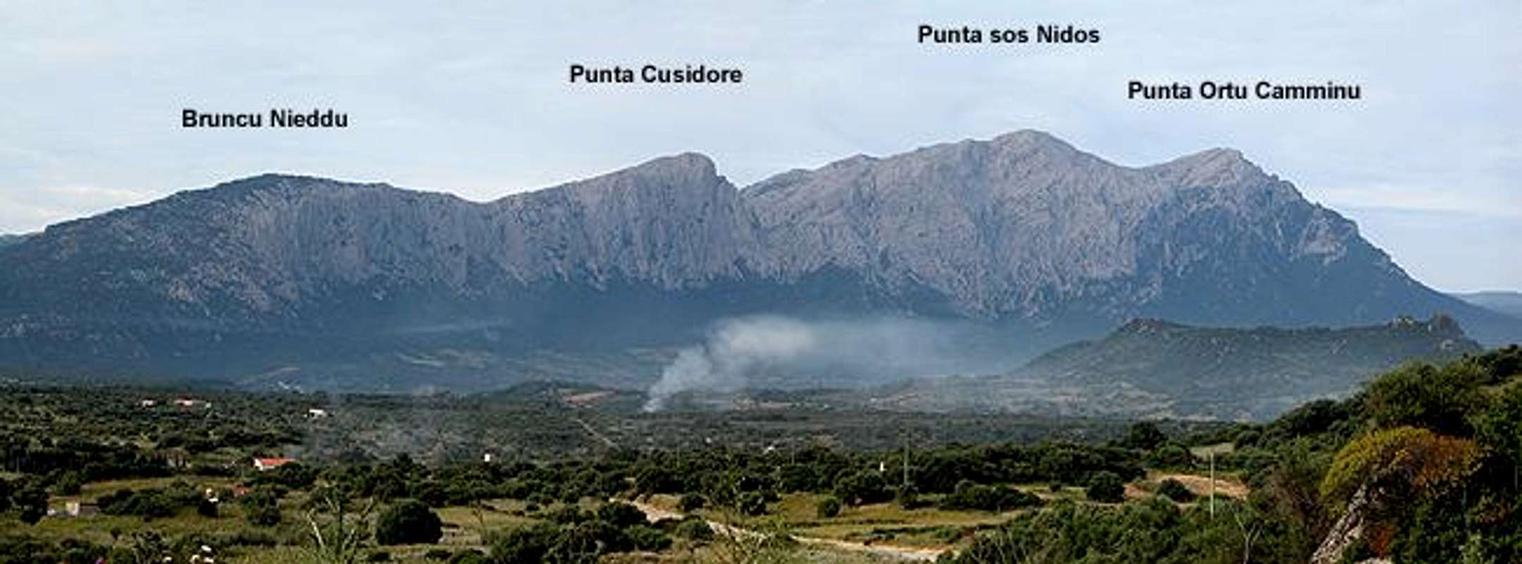
The Dolomite resemblance is most striking from afar - look at the north or west faces and you can feel relocated to the Pale di San Martino Group. There is a large high plateau which is bounded by huge drops towards the Oliena plain some 1000m below. The north faces are famous for long and difficult climbing routes. Punta Cusidore and Bruncu Nieddu attract serious climbers for nearly vertical climbs for between 350 and 500m. The west faces are too eroded to be climbed but below them - on Monte Maccione - there is one of the most famous climbing locations, with more than 70 routes with difficulties between difficulties from UIAA VI through X (see the links in the sections below).
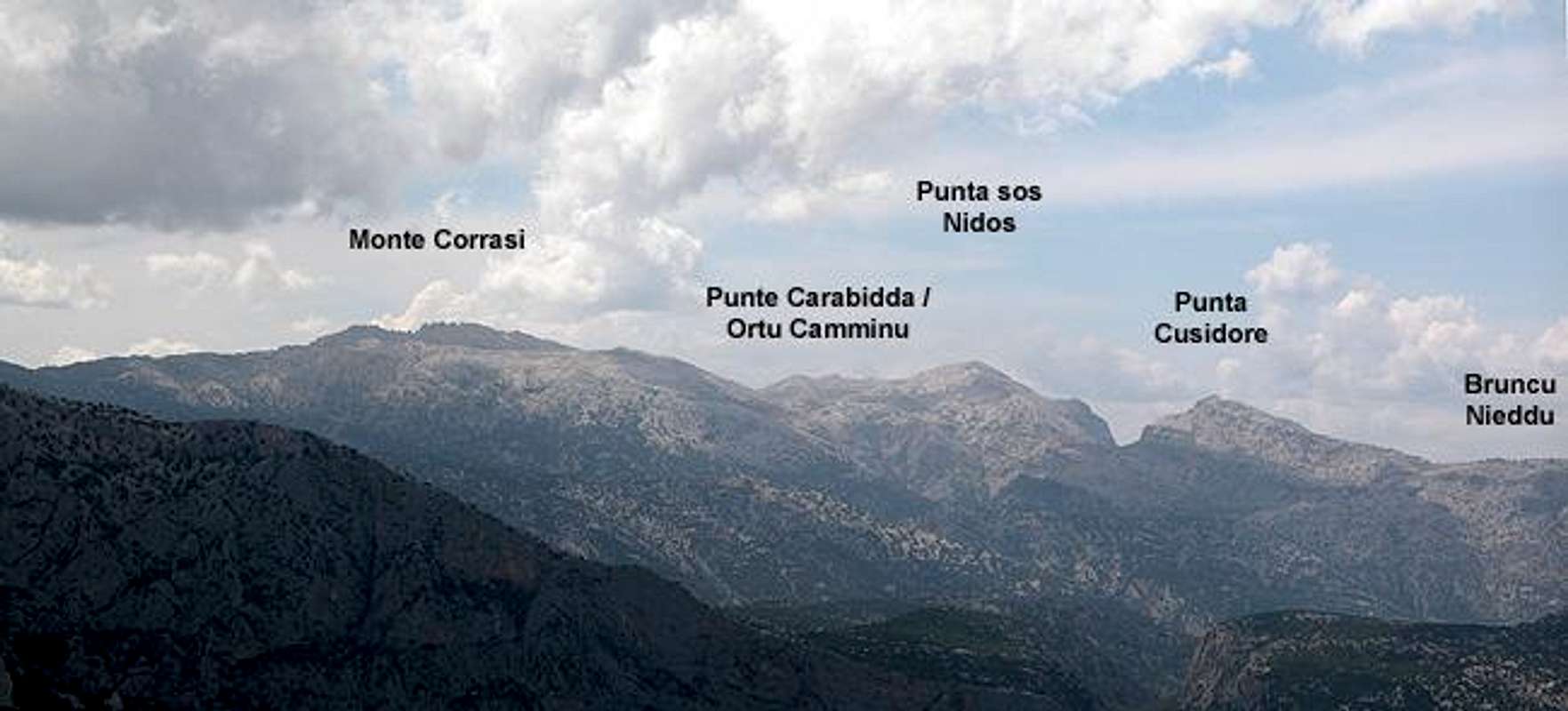
For regular hikers there are two short ascent routes. One, from Oliena follows a forest road to Scala 'e Pradu from where you can reach Monte Corrasi, Punta Carabidda, Punta Ortu Camminu and Punta sos Nidos. The other starts in the north near the chapel of Nostra Signora di Monserrata and follows a large scree couloir (quite difficult because of the orientation), Scala di Sovena. Here Punta sos Nidos, Punta Cusidore and Bruncu Nieddu can be reached.
Due to the erosion, the limestone on the high plateau is a typical karst formation. Lots of little drainage gullies crisscross the plateau and make hiking (rather scrambling) and orientation quite difficult. There are almost no trails along the plateau except for the ascent to Monte Corrasi. The same erosion has formed a deep gorge - which locals claim to be the most profound gorge in Europe - Gola su Gorropu. It has been cut deep into the high plateau by the Flumineddu River which springs from the base of Punta sa Pruna, Supramonte's second highest summit.
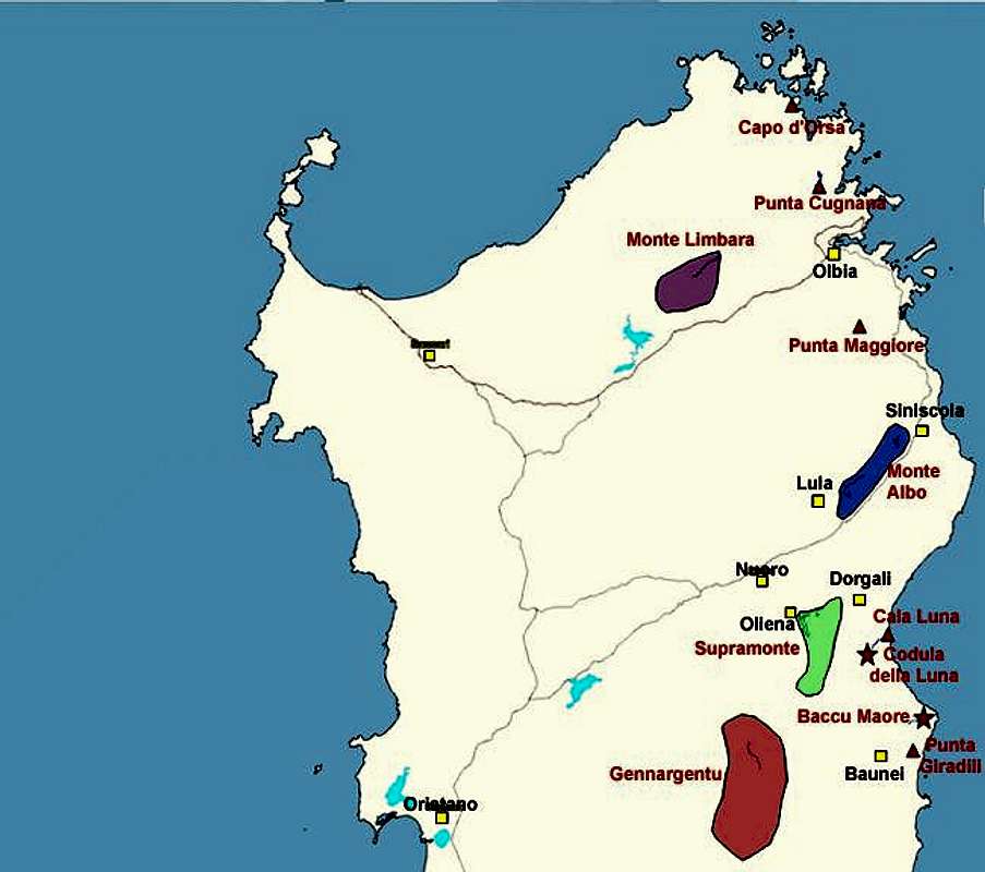
There are caves on Sardinia - which is also a typical feature of karst - but none of them occur in the high Supramonte region described here. Further to the west this mountain range gives way to the coastal mountain ranges, also called Supramonte, but denoted by their location. There are Supramonte Costiera, Supramonte di Baunei and Supramonte di Urzulei. The latter are named for the towns which are located in their centre. All three regions are good for hiking but don't have the importance of high Supramonte. Climbing is a different matter. Along the coast there are a multitude of climbing (sports and classic rock) locations with routes of all lengths and difficulties. These regions, however, will not be described here. Have a look at the following SP pages for further info:
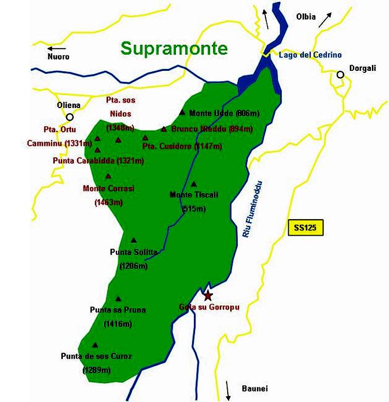
Interactive overview Map of Supramonte. The summits (and gorges) which have been submitted to SP are marked in red.
Supramonte, Monte Albo, Isola Tavolara
To the north of the Supramonte Range stretches the long chain of the Monte Albo massif. Both mountain ranges are closely related - in fact were part of a single mountain region in the tertiary age. Due to tectonic shifts of the earth's crust they drifted away from each other by about 40km. Even further to the north east there is Isola Tavolara, which also shows the same kind of limestone rock formations with vertical walls. Since it rises vertically directly out of the sea Isola Tavolara is one of the most impressive rock formations of Sardinia. For all visitors which toch down on the island at Oblia (air- or seaport) it is the first mountain they see.
For the respective locations of the three ranges look at the map in the "Getting There" section. Isola Tavolara is the long stretched island east of Olbia.
 |  |  |  |
Bruncu Nieddu
See the Bruncu Nieddu page here on SP. Rather low to be called a mountain, Bruncu Nieddu has two long and difficult climbing routes. |  | 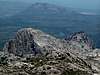 |  | 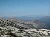 |
Punta Cusidore
THE most spectacular mountain in the whole Supramonte Range has six difficult climbing routes. Even the normal ascent is as difficult as hiking can get. See the SP Punta Cusidore page for more details.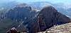 |  |  | 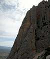 | 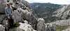 |
Punta sos Nidos
Relatively easy to get to from all sides, Punta sos Nidos is the Supramonte lookout peak. See the SP Punta sos Nidos page for more details. |  |  |  |
Punta Ortu Camminu
Punta Ortu Camminu forms a twin peak with Punta Carabidda. It is the northern of the two summits. Below both peaks there is the Monte Maccione climbing location with more than 70 short but very difficult routes. See the SP Punta Ortu Camminu page for more details. |  |  |  |
Punta Carabidda
The southern of the twin peaks, Punta Carabidda is perfect for views onto the gendarmes in front of Scala 'e Pradu, of Monte Corrasi and Punta Ortu Camminu. See the SP Punta Carabidda page for more details. |  |  |  |  |
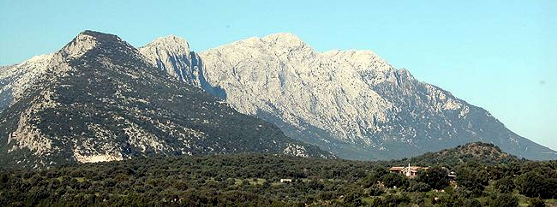
Monte Corrasi
Monte Corrasi is the Supramonte highpoint. It is quite eroded and thus offers no serious climbing opportunities. It is a popular hiking destination but, due to the erosion, trails are not very easy to be found. Bring compass and/or GPS. See the SP Monte Corrasi page for more details. | 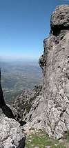 |  |  |  |
Punta sa Pruna, Punta de sos Curoz
Both summits, Punta sa Pruna and Punta de soz Curoz are rather unpopular for hikers / climbers since they are rather far from any of the possible trailheads near the Supramonte Range. Thus heading for them will certainly give you the real backcountry feeling - no one around there. From Punta sa Pruna you can descend into the Gola su Gorropu Gorge (see below).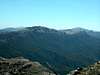 |  |  |  |
Monte Tiscali
Unfortunately I don't have any pictures of Monte Tiscali. It is one of the lowest mountains of the Supramonte Range but historically certainly the most interesting one. The native inhabitants of Sardinia were forced to flee from the roman conquerors of the island and fled into the Lanaittu Valley within Supramonte. Anound Monte Tiscali they fortified the karst caves and gorges in the area. Today Monte Tiscali is home to one of the oldest and best conserved prehistoric Nuraghen (= prehistoric Sardinian habitation) villages.Gola su Gorropu
Though not a mountain, Gola su Gorropu is one of the most fascinating locations on Sardinia. A deep gorge - claimed to be the most profound in Europe - it has been formed by the Flumineddu River, which springs from the slopes of Punta sa Pruna. Good Climbing opportunities are combined with a breathtakingly narrow gorge. See the SP Gola su Gorrupu page for more information.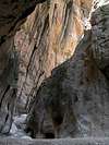 | 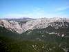 |  | 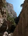 |  |
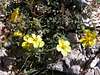
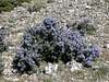
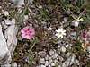
Flora (lots) and Fauna (little)
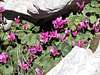
Supramonte is host to a lot of interesting flowers. There are lots of cyclamen and wild peonies together with rock roses and rosemary bushes which are typical for the machia. Moreover you can find beautiful orchids, though not as many as on Monte Albo.
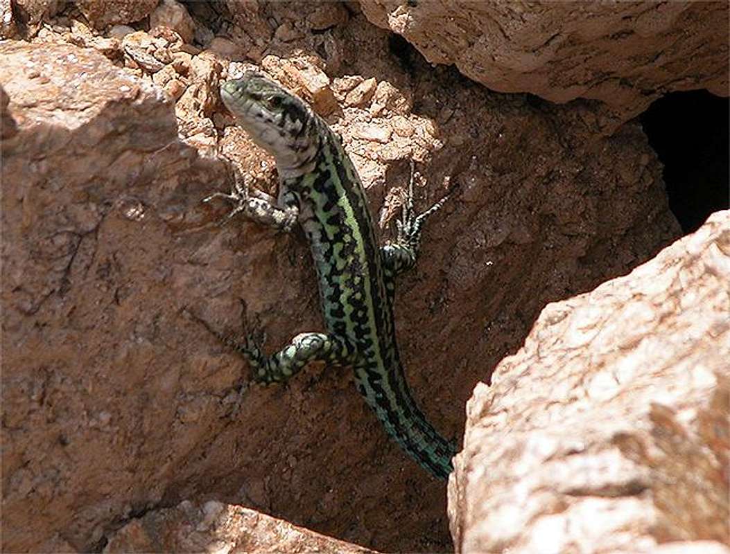
As for animals the guidebooks speak of wild mufflons and golden eagles. I haven't seen any. Just a couple of lizards and peregrine or kestrel falcons.
 |  |  |  |
 |  |  |  |
Getting There
Sardinia can be reached either by plane or by ferry. The main ports are Porto Torres and Olbia in the north and Arbatax and Cagliari in the south. Airports are at Alghero and Olbia in the north as well as (again) Arbatax and Cagliari in the south. For exploring the north eastern part of the island where most of the mountains are the best entry point is Olbia, which is where most flights go anyway.
Approaching the mountain range from Olbia airport
For the exploration of Supramonte there are three trailheads. In principle you can reach any destination in the range from either of these trailheads within a day's hike but should expect hard hiking or scrambling along the spiky limestone rocks. You better start near your destination.
- North Eastern Trailhead (Monte Corrasi, Punta Carabidda, Punta Ortu Camminu, Punta sos Nidos)
Get on motorway SS 131 south in the direction of Siniscola / Nuoro. At the exit Lula / Dorgali get off and turn on SP38 south (again direction Dorgali). Shortly before you reach the town turn right on SP46, direction Oliena. In Oliena follow the signs to Monte Maccione, which - if I understand correctly - is the larger mountain of which Punta Carabidda and Punta Ortu Camminu are a part of. The road leads to a restaurant at which you can park your car.
- Northern Trailhead (Punta sos Nidos, Punta Cusidore, Bruncu Nieddu)
Get on motorway SS 131 south in the direction of Siniscola / Nuoro. At the exit Lula / Dorgali get off and turn on SP38 south (again direction Dorgali). Shortly before you reach the town turn right on SP46, direction Oliena. Take this road up to a sign leading to the chapel of Nostra Signora di Monserrata. Here turn off left.
The following description is a little hard to understand on paper - nevertheless it is quite accurate. Follow the country road for 100m, then turn left. After another 600m turn right and head directly for Punta Cusidore. At an intersection the road turns left again and you follow it for another 600m. Here the asphalt ends and a gravel road takes you to a little fount. From here start to look for spaces to park your car. The road goes on for another 500m before the ascent trail (still a dirt road) starts climbing steeply upwards to the right.
- Western Trailhead (Bruncu Nieddu, Monte Tiscali, Gola su Gorropu)
Get on motorway SS 131 south in the direction of Siniscola / Nuoro. At the exit Lula / Dorgali get off and turn on SP38 south (again direction Dorgali). Shortly before you reach Dorgali, SP38 ends and you switch to SS125 direction Dorgali.
Get through the town (signs Cala Gonone, Baunei) and soon afterwards the road to Cala Gonone turns off through a tunnel to the left. Go straight on and 1km after the intersection, take a narrow road to the right. This road winds down into the Flumineddu Valley (always keep to the left (south)) and there takes you through vineyards and orchards. The asphalt ends after 8km. Go on for another 800m and you'll reach a parking lot near a picnic area on the shore of the river.