
-
 15729 Hits
-
 75.81% Score
-
 6 Votes
|
|
Mountain/Rock |
|---|---|
|
|
47.43320°N / 120.85751°W |
|
|
Chelan |
|
|
Scrambling |
|
|
Spring, Summer, Fall |
|
|
6666 ft / 2032 m |
|
|
Peak Overview
 Scramblers on Volcanic Neck
 Bean Creek Basin
Getting There
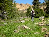 Bean Creek Basin
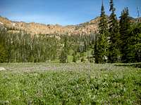 Bean Creek Basin
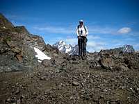 Ridge of Bean Peak
 TOPO! Software Image.
Red Tape & Camping
Once you've attained the should of Bean Peak, you are officially in the Alpine Lakes Wilderness. Self-serve permits are available at the trailhead.There are numerous campsites with running water in Bean Creek Basin, and in the basin between Volcanic Neck and Bean Peak.
Parking at the trailhead requires a Northwest Trail Park Pass ($5/day, $30/year). An interagency pass ($80/year), which is also good for access to all US national parks, is also valid for parking purposes.
External Links
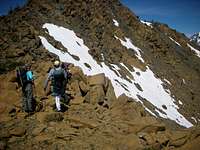 Dropping over Ridge of Bean Peak
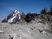 Mount Stuart
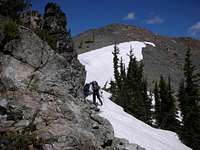 Summit of Devils Head
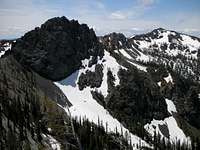 Volcanic Neck from Devils Head
Cle Elum Ranger District
West 2nd Street
Cle Elum, WA 98922
(509) 674-4411
Snow conditions are available from the Summit at Snoqualmie Ski Areas (of which Alpental is one) at the following website:
Summit at Snoqualmie Snow Conditions
Also, webcams are available from the Washington State Department of Transportation at: Snoqualmie Pass Web Cam