
|
|
Mountain/Rock |
|---|---|
|
|
47.36807°N / 120.72856°W |
|
|
Kittitas |
|
|
Hiking, Mountaineering |
|
|
5489 ft / 1673 m |
|
|
Overview
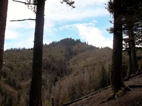
Looking up at Iron Bear
Iron Bear is an unofficial named highpoint located in the eastern Teanaway Region in the eastern Cascades. Though just slightly shorter than its slightly higher neighbor, Jester Mountain, Iron Bear is home to excellent western views of the higher Teanaway Region as well as Mount Stuart and some of the Enchantments as well. This peak might not be recognized in the Wenatchee Backcourt 100 due to fact that it is not prominent enough (259 feet) but that should not deter you from stopping at the summit of Iron Bear before attaining the slightly larger Jester Mountain. Unlike Jester Mountain Iron Bear is just a 50 foot walk off the trail to the true summit and the true views.
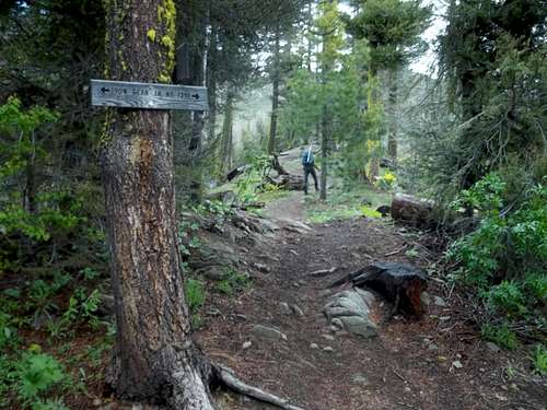
The 4 way trail junction that leads to Iron Bear
In the summer if you choose to just go to the summit of Iron Bear the roundtrip distance will be 6.75 miles and 1700 feet of elevation gain. This is all basically a Class 1 walk up pretty much directly to the summit. But Iron Bear is most of the time combined with nearby Jester Mountain. The total distance of the two combined this 7.5 miles and 2000 feet of elevation gain. Whereas Iron Bear has excellent western views its slightly taller twin Jester Mountain as superior eastern views. This would also be a good mid to late October hike when many of the western larches change there needles and turned into a bright yellow. You will see a number of western larches here with many especially near the top of Iron Bear.
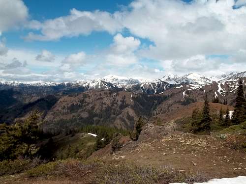
The view of the Teanaway from Iron Bear
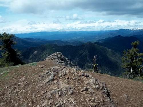
The top of Iron Bear
In winter this mountain becomes a completely different experience. Whereas in summer this combination of two summits can be done in a 3-5 hours, in winter this combination is 1000 feet more in elevation gain and can take the entire day. Add on the fact that the road is closed all the way to Route 97 and once past the trailhead the winter rotue head straight up, this peak and section of peaks can offer quiet a challenge. Please check the avalanche conditions before attempting ths section of peaks.
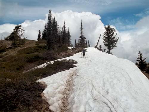
Rising up a melted out cornice
Getting There
Iron Creek Road FR 9714 is 19 miles from northeast and 30 miles south of Leavenworth off of Route 97. Mineral Springs is to the south. It will be on the western side of the road. Follow the road for roughly 3 miles to the end. If not driving a 4 by 4 it is recommended that you park in the lower parking lot and walk up to trailhead #1351. The road crosses a stream and becomes rougher higher up.Red Tape
Did not see any Northwest Forest Pass signs on this trailhead. Bring one though just in case.Camping
Camping is abundant on this road on the way up to the trailhead. These camping areas were empty when I was there on a Firday in June but are likely busy on the weekend. There is also a number of decent camping/bivy areas on the ridge. Please leave no trace.External Links
A great website by Eric Willhite on this summitA spring trip report on this summit
A winter trip report on the region
Northwest Avalanche Center