|
|
Mountain/Rock |
|---|---|
|
|
50.77000°N / 115.19°W |
|
|
9169 ft / 2795 m |
|
|
Overview
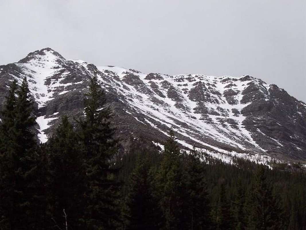
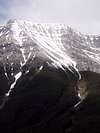
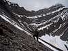
This impressive mountain is in the heart of the Kananaskis Country. Its upper third involves a long steep trudge up to the summit through rough, loose rocks. The view to the east as you climb the eastern slope is absolutely breathtaking as the Opal Range soars into view.I doubt that many people climb this mountain. It is difficult to find any information about it on the internet, nevermind climbing information. There was absolutely no one there we I climbed it with my friend in May 2005.
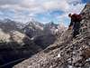
The difficulty of this climb is fairly moderate. Even though it is quite close to the highway (about 4 kilometres from where you park to the peak), it would be wise to allow the majority of the day for this mountain. It took me and my friend 10 hours, mostly because of all of the snow. The bottom requires a bit of guessing for the route, because it can be quite difficult and time consuming to find the right drainage to head up. Once in the drainage, there are a couple of fairly steep scrambles which can be tricky to downclimb on the way back after a full day. Once above the treeline, however, it is basically a long, steady trudge up to the summit. Close to the summit there are a number of steps about 2 metres high, but in the absence of snow, there could be a way to bypass these more difficult parts.
Overall, the view from this mountain is absolutely priceless, making the challenge of the 1260 vertical metre climb very rewarding.
 |  |  |  |  |
Getting There
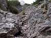
To get to Mt. Lawson, turn South off of Hwy 1 (Trans-Canada Highway) and go about 45 kilometres south on Hwy 40. Turn west onto the Fortress Ski Area access road. Cross the bridge (if open) and follow the road about 200 metres further until you get to the first switchback in the road. Park here, and head into the bush directly south.There is a nice animal trail that can be followed for a while, but after passing the first noticeable drainage, start shifting your direction more uphill, bearing at around 215º. You will eventually stumble on the second drainage that you want to follow up until you are above the treeline. This second drainage is tricky to find. Its very beginning is just a clearing of trees, with no real indication of any drainage. Further up, it will become clear that you are indeed in the right place. If you are having trouble finding it, you are probably not far enough west (uphill) to be hitting it.
Once above the treeline, the way requires very little route finding skills. Most of the more difficult sections can be avoided, otherwise expect lots of tedious loose rock with gusty winds.
For a more detailed description of the entire climb and other routes from the summit, check out "Scrambles in the Canadian Rockies" by Alan Kane.
 |  |  |  |  |