

-
 15438 Hits
-
 79.49% Score
-
 14 Votes
|
|
Mountain/Rock |
|---|---|
|
|
49.31966°S / 73.09607°W |
|
|
Mountaineering, Ice Climbing |
|
|
Spring, Summer |
|
|
9177 ft / 2797 m |
|
|
Overview
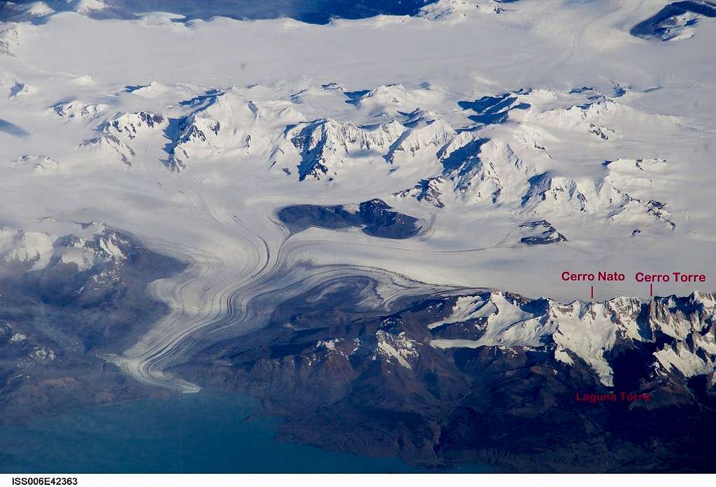
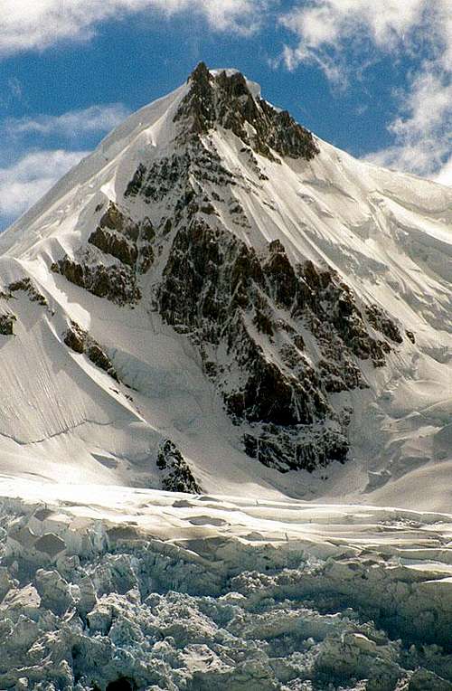
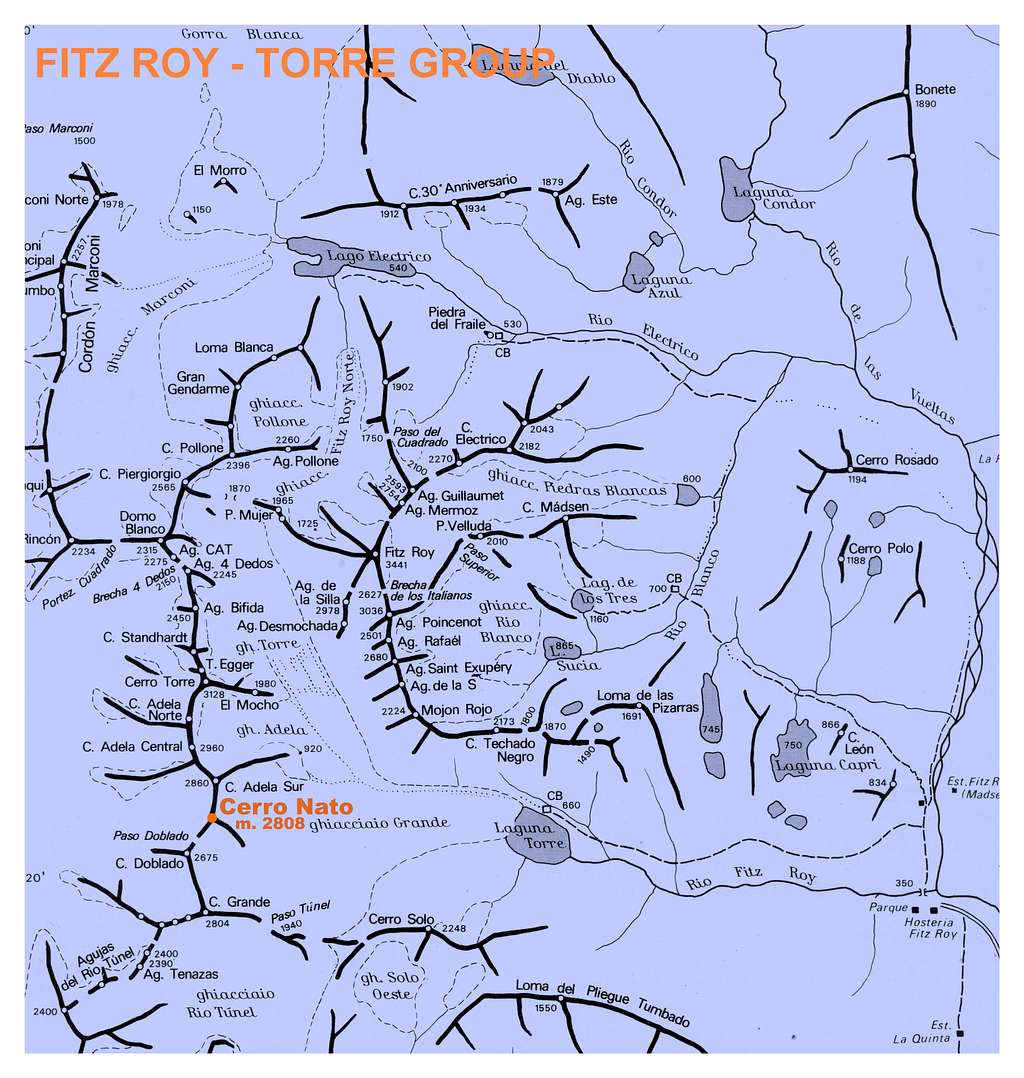
Cerro Ñato
The Cerro Torre - Cordòn Adela Group is a chain located in Patagonia inside Los Glaciares National Park and lined up between Brecha Cuatros Dedos to the North and Viedma Glacier to the South. This spectacular group includes some swell and worldwide famous granite peaks, as Cerro Torre, in its Northern sector and some mighty ice-capped summits in its Southern sector.
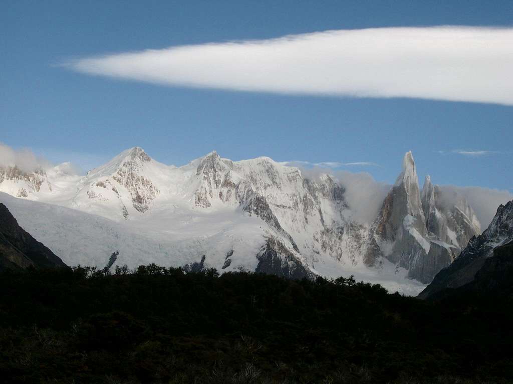
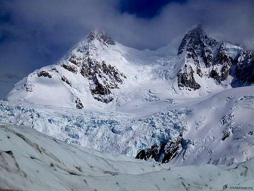
Cerro Ñato is one of these latter, an attractive peak located South to Cerro Torre, between Cerro Adela Sur and Cerro Doblado.
Getting there
The approach trek to Cerro Ñato starts from El Chalten, a small mountain town in Argentina, Santa Cruz Province, on the riverside of Rio de las Vueltas. The village offers some basic shops, phone, internet facilities and accomodations such as camping and beds. At the entrance of El Chalten there is a Park Office, where trekkers and climbers have to register and obtain permits (they are free: the only cost is the Park entrance fee). From El Chalten starts the trail to Cerro Torre and Cerro Fitz Roy, so during the peak summer season there is a lot of tourists, trekkers and alpinists. The village is located about 230 Km North of El Calafate, the real gateway to the Los Glaciares National Park, and the tour requires about 4 hours, on paved road (daily buses). El Calafate provides all modern facilities and all price accomodations (hotels, estancias, cabins, camping). The town is situated on the south side of Lake Argentino, about 320 km Northwest from Río Gallegos (5 hours drive on good paved road; daily regular bus services). One can fly directly to the new Calafate Airport or, alternatively, fly to the most important Rio Gallegos Airport (daily flies from Buenos Aires) and then drive for about 300 Km (5 hours) to Calafate along National Route Nr. 5.
From El Chalten a good path, following Rio Fitz Roy valley, leads to Bridwell Camp and Maestri Camp at Laguna Torre (camping place), from where a “mirador” can be reached: from here it's possible to enjoy a spectacular view on the impressive glaciers and peaks (Cerro Torre, Cerro Adela, Cerro Ñato, Cerro Doblado). The trail requires about 2,5 hours by walking. From the “mirador” a thin trail leads down on Glaciar Grande, which is crossed diagonally leftwards to gain the base of the impressive Cerro Ñato iced Southeast Ridge
History
- The first summiters of Cerro Ñato were Ettore Castiglioni, Leo Dubosc and Titta Gilberti (Italy) on February 1937, climbing the South-West Ridge, the Normal Route (AD) starting from Paso Doblado, a saddle between Cerro Ñato and Cerro Doblado
- The second ascent was realized by Walter Bonatti and Carlo Mauri (Italy) on February 1958, climbing the North Ridge, a snow ridge starting from Colle Trento, located between Cerro Ñato and Cerro Adela Sur
Routes
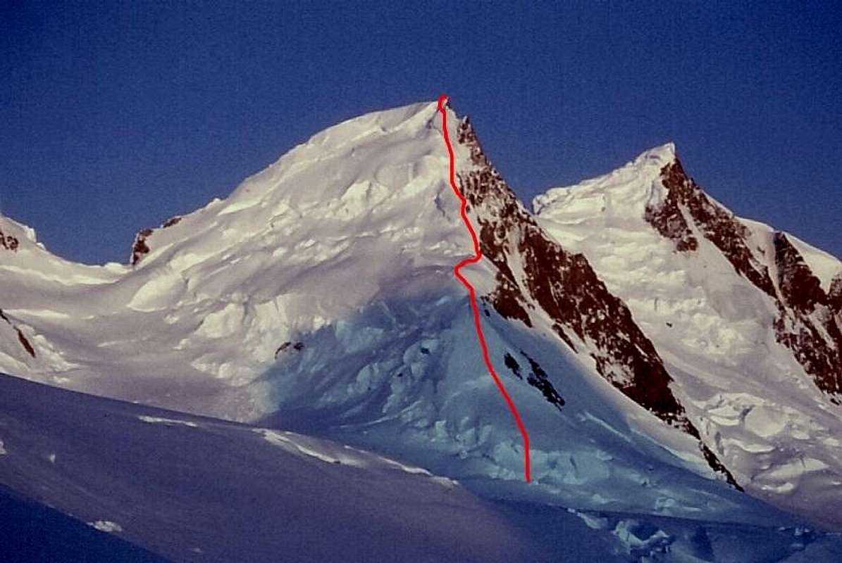
South-West Ridge (Normal Route from Paso Doblado, AD)
- First ascent: 8, February 1937 Ettore Castiglioni, Leo Dubosc and Titta Gilberti (Italy).
- Second ascent: 7, February 1958 Walter Bonatti and Carlo Mauri (Italy).
South-East Ridge (Luce de Leche - Milky Light, 950m TD- 70°)
- First ascent: 4, November 1987 Davide Brighenti and Alberto Rampini (Italy)
Red tape
Cerro Ñato is located in Los Glaciares National Park (Parque Nacional Los Glaciares), Santa Cruz province, Argentina, one of the most spectacular mountain area in Patagonia, on the border with Chile and Torres del Paine National Park. Los Glaciares National Park is a federal protected area and covering an area of 726,927 ha it's the second largest national park in the country. It was established on 11 May 1937 and in 1980 it was declared a World Heritage Site by UNESCO. UNESCO INFO Climbing permits are required in the National Park Office at the entrance of El Chalten. The permits are free, with the only requirement for the climbers to provide their full names and the peaks they are attempting to ascent.
When to climb
The best time to climb goes from November to late February, the local summer, being the region located on the Southern hemisphere.
Maps
External Links
Useful climbing info here: Pataclimb
www.pataclimb.com
Cerro El Ñato. 2797 meters
www.trekearth.com
Cerro Ñato, Cerro Adela and Cerro Torre