
-
 12235 Hits
-
 84.27% Score
-
 18 Votes
|
|
Mountain/Rock |
|---|---|
|
|
48.75160°N / 120.0684°W |
|
|
Okanogan |
|
|
Hiking |
|
|
Spring, Summer, Fall |
|
|
7437 ft / 2267 m |
|
|
Overview
 The Lookout Tower
At 7437 feet, North Twentymile Peak is the third highest mountain with a lookout in Washington State. In fact there are two remaining lookouts on the summit. The original cupola style lookout was built in 1923 and is in surprisingly good shape for having been exposed to harsh elements for nearly 100 years. This cupola style lookout is extremely rare and there are only a couple like it still in existence. The replacement lookout tower was built in 1947 and was staffed from that time until the 1980's. The lookout at the top of the tower is locked shut but access to the viewing platform is unlocked. The cupola style lookout is unlocked and a small ladder leads to the top level.
 The Cupola Lookout, Built 1923
North Twentymile Peak is a broad mountain with numerous ridges radiating out in all directions. There are roughly 20 small creeks which run down between these ridges to dump into the Chewuch River on the north and west sides and the Twentymile Creek drainage on the south side. South of Twentymile Creek is the sister peak, South Twentymile Peak, 6670 feet high. To the northeast, Thirtymile Creek separates North Twentymile Peak from Corral Butte.
 Tripod Fire Damage
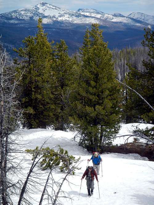
The Tripod Fire of 2006 burned much of the timber on North Twentymile Peak. This was one of the largest fires ever recorded in Washington. The standard route to the summit follows a trail on the south ridge and the majority of this trail passes through burned forest. 6 years later, in 2012, deadfall had not yet become much of a problem but as these dead trees continue to decay, the wind will knock them down and the route will become more and more unpleasant. Another trail system approaches from the east but that option is much longer and certainly not preferable.
Standard Route - Honeymoon Creek
 The Lookout Tower Seen From The South Ridge
The Honeymoon Creek trail begins at 3041 feet and gains 4400 vertical feet in 6.5 miles. Overall the trail is well graded and there are only a couple creek crossings where erosion from the fire has caused some damage to the path. The first half mile follows an old road. Follow the trail east and then northeast through burned ponderosa and lodgepole pines. The trail continues along the west side of the Honeymoon Creek drainage until 5500 feet at which point it switches back and forth to reach the south ridge.
 Nearing The Summit
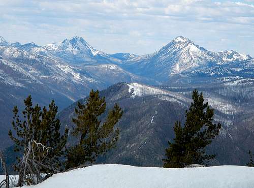
Passing over Point 6813, the summit comes into view and the remaining mile to the summit is more enjoyable with less damage from the fire. Views of the Pasayten Wilderness peaks to the west, the Tiffany group to the east and Sawtooth range to the south make for some rewarding views from the summit lookouts.
 Andrew And Remmel Seen From The Summit
On the standard year, most of the snow will be melted off of the standard route by the beginning of June.
Getting There / Driving Directions
One quarter mile west of downtown Winthrop, turn north from Highway 20 onto Westside Chewuch Road. Continue to follow this road for 18 miles as it stays on the west side of the Chewuch River. The name of the road eventually changes to National Forest Road 51 and then 5160. Keep your eyes open for the campground named Camp Four. 200 yards past Camp Four, a bridge crosses to the east side of Chewuch River. Cross the bridge and follow National Forest Road 700 for another 2 miles to the trailhead. View West From The Summit
Methow Valley Ranger District: 509-996-4000