


hgrapid - Oct 12, 2006 5:51 pm - Voted 10/10
Could I use this photo for a report?Dean,
I am writing a report for the U.S. Department of Energy on geothermal resources. There are several near Mount Grant. How far is this from Hawthorne exactly?
Anyway, can I use this photo and give you photo credits??? It is a GREAT photo. If I do use it, your photo will be seen by hundreds of people. If I can, just tell me who to credit it to. Thanks.
-Dan (hgrapid)

Dean - Oct 12, 2006 9:42 pm - Hasn't voted
Re: Could I use this photo for a report?You would be more than welcome to use the pic. Thank you for your nice comments about the pic. I am glad you could be able to use it.
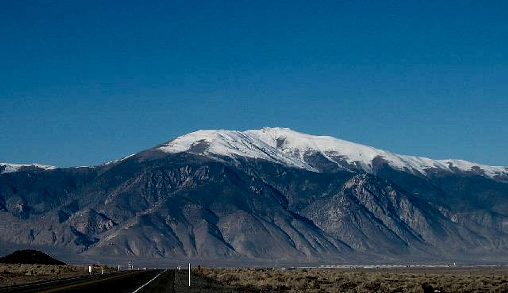
In answer to your second question, how much relief from the road to the summit? The road is at 4200 feet of elevation and the summit is 11739 so it rises a bit more than 7500 feet from the road to the summit. That view was taken as I was approaching Hawthorne from about 12-15 miles out.
hgrapid - Oct 12, 2006 5:52 pm - Voted 10/10
Oh, what is the relief for this photo?Another thing - how steep is that? How high above the road is Mount Grant???
Thanks!
hgrapid - Oct 13, 2006 2:02 pm - Voted 10/10
CANNOT USE IT UNTIL!!!Dean,
For the life of me, I can't find out how far Mount Grant is from the town of Hawthorne itself. This is important to me using the photo. If I don't have that information, I cannot use the photo.
Dean - Oct 13, 2006 3:02 pm - Hasn't voted
Re: CANNOT USE IT UNTIL!!!In looking at topozone, it appears to be about 9 miles I used the topozone map at a scale of 250,000 to guestimate the 9 miles

lcarreau - Jun 28, 2008 6:33 pm - Voted 10/10
I hope the manwas able to complete his report. Dean, am I
reading this right - Mount Grant is an
inactive volcano, with several geothermal
resources in the area?? (Didn't know that!)
How about the question over Red Tape? Did you
guys go in there with suits & sunglasses
disguised as the 'Men in Black?' Take care!!
Dean - Jun 28, 2008 8:27 pm - Hasn't voted
Re: I hope the manI never found out if he was able to use the pic and I didn't know anything about the geothermal aspects of the area.


Comments
Post a Comment