Welcome to SP!  -   
 
 MbPost.com -- It's SP for Mountain Biking!
Areas & Ranges·Mountains & Rocks·Routes·Images·Articles·Trip Reports·Gear·Other·People·Plans & Partners·What's New·Forum

Topographic map of routes on... [ Sizes: Orig | Small | Thumb ]
Topographic map of routes on...
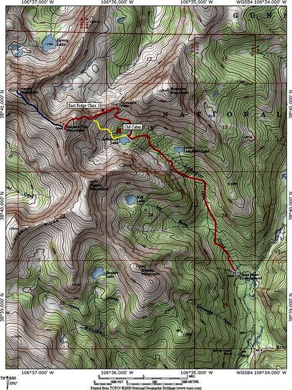
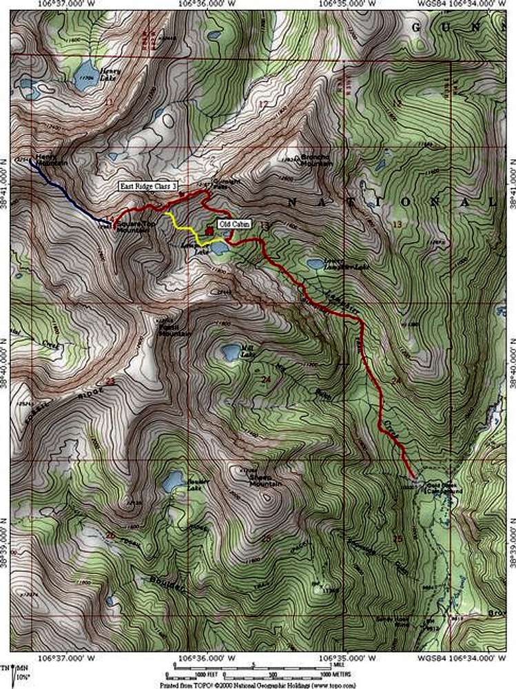
Topographic map of routes on Square Top Mountain. In red is the primary Gunsight Pass-East Ridge Route which is 7 miles long roundtrip and traverses a class 3 ridge. The blue route is 1.3 mile (roundtrip) addition of Henry Mountain. In yellow is the easy access grass gulley that bypasses the East Ridge and can be used on either ascent or descent. The grass gulley keeps the route at class 2 and provides a half mile long shortcut.


Map by National Geographic.


Comments

No comments posted yet.


Sign in to post!

Don't have an account? Register now.


Rate This Image
Current Score: 71.27

Log In To Vote
 Square Top Mountain (Fossil Ridge Wild.) (Mountain/Rock)


« PREV

Viewing
#20 of 20
GALLERY

You are at
the Last
Image

 JonBradford's Image Gallery


« PREV

Viewing
#1313 of 1387
GALLERY

NEXT »
Image Data

Submitted by JonBradford
on Aug 2, 2005 1:05 am

Image ID: 117978
Hits: 606 

Lat/Lon: 38.67940°N / 106.6111°W


"Beware of all enterprises that require new clothes."   --Henry David Thoreau   

© 2006 SummitPost.org. All Rights Reserved.