|
|
Route |
|---|---|
|
|
40.79290°N / 110.3666°W |
|
|
Long hike/scramble |
|
|
A few days |
|
|
Class 2 |
|
|
Getting There
Note: These directions were updated as of November 2009 by SP member ZeeJay:From the intersection of Highway 121 and Highway 40 in the town of Roosevelt in the Uinta Basin, drive west on 200 North (Highway 121). Stay on Highway 121 as it quickly bends to the north. Most junctions are marked with signs, but they are very hard to read in the dark. At mile 9.9, just after the actual mile marker 10 at a stop sign, at the hamlet of Neola go straight towards Uintah Canyon. At mile 16.7 continue straight. At mile 18, turn right to Uintah Canyon. At mile 21.9 turn right. At mile 22.2 turn left just after the bridge. Park at the trailhead at mile 25.6.
Route Description
Breifly put: From the trailhead (7800 feet elevation), follow the trail north along the Uinta River. After about 3 miles, you will reach a junction. You will turn left here, crossing Sheep Bridge and onto the Chain Lakes Trail. Follow the trail, steep in places to the Chain Lakes Basin. Lower Chain Lake is about 7.6 miles from the trailhead and at 10,580 feet elevation. 4th Chain Lake is two miles beyond and at 10,900 feet elevation. Any of these lakes make a fine campsite.From 4th Chain Lake, take the trail over Roberts Pass to the Lake Atwood Basin, and then over Trailrider Pass to Painter Basin. You then follow the trail all the way to Anderson Pass, but it is faster to make a more direct "bee line" to Anderson Pass from the Trailrider Pass area by crossing Painter Basin. Since the country is open and above timberline, navigation is easy with a map and compass, or GPS.
From the east side of Anderson Pass, and just before the final steep climb to the pass, leave the trail and head north. There is a track in places, because of people heading for the “shortcut notch” back to Henrys Fork to Kings Peak or vice versa.
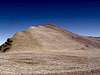
The notch is marked as 12,450 on the map. From the notch, climb up the ridge to the northeast. The ridge is easy, with only a few sections of boulder-hopping at the top. The summit is about 650 feet above the notch. Enjoy the fine views from the summit.
This route usually takes 4-5 days, sometimes more. The round trip distance is just under 50 miles.