One Blunder - One Miscalculation
I had considered calling this TR How to Ensure You Won’t Summit Chikamin Peak. I’m sure such a title would have been more intriguing. And yes, it is true that I did not summit Chikamin. Nothing epic, just one really stupid decision and too conservative of a turnaround time cost me several hours, which probably would have been enough time to finish the job. But I choose to go with the more positive title, because the stellar scenery along with the overall positive experience I had while in the Salmon La Sac area for those two days far outweighed the disappointment in not summiting.
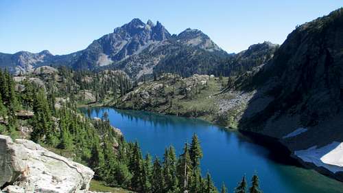
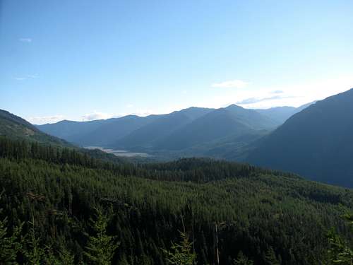
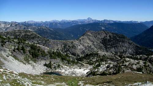
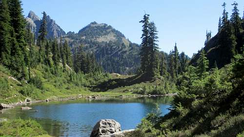
![Glacier Lake]() Glacier Lake and the Three Queens
Glacier Lake and the Three Queens
This was the last leg of my first trip in the North Cascades. For a long time leading up to the trip I debated between hitting the Enchantments or hiking in the Salmon La Sac area for these final two days. In the end I chose Salmon La Sac, for two reasons. First, Chikamin Peak came highly recommended, by at least three SPers. They all said the Glacier Lake Route was something worth seeing, and they were all correct! Second, it was Labor Day weekend and I assumed that between the two areas the trails in the Enchantments would be busier. I figured Salmon La Sac would be busy too, but I assumed the Enchantments would be a zoo, and I was hoping for at least some solitude. Salmon La Sac also had the advantage that it would be less than a two hour drive to the Gorge Amphitheater, where I would be heading on Sunday. So I booked my campsite for Friday and Saturday night and started researching. I knew I would shoot for Chikamin on Saturday, so I just needed to find a hike for Sunday morning.
Alone on Jolly Mountain
After leaving North Cascades National Park on Thursday morning, I headed for Ellensburg with my son Andrew and his friend Andy. They were heading to the Gorge for the DMB shows all weekend and one of the exits off of I-90 was where they were meeting their friends on Friday morning. This was a welcome change of plans that would allow me to go hiking on Friday. My original plans did not include a hike on Friday as I was going to have to drop the boys off at the Gorge so I just planned on making it a rest day as I figured it was going to be too late for me to get a hike in by the time I dropped the them off and made it to camp. Fortunately there was a change in plans and an additional vehicle was thrown into the mix and they were going to be able to catch a ride. As long as their friends arrived early on Friday morning I had a shot at a hike. I told Andrew to tell them to get there early! Fortunately, the drop off happened around 10 AM. I had plenty of time now for an afternoon hike! So the boys headed for the Gorge and I turned the car west and headed for the Alpine Lakes Wilderness, for what would be two stellar days solo on the trail.
I made it to the Salmon La Sac campground, found my campsite, set up my tent and was at the trailhead around 11:30 AM. Originally I had planned on hiking Jolly Mountain on Sunday morning as it would have been a good choice for a half day hike. But now that I had an extra half day of hiking time allotted to me Jolly Mountain made the most sense as the trailhead is very close to the campground and with about 11 miles and 4000 feet of elevation gain I knew that I could get it done before dark. In reality, it was the only good peak option I had with the time available. Everything else I was interested in involved more miles, more elevation gain, and a 12 mile drive down an unpaved road.
I read about Jolly Mountain just a few weeks before the trip, and I am glad I stumbled across it. The
Mountain Page talks about the incredible views from the summit. And that would be an understatement! It was a walk up besides, so a good choice if time is limited.
And in the truest sense of the word, Jolly Mountain is a walk up. There wasn’t a single step off trail all the way to the summit, except of course where I choose to step off of it and get a better vantage point for shooting pictures (a lot of pictures).
I parked at the Cayuse Horse Camp and was surprised that there weren’t any other cars in the “lot”. While it was Friday, it still was Labor Day weekend, so I figured the trails would be busy and I would be seeing a steady stream of hikers, but I was wrong. I would not see a single soul from start to finish! While I loved the solitude, I felt a little bad that I had inadvertently lied to my wife. She wasn’t real thrilled with me hiking alone these last two days of the trip. But I alleviated her concerns by informing her that the trails would be packed, and that while I would be hiking alone, I definitely wouldn’t be alone. Based upon what I saw on my four other hikes that week, the trails in the North Cascades are very busy. Well, much to my surprise that was not the case, on Friday or on Saturday.
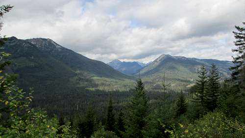
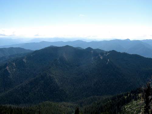
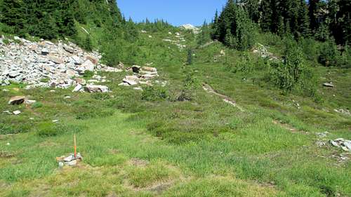
For the first four miles of the hike, it was mostly a walk through the woods. There were a few open areas that offered some good views to the ridgeline, but mostly I saw trees. This wasn’t a huge disappointment as there were still a lot of clouds overhead. The storm system from the four previous days was due to move out, but it was taking its time.
![Jolly Mountain Trail]() Jolly Mountain Trail
Jolly Mountain Trail
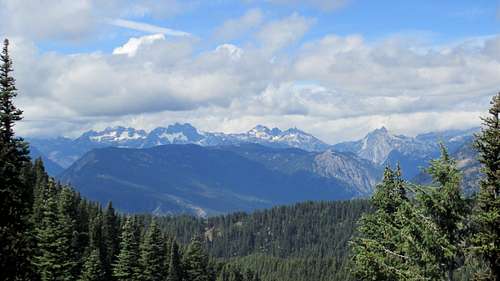
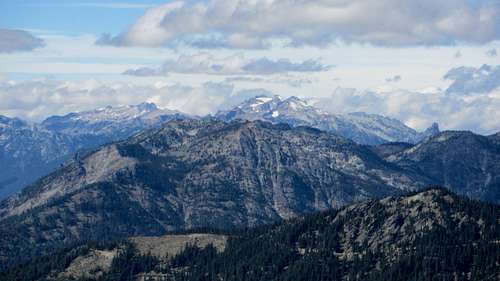
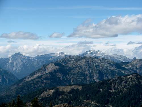
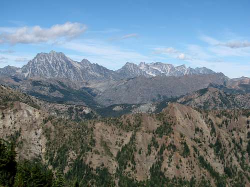
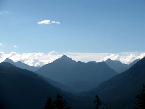
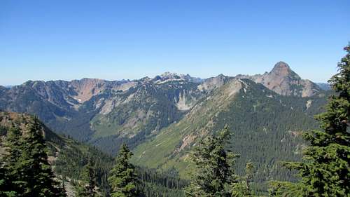
By the time I made it to Sasse Ridge the clouds started breaking up, and that was a good thing, because all the way from the Sasse Ridge junction to the summit the views are unobstructed. As the trail wound around the ridge I had nonstop views to more peaks than I could count, including: Lemah Mountain, Chimney Rock, Mount Daniel, Mount Stuart and the Enchantments. The fact that I was able to enjoy the views in complete solitude only added to the experience.
![Lemah Mountain and Chimney Rock]() First open view from Sasse Ridge
First open view from Sasse Ridge![Lemah Mountain and Chimney Rock]() Lemah Mountain and Chimney Rock
Lemah Mountain and Chimney Rock![Mount Daniel]() Mount Daniel
Mount Daniel![On the Ridge to Jolly Mountain]() Mount Stuart and the Enchantments in the distance to the far right
Mount Stuart and the Enchantments in the distance to the far right
Of course I also knew that this solitude could get swept away in an instance by the sound of a two cycle engine. The trail to the summit also happens to be a multi-use trail and I noticed fairly fresh tire tracks on Sasse Ridge. Fortunately no one, or any vehicle showed up, and I had to resort to a
Splattski for my summit mug shot. Solitude on a summit! What a good problem to have!
![Summit View from Jolly Mountain]() Summit View
Summit View![Summit View from Jolly Mountain]() Lemah Mountain and Chimney Rock
Lemah Mountain and Chimney Rock![Summit View from Jolly Mountain]() Mount Daniel
Mount Daniel![Summit View from Jolly Mountain]() Mount Stuart and the Enchantments
Mount Stuart and the Enchantments
I spent nearly an hour on the summit, which reminded me of my favorite line from A Slender Thread. We had to be grateful for our forty-five minutes into which was crowded the worth of many hours of glorious life.
The skies continued to clear up as I descended, which made the views that much better.
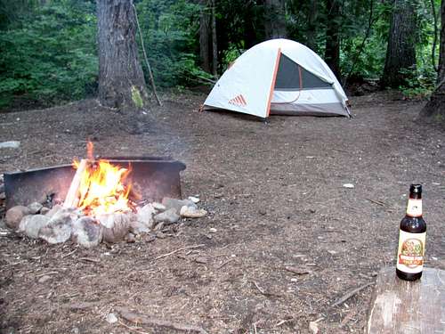
I made it back to camp, had my supper of one ham sandwich and some Cheezits and then proceeded to relax and soak in the stellar day I had, with a good fire and some Mirror Ponds. Life is good…
Glacier Lake, and then some, but not Chikamin Peak
I knew that today was going to be long so I wanted to get a fairly early start. I left camp and headed for the Mineral Creek Trailhead expecting to get there by around 7 AM. The drive took a little longer than I expected and I didn’t get there until 7:30. It was five miles further than I thought, and those last five miles are unpaved! I had missed a few details in the planning, and this would end up being a theme that would repeat itself a number of times over the course of the day. When planning for my hiking trips I rather enjoy sweating the details, but unfortunately in this case, some important details evaporated due to a lack of time caused by a rather hectic work schedule the last two weeks before leaving. I had enough beta to get me to the summit. I just should have studied things a little closer, and maybe the results would have been a little different.
There was only one other car at the trailhead, which again amazed me. It was Saturday and the trail should be busy. It wasn’t! I wouldn’t see anyone until I made it to Glacier Lake.
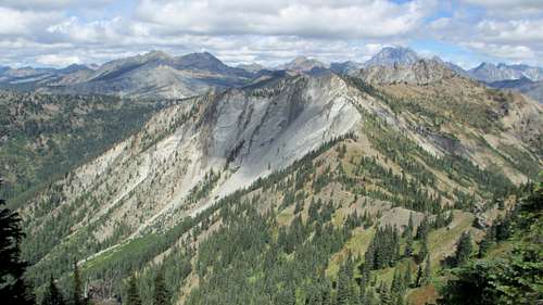
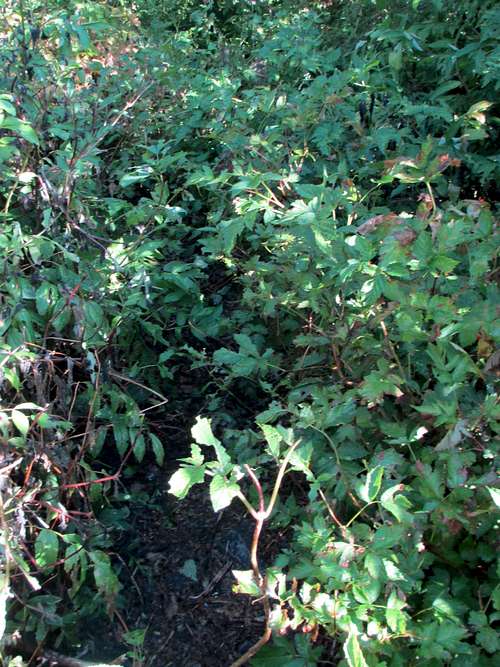
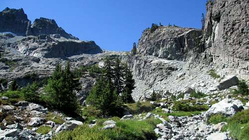
The first few miles of the trail were uneventful as the trail was well graded and there was the occasional break out from the trees to see the ridgeline. But after the stream crossing around two miles in the trail abruptly changes. The
Mountain Page clearly states that there is plenty of brush until you reach Park Lakes, and that would be correct. The trail narrowed and the brush was thick. Keeping my arms up in the air to push away brush was a necessity at times. After less than a mile of this my hiking shorts were completely soaked from all the dew. There was an occasional break in the brush where I would be able to clearly see the trail but it wouldn’t last and I quickly found myself back on the overgrown trail. This fight with the brush went on until I reached Upper Park Lake, which is a beautiful setting, where I spent some time soaking in the views.
![Mineral Creek Trail]() Mineral Creek Trail
Mineral Creek Trail![Mineral Creek]() Mineral Creek
Mineral Creek![Mineral Creek Trail]() The Never Ending Brush!
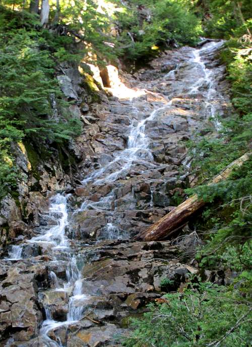
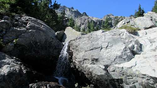
The Never Ending Brush!![Falls Below Park Lakes]() Falls Below Park Lake
Falls Below Park Lake![Upper Park Lake]() Upper Park Lake
Upper Park Lake
I made it up to the end of the Mineral Creek Trail at the junction with the PCT. From here I just had to find the boot path leading down to Glacier Lake. This was my biggest concern for this route. I wasn’t sure if the turn off was going to be obvious or not. The
Route Page mentions a saddle and a beautiful view north. Well, this would be my big blunder for the day. There were a few areas that looked like they could fit this description, and when I reached the correct turnoff I chose to keep walking by. There was a boot path, and then there was the makeshift cairn, consisting of an axe with a few rocks surrounding it. The clues were all there, but I got hung up on the words “beautiful view north”. There was just some grass, rocks and trees here, and besides, I could see up the trail further and there appeared to be a pass which looked like it would guarantee beautiful views north. My instincts were screaming that I was at the correct junction –
Just walk up the bootpath a little way and see what is there. But I chose to ignore my instincts and continued up the trail. Maybe if my options were hiking through some brush or hiking up that boot path I would have chosen the boot path. But it was the PCT, and the scenery sure looked beautiful!
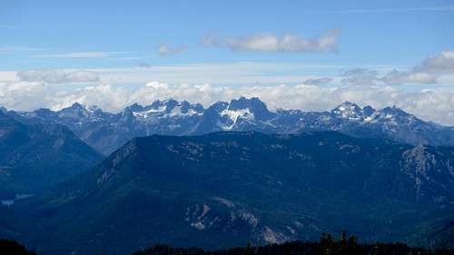
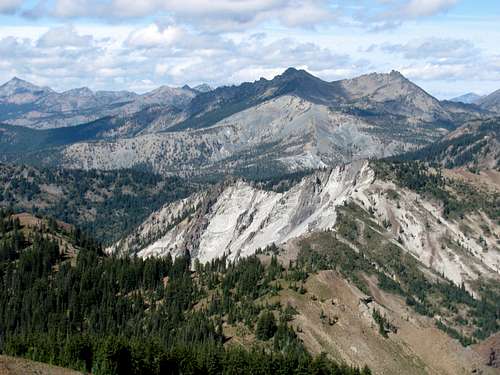
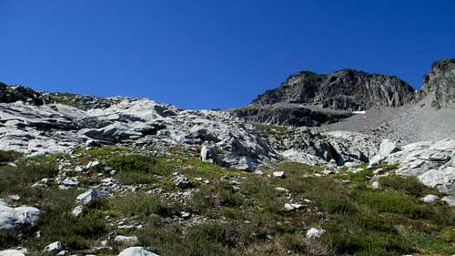
This decision would cost me about an hour of my time, but I just can’t bring myself to say that it was a waste of time. If I should have been in a hurry, concerned about the clock that was clicking down the daylight hours, I wasn’t. Later on I counted the number of pictures I stopped to take during this little side trip, and they numbered over 20. Even when I reached that pass and figured out that yes, I had made a mistake, I still headed up the trail a little further. The view from this pass was beautiful; it just wasn’t the correct beautiful view. I continued until I got a great view of Mount Thomson and Huckleberry Mountain and then finally turned around to get back to the day’s objective.
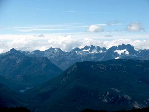
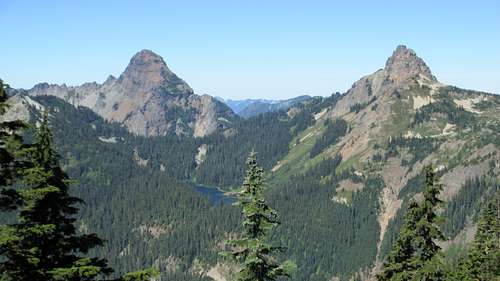
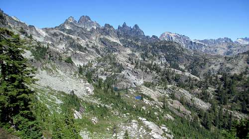
![Three Queens]() The Three Queens
The Three Queens![Alta Mountain]() Alta Mountain
Alta Mountain![Mount Thomson]() View from the "wrong" saddle
View from the "wrong" saddle![Mount Thomson and Huckleberry Mountain]() Mount Thomson and Huckleberry Mountain
Mount Thomson and Huckleberry Mountain
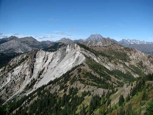
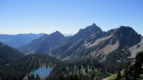
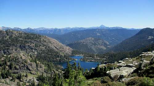
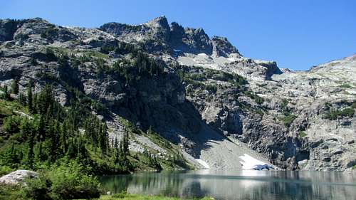
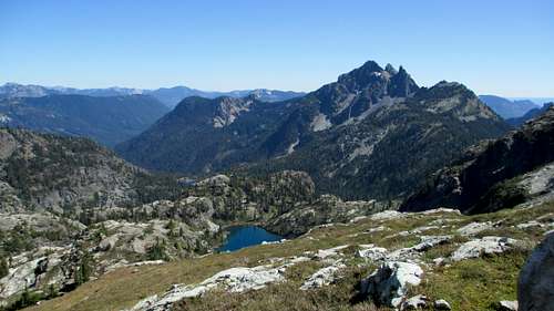
I got back to the saddle, walked up the boot path a few hundred feet and there it was. The beautiful view north! And for the next few hours I would enjoy some of the most stellar scenery I’ve had the pleasure of witnessing. Glacier Lake is a true alpine gem!
![The Saddle to Glacier Lake]() The Correct Saddle
The Correct Saddle![The View to Chikamin Peak From the Saddle]() Chikamin Peak and the Beautiful View North
Chikamin Peak and the Beautiful View North![Spectacle Lake]() Spectacle Lake from the saddle
Spectacle Lake from the saddle
I mostly followed the boot path for the 600 foot descent to Glacier Lake. The path is pretty narrow and there are a number of side paths so I got off track a number of times, but Glacier Lake was clearly visible. I made a few mental notes on the way down to make sure I would find the correct way on the hike out.
![The Way Out]() The Way Out
The Way Out
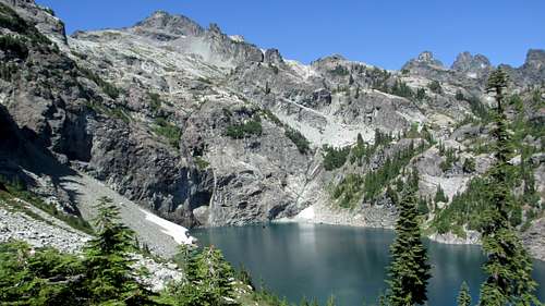
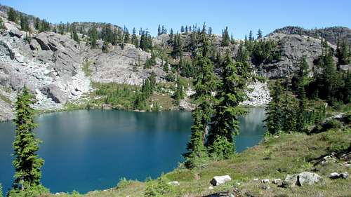
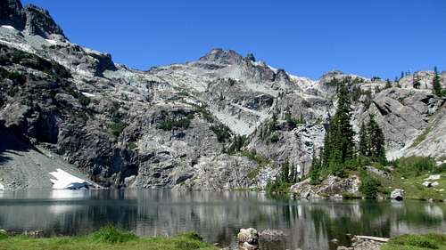
I reached Glacier Lake and saw a few tents. When I crossed the main outlet stream I finally saw the first of only a handful of people I would see all day. I slowly made my way around the lake counterclockwise. I say slowly because I was stopping pretty often to soak in the scenery and to take many many photos.
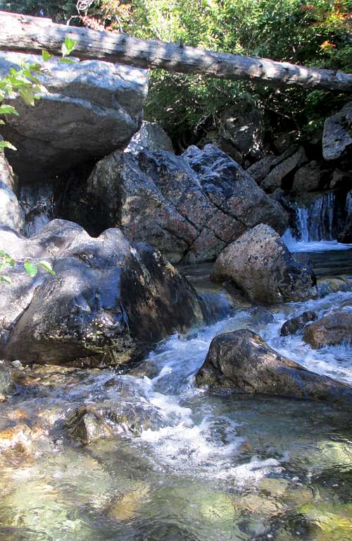
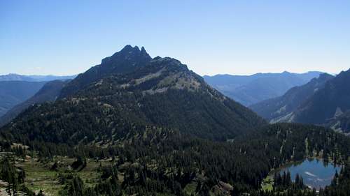
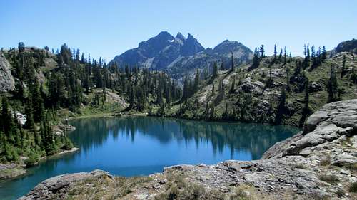
![Chikamin Peak and Glacier Lake]() Chikamin Peak
Chikamin Peak![Glacier Lake]() Glacier Lake
Glacier Lake![The Four Brothers]() The Four Brothers
The Four Brothers![The Three Queens]() The Three Queens
The Three Queens
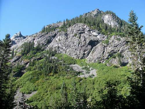
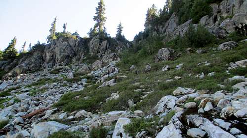
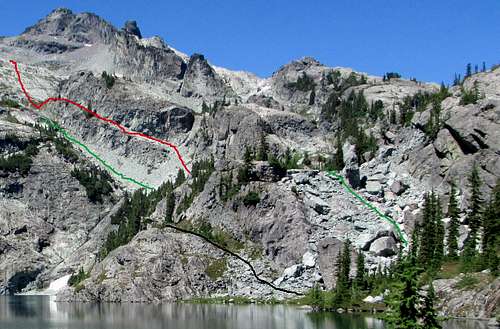
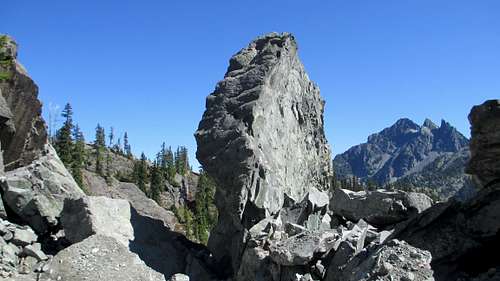
When I thought I was all the way around the lake I started up a short boulderfield. Unfortunately this was the wrong boulderfield. Fortunately, it didn’t take long for me to cliff out and see that there was more of Glacier Lake hidden behind this cliff. After a quick scramble down I headed up the correct boulderfield. The scrambling in this gully was fun! The boulders are huge and solid. There was one particularly huge rock jutting up at the top of the gully, which I eventually realized is the “cairn” for the route up this gully.
![Glacier Lake Route]() Click on photo for route info.
Click on photo for route info.
By now it was around 1 PM and I had to start thinking about deciding on a reasonable turnaround time as I wasn’t interested in hiking out Mineral Creek via headlamp. I have hiked many miles by headlamp so that wasn’t a concern. But all I could remember was how overgrown the trail was, and getting off trail in the dark seemed like a reasonable possibility. Besides, I was alone, which made me even less thrilled with hiking via headlamp. Based on that I gave myself a 2:30 cutoff. I’d see where I was at that time and then decide what to do.
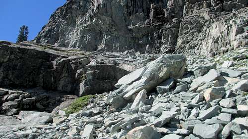
I followed the inlet stream for a short time and then veered left to head up the talus slope that would lead to the slabs below the Four Brothers/Chikamin saddle. Here I made a decision that fortunately did not cost me time. When I was hiking around the lake and looked up at the route I noticed a “ramp” above the talus. From down below it looked like this might make for a good route option. When I got to the talus, in short order I decided to go for the ramp. The talus up this slope is as loose as any choss I have ever encountered in Colorado’s San Juan or Elk Ranges. The ramp looked like less of a hassle so I headed that way. There was still loose rock here, but not as bad as the talus slope. Near the top of the ramp I eventually reached a small ledge about four feet high or so as I remember. It looked awkward to get up and over so I considered going down a narrow ledge to the left. The bottom of the ledge connected back near the top of the talus slope. I thought about heading down the ledge for a brief moment but it was too narrow – and exposed – for my taste. If I fell, it wouldn’t have been a very long fall, but the end result wouldn’t have been pretty. I headed back over to the ledge, and I was right, as it was little awkward getting over. Shortly after getting over that obstacle just a little further up the ramp was a short gully that put me back onto the standard route.
![The Talus Slope Above Glacier Lake]() The view of the talus slope is blocked by the trees
The view of the talus slope is blocked by the trees![An Alternate Route]() The "Ramp"
The "Ramp"
I made my way up the slabs, which was a nice change of pace as the rock was completely solid. It was now after 2 PM and I ran into two guys coming down. Based upon their feedback, I still had a ways to go. At this point I accepted that I was not going to summit. I was now at about 6,000 feet; just 1,000 vertical feet to go. Time was running out for the summit, but being this high on the slabs I still figured I could make it to the saddle. I continued up a little farther but realized today was not my day. It was only 2:15, but I decided that there was no use pushing it and that I should slow down and enjoy the beautiful setting I was in. I dropped my pack and took a short break, and was more than content. I think I knew for so long that I was going to run out of time that I it didn’t bother me to just stop there. I remember feeling the most content I ever had when missing a summit.
![The Four Brothers/Chikamin Peak Saddle]() Looking towards the Four Brothers/Chikamin Peak saddle
Looking towards the Four Brothers/Chikamin Peak saddle![Chikamin Lake]() Chikamin Lake
Chikamin Lake![The Three Queens]() The Three Queens
The Three Queens
I snapped a few pictures and headed down. I would continue to snap more pictures on the descent as well. I decided to take the talus slope on the descent versus the ramp and confirmed that it was very loose. I sent rock down the slope several times, and if I make it back here again I will definitely be bringing a helmet.
![The Glacier Lake Boulderfield Cairn]() View of the "Boulderfield Cairn" on the descent
View of the "Boulderfield Cairn" on the descent![Glacier Lake Tarn]() Glacier Lake Tarn
Glacier Lake Tarn
The hike down and around the lake and back up to the PCT was uneventful. Of course the 600 feet of elevation gain on the hike out was tough! I started seeing some backpackers, coming down to Glacier Lake from the PCT and then on Mineral Creek as well. I couldn’t help but be impressed with their fortitude. Backpacking into Glacier Lake via Mineral Creek would be no easy task. But in retrospect, that is the way to go for visiting the area. I could easily see spending a number of days here. And backpacking would allow for a much slower pace and make for a more relaxing and peaceful experience.
I made it back to the trailhead and realized that I gave myself too conservative of a turnaround time, as I still had about an hour of daylight left. I also realized that the last two miles of Mineral Creek Trail would have been fine to hike out via headlamp; the trail is wide and graded and there is little brush to deal with. I easily could have pushed my turnaround time to 3:30 or 4:00 PM, which would have given me a fighting chance at summiting. I still would have had the crux move,
the bunk beds, to get through and who knows if I would have make it through that, but still, a fighting chance.
I drove straight into Roslyn afterwards. I needed some hot food and some supplies. All the ice in my cheap styrofoam cooler had melted by now so the remaining Mirror Ponds were luke-cold at best, plus I needed some more firewood. Despite not summiting I was feeling really good. With the volume of stellar scenery I got to see in the past two days I couldn’t help but be in a great mood, so I planned on staying up late celebrating, so ice and firewood were critical at this juncture. Fortunately the General Store in Roslyn had the necessary supplies and the
Old # 3 had a pretty good burger and fries, along with a decent draft beer selection. I headed back to camp and enjoyed a beautiful night under the stars, with a roaring fire and ice cold Mirror Ponds. It was the perfect way to end a great first trip to the North Cascades.
From the Wilderness to the Wild
I still had Sunday morning available for a short hike but on Saturday night I decided that I should probably just forgo the hike and head to the Gorge. In reality there weren’t any hikes that I wanted to do that I could complete by early afternoon. I was most interested in Mount Daniel, which I knew would take the better portion of the day. Add in the 12 mile drive down a dirt road, and I knew that it wasn’t going to happen. If there was one thing I learned over the course of the week is that I underestimated the amount of drive time to the trailheads. And even though my heart said “Go for a hike!” my knees were telling me something completely different. My attempt at Chikamin made for a hard day, and while I enjoyed my slow time around the fire on Saturday night, I wasn’t moving very fast, even after 800 mg of Ibuprofen. Besides, I wanted to get to the Gorge so I could spend the day with Andrew. On Monday he would fly home to Chicago and I would fly home to NE Indiana. So it was an easy decision to pass on a hike.
With that decision made I was able to slow down and enjoy my Saturday night by the fire, and it also made Sunday morning that much more enjoyable as I was able to take things nice and easy. As normal, I woke up early Sunday morning so I took my time breaking down camp and loading up the car. I drove into Roslyn and hit the Roslyn Cafe for breakfast, which was a great choice. I highly recommend Cody’s Biscuits and Gravy!
I reached the Columbia River around 10 AM and stopped at the overlook off the interstate to take in the views. It’s a beautiful area, which made me think that the Gorge was going to be a pretty special venue for a concert, which would be correct.
Despite the sea of people in the Gorge camping area the afternoon was much tamer than I expected which was fine by me. I spent the time relaying my tales of the previous two days to Andrew and Andy while we browsed through each other’s cameras reliving our days on the trail from the past week.
Showtime eventually arrived, and the band opened with One Sweet World, which made me quite happy. I even guessed correctly that that would be the opener. I always seem to have a song running through my head when I am on the trail, and on Friday and Saturday, One Sweet World had made the “trail set list". Considering the scenery, appropriately so!
![Chikamin Peak and Glacier Lake]() Chikamin Peak
Chikamin Peak One sweet world, around this star is spinning…


Comments
Post a Comment