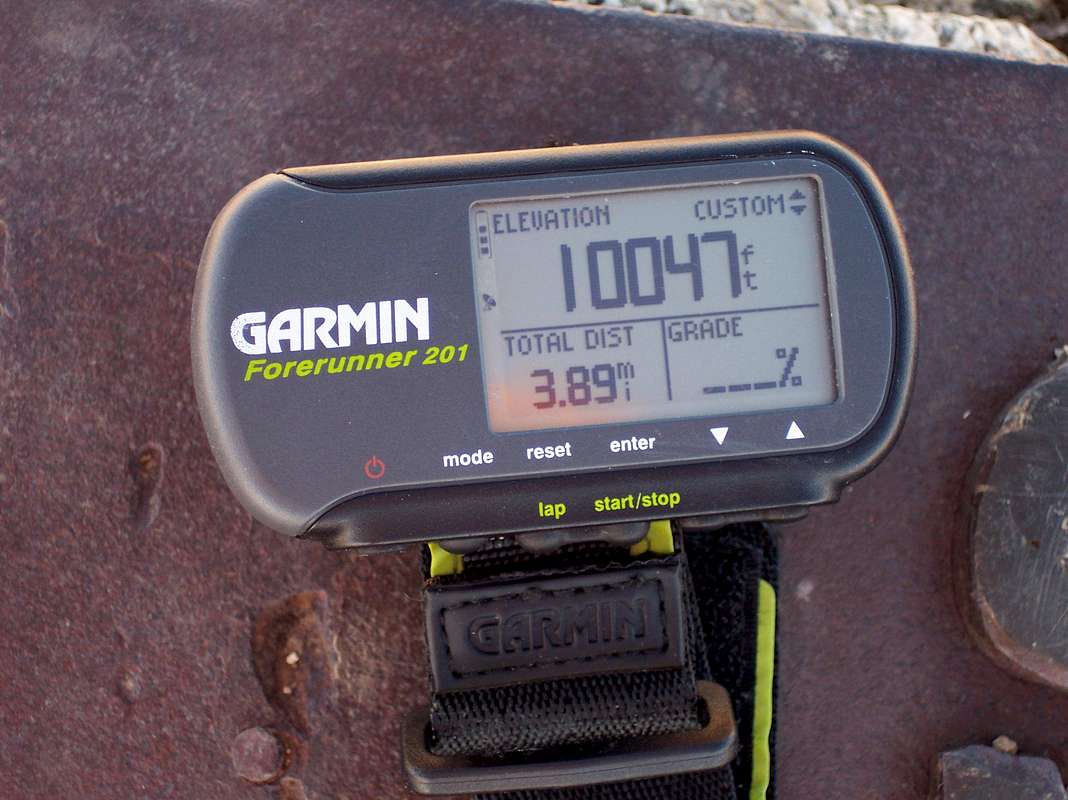


135driver - Nov 23, 2007 3:43 am - Hasn't voted
Hmmm.Makes you wonder. Which one is right? 10047 or 10064. Garmins are real nice.

rematore - Nov 25, 2007 11:01 am - Hasn't voted
Re: Hmmm.I do wonder how precise the GPS's are. I've heard the Army keeps them deliberately imprecise, but who knows. Most of those markers are pretty old, so I wouldn't be surprised if they were wrong.
135driver - Nov 25, 2007 12:10 pm - Hasn't voted
yeah,When I used to fly KC-135's, we used to do emergency approaches to airfields using Handheld GPS's and they were very accurate. Your's is probably closer to the real summit altitude.

jsakai - Jan 25, 2008 10:06 pm - Hasn't voted
GPSCivilian GPS units usually have a very small factor of error , this is usually only a few meters in Lat, long and elevation.the one in pic is within this "few meter" range.My magellan does same thing,it will even give a different elevation for same peak on different days...not by much though!
I would trust the national geodetic survey's reading of 10,064'.If they can determine that Everest grows about 1/4" a year, I think they can tell within a few inches for Baldy.
Also, the Garmin website says that the elevation accuracy may be off by as much as +/- 400' depending on positions of satelites at time of reading.....wow!

rmac10 - Jun 1, 2008 6:31 pm - Hasn't voted
True elevationsWho knows for sure the true elevations? It is interesting, though, that the latest elevation for Mt. Whitney is 14,505 ft.--making it the only peak in the lower '48 over 14,500 ft. Almost more note-worthy is Mt. Williamson's new elevation listing--14,403 feet; a gain of over 28 feet! Do you suppose Mt. Barnard is over 14,000 feet again?


Comments
Post a Comment