
-
 1803 Hits
-
 73.37% Score
-
 4 Votes
|
|
Route |
|---|---|
|
|
43.34969°N / 42.44315°E |
|
|
Download GPX » View Route on Map |
|
|
Summer |
|
|
Overview
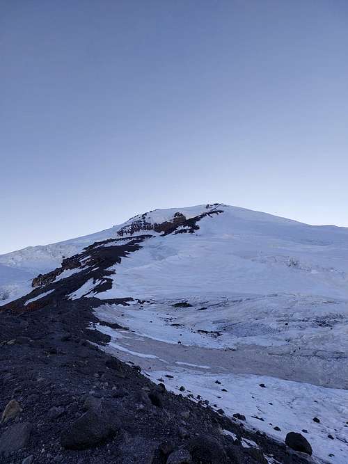
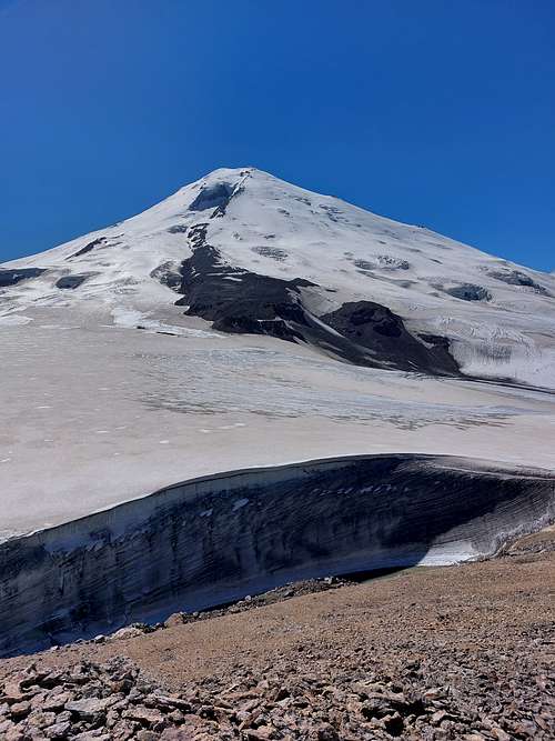
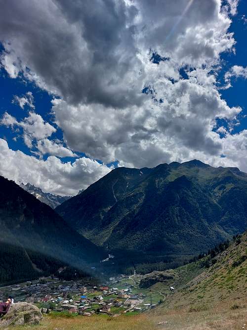
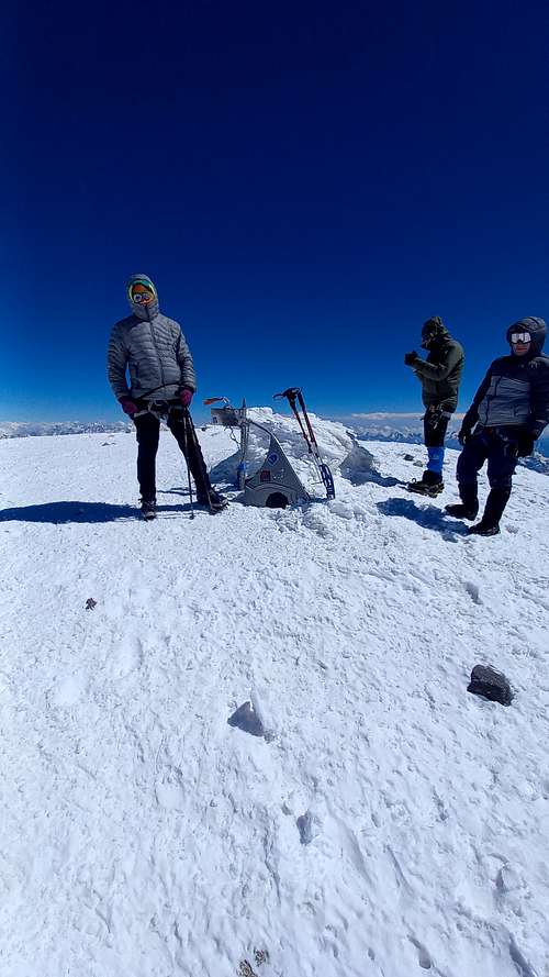
Mt. Elbrus is the highest mountain of Russia and Europe( 5642 m). Eastern peak is a bit lower than Western - 5621 m. This peak is available and comfortable for ascending from 3 sides - East, North and South. West is far from here, so isn't comfy. East is a 'wild' side - no infrastructure, no huts and long way to make to the ascending camp. It takes 3-4 days to get to the camp(4300m) from village Elbrus and 2 days to get back. This year our team decided to try this route - and, i need to say, this is the most beautiful way to the Summit. During the ascending you can spectate amazing views at the Main Caucasus Ridge, see famous Donguzorun glacier(number 7), ascend near The Side Crater and walk across East Summit Crater. Also you can touch the ground and walk on Achkeryakolski lava flow, solid Moon-like stone of frozen lava.
 |
 |
 |
 |
 |
 |
 |
 |
Getting There
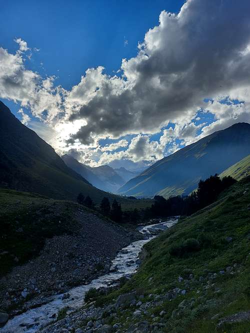
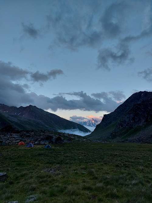
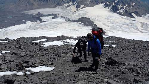
To reach the starting point you need to go the village Elbrus in Baksan Valley, this valley also leads to the South side. Here you can sleep in guest houses and take a rest. Then you need to enter the Irik valley river. It's a popular tourist route, so you won't get lost. At 2300 m you can stay for the night with tents among trees, the last trees on the route. After this you need to climb in the right valley of Irikchat and move along. At 2500 and 2800 m there are good campsites. At 3100 and 3300 you can also stay with tents, but during bad weather these campsites are cold and windy. Next aim is Irikchat pass (3650 m). This is a steep (35-40 dg) rocky slope without snow at summer. No ropes or other gear needed, no danger of stonefall. From the pass Mt.Elbrus and glaciers are seen to you. And after small climb on Red Mound you get to the glacier. Glacier is solid, but isn't open, some snow can hide crevasses, but the biggest ones are open to see and narrow enough so you can jump over. Glacier is sloping, so you don't need crampons to walk here. For safety you can use rope, but all people here walk without it. At 3850 is the ending of huge lava flow, and when you climb there, you reach the low lava flow camp(3900 m) It's a good place to stay with a water stream. Next day is lava flow climb to the high lava flow camp(4300 m). It's the starting point for summit ascending. Lots of tent places.
Ascending route follows the lava flow almost until the summit, for 90 % of time you don't even need crampons. Before the summit(from 5200-5300 m) is the end of rock route and snow route begins. Here you need to take on crampons and use the rope for team. 1-2 hours snow walking, and you reach Freshfield rocks. From here - walk across snowy crater and you ascended East Summit. It doesn't look like a sharp peak, more like field with a hill. On the way back you can use snow near the lava flow - it's faster to descend here.
Route
The whole route you can see in GPX file attached to this page
Red Tape
No permits or fees needed here.
When to Climb
High season with warm and stable weather is from July to September. In my experience - the best weather is at the end of July.
Camping
Along the route you can place a tent in the next campsites( i write the height of this campsites): 2300 m , 2600 m, 2800 m, 3100 m, 3300 m, 3600 m , 3900 m, 4100 m, 4300 m