
Comments
No comments posted yet.
|
|
Trip Report |
|---|---|
|
|
40.62452°N / 115.44595°E |
|
|
Jul 4, 2021 |
|
|
Hiking, Mountaineering, Mixed, Scrambling |
|
|
Summer |
It was Fourth of July weekend 2021, and I wanted to test myself by doing a couple climbs back-to-back. On Saturday I'd gone up to Liberty Peak, and afterward I still hadn't decided which peak would be next. It needed to be a hard one, I thought to myself. I'd become a little obsessed lately with the prospect of doing some big Himalayan treks and other treks and climbs that require multiple days of serious work, so this was the challenge I'd proposed for myself. That's when Mount Gilbert came to mind. While passing it from Lamoille Canyon's scenic byway that night, I'd seen how much snow had melted. Its north face looked different without it. I'd still take an ice axe because there was a long diagonal strip of snow at the point that gave me some worries last time. Otherwise I'd need nothing special besides the regular gear---
Mountain-Forecast.com called for a cloudy day and a clear night. Admittedly though I was skeptical given the way mountains can be.
In terms of a start time, I'd head up whenever I felt like it, but no later than early afternoon.
After sleeping in and tinkering around for a little bit, it was nearly 11:00. I had to get going. It was reaching the 90s already as I pulled out onto the road. It was nice to be going somewhere a little cooler.
Arriving near Camp Lamoille, a number of vehicles were parked in the area to enjoy the summer beauty of the canyon during this holiday weekend. I changed out of my tennis shoes and regular socks and geared up. The hike began at about five after noon. Passing Camp Lamoille, a group, presumably mostly family, had reserved the area. A few RVs were there, and one interesting feature caught my eye---the flag pole displayed an American flag with a Norwegian flag flying just below it. For whatever reason, the display gave these mountains a more international feel as I continued hiking within them. Then on the other side of the camp was the official trailhead with a sign that simply read "Trail" with an arrow beneath it pointing to where the trail began. This is the official way into the mountains of Lamoille Canyon's Right Fork.
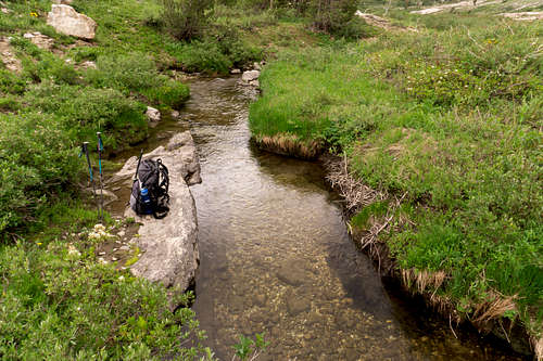
At the start is a beautiful beaver damn area to the left of the trail where there are many shallow-but-wide pools that trout like to drift around in. Perhaps 100 meters more is the official stream crossing where the trail continues on, via a rather flimsy bridge though. I'm always paranoid crossing over it, especially with electronics that are not in waterproof packaging, so this time I took an easy, ankle-deep route through a narrow section of stream a little ways before the bridge. I passed a small group of people as they were coming down from the upper canyon area. A woman was out in front and she said that they'd been rained on earlier, but that it was a great time nonetheless. The right attitude in the mountains, I thought to myself. A brown, older labrador retriever went by with them, then a friendly German shepherd came by, coming close to say hello and get a quick pet as it passed.
Soon I crossed the wilderness boundary, and the vegatation really began to display some brilliant natural colors. Certain areas of the trail were barely visible due to the growth that the extra rain seemed to be encouraging. I wondered how much of the growth was also more of a return to normal after the fire of 2018 wiped out so much vegetation in the area.
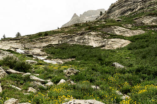
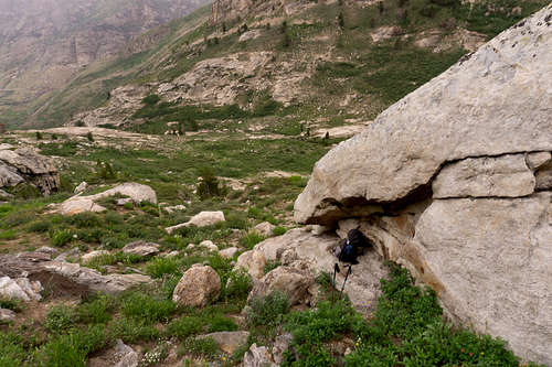
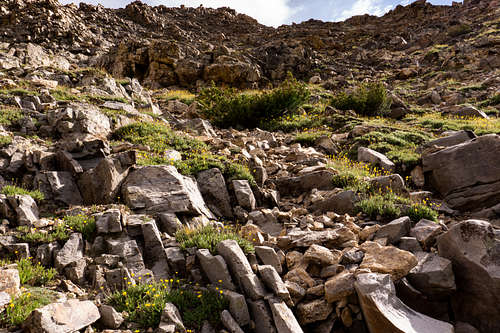
Below are a few pictures of the trail:
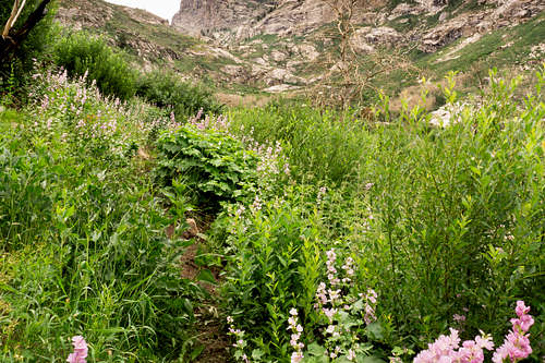
A large grove of "one flower," i.e. helianthella uniflora, a type of sunflower, spreads across a swath of the canyon floor below. A few orange-red Indian Paintbrushes (castillega miniata) were in the mix as well.
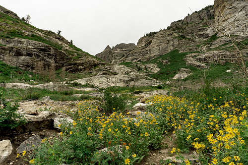
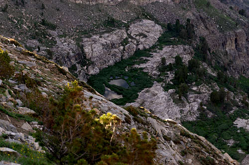
Below, just before the final ascent prior to crossing the stream to get to the mountain. The top of Mount Gilbert is visible through the mist in the upper right of photo. The trail stays to the left of the waterfall, and then the terrain flattens out up above, allowing for a simple stream crossing.
The light rain from up above sprinkled across the canyon floor. It was like how it sprinkles in the Pacific Northwest, I thought---light enough to walk outside for a few minutes, and nobody knows you were ever in the rain when you come back in.
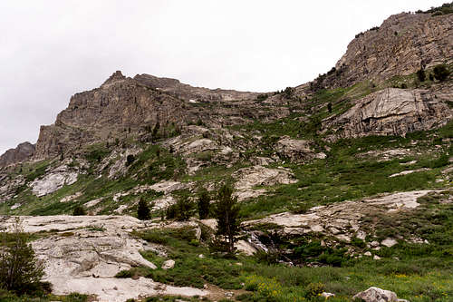
After continuing up the trail more, the terrain plateued onto the saddle feature that far-away motorists can see from the Canyon's scenic byway. Mount Gilbert stands high above the west side of this area. The way up the mountain is quite straight-forward.
I meandered west off of the trail for 20 or 30 meters in search of a good stream crossing. The sprinkling continued, and the sky looked a little more threatening now. The large light-gray rain clouds drifting by overhead were followed by seemingly larger and slightly darker ones. But by looking northwest I could see that the sky far beyond the canyon's north end, in the direction of Ryndon, was a lot of blue. That may very well extend this way soon, I thought. The temperature was warm with a hint of humidity in the air. Wandering alongside the stream, I found a relaxing area to refill water while enjoying the natural beauty and sounds around me. Sweet scents wafted in the light mountain breeze during this peaceful time, and nobody else was in sight. Kneeling down to the water, I swept my Sawyer bladder upstream and began refilling the bottle I'd been drinking from.
Shortly after getting up the foot of the mountain I grew a little hesitant as the rain seemed to be getting heavier. If it really started pouring, then the plan was to wait before fully committing to going higher. I put my pack on a shallow rock ledge with slight overhanging features during this observational period. The temperature felt good. Large rain clouds overhead were quickly moving eastward over the mountaintops. Then blue sky began to appear between them.
Continuing upward with several hundred meters left to ascend, I looked to where my route would go. Suddenly, at the base of a perhaps 30-meter rock wall something moved. My eyes adjusted to more clearly see into the shadow cast by the wall. One mountain goat followed by another was traversing northward, to the right of where I'd be heading. I knew that getting good photographs of them would require a more powerful lens, so I quietly continued upward, focusing on the scrambling and boulder hopping I needed to do.
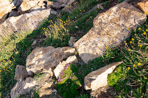
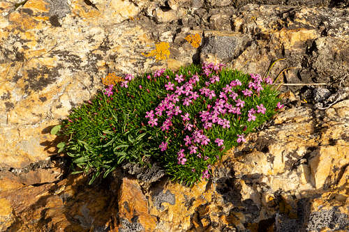
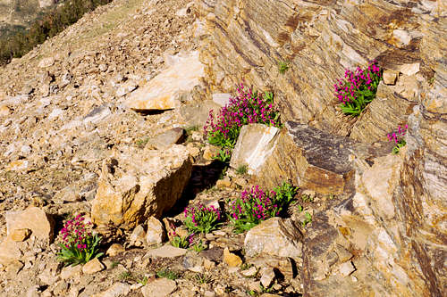
Some incredibly vibrant mountain flowers appear in both tiny and large patches on the way up the mountain. Below are some displays of a couple types of alpine plants that also appear near the poles of the world, the violet-colored Silene acaulis and the brilliant yellow Geum rossii.
Soon I came to a snowy area that I'd had to cross last year, which had been quite nerve-racking despite it being a small section. This time it was nice having more confidence---the days on the snowy slopes near and below Gannett Peak had helped with this. With my ice axe in hand I leaned slightly toward the slope and crossed over. Exposure here was unavoidable, though it was the safest crossing point in the area. I stood there and took a quick rest. Trusting and enjoying myself in such a hazardous environment is surely part of the adventure.
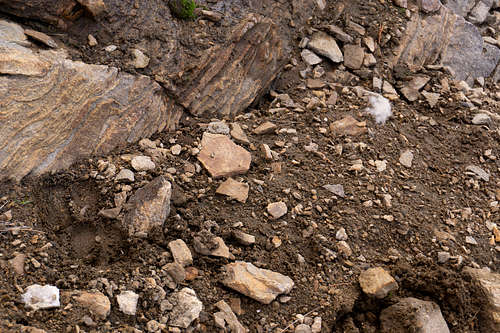
Stepping onto solid ground told me of the direction that the mountain goats had gone. Hoof prints were stamped into a patch of mud and a ball of white hair lay not far from it. The left picture below shows the prints and hair. The right displays a broader view where the mysterious mountain creatures passed over this steep and rugged terrain, surely with ease.
 |
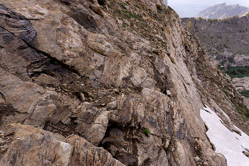 |
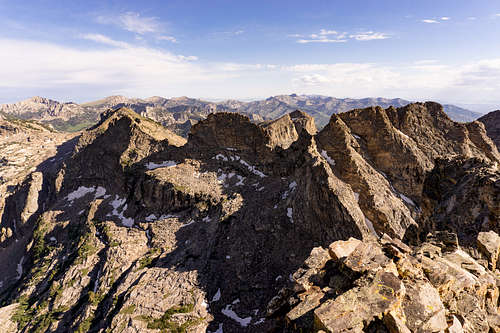
Traversing around the mountainside to the northwest finally had me in sight of the ridgeline I planned to follow up to the peak. The views were truly impressive from such a vangtage point so far up the mountain.
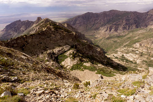
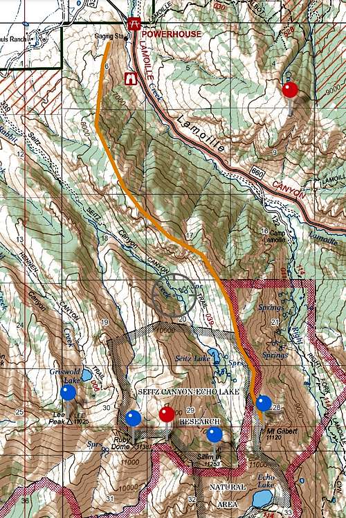
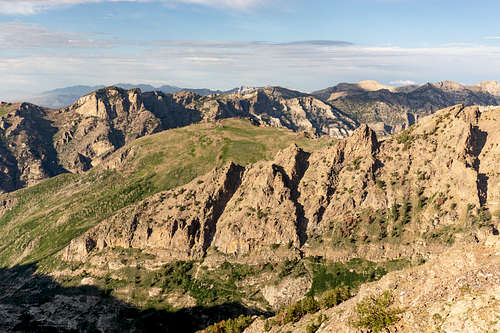
Continuing to skirt around the mountainside finally led to the summit ridge, the highest stretch of a more-than-four-mile-long ridgeline originating near the first recreational area upon entering the canyon from the north. The orange line below highlights this ridge.
I rested and enjoyed the views. Water consumption was right on track---I had maybe a quarter of a liter left in my big bottle and I hadn't touched the 1-Liter bottle yet. Then I kept climbing, moving upward either directly on top of or just east of the ridgeline. Certainly a little farther to my left, east, was more shallow terrain to ascend, Class 3-ish. I thought of what Sandy Allan says in his book In Some Lost Place. During the team's famous Mazeno Ridge traverse on Nanga Parbat he often wanted to be mostly climbing instead of walking if he could help it. Here I entered a Class 4 ascent of much delight regardless of its brevity. I quickly photographed the last several meters before the mountain plateued. Here is just east of the summit ridge during this final push:
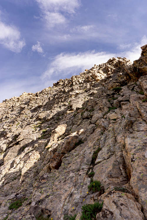
The cairn then appeared and I photographed it while attempting to display the steepness of this great glacial horn's northwest side.
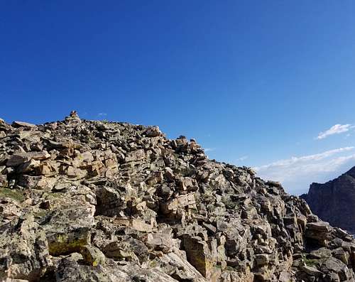
At 17:00 hrs I stood on top of Mt Gilbert for the second time. Next time I'll come with company, I told myself, for the views are ones to share and experience with others if possible.
The summit register was gone, which would've been mysterious if a number of other registers hadn't disappeared this year already. Someone might've been cleaning up since all the register containers that I knew of besides Ruby Dome's were cheap plastic tupperware ones that seemed to always be cracking. It was an interesting idea to bring something back up that was sustainable like what they did in the Pacific Northwest. Perhaps next time, after getting the opinion of the rangers.
I pulled out my phone and let a friend know that I'd made it up and was preparing to descend. Of every peak I'd been on in the Rubies, cell phone signal has been available. The early evening was barely breezy and cool, though the sun was still intense. Three-and-a-half hours or so of daylight remained as I took pictures and jotted some things in my trekking journal.
Here is a view from atop Mt. Gilbert while looking south. The southernmost peak of the range above 11,000 ft, King Peak, is visible, albeit barely, approximately 10 miles away.
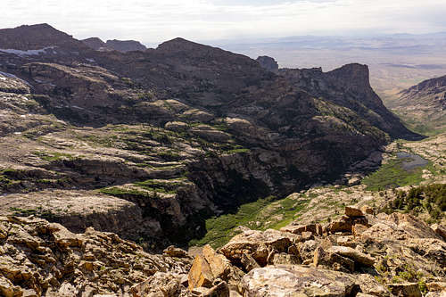
Next I peered southeast across the right fork's end (below). Thomas Peak is towering high up on the left edge of the picture, and then Snow Lake Peak and Mt Fitzgerald are the next visible peaks to the right of it. Snow Lake Peak, Mt Fitzgerald and Mt Gilbert are the three most prominent glacial horns in the range. They may not be the one and only Matterhorn of the Swiss Alps, but they're still great fun for a day or more of adventure.
Another awesome sight is Seitz Canyon, looking toward the northwest:
Slightly more to the north and you can see the opening to both Seitz and Lamoille canyons.
If it weren't for Seitz Canyon's entranceway being on private property, it seems likely that more people would begin a Mt Gilbert climb from there instead of from the Camp Lamoille area. The elevation seems to increase more gradually from that side.
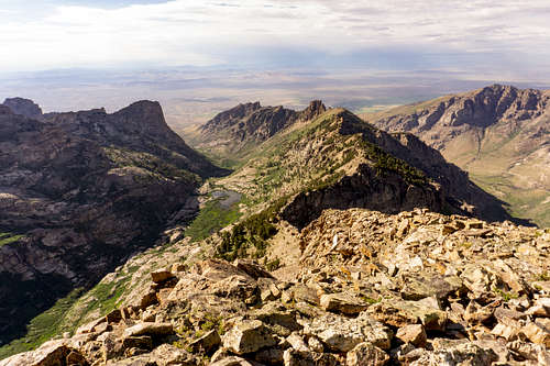
A portion of the range to the northeast illuminated in the warm evening sunlight. I compulsively took another photo (below). Verdi Peak, in the upper-far-right side of the picture, is another strenuous day hike that people often do directly from the main canyon's scenic byway after parking near the Terraces campground area. Just beyond Verdi Peak, farther northeast, was Smith Peak, which I'd have to do soon, I thought. Was Old Man on the Mountain or Soldier Peak or John Day visible? I wondered. They would be up on the left side somewhere in the silhouetting line of mountains almost out of sight. At least one of them must be, but I couldn't be completely sure.
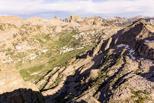
At 17:30 hrs I began the descent. The continuity of the ridgeline was striking as I started down.
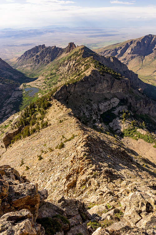
Here is a better look at the long ridgeline I mentioned earlier in the map excerpt:
After barely 10 minutes it became clear that I could be in the sun for a couple hours longer. I stopped then in the shade and put on a long-sleeved shirt, long pants, and also a bandana that covered my neck. The shade was pleasant, and a part of me wanted to sit there in it for a long time. But that didn't seem like the best idea after thinking about it more. I got up and continued. It was nice downclimbing some while facing in. It helped prevent hyperextending a knee and it felt more stable using both hands and feet to get lower, plus good practice for the bigger mountains.
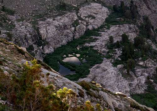
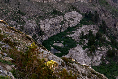
The beauty of the area continued to capture my attention. A small, unnamed, seemingly spring-fed body of water is not too far to the north of Mt Gilbert's summit, and it looked as smooth as glass as it reflected clouds that were moving across the sky above.
 |
 |
 |
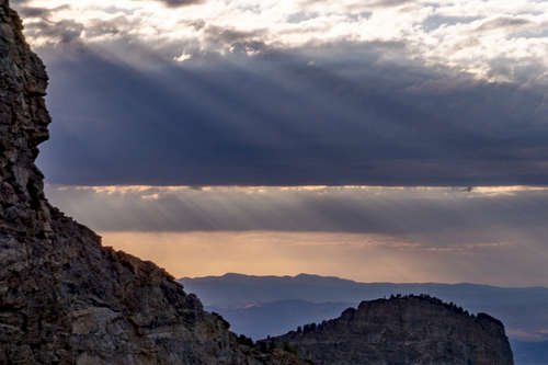
The descent continued. Clouds began accumulating. Would it storm? I'd be a little surprised after earlier seeing the forecast for a clear night in the area. But then again, these are the mountains. The sun fanned out impressive rays of light between multi-colored cloud layers in the meantime. Another photograph:
Then mosquitos suddenly were out in droves and I moved swiftly while often swatting them from in front of my face during the traverse. Hopefully I wouldn't breath one in and start gagging on it like last year in The Winds. It was good having the long-sleeved shirt and the long pants on.
Getting down to the lower terrain required constant attention. I descended many more sections facing in. I crossed the same narrow, snowy section as before amid the old mountain goat tracks while jamming a trekking pole below me and my ice axe handle far into the snow just above me for security. It was surprising how cold the snow was.
At times when I'd simply hike down grassy or dirt-covered sections, I used at least one trekking pole for stability and to avoid hyperextending a knee or slipping. I thought I heard people talking down below where the trail would be.
The headtorch would have to come out soon. A quarter of a liter of water remained, and I felt dehydrated and a little fatigued now. Somewhere more to the north was water flowing that I could hear, within the thicket somewhere. I wanted to avoid having to go over there in order to minimize the bushwhacking and the potential for slipping on the branches and leaves. Nonetheless, outside of that area, on the moist dirt that was the majority of terrain now, I slipped and had a harmless fall on my bottom. "Take it easy. Nice and slow," I told myself.
Near the final 100 meters or so before reaching the trail, the options for safe descent narrowed. As is the same with getting up onto the mountain, one must be careful on the large slabs of sloping rock faces that offer only a few narrow routes below and above them. The sky was darkening quickly upon reaching the final 50 meters or so.
Now I was the closest I'd been to the stream of water rushing down the mountain. I could resist it no longer, and I hurried through groves of thigh-to-waste-high vegetation with another swarm of mosquitos in tow, arriving at a stream flowing vigorously over a small rock face. I dunked my hat in the stream and then soaked my arms. The descent had become very hot for me, and it was immensely refreshing to feel the cold of this mountain water. I pulled the Sawyer filter out of my pack and leaned toward the small waterfall to systematically refill my 1.5-Liter bottle. Securing its top, I then filled up the Sawyer pouch once more and drank its cold contents before putting it away.
The mosquitos had abated some. Still bent over and near the rushing stream, I felt drops of water on my back. It had to be spray coming off the stream, or rain, or a mixture. I stood up and looked toward the blanket of orange-gray clouds dangling in the twilight. Rain. Of my many times in the Rubies, this was the first time out in the rain here. It was soothing. The air was warm and it carried the smell of the clean mountain precipitation. Still, I very much wanted to be back on the trail before it got any more wet out. Feeling slightly concerned, I put my electronics in a plastic bag deep in my pack, and then I went to go find the best way down to the canyon floor.
After heading south away from the stream and back through the bush, I found what seemed to be the crease in a rock slab that I'd climbed up at the start of all of this. After about 5 meters of shallow Class 3-to-4 downclimbing of the rock crease, it was soon apparent that the way was not safe because the rock was getting slick, and I could not see a good way from there that didn't require what I considered unnecessary hazard. While reaching that verdict, thunder rolled from the south. I quickly scurried back up the crease and knew then what I must do. I went back to the stream just to my right, to the north 30 meters or so, and began following it down the wet rocks. With a few careful steps, I was bushwhacking again on the north side of the stream. From there the remaining descent back to the trail became simple.
It seemed that as soon as I reached the main trail, the rain intensified. For the first time in the Rubies I dawned my wet-weather jacket. It was dark, though the sky dimly illuminated the canyon. A picture would've been great, I thought, but I wasn't going to take the camera out in this rain. With my headtorch in hand, I followed the trail back down toward Camp Lamoille. The temperature was still slightly warm and refreshing as I listened to the mountain shower meet the hood of my raincoat. Though I'd expected to feel more tired, the ease of the trail compared to Mt Gilbert made for a mostly effortless traverse. I expected to slip somewhere, so I forced myself to hike at about half the speed that I normally would. At times I merely creeped down the canyon. The trail was quite easy to follow in the dark despite the overgrowth in various stretches. After about 15 minutes, the rain subsided. In the distance the lights at Camp Lamoille appeared, lingering in the darkness.
Continuing on, to the north, in the upper peripheries of my vision, something flashed. I thought it could be a photographer, and then thunder sounded. That took about 5 seconds between the flash and the sound, I realized. Hopefully nothing comes down here. At least I wasn't exposed as the highest point within my surroundings. Another flash and light. One second, two seconds, three seconds. Thunder rolled after 14 seconds or so, seeming to be farther north and to the east, though the canyon walls can make sounds deceptive sometimes.
I reached the rickety bridge that I'd avoided on the way up. Instead of sifting through the brush to find where I'd crossed earlier, the bridge seemed worth the risk, especially since the electronics were protected now. In a few wide strides I was across.
After another quarter mile or so I reached Camp Lamoille where the people were. A dog let out a muffled bark before its owner convinced it that everything was fine. I gave the party a wave and continued in silence as they watched me pass.
I then arrived to my vehicle after an easy half a mile more on the gravel road that stretches between the parking area and the trailhead. Grateful to have a change of clothes waiting, I removed my boots and wrung out my soaked socks. The boots would take a couple days to dry completely. It had been another great day in the mountains, and it might've even been one of the richest experiences yet of my solo journeys. I took a minute to make one last entry in my hiking journal before exiting the main canyon and heading home for the night.