
-
 5490 Hits
-
 71.06% Score
-
 1 Votes
|
|
Route |
|---|---|
|
|
8.34235°S / 115.50298°E |
|
|
Download GPX » View Route on Map |
|
|
Hiking |
|
|
Spring, Summer, Fall, Winter |
|
|
Most of a day |
|
|
Class 3 |
|
|
Overview
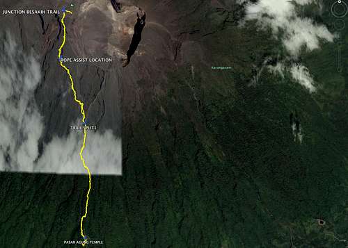
Mt. Agung route in yellow
Note that this is a route, not a trail. It is clearly marked with white paint but is mostly class 2 with some class 3. There is one spot where a rope is employed but it could probably be climbed without it.
The total mileage is 5.5 miles round trip with about 4,831' of elevation gain, all in the first 2.75 miles.
Getting There
The trail starts at the base of the stairs to Pasar Agung Temple. If you are with a guide, they will pick you up and drive you there. Please see the description for Getting There on the main page for the mountain.Route Description
The route starts on the 300 stairs to the Pasar Agung temple. Before ascending the final stairs up to the temple gate, turn left and wind your way through some stone structures. It is this part where a guide is most needed as it is night and there are no trail markings.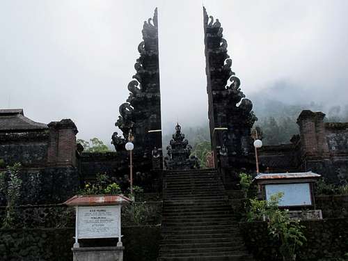
Pasar Agung Temple gate
Once past the temple structures the trail begins on soft and slippery reddish brown dirt. At approximately 7730 feet elevation and 1.5 miles there are some white arrows painted on the rocks that point left to the crossover route. Turn left (west) to leave the main trail and follow the white paint up and across the mountain. This is the section that contains the rope assist.
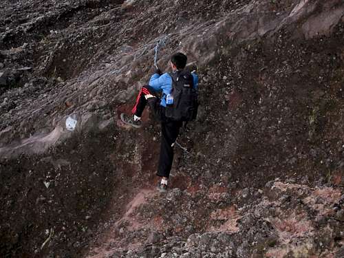
Mt Agung Crossover route rope section
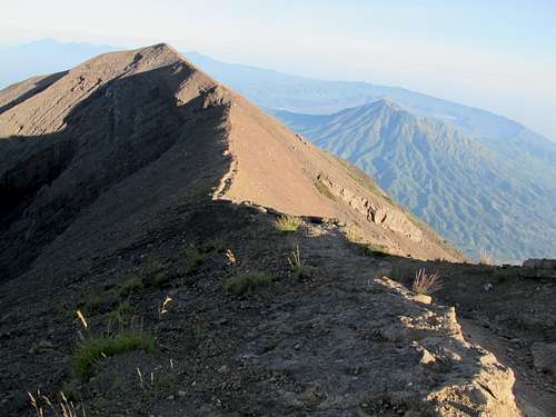
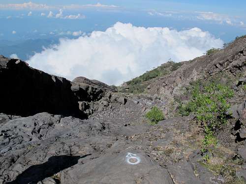
The Besakih Trail runs along the ridge
This route traverses the mountain to the west saddle of the crater rim. When you reach this saddle you are almost there. Join the trail from Besakih and go right (east) for .1 mile towards the highest point.
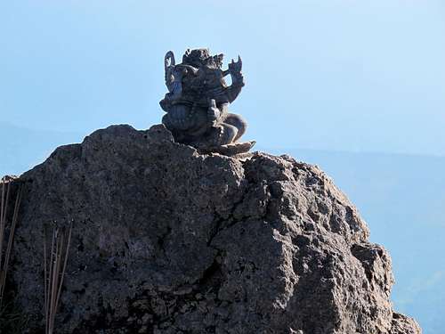
Little statue on top of Mt. Agung
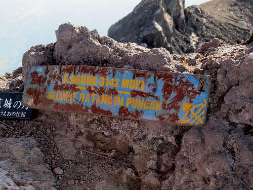
Mt. Agung high point marker
The descent of the mountain is tedious and tough on legs and knees.
White trail markings on the Mt. Agung crossover trail
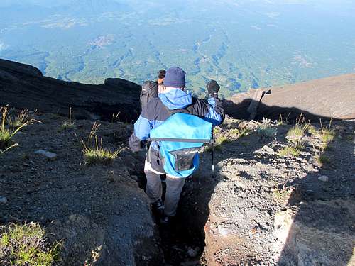
Mt. Agung crossover trail steepness
Headlamp and spare batteries.
Trekking poles would be very helpful for the steepness.
Rain gear (can also be used for a light jacket).
A light jacket for the top.
Shoes or boots that grip well.
It is advisable to start in the dark. It is cooler, plus you can witness the colors of the sunrise as you ascend or at the top.
During wet weather this route would be fairly hazardous due to its steepness and lack of trail.
There is a small, filthy squatting toilet at the parking lot.
Some time after dawn there are vendors in the parking lot who sell beverages, food and trinkets.
You can find a guide on some social sites such as TripAdvisor or even here. Your guide may be able to arrange nearby lodging as there are homestays that cannot be found on the internet.
If you hire a guide, they will normally bring snacks and hot water with tea, coffee and hot chocolate.