Toggle navigation
Mountains
Routes
Images
Trip Reports
Forum
What's New
People
Areas & Ranges
Articles
Trailheads
Canyons
Huts & Campgrounds
Albums
Logistical Centers
Fact Sheets
Lists
Custom Objects
Gear
Plans & Partners
WELCOME TO SUMMITPOST
SIGN IN
REGISTER
Glacier National Park, MT
Additional Parents
Image
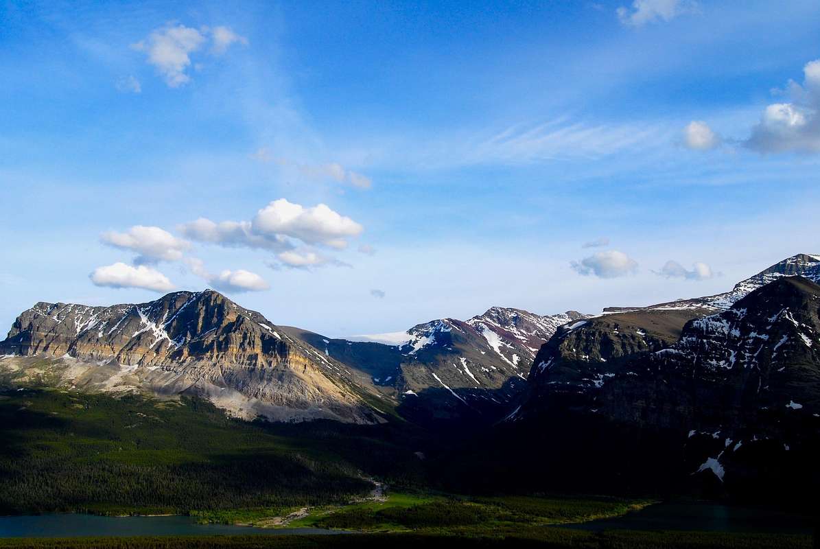
near Apikuni Falls
View High-Resolution Image
near Apikuni Falls
A high vantage point near Apikuni Falls yields a great view up the Canyon Creek drainage. Wynn Mountain (left) and Allen Mountain (right, actual summit just out-of-frame) frame the drainage, which empties into Sherburne Reservoir. June 22, 2008
« PREV
NEXT »
distressbark
on
Nov 9, 2014 10:00 pm
Comments & voting
Other parents
Lat/Lon:
48.81444°N / 113.64324°W
Image ID:
921497
1111 Hits
71.06
% Score
1
Votes
Log in to vote
Comments
No comments posted yet.
to post!
Don't have an account?
Glacier National Park, MT
(Area/Range)
« PREV
Viewing
#1227 of 2007
GALLERY
NEXT »
distressbark's Image Gallery
« PREV
Viewing
#487 of 598
GALLERY
NEXT »
Wynn Mountain
(Mountain/Rock)
Loading....
To Dance Beneath the Diamond Sky (Glacier National Park 2008)
(Album)
Loading....
×
You need to login in order to vote!
User Name
Password
Remember me
Forgot your password?
Log me out when I close my browser.
Keep me logged in all the time.
sign in as a user
Don't have an account?
Register now for FREE
Rating available
Suggested routes for you
People who climb the same things as you
Comments Available
Create Albums
Register Here


