
-
 219311 Hits
-
 100% Score
-
 255 Votes
|
|
Area/Range |
|---|---|
|
|
48.69700°N / 113.717°W |
|
|
Hiking, Mountaineering, Trad Climbing, Scrambling |
|
|
Spring, Summer, Fall |
|
|
10466 ft / 3190 m |
|
|
Completed...but not to be set in stone.
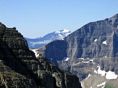
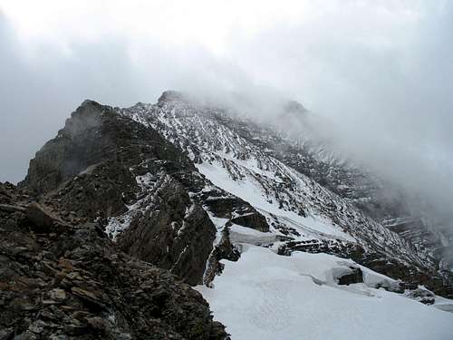
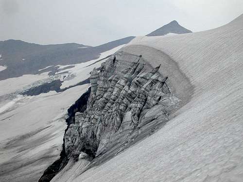
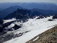
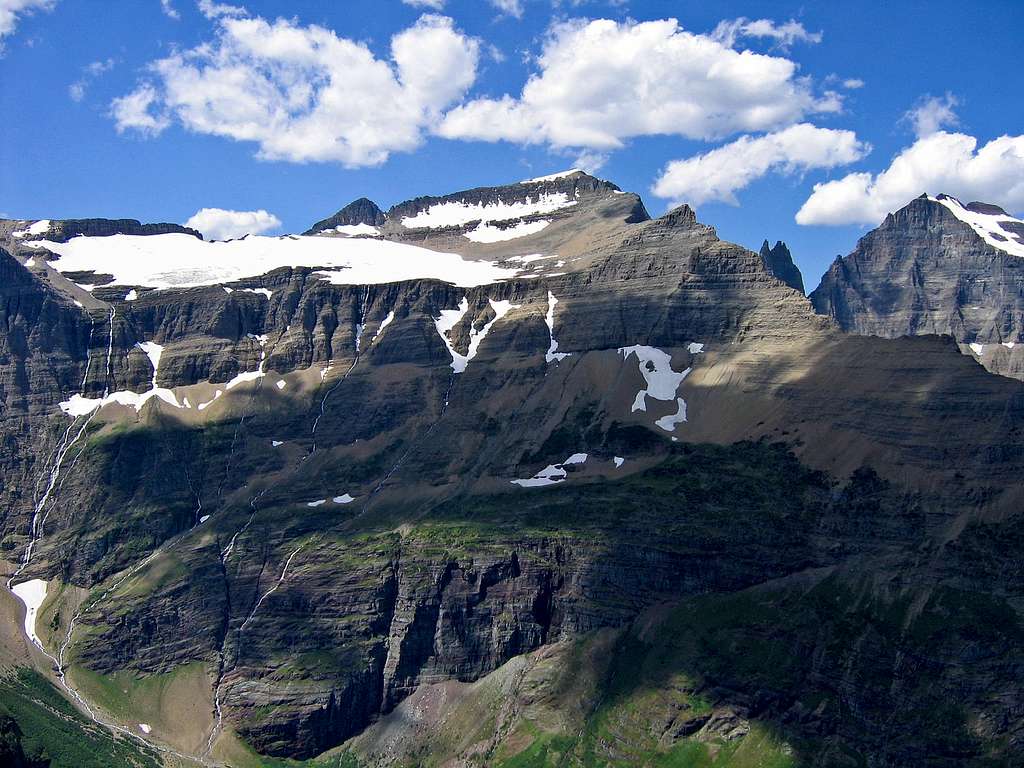
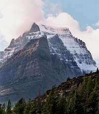
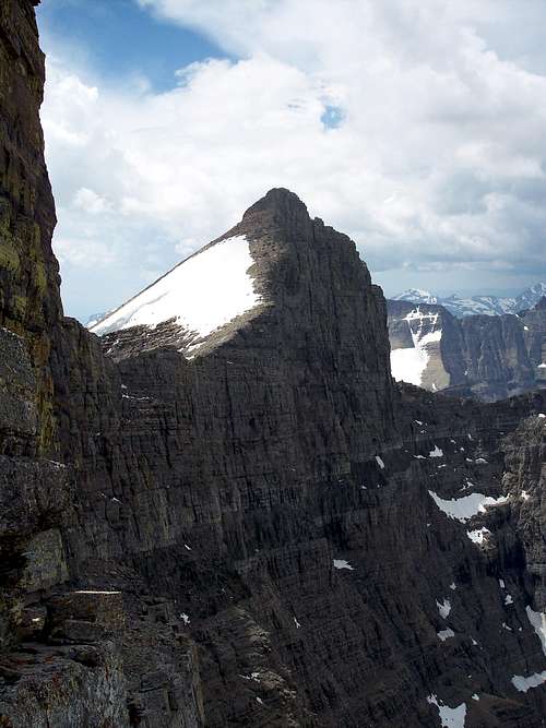
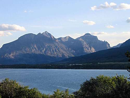
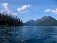
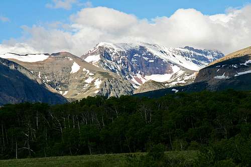
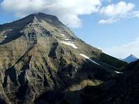
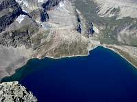
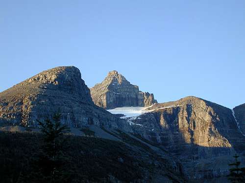
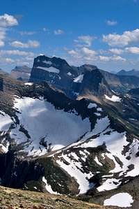 Swiftcurrent Glacier, Mt Gould
So enjoy what's here, but do keep checking back; it is an organic, fluid proposition, with much to add, subtract, and rethink. I welcome your comments and suggestions. Also your photos. Enjoy this fantastically great place with me!
—Vernon
AND NOW....
TO BEGIN...CAREFULLY
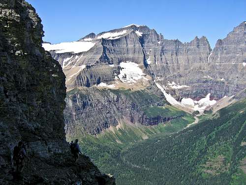
(The Ptarmigan Tunnel to Ahern Pass Goat Trail)
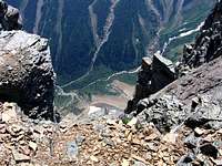
Image taken while standing in front of the Ptarmigan Tunnel, looking back along the access trail from Many Glacier's Swiftcurrent Campground. Relax, enjoy the view, but don't dawdle for long: awaiting is an unforgettable excursion through the definition of what a mountain paradise is all about...
you get there by going this way...
[although do take the time to check out Bob Sihler's excellent
Ptarmigan Tunnel to Ahern Pass route page
—detailed information and some (very) nice pictures take
you through the heart of a truly unforgettable area!]
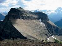
 Access to Goat Trail, #1 Access to Goat Trail, #1 |
 Access to Goat Trail, #2 Access to Goat Trail, #2 |
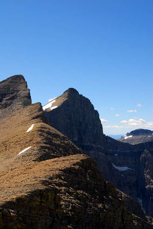
 Access to Goat Trail, #3 Access to Goat Trail, #3 |
 |
 |
|---|
|
|---|
|
|---|
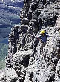
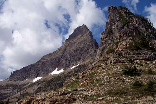
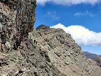
A marvel of goat engineering. That is what this page begins with.
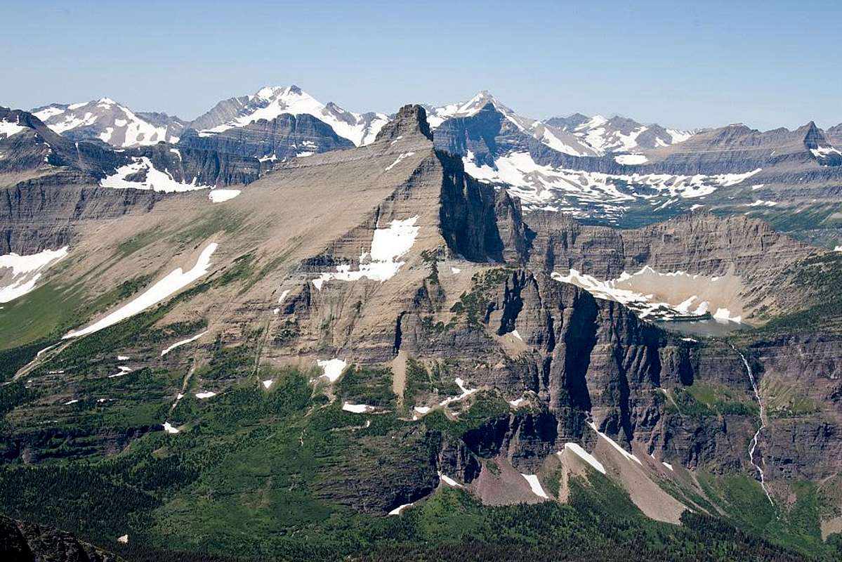
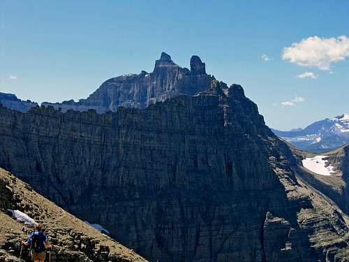
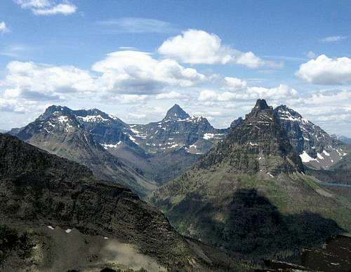
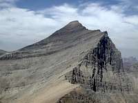
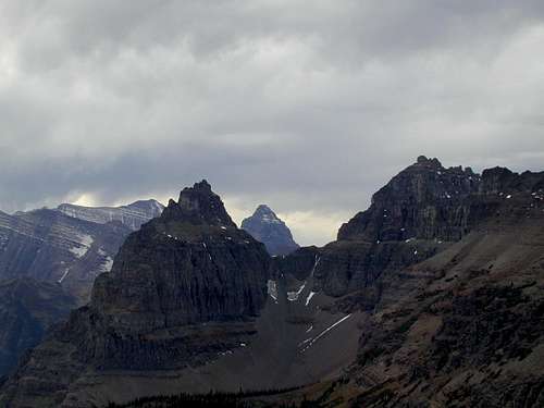
There are a few things to remember, four of which come immediately, easily, to mind: Merritt. Ipasha. Natoas and Ahern, the bookends. Over and over they come at you, from that first unforgettable view when, by the simple act of walking around a cliff, with no warning you come face to face with thousands and thousands of vertical feet of glacially chisled rock looming impossibly big across the canyon, and no matter how many mountains you've already seen, it is special, and you know it's Merritt, with Old Sun Glacier drawing your eyes again and again to the summit, then sliding along the sharp-spired ridge to neighboring Ipasha—to a mountain as beautiful as its name. The glaciers had a field day here, munching and carving and ripping and making Paradise, and you do what everyone does: stop in your tracks and try fitting the vision in your head, until those behind let you know they'd like to see as well so would you please move on. Then, soon you hear the ones behind them, "hey, move along."
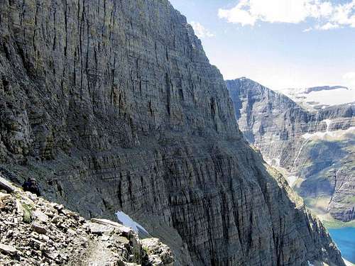
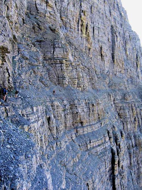
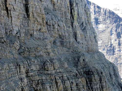
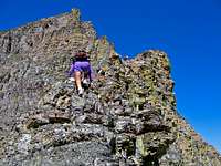
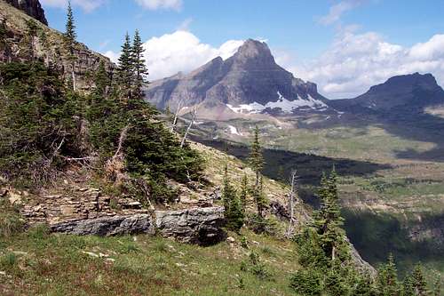
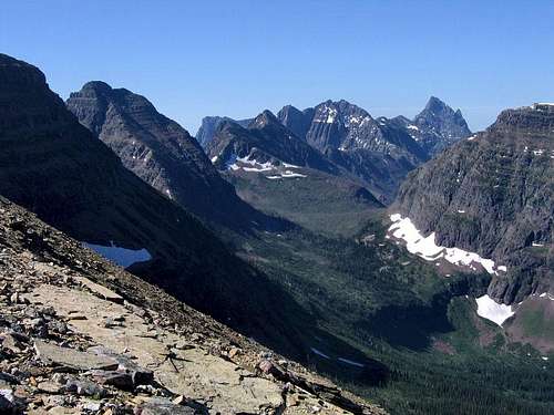
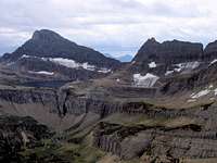
This goat trail has its dangers with exposure, and one soon learns to not walk and gape at the same time. The actual cliff part of this trek is about four miles long, and even though there is relief along the way, for maybe half that distance slipping on a pebble could prove...well, it's not something you want to do. You need to know how you react to exposure before these miles of greatness. In addition to the magnificent cliffs above and below this seemingly fragile marvel of goat engineering, across the way—always, The Four lying across the way!—is the Lithoid Cusp, the highest of a series of sharp, none-of-which-have-ever-been-climbed, spires forming the ridge between Merritt and Ipasha; and, at one point—not over there, but over here—the cliffs bend, wrap in a bit of a curve to reveal an unusual view of Iceberg Peak; then finally, coming towards Ahern Pass, the view opens to reveal another, more distant, beauty: seldom-climbed Longfellow Peak.
From Ahern Pass (and early in the summer you'll want both ice axe and crampons to ascend the snow field to the saddle—later in the summer you'll probably still want crampons; we did it late in July of a dry year, and were glad to have them) the ascent is 600' up to Iceberg Notch, which gives a rather precipituous view of the almost 1600' vertical climb down the other side to Iceberg Lake. I remember rather innocently asking, "where's the way down?" (I mean, for crying out loud, standing on the notch and peering down at the lake, you couldn't even see the way; it was too steep!) The answer, all the while gesturing down ("down" seems to be a key word here) to the lake, "that way." Very funny. But no ropes needed in good weather (actually, we didn't take ropes with us, because
Where to begin?
With something stunning, something getting-in-your-head memorable, that won't for any reason leave.
Not that you want it to....
Journey to "The Crown of the Continent"
 West and Southwest from Medicine Grizzly Peak
 Mount James, from Amphitheater Mountain
 Beargrass, spring green
 An unusual tableaux, as seen from Rising Wolf Mountain
The Blackfeet people living on the plains just east of the mountains called this area, "The Backbone of the World," and were the dominant tribe of the region long before the first explorers and fur trappers came onto the scene. Other tribes in the area were the Kalispel and Kootenai to the west; the Crow, Sioux, and Assiniboine in the south; and the Blood Indians to the north, in what is now eastern Alberta. The tribes, naturally enough, didn't have clearly delineated territories,
 Smoke & fiery sun in GNP...
 Exposure on Mt. Wilbur
 Swiftcurrent Mountain
But there is something different about the unfolding history of these
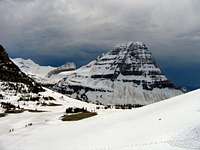 Around Logan Pass this is known as "Spring"
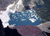 A long way down on Mt. Wilbur
 Chief Mountain
  |
 |
|---|
Two remarkable men played defining roles in the unfolding history of the area. By 1880 the Blackfeet were being persecuted by the U.S. government, devastated by smallpox, the last of the buffalo had been killed off in 1882, and the winters of 1883 and 1884 were witness to mass starvation on the reservation. One white man, James Willard Schultz, living among the Blackfeet, decided to help. He wrote to George Bird Grinnell (follow this link to A Singularly Important Individual section of the Mount Grinnell page), then editor of Forest and Stream magazine, who used his influence, both through the magazine and influential government friends, to increase government aid to the tribe.
 Blackfoot Mountain glacial moraine
 Graceful Eagle Plume Mountain
Schultz and Grinnell weren't, of course, the only individuals of sensitivity and intelligence in this part of the developing country. Many others, both Whites and Natives, recognized, and were cognizant of, the almost overwhelming problems of disparate cultures in conflict, and somehow were able to persuade all peoples that despite the myriad differences and conflict, this place was indeed great, and simply must be preserved. Out of a dark tale all too familiar throughout the Americas, wisdom was found...enough, eventually, on all sides. He didn't work alone, but of them all, today it is George Bird Grinnell recognized as "The Father of Glacier National Park."
Since 1910...quickly
 Sunlight on Grinnell Glacier Basin
 Kupunkamint, White Calf, & Divide Mountains rise from the eastern plains
 Mt. Wilbur, B-7 Pillar
 Red Eagle Fire cleared the view to Divide Mtn
 Mystic Wynn Mountain
 View west, from Kupunkamint Mountain
 The Guardhouse, Porcupine Ridge
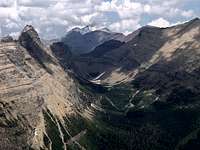 Gable Mountain, from Bullhead Point
 Goat Haunt Ranger Station—what a place to spend a summer!
So...what about those glaciers, anyway?
 Fifty-foot wall on Blackfoot Glacier
 Grinnell Glacier and Upper Grinnell Lake
 Kintla Glacier, from Kintla Peak
 Close-up of Sperry Glacier
 Old Sun Glacier
 The business end of Old Sun Glacier
 Overview of Blackfoot Glacier
 Harrison Glacier
 Crossing Blackfoot Glacier
 A distant view of Sperry Glacier as it spreads over Gunsight Mountain
 Crossing Swiftcurrent Glacier
Glacier National Park is one of only two remaining glacier concentrations in the Rocky Mountains south of the U.S./Canadian border (the other, of course—having slightly more area of glacial coverage than
 Closeup of Jackson Glacier
Of the approximately 50 glaciers left in the park 37 have names; there were over 150 in 1850. Five of those remaining are larger than 1.0 square
 Traversing Blackfoot Glacier
 Overview of Sperry Glacier
If current trends continue unabated, at some point in the not too distant future Park Rangers are going to be explaining that Glacier National Park derives its name from a cataclysmic event happening slowly, over many, many years, then ending about 11,000 years ago, but that when the first trappers and explorers entered this area in the 1800's—honest!—there were still spectacular remnants left of what must in ancient times have been an
 Harrison Glacier
 Jackson Glacier overview
Anyone doing research on receding glaciers—whether those in Glacier National Park, or worldwide—will find no shortage of material to read, some of which is naturally better than others, and it will soon be apparent that a great deal of repetitive information exists from article to article. With that in mind I have provided several links to articles that I believe to be informative—and relatively non-repetitive in their presentation—in this particular area of research. First, the "before and now" link in the second paragraph above leads to a project documentation which is excellent because it visually, by means of photographs, deals specifically and impressively with just Glacier National Park. In addition, immediately below are links to three articles also focusing on GNP—I found them to be not only interesting, but unusually informative.
#1 — Glacier Monitoring in Glacier National Park
#2 — Glacier Retreat in Glacier National Park
#3 — Modeled Climate-Induced Glacier Change in Glacier National Park, 1850-2100
Next, the article, Glaciers of the American West, is a result of research encompassing more than just GNP, and provides noteworthy comparative information on all remaining glaciated areas in the Continental U.S.
And finally, I'm including this link to the article, A Sign of Things to Come, because, while focusing on climate change in Montana, it does so within a global context. It is a thoughtful (not beating you over the head) interview with 2009 Nobel Laureate Steve Running, is one of the best (of many) articles on global warming I have yet encountered, is quite readable, and I recommend it very highly!
FIVE LINKS TO EXCELLENT/INTERESTING ARTICLES
Ice Sheets, and (on the right) that what a hundred years ago was one large glacier has
receded to the point it is now two small—although beautiful—glaciers.
Mountains, mountains, and then...MORE MOUNTAINS!
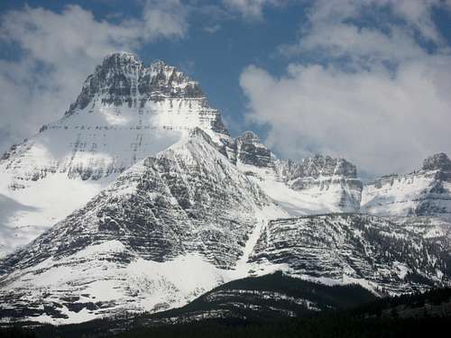
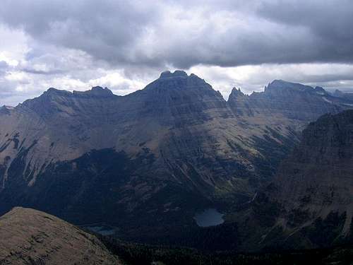
 Mount Merritt, Natoas Peak
INTRODUCTION
 Crowfeet Mountain
 Mount James in a garbled landscape
 The everpresent depths, well defined
 Iceberg Peak
 Final summit approach on Heavens Peak
Beginning with a source of information:
COMPLETE PEAK LIST FOR WATERTON-GLACIER INTERNATIONAL PEACE PARK
 Sperry Glacier and the three summits of Gunsight Mountain
THE LOGAN PASS AREA
 Logan Pass crest
 West-Southwest from Reynold's summit
 Logan Pass area from Swiftcurrent Mtn. (enlarge this!)
 Hidden Lake, Reynolds Mountain await winter
 Reynolds Mountain, Heavy Runner Mountain
 Clements Mountain
 A real beauty of a scene!
 Oberlin Summit
Probably it starts with oh-so-familiar Reynolds Mountain, the sentinel with its impossible-to-avoid North Face Traverse drawing the exclamation, you walk across THAT? from the many visitors that don't climb but just take it all in with amazement. Then, although not seen so much on calendars—meaning that neither name nor physical recognition is as immediate—nearby neighbors Clements, Heavy Runner, and Pollock Mountains, with not-much-more-distant Little Chief Mountain, and the road's namesake Going-to-the-Sun Mountain, all supply a visual treat to the east. Looking north is easy because the huge western wall of Pollock Mountain is the guide as vision briefly grapples with the small point of Bishops Cap, then follows the Garden Wall to Mount Gould and beyond. Simply put, the thing about Glacier National Park that gets to everyone is the view, and the spellbinding center of it all is Logan Pass. The take is much richer for those climbing and hiking, but even if "only" driving the Sun Road, it is still the sort of thing stays with you, residing in memory, I think (and it's a good thing), alongside ancient and vague lives of fires and caves.
 Logan Pass area from Little Chief Mtn
This is also a fun place for those from areas getting little or no snow, as even after a mild winter, impressive snowfields last well into July. There is an area not far east of the Logan Pass summit known as the "Big Drift," which, if passing through GNP soon after the Sun Road opens, provides the thrill of driving alongside a wall of snow which even following winter with less than normal snowfall, is 40 feet high, and if the winter has brought a heavy snow pack, is 80 to 85 feet deep (and a substantial challenge for clearing crews)! An additional—and far from negligible—side benefit of this late-melting snow in the Logan Pass area is that there is easily accessible, excellent terrain for practicing the all-important skill of ice axe self-arrest.
 Pollock, from Oberlin Pollock, from Oberlin |
 Like a painting.... Like a painting.... |
 Mount Edwards Mount Edwards |
 Siyeh, from Bishops Cap
 Mount Oberlin, Mount Cannon
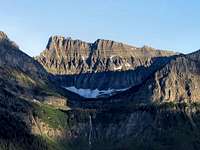 Light playing with Clements Mountain
 Bearhat Mountain, from Mount Clements
on Reynolds Mountain (L), and Mounts Clements and Oberlin (R).
 East, from Bearhat Mountain
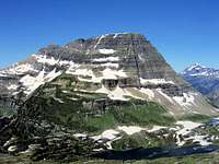 Bearhat Mountain, Mount Vaught
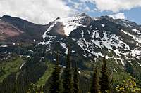 Allen Mountain's west face
 A land sculpted by glaciers...
One of the highlight, built-in "touristy" features of GNP is that you can get countless great photos right from your car, but as usual with mountain country, taking to the trails and peaks brings results only hinted at from the highway—climb these mountains and another world opens up!—and so it is with the Logan Pass Area. There are many, many summits, approaches, and climbing experiences here; even though it is not difficult to understand why a "drive-through" satisfies most, take the time and effort to leave your vehicle, and it gets a LOT better. And does so with almost stunning rapidity.
 First view of Mt. Grinnell summit
THE MAGIC OF MANY GLACIER
 Mount Gould, from Mount Siyeh
 View from Mt. Wilbur
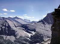 REALLY—nothing here but mountains!
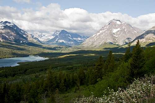
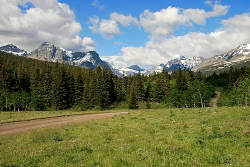
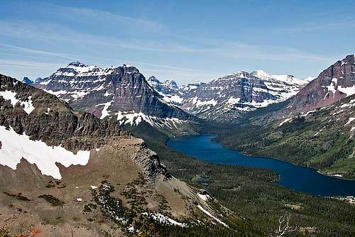
Although some people may believe the Many Glacier area is too barren, windy, and cold, for most mountaineers and serious hikers there is no more satisfying region in all of North America. There are several great valleys radiating from the Swiftcurrent Lake environs and at least ten other lakes nearby, many of them excellent for fishing. The greatest attraction of the region, however, is surely the encircling array of mountains. All of the peaks normally climbed in this vicinity are easily reached in a single day, and there are good facilities for eating, sleeping, buying supplies, enjoying entertainment, doing laundry, taking showers, and receiving medical attention at the conclusion of those climbs.
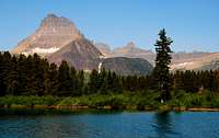
 Mount Henkel, from Iceberg Lake Trail
 Beautiful Iceberg Peak
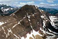 Crowfeet Mountain
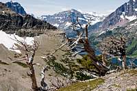
as seen from the Ptarmigan Tunnel to Ahern Pass Goat Trail
 Unusual perspective into the Many Glacier Area.
 Rock-solid grandeur!
 Mount Grinnell
 Nothing else needed here—Mount Gould stands alone, 4700' of get-your-attention glacial carving!
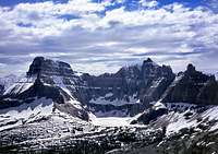 Wilbur, Iceberg Peak, Iceberg Lake
 Angles and lines—Siyeh from the west
Valleys are, of course, defined by the peaks and ridges around them, and those parameters of definition in this area are remarkable in both quantity and quality. Within 15 minutes of the campground one can be on the way up Mount Henkel, and its short, 1.5 mile climb (all class 2 and 3, but in that distance elevation gain is almost 4000') leading to spectacular views of the wonderful Mount Wilbur/Pinnacle Wall/Iceberg Peak cirque enfolding Iceberg Lake, and points beyond—Vulture Peak, Mount Merritt, Rainbow Peak, Mount Carter—but also looking south to Mount Gould, then even further south to beyond the Logan Pass Area. If so desired, traverses to either Apikuni and/or Crowfeet Mountain (Henkel is between the two) provide a visually breathtaking introduction as to why you're in this place to begin with! And in case you need it, the summit of Crowfeet Mountain provides easily obtainable, mute—but exciting—evidence (its 2000'+ wall is sheer enough you won't be shy about having someone hold on as you peer over the edge to Kennedy Lake below) of the voracious action of the great Continental Ice Sheet.
 Mount Wilbur, Iceberg Peak
 Grinnell Glacier Basin
Or, if you'd rather, the Cracker Lake trail leads from the Many Glacier Hotel, providing ready access to massive Allen Mountain, and also to one of the many wonderful GNP ridge walks, this from the summit of Mount Wynn, 5.5 miles to the summit of Mount Siyeh—one of the six peaks over 10000' in the park—and if you thought the 2000 feet of air from the top of Crowfeet Mountain impressive,
 Hot showers, good food...and a sense of scale
 A good take on the great east face of Mount Gould
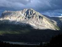 Wynn Mountain
There's another 4,000-foot face in the Many Glacier Area, the east face of Mount Gould, which due to its ready accessibility, is one of the classic, most often seen views, of Glacier Park. This face has maybe been climbed once. "Maybe," because the individual claiming the solo (!) ascent has enough inconsistencies in his story that...maybe, maybe not. But the sheer face so often seen posing behind the Many Glacier Hotel is indeed that of Mount Gould—which, by the way, is readily-enough climbed from the west, accessed from the Weeping Wall parking area along the Sun Road; or approximately 1,000 feet of rapid, bushwhacking, elevation gain may be saved by simply beginning the climb at the Logan Pass Visitor Center, with approximately two miles of relatively level walking along the Highline Trail leading to the intersection of that initial steep, brushy climb from the Weeping Wall, and the easy trail you've been on. Energy expended and time saved versus easy trekking: the choice is yours.
 Swiftcurrent Basin...Oh My!
 Bullhead Lake
No 4,000-foot faces on Mount Wilbur, and at 9,321 feet it is not the area's highest, but I still think of Wilbur as the "monarch" of the Many Glacier Area. It is a technical-only climb, one of five such summits in the park. It is also a very, very beautiful mountain, with a quite real lure drawing one to its heights; for those with technical-climbing aspirations and abilities (there
 Mount Wilbur & Pinnacle Wall
Anyone just wishing a day's outing with a minimal amount of off-trail climbing can do the excellent 5-mile trail leading from the Swiftcurrent Campground to Iceberg Lake—an interesting and aptly-named bit of geography that is one of the more popular destinations in the area—and will put you at the base of not only Wilbur, but also the Pinnacle Wall, and Iceberg Peak. And if, at the 2.5-mile point you continue on another 2.5 miles to the Ptarmigan Tunnel rather than turn left to Iceberg Lake, you'll have the opportunity to enter the Belly River area through the tunnel. Or do the remarkable goat trail which started out this page.
 Mount Wilbur set off by snow
 Climbing on Allen Mtn, #1
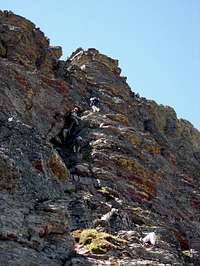 Climbing on Allen Mtn, #2
 Color to hike by
INTERLUDE—The Joy of Climbing in a Beautiful Place
 Saint Mary Valley Saint Mary Valley |
 Blackfoot Mountain Blackfoot Mountain |
 Citadel Mountain, Blackfoot Mountain Citadel Mountain, Blackfoot Mountain |
 Looking into the park's interior, from Divide Mountain Looking into the park's interior, from Divide Mountain |
THE SAINT MARY VALLEY AREA

 Divide Mountain, from the Logan Pass area
 Curly Bear, Red Eagle, St. Mary Lake, from Divide Mountain
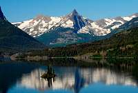 Fusillade Mountain, Saint Mary Lake
 Mahtotopa and Little Chief
Then you are there, and the small community of Saint Mary is everything it should be, with lodging (both motels and camping), a couple of excellent(!) restaurants, a grocery store, tourist shops, laundromat, available showers, gas stations, and to top it off, an abundance of wind (I just threw that in to see if you're paying attention; anyway, it's true). It also is maybe a half-mile from the park entrance and (really excellent) Visitor Center, which is always stocked with a good assortment of books, maps, videos, and staffed by friendly and knowledgable NPS Rangers (among other things, you can...Register. Your. Climb.). Slide shows and talks are presented throughout the day; it is worth stopping here! And besides, this all comes with a nice view.
 Norris Mountain, Split Mountain.
 These mountains sometimes appear just a bit...weird.
There is a beautiful, graceful, peak not far south of town, readily visible from any approach to Saint Mary—it is, in fact, seen from as far away as the Hidden Lakes Trail above the Logan Pass Visitor Center—which has a special and poignant significance in the unfolding history of Glacier
 A wonderful "loop" of a ridge walk!
 Going-to-the-Sun Mountain
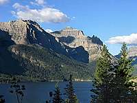 Little Chief Mountain, Saint Mary Lake
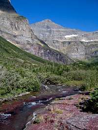 Matahpi Peak
Most people know that Glacier gets its name from the sculpting action of the last Continental Ice Sheet on the soft, sedimentary, rock which makes up these mountains—the land was, literally, chewed up and spit out! Such monumental activity left behind a remarkable visual record of destruction in the form of mountains sheered off, leaving thousands of feet of air visibly defined by abrupt angles and sheer walls. And magnificent ridges. More than any place I have been GNP has expansive, beautiful, long, wind-swept ridges leading between the peaks. Days can be spent on these exposed places, amidst rock, tundra, flowers, sheep, goats, and sublime, windy views! (That's the second time in as many sentences I've used the word "wind." The park gets a lot of it, even—especially east of the Continental Divide—at lower elevations, and often at a substantial velocity. Take note; sometimes the simple act of setting up a tent...isn't.)
 Sunrise on Saint Mary Lake
 Mount Jackson
 Almost-A-Dog Mountain
 Beautiful Blackfoot Mountain
But of course the Saint Mary Valley, the Red Eagle Valley, the smaller, unnamed "tributary" valleys, are all about the defining peaks and ridges around them, and access to those mountains. GNP has an excellent system of interconnecting trails, but occasionally the decision is made to no longer
 Going-to-the-Sun Mountain, from Matahpi Peak
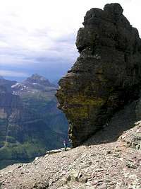 Looking out from Bishops Cap
Don't misunderstand, there is a good trail leading from Red Eagle Lake, but it bypasses the upper Red Eagle Valley, going instead up Hudson Bay Creek to Triple Divide Pass. Red Eagle Pass is now reached from the other
 Relaxing on Thunderbird Mtn
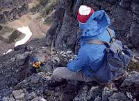 One of the all-time great belaying shots!
Driving the Sun Road west out of Saint Mary it is perfectly obvious you are in a mountain-climbing paradise, but what is not so readily apparent is all the access betwixt and between, and even on, these great peaks. Trails lead to passes, to gullys and cliffs and ridges, and snowfields and glaciers, to valleys, and creeks which must be forded, and sometimes the best way is a "no-trail" leading into bushwhacking hell, but ultimately to open tundra, and then summits and sky. And always the mantra, "There are
 Clements and Company
 Entering GNP
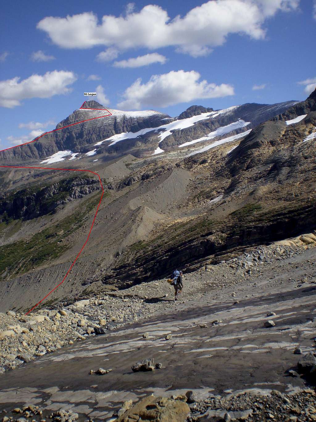
And oh-my-goodness, the mountains in this place! Going-to-the-Sun, Jackson and Blackfoot, with their massive glacial fields, Little Chief, Citadel, Almost-A-Dog, Dusty Star, Red Eagle, Curly Bear, Mount Logan—which has a traverse around it called, "The Scenic Death March"—the technical-only Walton and Split Mountains. (A beautiful view of Split Mountain is seen from the Saint Mary Visitor Center.) And still more: Mount Siyeh, with its poor, broken, humpback—and the overwhelming splendor of its 4200' sheer face. Fusillade, and its opposite, Singleshot; Divide, with its sad, noble entry into recent history. These peaks sometimes go on forever in the mind, entrapping you within their endless marvel...and still, I haven't nearly named them all.
Blackfoot Mountain (9597') is one of the great ones. One of those getting in your head and doing wonderful things. Part of an unforgettable trilogy of neighboring Mount Jackson (10052') and Mount Logan (9239'), and situated such as to be still buried in glaciers. And in this place Edwards, and others, have been thrilled enough to write such as: Deeply crevassed Pumpelly Glacier clings to the south flank of Blackfoot Mountain and beyond it, across the immensely deep Nyack Valley, Mt. Stimson's mighty bulk commands attention. F. E. Matthes (1904) wrote: "Here is a scene which dwarfs the Yosemite Valley and makes the Grand Canyon seem commonplace." He especially admired Harrison Glacier, saying: "Descending 3,000 feet in tumultuous ice-cascades this magnificent glacier eclipses all others we have seen."
 Saint Mary January
I think my point here is not to tell you how and where to ascend these peaks, or how to access the different areas—the Edwards book does that, and contour maps—and individual SP pages!—but rather the goal is one of motivation, inspiration, and an invitation to explore. This vast Saint Mary Valley area is chock full of things to do, and by no stretch of the imagination is it unique in the park. As Edwards says, In summary, the extensive St. Mary Valley area provides enough challenging destinations to keep most mountaineers occupied for several years!

CLIMBING INTERLUDE
 Road Closed for the Winter Road Closed for the Winter |
 Heavens Peak, Mount Vaught—sentinals on the way up Stanton Mountain Heavens Peak, Mount Vaught—sentinals on the way up Stanton Mountain |
 Classic Lake McDonald View Classic Lake McDonald View |
 An ominous Cannon Mtn An ominous Cannon Mtn |
Saint Mary Winterlude


Winter in mountains is always an adventure, with not much room for error. Bundle up, the primeval awaits; no forgiveness, and what you wear can mean your life! So very mellow in the heart of summer, January makes those halcyon days seem like something invented, tales to be told around a snapping, crackling fire. A thing to imagine, that (really!) in another time if not place, it honestly and actually does get warm here.
 Mount Brown, Lake McDonald in the distance Mount Brown, Lake McDonald in the distance |
 Edwards Mountain, Little Matterhorn, from Floral Park Edwards Mountain, Little Matterhorn, from Floral Park |
 A different perspective on Cannon and Brown A different perspective on Cannon and Brown |
Mostly, these mountains stand free and unused in winter, except very occasionally, and then only by competent, well-equipped individuals familiar with cold wind, difficult terrain, and avalanches. Immediate northern neighbor Waterton Lakes National Park is the official windiest location in Canada. I don't know where this place, this Rocky Mountain Front east of the divide, falls in the U.S. hierarchy of such things—which, in any case, changes from year to year—but simply put, winter here is not nice, often intense enough it is difficult to enjoin. Very few stay in Saint Mary through these months; the road just barely stays open, and the warm, embracing town of summer stands starkly alone against the hammering cold and driven snow. The day we were there it reached 10 degrees (F), with steady wind strong enough it was difficult to stand. A few days later it was 30 degrees colder, same wind, heavy snow.
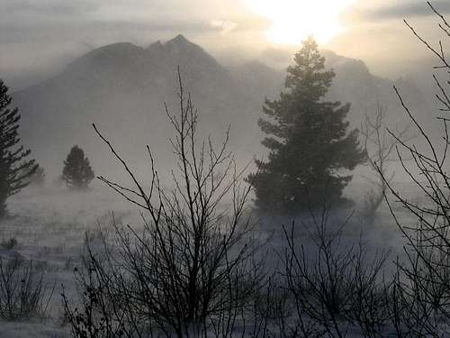
So these are pictures—and from the edge at that!—of an area and time best left to itself.
Look at these photos. Dream of illusive summer....
THE LAKE McDONALD AREA—A GENTLE ENTRANCE
 Quite alone on Heavens Peak
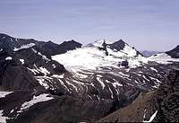 Beautiful Gunsight Mountain, Sperry Glacier
 Early fall on the Garden Wall
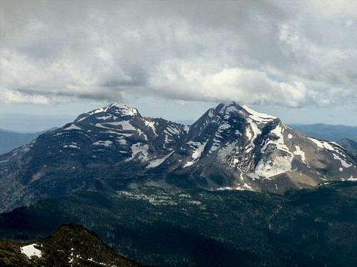 Mount Vaught, Heavens Peak
But of course this isn't really an area where "mellow" holds much sway. The park is entered—and this is true of all entrances—relatively quickly; even during those deceptive first miles vision will whenever possible slip over the water, taking in the far end of the lake. And there you have it. It is oh-so-nice where you are, and visual distance takes a bit of an edge off the immediate future, but you know things are going to change, and quickly. So in the meantime stop wherever you wish. Walk the few feet to the lake, have a picnic. Take pictures. Relax, but do so in anticipation, because even the nicest of summer days at these climes is soon going to change. As will the terrain, and the road. What you see at the far end of the lake makes it so.
 Edwards Mountain.
 Avalanche Lake
Lake McDonald is a beautiful glacial lake, and its lie is mostly north and south; it is ten miles in length, with the Sun Road following the shore-line relatively closely during that distance. But this side of GNP is west of the Continental Divide and as
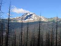 Heavens Peak, Burnt Trees
But even though such is not visible from the road, things have been changing, and at about the time the far end of the lake is reached comes the realization that yes, the mountains drawing you to them have become much closer and are looming huge and seemingly impassable, but there are
 Sometimes you just know it's going to be a good day!
 Not so precipitous, but beautiful!
 Triple Divide Pass
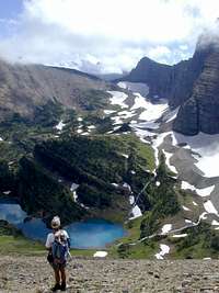 Triple Divide Pass, from Split Mountain
The drive into, through and beyond the Lake McDonald Area is indeed quite special, but this is more than just drive-through scenery; there is a great deal to do beyond the highway. These are big mountains, requiring real effort on the part of those wishing to reach their summits. Probably the
 Red Mountain
Each area of GNP has well known hikes—some relatively short, some rather lengthy—which can be taken by those not interested in climbing the peaks, and this area is no exception. One of the best trails of this type in the park begins at the Avalanche Lake Campground, and is an easy two miles through lush, dense forest to a truly stunning Avalanche Lake. While standing on the shores of the lake taking in the thousands of feet of precipitous, glacier-carved walls, even late in the summer you can count five (!) waterfalls cascading down from the glaciers and snowfields above. This trek is well worth the time and effort, leading to a real beauty of a scene!
 Whitebark pine, Mount Helen
 Mount James
Several other trails are of interest. One of them is the Sperry Chalet Trail, which takes off from the Lake McDonald Lodge, running the six miles to the Sperry Chalet, from where it is relatively easy and good access to both Edwards and Gunsight Mountain, as well as the Sperry Glacier. There is a steep trail splitting off the Sperry Chalet Trail, leading to the Mount Brown Lookout, from which vantage point it is another 1100' to the summit of Mount Brown. And it is worth noting that a quite popular trail takes off from the "Loop" on the Sun Road (which is the point at which the highway doubles back for the final, lengthy, ascent to Logan Pass—there is parking for those doing one or multiple-day outings), going 4.5 miles to the Granite Park Chalet, the Highline Trail, and many points distant. Almost all GNP trails link to other trails, accessing yet another trail, leading to.... Well, you get the idea. If you really wish, it is possible, on foot, to get almost anywhere from...anywhere.
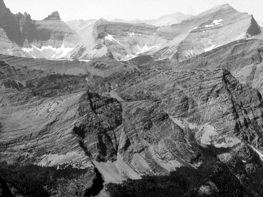
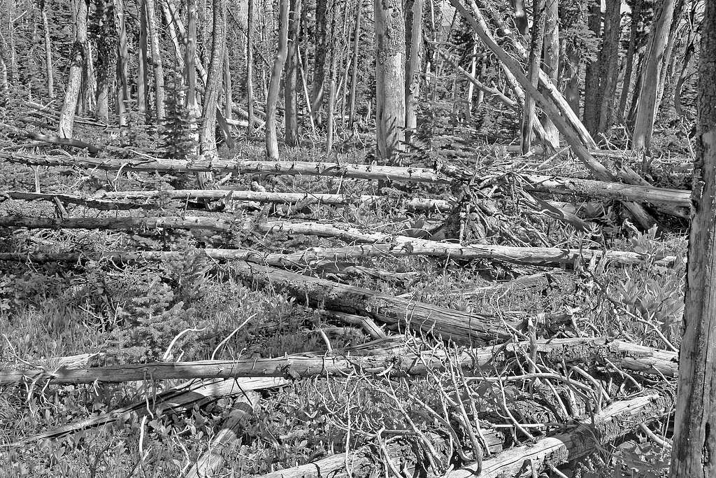
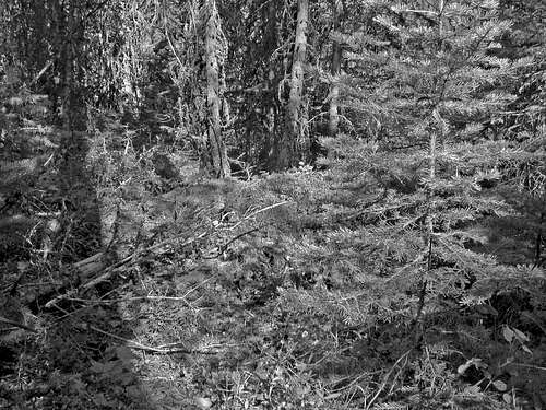
Black and White Interlude
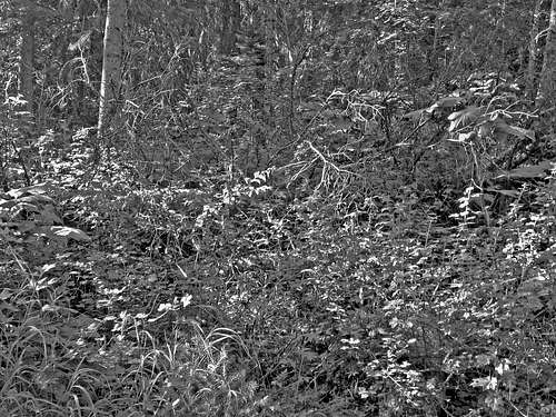
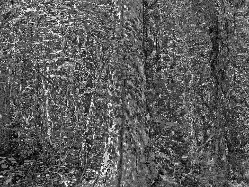
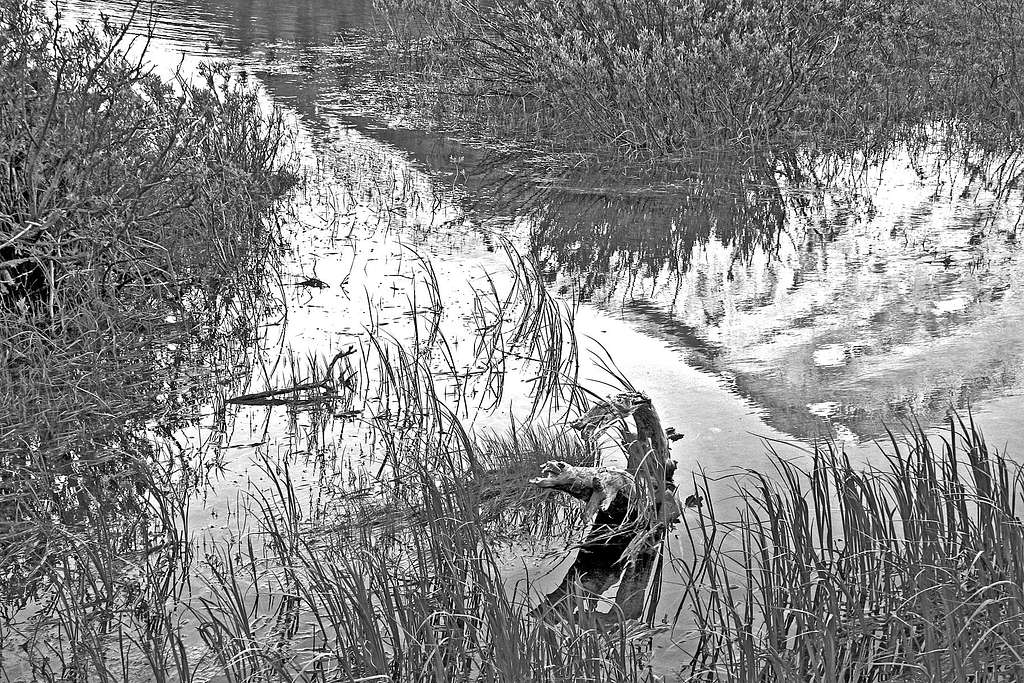
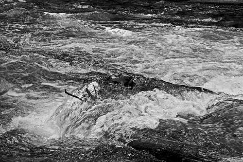
I tell you, it's ridiculous: many of these peaks have nothing in the way of even a goat trail up them, with the price of admission being savaged legs and stressed dispositions, unending descents seemingly NEVER coming out where it all started in the first place, and did you remember your bug spray? With that in mind, this section is humbly dedicated to the fond (?) memories of the beauty encountered during some quite interesting and wearingly claustrophobic hours.
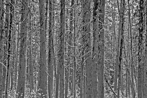
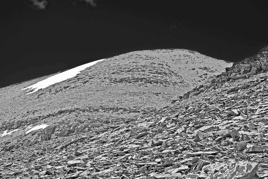
I love this sort of picture (and black & white), and just naturally assume everyone else does as well, so take leave of the peaks, lakes, walls, and glaciers to lose yourself for a moment in an overgrown vista with no real point of focus.
[If, however, it is not really your thing (gasp!)...other GNP areas immediately below await your attention.]
(More than most, enlarging until they fill the screen brings great benefit to these black & white pictures.)
THE CUT BANK & TWO MEDICINE AREAS
 Flinsch Peak, Oldman Lake
 Sinopah Mountain, Two Medicine Lake
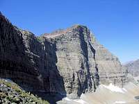 Norris Mountain
 The huge and dangerous east face of Rising Wolf Mtn
The normal geological perception of Glacier National Park is that of a seemingly endless ocean of huge mountains, with sheer cliff faces feeding into the abrupt and startling angles and lines of glacial action. That is indeed an honest reflection of the place, yet here in the Cut Bank and Two Medicine areas it is almost as though the cold fury of the ice sheets occasionally backed off—even if only just a little—from the serious and cataclysmic intent present throughout the rest of the park. Or, appearances might be deceiving, and it could be that it was actually worse; that the Continental Ice Sheet rode up and over the mountains, thus polishing and grinding them into a more rounded countenance than their craggy counterparts. Whatever the cause, the result is that the peaks here present some wonderful scrambles without having to deal with the gigantic and precipitous walls present elsewhere. To be sure, there are cliffs, but rather than the unavoidable, serious, technical-challenge type, with patience and careful route selection they often fall into the category of a good learning experience for GNP-type rock, and rock faces.
 Graceful Mount Ellsworth
 Two Medicine windy morning
 An endless sea of peaks
 Sinopah Mountain
 Unique Triple Divide Peak
Aside from the overabundant natural splendor, if there is any one thing
 Razoredge Mountain
Immediately upon leaving the Two Medicine campground the choice is which of four major through trails to take—and there are others, not through, but leading to summits. Trails taking you on whichever side you choose around Two Medicine Lake, to places like Sinopah or Grizzly Mountain; or to Dawson Pass, with its ready access to both the beautiful horn of Flinsch Peak (9225') and massive Rising Wolf Mountain—at 9513' the highest peak in the area, and easily
 Triple Divide Peak from the south
 Technical-only Split Mountain
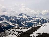 Grizzly Mountain
 The impressive east face of Mount Morgan
Surrounding Two Medicine Lake are a number of brilliant red (this is the most brightly colored area of the park), relatively easily ascended peaks, all with superbly rewarding summits. Mostly scrambles (although full days), peaks such as Scenic Point (7522'), Appistoki Peak (8164'), Mount Henry (8847'), Mount Ellsworth (8581'), Dancing Lady Mountain (7353'), and the memorably named Never Laughs Mountain (7641') are not unduly difficult, and present an excellent "testing the waters" introduction to this portion of the Northern Rockies (although, as usual with GNP, use caution on snow fields, and be alert for rock falls). Another
 Mount Phillips
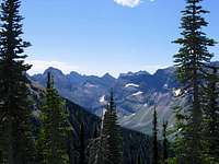 A Rugged Country...
There are, of course, other peaks in the area not so easily ascended as to be classified as simple "scrambles," yet are not really difficult in any technical sense of the term (i.e., they require caution and patience, not ropes). Probably the most well-known of these (and certainly, being one of the most well-known views in the entire park, the most-oftened photographed!) is Sinopah Mountain, which makes for a very nice (not too long; maybe 6 or 7 hours) day, and provides an excellent introduction to route finding and cliff climbing on Glacier Park sedimentary (that is, rotten) rock. Another climb in the area, but a much longer day, is Mount Rockwell (9272'), beautiful, huge, and—from certain angles—misshapen appearing. This peak is most often ascended from Two Medicine Pass, which it "anchors" opposite Grizzly Mountain; according to Edwards there are class 4 pitches near the top.
 Fire & smoke & Stimson...
There are many nice peaks in the Cut Bank area, one of which, Triple Divide Peak, is a genuine world-class anomaly, in that it is one of only three peaks world wide where water from its summit flows into three bodies of salt water (Pacific Ocean, Gulf of Mexico/Atlantic Ocean, Hudson Bay/Arctic Ocean & North Atlantic). This is more than just an interesting happenstance, as over the millennia all sorts of living things follow water upstream, from ocean to source; Glacier has one of the most diverse
 Little Dog Mountain
 Summit view from Mt. Stimson
There is yet one peak remaining to single out in these diverse areas of the park. Split Mountain (8792', and one in the lineup of the beautiful view seen from the Saint Mary Visitor Center) could be considered to be in either the Cut Bank or Saint Mary Valley areas, and has good (but lengthy) approaches from either. It is one of the five technical peaks in GNP,
 The wonderful view north from Mount Stimson (a real treat when enlarged!)
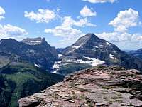 Mounts Pinchot & Stimson
So that does it for these two relatively quiet and colorful areas. Trail outings and scrambles abound here, although difficult ascents are certainly present if desired. Cut Bank, Dawson, and Two Medicine Passes are readily accessible for those not wishing to climb, and provide spectacular views—and access—into the wild and remote Nyack Valley, and the huge south-central portion of the park. Triple Divide Pass provides access not only to its unique namesake peak, but is part of a trail system which can be followed all the way to (or from) Saint Mary. The Cut Bank and Two Medicine areas provide a vivid reminder, should one be needed, that greatness in this park does not reside exclusively in its peaks, but also in the wilderness experience made accessible and tangible via the many trails throughout the region.
THE NYACK-COAL CREEK AREA
this part of the park is rarely visited with any regularity. —Aaron Johnson
 |
 |
|---|
 View into the park from the south...
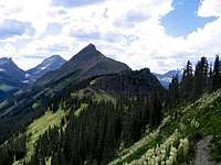 Tinkham Mountain...
 More from Grizzly Mountain: Eagle Ribs and Mount Despair
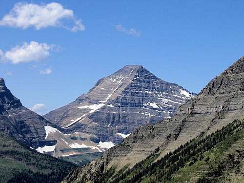 Monarch of the Nyack!
The great southern quarter of the park is poorly known and seldom visited. It is barely mentioned in Dr. George Ruhle's otherwise remarkably complete guides to the trails in Glacier National Park.* One reason for the apparent lack of interest in the area is that there is no dry way of getting across the broad middle fork of the Flathead River anywhere between West Glacier and the Walton Ranger Station (a distance of more than thirty miles). When the bridge at Nyack was removed it effectively isolated more than 300 square miles of park and as of 1990 the Park Service has not yet installed any cable carts (which were discussed many years ago). [As of 2006 the situation is unchanged; the NPS has no plans to install any form of river-crossing aids.] Hikers and climbers must treat every crossing of the river as potentially lethal. Some hiker will drown there soon...don't let it be you!
[*Note: Roads and Trails of Waterton-Glacier National Parks: The Ruhl Handbook — Currently out of print, but as of this writing (May, 2006), available through used book sources.]
 Final approach up Mount Stimson
 Rappelling...
 ...off Mount "St. Nick"
 Battlement Mountain
 Summit Mtn, southern terminus of GNP Continental Divide Trail
It is worth noting that the Walton Ranger Station—starting point for both the Ole Creek and Park Creek Trails—is actually on the GNP side of the river, as for a
 Vigil Peak
 A Great Quartet of Peaks!
 Honesty!
 Mount Cannon, East Ridge
Continuing along the park's southern boundary, the remaining 25 miles between Walton and East Glacier—which includes crossing the Continental Divide at Marias Pass, with the attendant change in water flow, and at
 Wrong Summit!
 Kintla summit view, looking east.
One last point of information regarding water crossings is that GNP has a great many streams, many of which (actually, once away from the more well-traveled areas and trails, the word should be "most") have no bridges, and must be forded—many bridges, in fact, are removed during winter, with spring replacement being dependent on weather and available access. Also, it should come as no surprise that during spring runoff, or after periods of rain, these crossings can be exceedingly difficult, and dangerous. Yet more reasons to consult with the Park Service on your route!
So.... Here is escape, and confrontation with a great and staggering natural brilliance. The high point is huge Mount Stimson, second highest in GNP at 10,142 feet, rising more than 6,000 feet above Nyack Creek as it wraps around the mountain on its way to the Pacific—Mount Stimson, which challenges with more than 7,000 feet elevation gain from the trail head! Here also is the most difficult summit ascent in Glacier National Park, the entirely technical Mount Saint Nicholas, readily seen from the highway, and—to put it mildly—a real beauty of a mountain. And another gem, the relatively unknown Tinkham Mountain,
 Peak 8542 & Wahcheechee Mountain
These mountains, and the beautiful, deep glacial valleys setting them apart, will not leave your mind's eye, but long afterwards accompany you through more ordinary days: Vigil, Battlement, Statuary, Caper, Salvage—the companions to St. Nick (Vigil, Battlement, and Caper are rarities in that, rather than always from the south, they are sometimes accessed from Two Medicine Pass, via the Lake Isabel basin). And the neighbors Pinchot and Stimson, and what a fittingly beautiful pair! Then, spreading out through the
 View into GNP from Canada
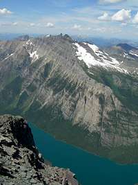 Long Knife, from Kinnerly
While more will almost certainly be added in the near future, at present there are only three peaks in the Nyack-Coal Creek area represented on SummitPost: Mount Saint Nicholas, Tinkham Mountain, and Mount Stimson. There is a reason for this: Entry—not to mention success—requires effort, planning, endurance, and except for the perimeter peaks, all climbs take at least three days. If for nothing else than the mental and emotional imagery you return with, it is, however, well and easily worth whatever it takes.
 Mt Chapman, Thunderbird Mtn, Bowman Lake
CLIMBING INTERLUDE
 Over 5,000' from Merritt's summit to Mokowanis Lake. Over 5,000' from Merritt's summit to Mokowanis Lake. |
 A Nice Scramble up Kaina Mountain! A Nice Scramble up Kaina Mountain! |
 Blue! Blue! |
THE WILD NORTH, BY NORTHWEST, BY NORTHEAST
 Sheer face of Goat Haunt Mountain.
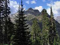 Kootenai Peak
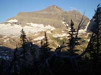 Kintla Peak
The Livingston Range (of which Edwards says, it's...the most rugged terrain in the park), extends north from Heavens Peak to Kintla Lake; the North Central Area runs north and west from Ahern Pass (see Ptarmigan Tunnel to Ahern Pass Goat Trail section, which began this
 Mount Kipp, Sue Lake
 Kinnerly Peak
These northern areas, then, basically (but keep in mind—loosely) extend north of a line running from Heavens Peak (readily visible from Going-to-the-Sun Road in the vicinity of "The Loop") to Ahern Pass, then extending further east, but just north of the Many Glacier Area, to the eastern edge of the park north of Yellow Mountain. Northern GNP ends, of course, at the U.S./Canadian border.
 Mount Merritt, Old Sun Glacier
 A very nice view around Cosley Lake
So, the northern areas are huge, extremely rugged, but do have one distinction separating them from the equally wild—and remote—South Central area, which is that their entrance
 Chief Mountain.
 Ahern Peak
But mostly this section of the park is reached the same as elsewhere: on foot.
 Wild, inhospitable country!
 Longfellow Peak, Granite Park Chalet
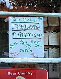 Sign posted at Many Glacier entrance.
 Wildlife Warning, #1
 Wildlife Warning, #2
 Wildlife Warning, #3
 Typical GNP cliffs and rotten rock: the key is patience
 GNP is full of this sedimentary stuff!
Almost finished, and.... If nothing else is, or has been, accomplished with this page, it would be satisfying to have provided both the stimulation and inspiration to not only investigate the possibilities present in this great national park, but also to have instilled the awareness that here, indeed, is a wild place, and the dangers are very real. I'm going to mention something one more time, because—simply put—it is important: Register (and discuss) your outing with the Park Service. Let them know your route, including point and estimated time of exit. And it should probably go without saying, but unfortunately with some individuals doesn't: Also inform them of your safe return; no one wants to be combing the back country looking for someone already comfortably ensconced back at camp, or home!
 Granite Park Chalet
LEAVING
Do you come here often?
Oh sure...as often as possible. Because when I'm face to face with these peaks there are no greater mountains on the planet. I mean, I know that's not true, but during the time spent on them...in their midst...no other possibility exists. To use a kind of common vernacular that gives a sense of perspective...well, they'll just about blow the top of your head off.
Yeah, I keep coming back. It feels good as the everyday layers peel away, feels good to fill my mind with what is here. But I do admit that it gets harder to leave all the time. This place has a certain quality about it—I guess maybe you'd call it wildness—which in no way can be avoided, or ignored...not that that's the sort of thing you'd ever consider resisting. And even though that quality isn't in the least compatible with life back home, invariably causing no end of conflict and depression through drawn-out days of ordinariness, and despite that you know perfectly well those feelings will happen every time...still—you can't help but take them with you. Sometimes it is really tough leaving. You keep looking over your shoulder.
So anyway...yes. I come here whenever possible. Always will.
And now I'm done with it.
—Vernon
Notes on Glacier National Park's "Bible"
 Sperry Chalet
It is not possible (and probably not desirable) for me to list each climb—or summit—in GNP, but as an introduction to a specific point, will mention Longfellow Peak. When approaching the park via Hwy 2—the standard approach from the west—it is one of the big mountains attracting your attention, then is visible again as the road ascends to Logan Pass. It is the mountain with a kind of blockish "chip" (known as "Paul Bunyans Cabin") on its south shoulder not far below the summit, and access to this peak is difficult enough, and lengthy enough, that it may well not be climbed every year. It is a striking mountain, but the reason I mention it here is that I am going to use it as an example of how important it is for anyone doing serious climbing/exploration in GNP to make use of J. Gordon Edwards' A Climber's Guide to Glacier National Park. This is not the sort of thing I'm going to do more than once on this page...so pay attention.
Two quotes, both from "The Northeast Ridge Route" up Longfellow Peak will suffice.
Distance to summit about eleven miles, 5.5 miles of it by human trail. Elevation gained is about 4,600 feet. Class 2 and 3, except in the chimney leading to the summit snowfield, which may be class 4 or 5. Ropes should be carried for belays, and at least one ice ax in each party is essential in June and early July.
And the second, even more telling:
Do not attempt this climb unless the northeast ridge is bare of snow up to the elevation of the bottom of the huge broad snowfields that extend downward nearly a thousand feet below the summit. If this ridge is snow-covered, then certainly the broken chimneys leading from it up to the upper reaches of the peak will be filled with ice and snow, preventing access to the broad snow slopes above them. (The northeast ridge above these cliffs, beside the tremendous snowfields which cover the entire upper east slopes, is bare of snow by mid-July, even though it appears to be snowy when the mountain is viewed from the road.)
Self-explanatory. Important information. Get the book!
BUT ALSO....
This book is not perfect, contains a few (not many) editorial errors, and makes no attempt to include every peak in GNP (although the "majors" are all represented). It is important to note that while the most recent iteration is dated 1995, the original edition came out in 1961. There were, of course, several revisions between 1961 and 1995, but some of the material presented is still from earlier editions; most of the time that is okay, but experience (and scarred legs!) tells me that there is one facet of that earlier information which may well be dated, and should be taken with the proverbial grain of salt: that of bushwhacking, and game-trail "shortcuts." GNP's terrain (avalanches, floods, run-off, fires, blow-downs) and substantial undergrowth (alder, many other species too horrible to identify—meaning they're there, but I don't know their name!) changes relatively rapidly and dramatically, and what may have at one time been an acceptable game trail would not, as a secondary means of travel, necessarily been the subject of return visits so as to check the continued practicality of such routes. These problems exist primarily below timberline, are usually most severe at lower elevations along streams and lakes, and my strong recommendation is, before attempting, to check with those rangers or individuals knowledgable regarding particular areas.
One specific item to serve as illustration: page 323 in the current Climber's Guide lists "The Upper Two Medicine Lake Route," as an alternate approach/exit from Mount Rockwell. DON'T TAKE IT! The undergrowth is so severe, the game trail faint enough, that it added five VERY unpleasant hours to our descent! Rockwell is a magnificent mountain, wonderful climb, and well worth the effort, but return the way you came (via Two Medicine Pass/West Face Route).
The above is just one example, one in which we took the book to heart, and got into trouble. If Edwards mentions "game trails" along lakes or creeks, or uses the word "bushwhack," in referencing an alternative route—be very wary!
But that aside: for serious exploration and/or climbing, A Climber's Guide to Glacier National Park is an invaluable necessity. Nothing else in print even comes close.
The Red Tape, Wildlife, & Cautions Section
 |
 |
|---|
 Lake McDonald Lodge
Walking, hiking, climbing in this home of the great bear makes of everyone a kindred spirit in that it brings to us a deeper understanding of humility.
Now...click on the picture to the right (you'll then be able to easily read the smaller print). It's the kind of humorous spontaneity not seen very often in governmental agencies—and we did indeed get a kick out of it—but don't kid yourself: Its message is an important reality of daily life in the park!
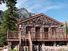
 Many Glacier Hotel
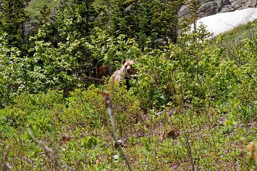
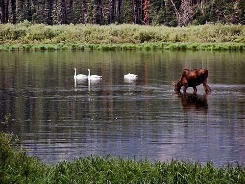
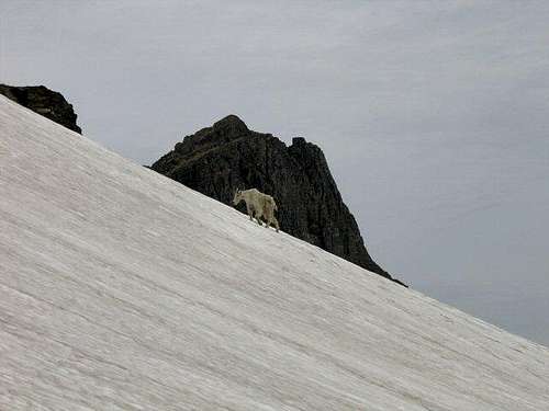
No permits required, but you must pay a park entry fee, which is $25 for one week, or $35 for an annual pass (click on this link for all current pass/entrance fees). Registration for day climbs in Glacier National Park is recommended, but not mandatory. Probably anyone prone to climbing in this part of the country already knows this, but the Northern Rockies are full of wildlife. [img:177184:alignright:thumb:Wildlife Warning, #2]Always be aware, and don't do anything stupid, like—for example—feed the bears, think that a mountain lion is even remotely related to your pet cat, or run up to a moose (moose are quite unpredictable, [img:177188:alignleft:thumb:Wildlife Warning, #3]irritable, and very dangerous). And never, ever, EVER forget you're in grizzly country [an excellent, informative link!]; they insist on being left alone—disagreement on that point is not an argument you'll win! Bear spray and noise should be part of every GNP foray you make into the back country. Black bears will be found in the forests, grizzlies commonly venture onto the above-timberline tundra, sometimes, when in pursuit of such delicacies as ladybugs or cutworm moth larva, even to the summits! Also note that improperly stored food in park campgrounds (i.e., scraps left around the table or campfire, or edibles in your tent rather than your car) will subject you to a $50 fine (it should be more, but that's just my opinion). If you wander off, leaving your pack unattended, and there is food in it which attracts the attention of, for example, a bear, it is also a fine. Folks, the Park Service is serious about not providing human food access to the critters!
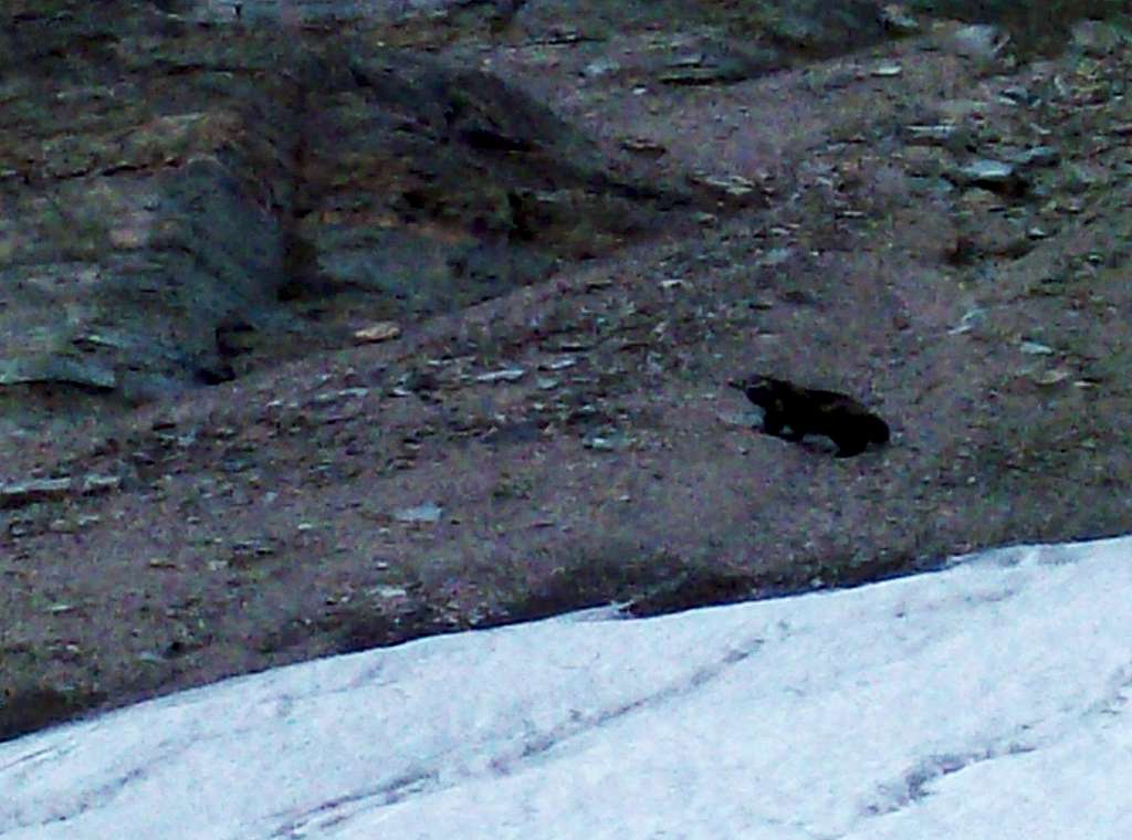
One of the more colorful, elusive critters residing in GNP is the wolverine. They primarily, but not exclusively (it too—along with the grizzlies—will occasionally make its way to the summits), reside in the Many Glacier Area (and have also been seen on Logan Pass)—keep your wits about you; a photo opportunity involving a wolverine is something rare and special! (Click on this link for an excellent, interesting article on a wolverine study in GNP. IT IS WELL WORTH YOUR TIME!)
How (and when) to reach the place...
Glacier National Park is in Northwestern Montana, and its northern boundary is the U.S./Canadian border. Closest U.S. communities with a jetport are Kalispell and Missoula, if you wish to come to the park from the west, and from the east, Great Falls—there are innumerable car-rental facilities in each locale. Kalispell is closest, being only (approximately) a 45-minute drive from the entrance at West Glacier. Coming from Canada, Calgary is about a three hour drive from the border, and gives you the option of seeing Waterton Lakes National Park first.
Map of Waterton-Glacier International Peace Park
(Note that clicking on the image after it loads brings up a larger version, making it MUCH easier to read.)
Standard Precautionary Note: All GNP roads are closed in winter, with Going-to-the-Sun Road (the major route through the park—its western terminus is at West Glacier; the eastern is at Saint Mary) sometimes not opening until July (average opening is second week in June; earliest opening ever is May 16, 1987, with the second earliest being May 22, 2005). Don't head out early in the year (i.e., June/early July) without checking the status of these roads—it is not unusual to have repeated, sometimes lengthy, road closures due to storms, avalanches, rock slides, or all three! The same holds true for late in the year; weather changes dramatically in Glacier, beginning usually around the end of August, with road closures normally becoming more and more frequent throughout the month of September (although don't shy away from going, there can also be very nice—albeit cool or cold—days of Indian Summer throughout this time frame; plus the park is relatively free of people after Labor Day). The following links are relatively self-explanatory, and provide all sorts of useful information:
Current GNP Road Status
And finally, click here for current information, as well as easy access to some interesting photos showing the Plowing of Going-to-the-Sun Road. Weather permitting, the Forest Service traditionally begins plowing the Sun Road the first Monday in April. It is a long, difficult, dangerous undertaking getting from that tenuous start to opening day!
When To Climb, & Climbing Considerations
[img:69002:alignleft:small:Typical GNP cliffs and rotten rock: the key is patience][img:331499:alignright:small:GNP is full of this sedimentary stuff!]
From mid-to-late June/early July (during this time frame expect LOTS of snow in the high elevations) to early fall, depending on snow conditions. Traditional climbing season in the Northern Rockies is July, August, and September—with September weather becoming progressively colder and more unstable (sometimes dramatically so: PAY ATTENTION!) as the month progresses—but does of course vary from year to year. There are occasional winter climbs in the park, but not often, and then only by well-equipped, area-wise, extremely competent individuals. Basically, most of GNP is inaccessable through the winter, and avalanche danger, to put it mildly, is extreme almost everywhere.
This Link will take you to the latest trail status information, something of which it is important to be aware, especially during June and July.
CLIMBING CONSIDERATIONS
Because of the nature of the rock, there are special considerations regarding climbing in Glacier National Park, and grading systems unique to the Park have been developed by both J. Gordon Edwards and the Glacier Mountaineering Society. Anyone doing more than just "trail" hiking in this part of the Rockies should read the excellent and important information put together by Fred and Moni Spicker. Much—if not most—of the rock in GNP is sedimentary and rotten, and you need to know about it: Glacier National Park Rock & Grading Systems.
Camping & Lodging
There are numerous campgrounds available within Glacier National Park, of which only Fish Creek and Saint Mary take reservations (not required, but probably a good idea during the peak summer tourist period, especially on weekends). There are also many campgrounds (including KOA, NFS, and privately owned commercial) as well as motels just outside the park on both the west and east sides. Lodging, whether camping or indoors, should be no problem.
Click here for General Camping Information, and click here for Current Site Availability in specific campgrounds.
The communities of East Glacier Park, Browning, Babb, and Saint Mary, are all on the Blackfeet Indian Reservation, where there are a great many additional services available.
Also, for those so inclined...GNP does have Backcountry Campsites throughout the park. Some of these sites can be reserved (they often fill quickly; check the application date restrictions, and reserve early); others are on a first come basis. Anyone doing extensive, multi-day, remote hiking/climbing would be well advised to check this out. (Note that the Nyack-Coal Creek area—SW region, which includes Mounts Stimson and Saint Nicholas—has different regulations than the rest of the park; these are covered in the page accessed by the above link.)
General Contact Information on GNP Lodges & Chalets
THIS LINK connects to specific lodging/tour information for the following locations: Glacier Park Lodge, Prince of Wales Hotel, Village Inn at Apgar, Many Glacier Hotel, Rising Sun Motor Inn, Swiftcurrent Motor Inn, and the Lake McDonald Lodge.
IN ADDITION:
Specific Information on the Granite Park Chalet
Specific Information on the Sperry Chalet
| [img:179319:alignleft:thumb:Granite Park Chalet] | [img:124086:alignleft:thumb:Sperry Chalet] | [img:197815:alignleft:thumb:Lake McDonald Lodge] | [img:214685:alignleft:thumb:Many Glacier Hotel] |
Current Park Conditions/Web Cams
Weather page, an overview, plus current conditions
This is the New NPS Web Cam Page.
External Links/Additional Information/Items of Related Interest
- Non-Park Service Information Link (Worth checking out!)
- Glacier National Park Chat—a great source for friendly conversation
and information concerning all things GNP related!
In Tribute
On March 1, 2011, Vernon Garner, Saintgrizzly, left us after losing a bold, inspiring fight against pancreatic cancer. Or maybe he won, for he is at last free of his pain and has "shuffle[d] off this mortal coil."Vernon was an important contributor on SummitPost, but beyond merely making good, informative pages, he actually inspired many who read his work. No one put more work into his or her pages than Vernon did, and many of those pages, especially those related to Glacier National Park, the place he loved above all others, are works of art in both the writing and layout. More than one person has wanted to visit Glacier or go back to Glacier largely due to what he shared about that magnificent place.
Many people on SP counted Vernon among their friends, and many more saw him as one of the best, one of those who exemplified the spirit of this site. He was one of the best of us, he will be missed, and he will not be forgotten.
As a tribute to him, Vernon's pages will remain in his name. Any member who sees a need for an addition or correction should please contact site management via the "Send PM to the Elves" feature.
Rest well and climb on, Vernon.