-
 9681 Hits
-
 74.01% Score
-
 4 Votes
|
|
Route |
|---|---|
|
|
38.56620°N / 78.3517°W |
|
|
Hiking, Scrambling |
|
|
Spring, Summer, Fall, Winter |
|
|
Half a day |
|
|
Strenuous due to scrambling and bushwhacking in dense forest and on slippery rocks |
|
|
Overview
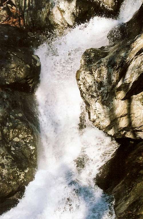
The attitudes and methods of the politically correct speech and thought police that roam this country these days usually sicken me, but I do cringe at the name of this route. Nevertheless, this is a worthy route that deserves inclusion here on SP. Negro Run is the stream that crosses the Whiteoak Canyon Trail just a couple minutes below the sixth (lower) falls. Negro Run has several cascades and falls of its own, a couple of which are visible from the Whiteoak Canyon Trail, but there is no formal trail along the stream. Hence, few people ever explore it. And so adventure calls.Update: this stream is now called Tims River. Soon, I will fully update this page to reflect this change and relate the events leading to it.
Getting There
At Sperryville along U.S. 211, look for signs indicating 522 and 231 and follow the directions to them. Turn right on 231. You can also reach 231 via 522 from Culpeper, and you can take 231 all the way from Charlottesville. After about 10 miles along 231, you reach a tiny town called Etlan. Look on the east side of the road for a small convenience store. Directly across the road from the store is SR 643. There should be a sign indicating access to Whiteoak Canyon. Follow this road for about 4 miles until you reach a stop sign. Turn right (a sign for Whiteoak Canyon should confirm this). You are now on SR 600, and it takes you all the way to the signed parking area and trailhead, almost at the very end of the road. Instead of turning into the parking area, continue straight for about 0.8 mi to the end of the road, which is where the Berry Hollow Fire Road begins. It is about 5 miles from the junction of 643 and 600 to the trailhead, and the drive takes about 15-20 minutes.Route Description
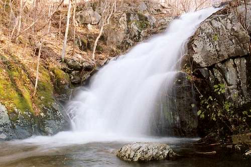
Follow the Whiteoak Canyon Trail for almost 1.5 miles until a stream from the north crosses the trail. The hiking to this point is easy; the trail is in good shape, and there is little elevation gain. Although Whiteoak Canyon’s waterfalls are all beyond this point, the stream still has many scenic cascades and pools below its confluence with Negro Run.
You may spot a use trail on the right side of Negro Run, and you can take it to make the going easier for a few minutes, but it peters out before reaching the lower falls on Negro Run. To experience the stream from different perspectives and to throw some route-finding fun into your trip, I recommend ascending along one side of the stream, enjoying and exploring as much as you want to, finding a safe place to cross (not easy due to the steepness of the canyon, the depth and force of the water, and the slippery nature of the rocks), and descending along the other side.
Negro Run stretches for about two miles into some pristine, pathless wilderness in Shenandoah National Park. Go as far as you want. Expect steep, rocky, and slippery terrain. A venture out here will require bushwhacking and scrambling, not much actual hiking.
There could be icy conditions from late fall through early spring. Use extra caution at these times.