Intro/Stats
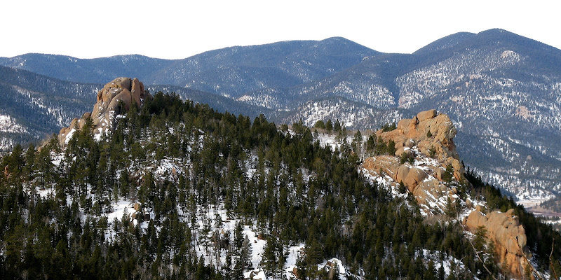
"Lake Park Peak" (11403')
"Tarryall Peak" (11780')
Lost Creek Wilderness/Tarryall Range, CO
13 miles RT, 4200' gain
From Spruce Grove TH (8560')
Participants: John and Renata Collard, Kevin Baker
Slideshow
I was hoping to hit something high on New Year's Day to get the year off to a good start, but those pesky winds had other plans. The LCW is always an excellent plan B, especially since the area hasn't received as much snow as the rest of the state. Who knows, we may even get by without snowshoes! John and Renata are always up for a slog, so we set out sights on Lake Park and Tarryall Peaks right in the heart of the majestic LCW.
Lake Park Peak-More Than We Bargained For
We met at the Spruce Grove TH, which is a little over 13 miles n.w. of Hwy 24on the Tarryall Road (CR-77). We set out at a less than alpine start of 8am anticipating a long day. The temp was a moderate 33 degrees, but we could tell the winds were ripping pretty good up high. The trail crosses Tarryall Creek at the start and goes underneath a cool tunnel of rock. It then contours above some private property before heading up a drainage to Lizard Rock.
There was quite a bit more snow than my visit to the area 3 weeks ago, but there were still quite a few dry patches until we reached a mini-saddle to the east of Lizard Rock. Here we entered the LCW proper and hung a right at an intersection with the Brookside/McCurdy trail.
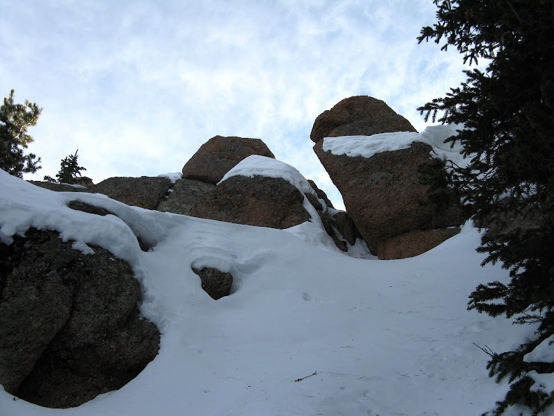
Lizard Rock looks to be 5th class:
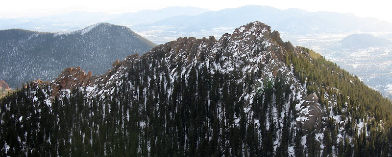
The trail then wrapped around the saddle onto a northwest facing aspect, and as expected the snow got a lot deeper. It was mostly 1-1.5 ft deep, not enough for snowshoes to be any benefit since it was mostly all sugar. We followed an old bear track for awhile, but he wasn't too interested in taking the switchbacks! The views north to The Catamount beckoned us onward to Hankins Pass.
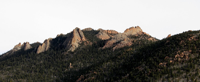
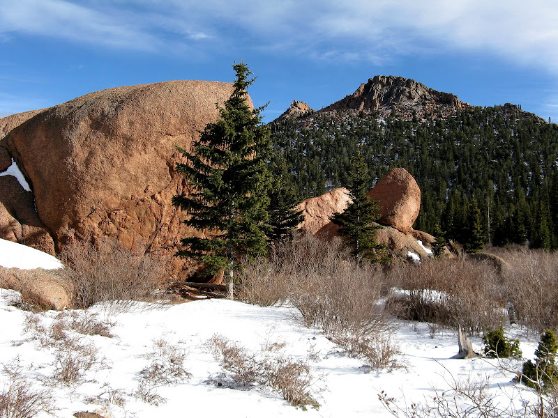
We were still moving pretty well despite the snow and took a break at Hankins Pass. Renata made some treats and I had some tasty fudge. She told me that I had just consumed a Drunken Isador with a bit of rum! Not to worry mom, because the alcohol is evaporated, thus my 36 year streak of no alcohol is still intact! John did a nice job of trail breaking above Hankins Pass as we were able to follow the trail. We took a more direct line through the trees when the trail ridiculously zigs way too far to the west. On the way up to Lake Park we were treated to some spectacular granite formations.
We reached a 10940' saddle s.w. of Lake Park Peak and bushwacked our way up to its' s.w. ridge. Per Roach's instructions, we stayed on the right side of the ridge to avoid some towers, but it was still no cakewalk. The deadfall was pretty thick and the snow was not as thin as we had wished. At around 10720', we were due south of the summit and headed straight up after contouring below the ridge. We finally topped out at 12:20 after a tiring climb up the ridge. It looked like it was going to be a long slog over to Tarryall, but we felt like it was still in the cards for the day.
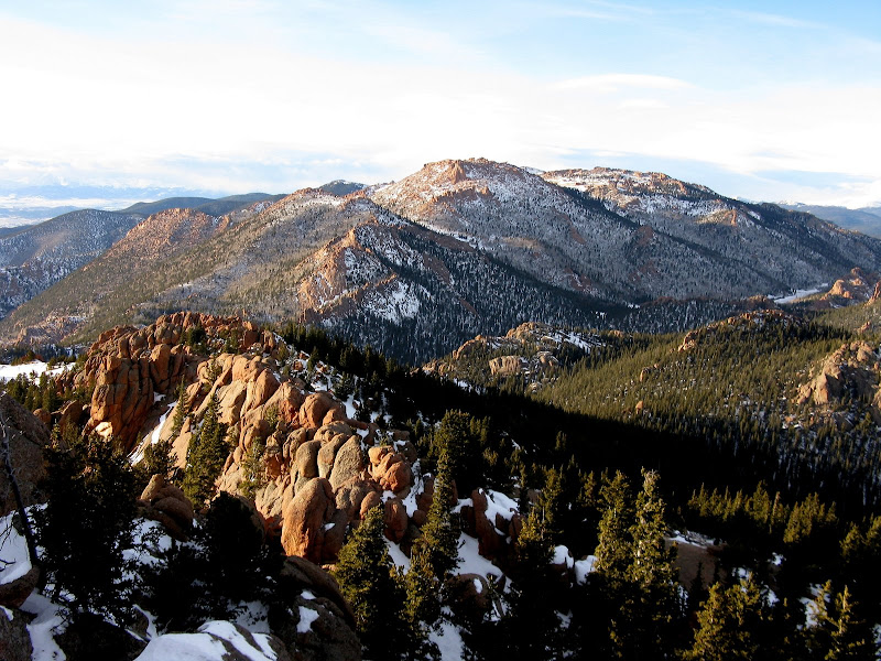
The Catamount and Tarryall (R) from Lake Park summit:
Tarryall Where Are You?
We took a nice, long break on the summit to refuel for the next leg. Instead of reversing our ascent route, I found a nice line down the n.w. side of the ridge that was free of boulders and was a nice plunge step down to Lake Park. It would have been brutal ascending this slope though, as the snow was pretty deep.
Lake Park Peak from Lake Park:
Once down in Lake Park, we skirted some willows on the south side and attempted to pickup the trail. We somehow missed it and did some rough bushwacking amidst many boulders until we found the trail again at a mini-saddle above Lake Park. The effort really intensified when the trail wrapped around onto northeast facing slopes. We had to start rotating trail breaking duties a lot sooner and Renata even got in on it. Renata kept saying, "Send Kevin!" For some reason, I was moving pretty slow today. Must have been too much New Year's egg nog and fondu the night before!
We finally donned the snowshoes less than 2/10ths of a mile from the summit as the snow was knee deep in spots with a crust layer on top. We were a bit above the trail at this point and I ended up making a beeline for the summit instead of hitting the saddle n.e. of the summit. Big mistake. I guess we should have read the route description! We plowed our way upwards and came to a gully that we thought might be the correct one.
We took off our snowshoes here and after a considerable effort of plowing up steep powder I topped out on the ridge. Surely this is it.
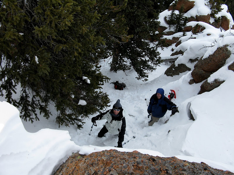
Looking down at John and Renata in the gully:
A class 4 section blocked easy passage and I contoured around it only to find a 10 ft mini-cliff that kept us from the true summit!
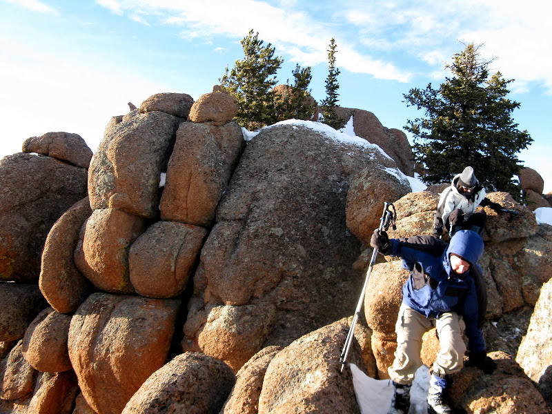
I was ticked as we now had to go back down the gully and look for another way. I passed through a steep notch to keep from losing more elevation and found another gully that topped out to the north of the show stopper. John and Renata countoured a bit below my line. A bit of scrambling on the ridge and we were finally there, topping out at 3:37.
Our improvised route to the summit:
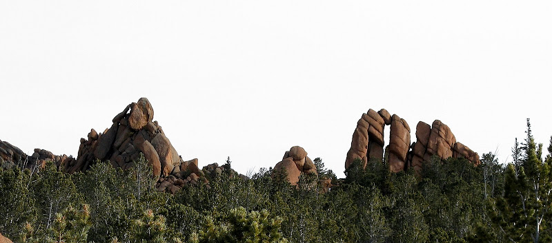
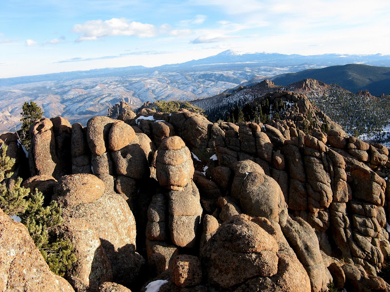
We were the first to sign the register since Tyson Ferryman back in Oct. This summit afforded some of the best views in the LCW that I have seen to date. Granite hoodoos surrounded the summit as the late afternoon light provided a nice prize for our efforts. I will have to return someday to soak up the enchanting beauty of this place.
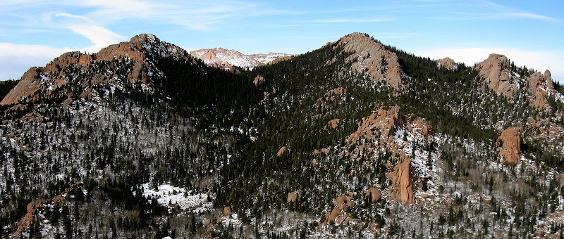
Bison and McCurdy to the n.w.
The Catamount looking mighty formidable in winter:
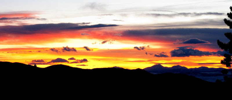
We only hung around long enough to sign the register and snap a few pics as we had many miles before we sleep! I left my snowshoes on for awhile on the descent, but they weren't much use below the point where we put them on. We took our last break above Lake Park and were treated with a spectacular winter sunset near Hankins Pass.
The uneventful hike back to the cars seemed like it would never end. Nearly 4 hours later, we staggered back to the cars at 7:30. I kept seeing the lights of a ranch below, but they never seemed to get closer. The first real slog of the winter is always a test and these two peaks were tough even though the LCW doesn't have a ton of snow yet. It was a fine New Year's bash indeed!
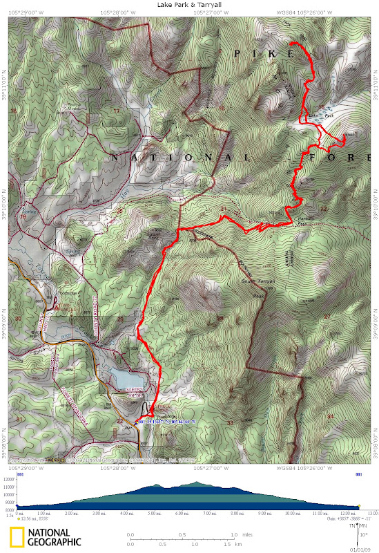
GPS track:


Comments
Post a Comment