
|
|
Route |
|---|---|
|
|
46.76398°N / 122.2983°W |
|
|
Hiking, Mountaineering |
|
|
Spring, Summer, Fall, Winter |
|
|
Most of a day |
|
|
Route Description
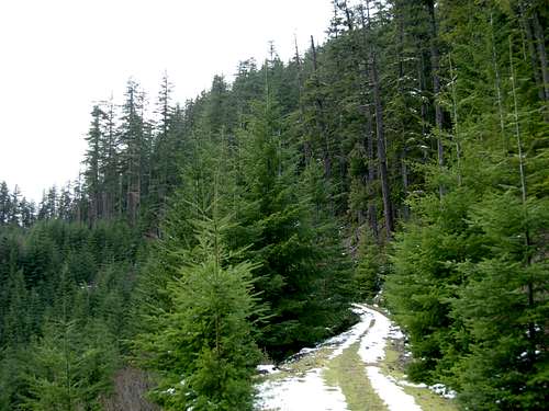
The "NFD #74 Road" approach provides the most hiker-friendly route leading towards the summit of Quiemuth Peak, the highest point in Thurston County of Washington State. This approach is the most well-known route for the mountain, as it was drivable by vehicles, for at least most of the route, for many years. However, recent landslides and mudslides have washed out several sections of NFD #74 Road, wiping out large chunks of asphalt and gravel, and leaving behind gigantic fallen old-growth logs and layers of thick mud. Although the route is still the most well-known for Quiemuth Peak, it is now a long 17.5 miles roundtrip summit hike with 1700' elevation gain rather than being a long drive with only a short hike having minimal (300'-500') elevation gain. However, this route might be a preferred choice of mountain biking enthusiasts, who would only need to carry bikes through the brief washout areas but then would have well-constructed forest roads to ride on. Road Washout
Currently, no plans are in place for the U.S. Forest Service to repair NFD #74 Road. Future logging prospects might cause the road to be repaired, which would probably take many years, but it might be more likely the road will eventually be decommissioned rather than spending millions of U.S. Dollars to repair the road encircling Quiemuth Peak. Hikers and mountain bikers should be able to use this route for many years without concern of vehicles using the road.
Getting There
From the intersection of Pleasant Valley Road and NFD #74 Road:1) Follow NFD #74 Road west, then northwest, then west, then south, then east around the mountain. Key areas to note during this stretch:
Travelers will pass a closed gate after 0.1 miles, then several (2-3) major road washouts within the next 0.5 miles after the gate.
2) After 6.0 miles, NFD #74 Road intersects with FR #7409. Turn left onto FR #7409, continuing to follow the slope east/northeast.
3) After 0.4 miles, FR #7409 intersects with Road #017. Turn left onto Road #017, continuing to ascend the slope east/northeast before the road switchbacks west (after nearly 1.0 mile) along the south slope of Quiemuth Peak. NOTE: Some maps reference Road #017 as Road #015.
 Ascending Road #017
4) After nearly 2.0 miles of following Road #017, the road abruptly ends (~2600' elevation).
5) Turn north and steeply climb off-road up the final forested slope leading to the summit. The slope has approximately 300' gain in 0.3 miles. The summit (2922' elevation) is on the west side of the hilltop in a thick forested grove, and is marked by a cairn and summit register (jar).
Essential Gear
No technical gear needed. Standard hiking clothes recommended.Hiking poles and/or hiking stick highly recommended.