
-
 4449 Hits
-
 76.66% Score
-
 7 Votes
|
|
Route |
|---|---|
|
|
46.67313°N / 12.18601°E |
|
|
Hiking |
|
|
Spring, Summer, Fall, Winter |
|
|
Half a day |
|
|
Hike |
|
|
Overview
 Dürrenstein / Picco di Vallandro south ridge |
The short hike (2 1/2 - 3h) from Plätzwiese / Prato Piatta to Dürrenstein / Picco di Vallandro is one of the most popular ascents in the eastern Dolomites. The trailhead can be reached by car and the 800m ascent follows an easy zig-zagging route across the west slopes of the mountain. It is famous for its beautiful views and known to be easy. There is only one "difficult" protected section close to the summit, which still turns back many of the aspirants.
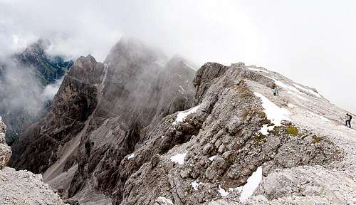
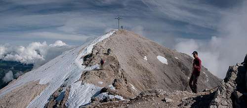
 Dürrenstein south ridge
On a fine day you can expect hundreds of hikers attempting the summit with long queues at this crux. Basically you'll be marching in step towards the destination. The summit itself is rather small so that you might end up in a densely packed group of hikers. Therefore, quite often hikers rather attempt one of the secondary summits, the so-called "pyramids" to the south of the main summit. There you will find no tracks and a very brittle underground. Still, ab it of solitude is a worthwhile reward.
Getting There
  |
The main page describes the itineraries to Toblach / Dobbiaco, from where the following sections remain:
- Take SS49 west until you reach the intersection to Prags / Braies (sign).
- In Außerprags /Braies di Fuori turn left to Bad Altprags / Bagni di Braies, Brückele / Ponticello and Plätzwiese / Prato Piatto. Currently there is a fee of 5€ for the last part of the road
Route Description
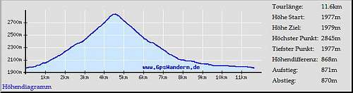 Route Profile Route Profile
|
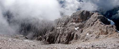
 Dürrenstein summit
From the parking lot at the northern end of Plätzwiese / Prato Piatta follow the road towards Hotel Hohe Gaisl / Croda Rossa. Pass the building and immediately behind it turn east onto trail numer 40.Signs point to Dürrenstein / Picco di Vallandro and Strudelköpfe / Monti Specie. The trail follows a slippery creek bed, which it steep climbs towards a trail intersection on a ridge. Here Alta Via delle Dolomit No 3 crosses, while our trail stay in easterly direction for a couple of steps before turning northwards. (Alternatively you can take the road to Dürrensteinhütte and follow a narrow and often invisible path back to the trail intersection.)
 |
 |
 |
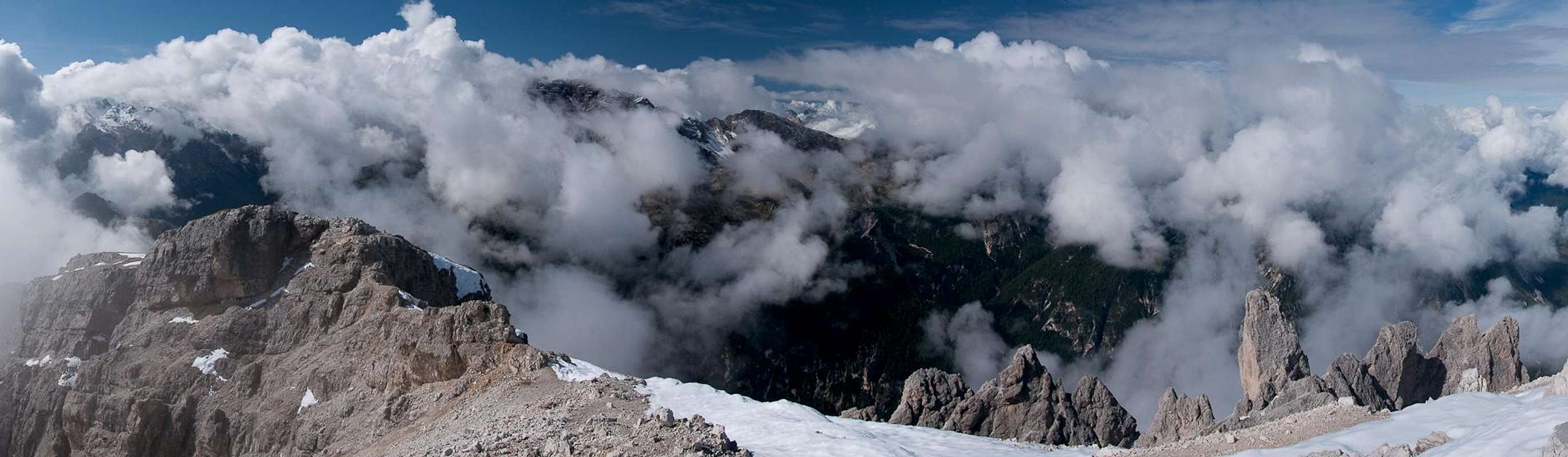
You cross a gate and wit it the timberline. For the next 2km you traverse the lower west slopes of Helltaler Schlechten / Crepe di Val Chiara with wonderful views across Plätzwiese towards Hohe Gaisl / Croda Rossa in the west and Cristallo to the south. At about 2400m the trail turns eastward again to get closer to the Dürrenstein south ridge, which it finally reaches after another turn to the north.
 |
 |
 |
 |
You reach the ridge in the saddle between the main summit and the neighbouring First Pyramid, which offers a wonderful view down a gully into Höhlensteintal / Val Landro. The trail remains on the western side of the ridge and steeply climbs towards a foresummit. Here the "crux" of the route, a 2m descent into a saddle, is protected by a loosely dangling cable. Head down with or without the help of this cable and then follow the remaining 50m of ridge to the summit.
Essential Gear
Hiking gear is sufficient.